|
Sniatyn
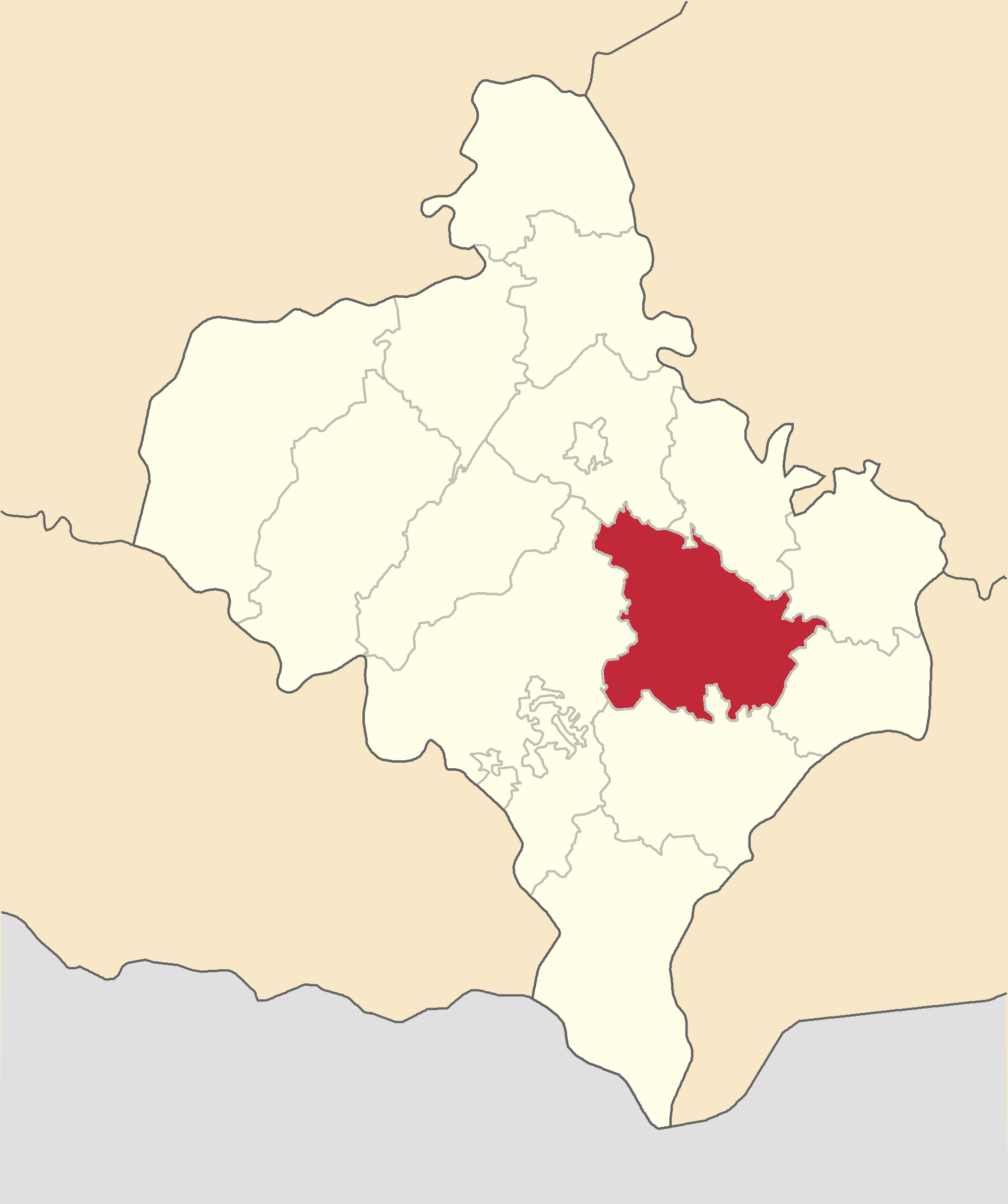
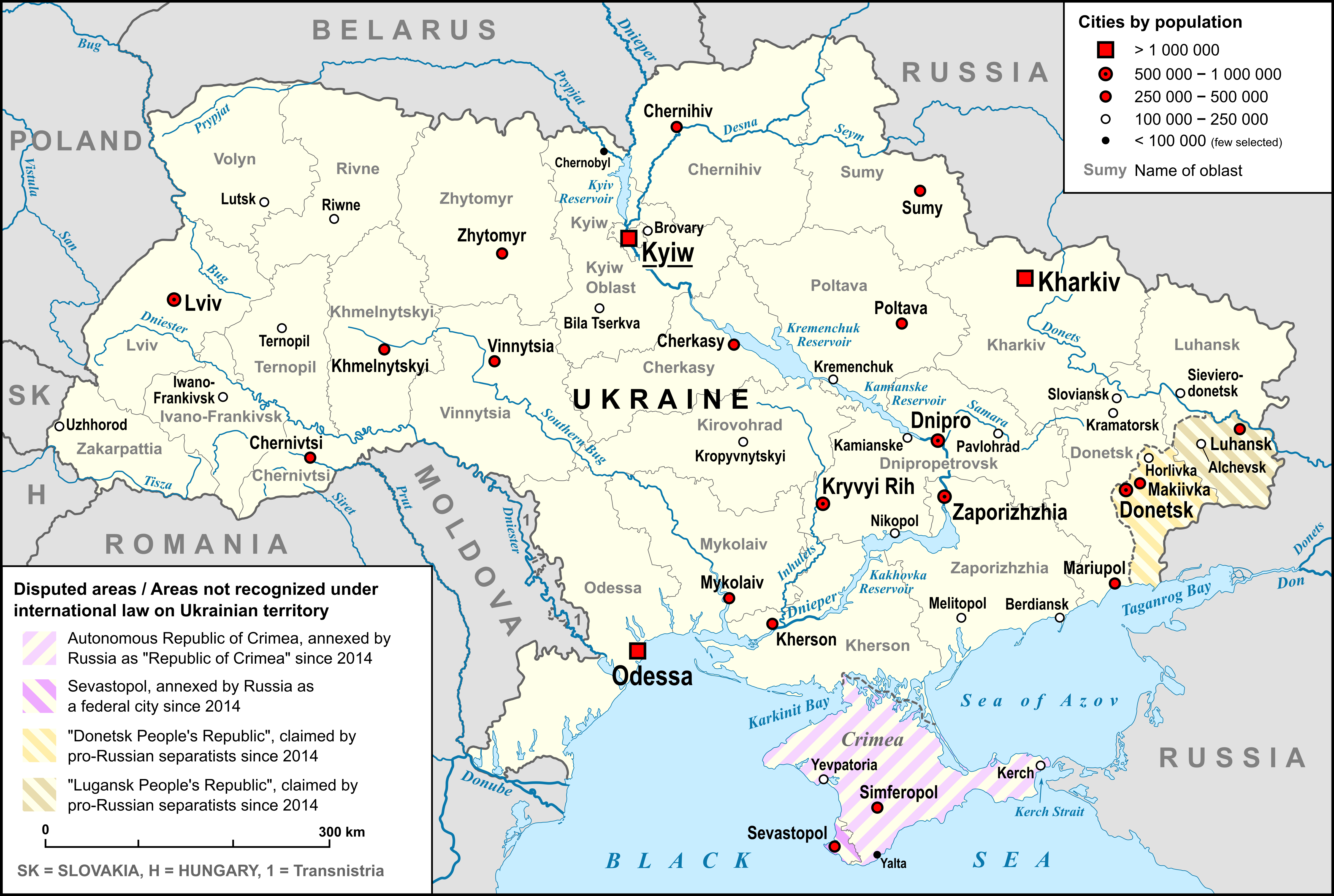
Sniatyn (, ; ; , older ; ) is a city located in Kolomyia Raion of Ivano-Frankivsk Oblast, in western Ukraine along the Prut river, in the historic region of Pokutia. Sniatyn hosts the administration of Sniatyn urban hromada, one of the hromadas of Ukraine. Population: In 2001, population was around 10,500. In the interbellum period, it was a rail border crossing between Poland and Romania. History The first mention of the town is in 1158. Ksniatyn was named after Kostiantyn Stroslavich, a boyar and general of Yaroslav Osmomysl—a prince of medieval Halych Principality. From 1416 comes the first mention of an Armenian in Śniatyn. The town was given the Magdeburg rights in 1448. In 1628, an Armenian commune was established by King Sigismund III Vasa, one of several such communes in Poland. As a result of the First Partition of Poland, Sniatyn (and Galicia) was attributed to the Habsburg monarchy. In the interwar period, Śniatyn was part of reborn independent Poland, within ... [...More Info...] [...Related Items...] OR: [Wikipedia] [Google] [Baidu] |
Sniatyn (BildID 15716067)
Sniatyn (, ; ; , older ; ) is a city located in Kolomyia Raion of Ivano-Frankivsk Oblast, in western Ukraine along the Prut river, in the historic region of Pokutia. Sniatyn hosts the administration of Sniatyn urban hromada, one of the hromadas of Ukraine. Population: In 2001, population was around 10,500. In the interbellum period, it was a rail border crossing between Second Polish Republic, Poland and Kingdom of Romania, Romania. History The first mention of the town is in 1158. Ksniatyn was named after Kostiantyn Stroslavich, a boyar and general of Yaroslav Osmomysl—a prince of medieval Principality of Halych, Halych Principality. From 1416 comes the first mention of an Armenians in Poland, Armenian in Śniatyn. The town was given the Magdeburg rights in 1448. In 1628, an Armenian commune was established by King Sigismund III Vasa, one of several such communes in Poland. As a result of the First Partition of Poland, Sniatyn (and Galicia) was attributed to the Habsburg mon ... [...More Info...] [...Related Items...] OR: [Wikipedia] [Google] [Baidu] |
Ivano-Frankivsk Oblast
Ivano-Frankivsk Oblast (), also referred to as Ivano-Frankivshchyna () or simply Frankivshchyna, is an administrative divisions of Ukraine, oblast (region) in western Ukraine. Its administrative center is the city of Ivano-Frankivsk. It has a population of The area, also known as Prykarpattia, was part of the historical region of Galicia (Eastern Europe), Galicia, where the Kingdom of Galicia–Volhynia flourished. After World War I, the area became part of the Second Polish Republic and was administered as part of Stanisławów Voivodeship until the invasion of Poland. The area was annexed by the Soviet Union and was known as Stanislav Oblast until 1962, when its administrative center was renamed after the Ukrainian writer Ivan Franko. Kolomyia was a historical center of the oblast and remains a major cultural center of Pokuttia, the traditional name for the southern part of the oblast. Name On November 9, 1962, a decree was issued by the Presidium of the Verkhovna Rada of the ... [...More Info...] [...Related Items...] OR: [Wikipedia] [Google] [Baidu] |
Kolomyia Raion
Kolomyia Raion () is a raion (district) of Ivano-Frankivsk Oblast (region). The administrative center of the raion is the city of Kolomyia. Population: On 18 July 2020, as part of the administrative reform of Ukraine, the number of raions of Ivano-Frankivsk Oblast was reduced to six, and the area of Kolomyia Raion was significantly expanded. Two abolished raions, Horodenka and Sniatyn Raions, as well as the city of Kolomyia, which was previously incorporated as a city of oblast significance and did not belong to the raion, were merged into Kolomyia Raion. The January 2020 estimate of the raion population was Subdivisions Current After the reform in July 2020, the raion consisted of 13 hromadas: * Chernelytsia settlement hromada with the administration in the rural settlement of Chernelytsia, transferred from Horodenka Raion; * Horodenka urban hromada with the administration in the city of Horodenka, transferred from Horodenka Raion; * Hvizdets settlement hromada with the a ... [...More Info...] [...Related Items...] OR: [Wikipedia] [Google] [Baidu] |
Sniatyn Urban Hromada
Sniatyn urban hromada () is a hromada in Ukraine, in Kolomyia Raion of Ivano-Frankivsk Oblast. The administrative center is the city of Sniatyn. Settlements The hromada consists of 1 city (Sniatyn Sniatyn (, ; ; , older ; ) is a city located in Kolomyia Raion of Ivano-Frankivsk Oblast, in western Ukraine along the Prut river, in the historic region of Pokutia. Sniatyn hosts the administration of Sniatyn urban hromada, one of the hromadas ...) and 26 villages: References {{Ivano-Frankivsk Oblast 2020 establishments in Ukraine Hromadas of Ivano-Frankivsk Oblast ... [...More Info...] [...Related Items...] OR: [Wikipedia] [Google] [Baidu] |
Armenians In Poland
Armenians in Poland (; ) are one of nine legally recognized national minorities in Poland, their historical presence is going back to the Middle Ages. According to the Polish census of 2021 there are 6,772 ethnic Armenians in Poland. They are spread throughout the country, having largely assimilated while preserving a long-standing tradition of settlement. History Origins and historical role The origin of Armenian presence in the region can be traced to the end of 10th century:"The Armenian presence in these regions dates back to the tenth century. Ana, the wife of Prince Vladimir (978-1015), was an Armenian, and, according to Slavic legends and early sources, the princes of Galicia and Kiev employed Armenians living in Kiev as mercenaries. After the Seljuk penetration into Greater Armenia and the fall of Ani in 1064, waves of Armenian immigrants found their way north to the western Ukraine. New immigrants arrived in the twelfth century. The Mongol conquest of Kiev in 1240 and t ... [...More Info...] [...Related Items...] OR: [Wikipedia] [Google] [Baidu] |
Prut
The Prut (also spelled in English as Pruth; , ) is a river in Eastern Europe. It is a left tributary of the Danube, and is long. Part of its course forms Romania's border with Moldova and Ukraine. Characteristics The Prut originates on the eastern slope of Mount Hoverla, in the Carpathian Mountains in Ukraine ( Ivano-Frankivsk Oblast). At first, the river flows to the north. Near Yaremche it turns to the northeast, and near Kolomyia to the south-east. Having reached the border between Moldova and Romania, it turns even more to the south-east, and then to the south. It eventually joins the Danube near Giurgiulești, east of Galați and west of Reni. Between 1918 and 1939, the river was partly in Poland and partly in Greater Romania (Romanian: ''România Mare''). Prior to World War I, it served as a border between Romania and the Russian Empire. After World War II, the river once again denoted a border, this time between Romania and the Soviet Union. Nowadays, for a length of ... [...More Info...] [...Related Items...] OR: [Wikipedia] [Google] [Baidu] |
Stanisławów Voivodeship
Stanisławów Voivodeship () was an administrative district of the interwar Poland (1920–1939). It was established in December 1920 with an administrative center in Stanisławów. The voivodeship had an area of 16,900 km2 and comprised twelve counties (powiaty). Following World War II, at the insistence of Joseph Stalin during the Tehran Conference of 1943, Poland's borders were redrawn, Polish population forcibly resettled and Stanisławów Voivodeship was incorporated into the Ukrainian Soviet Socialist Republic as Stanislav Oblast (later renamed as Ivano-Frankivsk Oblast). September 1939 and its aftermath Following German invasion on Poland, and in accordance with the secret protocol of Molotov–Ribbentrop Pact, Soviet forces invaded eastern Poland on September 17, 1939. As bulk of the Polish Army was concentrated in the west, fighting Germans, the Soviets met with little resistance and their troops quickly moved westwards. Polish authorities originally intended to ... [...More Info...] [...Related Items...] OR: [Wikipedia] [Google] [Baidu] |
Pokutia
Pokuttia, also known as Pokuttya or Pokutia, (; ; ) is an historical area of East-Central Europe, situated between the Dniester and Cheremosh rivers and Carpathian Mountains, in the southwestern part of modern Ukraine. Although the historic heart of the area was Kolomyia, the name ''Pokuttia'' (literally 'around the corner') is derived from the town of Kuty, which literally means 'angles' or 'corners'. The region is now inhabited mainly by Ukrainians. History Having been a part of Kievan Rus' and then one of its successor states, Halych-Volhynia in the early medieval period, the area was incorporated into Kingdom of Poland after 1340 by Casimir III of Poland in accordance with agreement made with Yuri II Boleslav, the last King of Ruthenia, before his death in 1340. Władysław II Jagiełło, needing financial support for his battles against the Teutonic Knights, used the region as a guarantee for a loan which he obtained from Petru II of Moldavia, who himself gained control of ... [...More Info...] [...Related Items...] OR: [Wikipedia] [Google] [Baidu] |
List Of Cities In Ukraine
There are 463 populated places in Ukraine, populated places in Ukraine that have been officially granted city status () by the Verkhovna Rada, the country's parliament, as of 23 April 2025. Settlements with more than 10,000 people are eligible for city status although the status is typically also granted to settlements of historical or regional importance. Smaller settlements are Populated places in Ukraine#Rural settlements, rural settlements () and villages (). Historically, there were systems of city rights, granted by the territorial lords, which defined the status of a place as a ''misto'' or ''selo''. In the past, cities were self-governing and had several privileges. The list of cities is roughly ordered by population and the 2022 estimates are compared to the 2001 Ukrainian census, except for Chernobyl for which the population is an unofficial estimate. The City with special status, cities with special status are shown in ''italic''. The average population size is 62,000. ... [...More Info...] [...Related Items...] OR: [Wikipedia] [Google] [Baidu] |
Warsaw
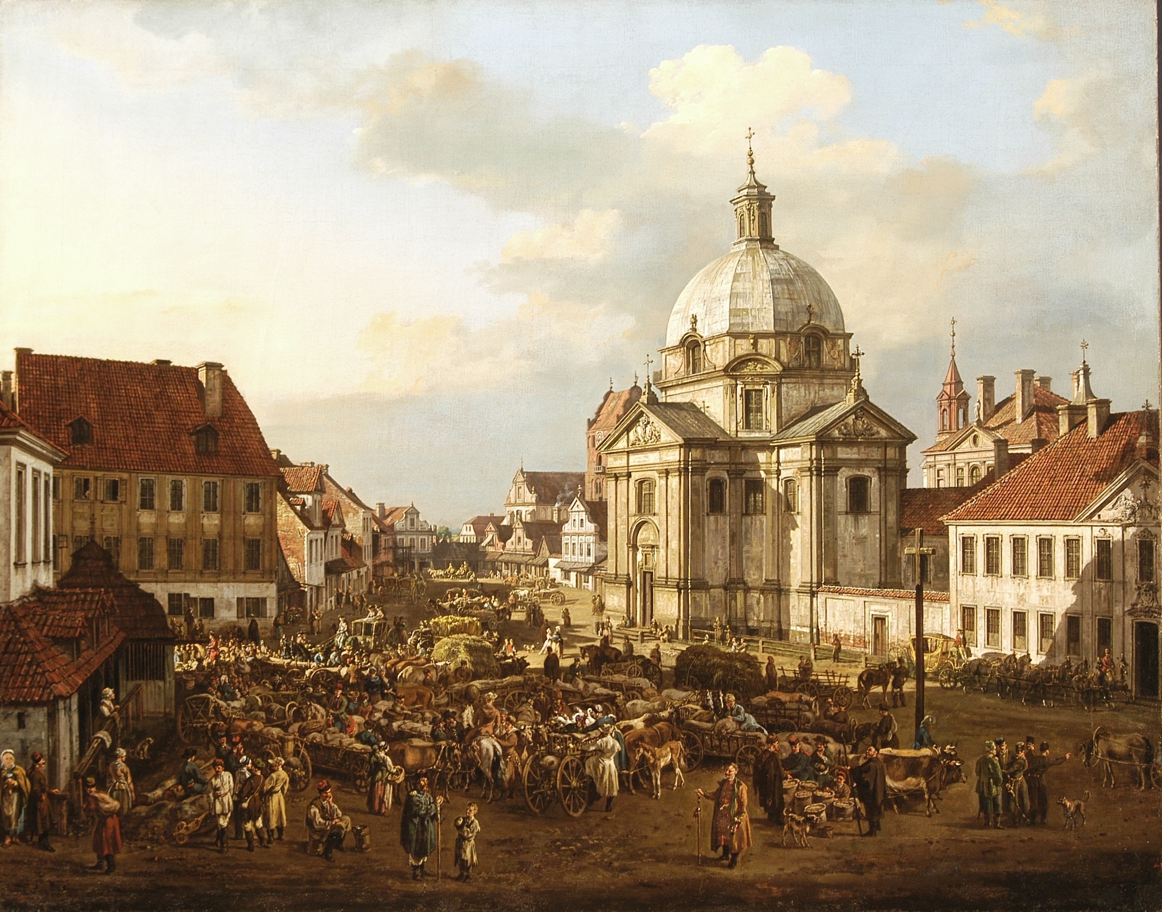
Warsaw, officially the Capital City of Warsaw, is the capital and List of cities and towns in Poland, largest city of Poland. The metropolis stands on the Vistula, River Vistula in east-central Poland. Its population is officially estimated at 1.86 million residents within a Warsaw metropolitan area, greater metropolitan area of 3.27 million residents, which makes Warsaw the List of cities in the European Union by population within city limits, 6th most-populous city in the European Union. The city area measures and comprises List of districts and neighbourhoods of Warsaw, 18 districts, while the metropolitan area covers . Warsaw is classified as an Globalization and World Cities Research Network#Alpha 2, alpha global city, a major political, economic and cultural hub, and the country's seat of government. It is also the capital of the Masovian Voivodeship. Warsaw traces its origins to a small fishing town in Masovia. The city rose to prominence in the late 16th cent ... [...More Info...] [...Related Items...] OR: [Wikipedia] [Google] [Baidu] |
First Partition Of Poland
The First Partition of Poland took place in 1772 as the first of three partitions that eventually ended the existence of the Polish–Lithuanian Commonwealth by 1795. The growth of power in the Russian Empire threatened the Kingdom of Prussia and the Habsburg monarchy and was the primary motive behind the First Partition. Frederick the Great, King in Prussia, engineered the partition to prevent Austria, which was envious of Russian successes against the Ottoman Empire, from going to war. Territories in Poland–Lithuania were divided by its more powerful neighbours (Austria, Russia and Prussia) to restore the regional balance of power in Central Europe among those three countries. With Poland unable to defend itself effectively and foreign troops already inside the country, the Polish Sejm ratified the partition in 1773 during the Partition Sejm, which was convened by the three powers. Background By the late 18th century, the Polish–Lithuanian Commonwealth had been redu ... [...More Info...] [...Related Items...] OR: [Wikipedia] [Google] [Baidu] |
Gold Reserve
A gold reserve is the gold held by a national central bank, intended mainly as a guarantee to redeem promises to pay depositors, note holders (e.g. paper money), or trading peers, during the eras of the gold standard, and also as a store of value, or to support the value of the national currency. The World Gold Council estimates that all the gold ever mined, and that is accounted for, totalled 190,040 metric tons in 2019How much gold has been mined? ", World Gold Council but other independent estimates vary by as much as 20%. At the price of $40 per gram reached on 16 August 2017, one metric ton of gold has a value of approximately $40.2 million. The total value of all gold ever mined, and that is accounted for, would exceed $7.5 trillion at that valuation and using WGC 2017 esti ... [...More Info...] [...Related Items...] OR: [Wikipedia] [Google] [Baidu] |


