|
Semirara
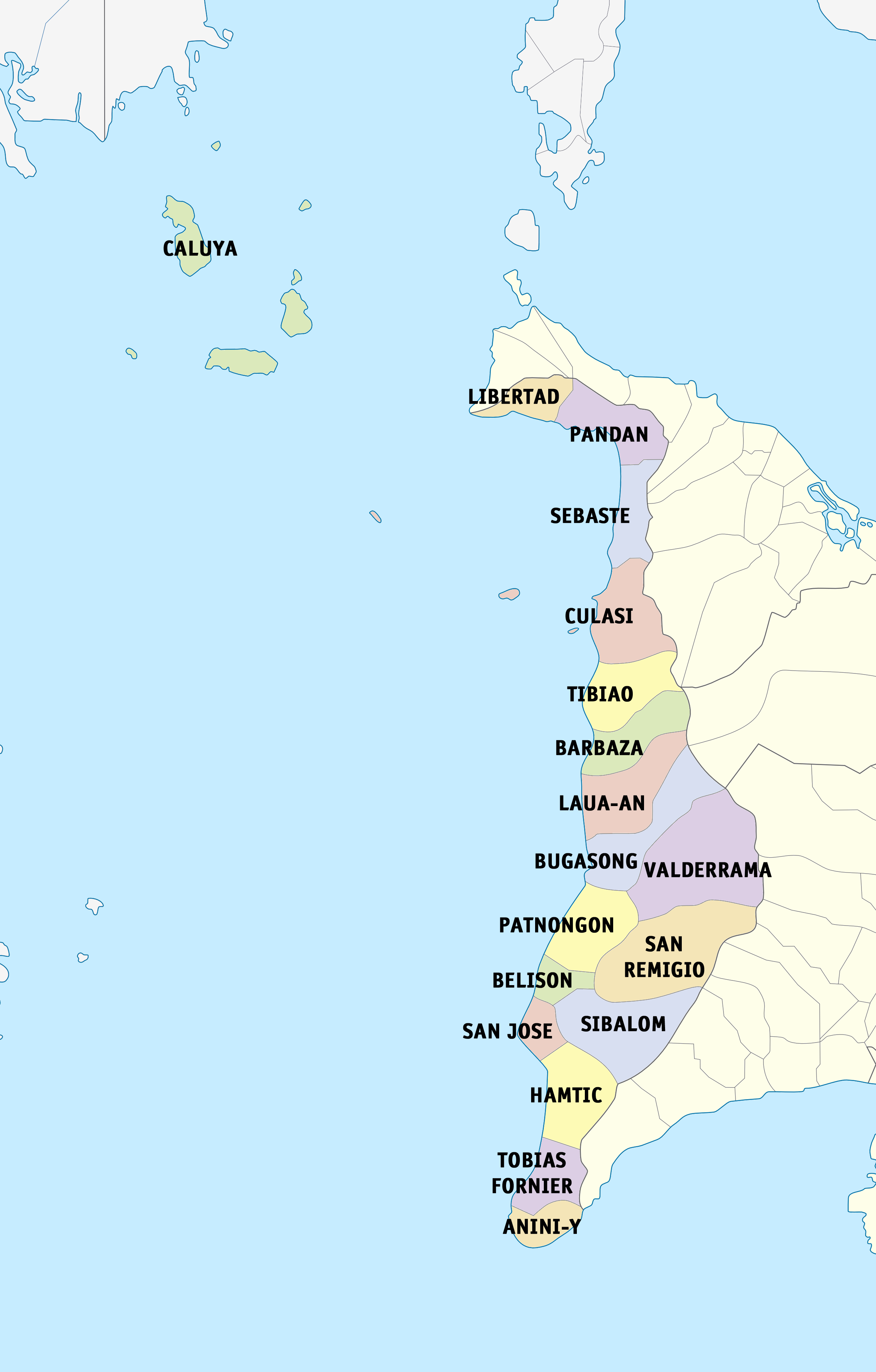
Semirara is an island in the Philippines located in the Caluya archipelago which is situated south of Mindoro Island. It is under the jurisdiction of the town of Caluya in the province of Antique. It is a major site of coal mining in the Philippines. Other economic activities in the island include fishing, seashell gathering, and farming. History A 1905 report documented the island as then being forested, and it was estimated that nearly half the trees were a species of Molave described as "wonderful hard wood", as "scarce along the coasts of the archipelago". This large and readily accessible supply was noted to possibly be of considerable importance. The report also documented a profusionn of wild grapes on the island, describing them as edible and similar in size to the Concord grape. and noting that a large quantity of seeds would be brought a forest reserve facility for experimentation aimed at producing a cultivatable variety. The island was declared a mineral reservati ... [...More Info...] [...Related Items...] OR: [Wikipedia] [Google] [Baidu] |
Semirara Mining And Power Corporation
The Semirara Mining and Power Corporation (SMPC) is a mining company based in the Philippines. The company, a subsidiary of DMCI Holdings, operates its main coal mine in Semirara Island and is the biggest coal producer in the Philippines accounting for 92 percent of the total national production as of 2015. History The company was established on February 26, 1980 as the "Semirara Coal Corporation" (SCC). The company entered an agreement with the Department of Energy for an exclusive right to develop, explore, and mine coal resources on Semirara Island in the town of Caluya, Antique. The company discovered coal mining sites in Semirara in Unong and Panian. In 1981, coal deposits were discovered in a third site; in Himalian. SCC, along with Austrian state firm Voest Alpine opened the first coal mining site in the island in Unong in 1984. In 1997, DMCI Holdings, Inc. began acquiring in SCC securing 40 percent of the company's common shares which it bought from Voest Alpine. By ... [...More Info...] [...Related Items...] OR: [Wikipedia] [Google] [Baidu] |
Caluya
Caluya, officially the Municipality of Caluya (; ; ), is a municipality in the province of Antique, Philippines. According to the 2020 census, it has a population of 38,908 people, making it the sixth most populous municipality in the province. Semirara Island has an area of , and is home to the Panian Mine, a vast open-pit coal mine in operation since 1999, and the Unong Mine, which was active from 1984 to 2000. History The Island of Caluya was once called ''Polo Pandan'' by Moro pirates searching for commercial ships as target victims. These pirates with their pillager vintas called ''salipsipan'' utilized the place for haven and rest after divesting ships of valuable belongings. In fear of the pirates, only few fishermen dared to fish in the area. The Moro pirates called the place Polo Pandan because the entire coastal area was covered by pandan screw pines. Several years later, fishermen from other islands, who were catching turtles for Chinese traders using their fish ... [...More Info...] [...Related Items...] OR: [Wikipedia] [Google] [Baidu] |
Antique (province)
Antique (), officially the Province of Antique, is a Provinces of the Philippines, province in the Philippines located in the Western Visayas Regions of the Philippines, region. Its capital and most populous town is San Jose de Buenavista, Antique, San Jose de Buenavista. The province is situated in the western section of Panay Island and borders Aklan Province, Aklan, Capiz, and Iloilo (province), Iloilo to the east, while facing the Sulu Sea to the west. The province is home to the indigenous Iraynun-Bukidnon, speakers of a dialect of the Kinaray-a language, who have crafted the only rice terrace clusters in the Visayas through indigenous knowledge and sheer vernacular capabilities. The rice terraces of the Iraynun-Bukidnon are divided into four terraced fields, namely, General Fullon rice terraces, Lublub rice terraces, Bakiang rice terraces, and San Agustin rice terraces. All of the rice terrace clusters have been researched by the National Commission for Culture and the Arts a ... [...More Info...] [...Related Items...] OR: [Wikipedia] [Google] [Baidu] |
Tablas Strait
Tablas Strait (), also Tabuas Strait, is a strait in the Philippines separating Mindoro Island, Tablas Island, Panay and Romblon Romblon (, , ), officially the Province of Romblon, is an archipelagic province of the Philippines located in the Mimaropa region. Its main components include Romblon, an archipelagic municipality of the same name that also serves as the provi ... islands. The approximate depth of the strait is . The strait is known for being the place where the Sulpicio Lines-owned passenger ferry MV ''Doña Paz'' and oil tanker MT ''Vector'' sank on December 20, 1987, after colliding with each other, resulting in more than 4,386 deaths. It was the deadliest peacetime maritime disaster in history. References Straits of the Philippines Landforms of Romblon Landforms of Oriental Mindoro Landforms of Antique (province) Landforms of Aklan {{Philippines-geo-stub ... [...More Info...] [...Related Items...] OR: [Wikipedia] [Google] [Baidu] |
Airstrip
An aerodrome, airfield, or airstrip is a location from which aircraft flight operations take place, regardless of whether they involve air cargo, passengers, or neither, and regardless of whether it is for public or private use. Aerodromes include small general aviation airfields, large commercial airports, and military air bases. The term ''airport'' may imply a certain stature (having satisfied certain certification criteria or regulatory requirements) that not all aerodromes may have achieved. That means that all airports are aerodromes, but not all aerodromes are airports. Usage of the term "aerodrome" (or "airfield") remains more common in Commonwealth English, and is conversely almost unknown in American English, where the term "airport" is applied almost exclusively. A water aerodrome is an area of open water used regularly by seaplanes, floatplanes or amphibious aircraft for landing and taking off. In formal terminology, as defined by the International Civil ... [...More Info...] [...Related Items...] OR: [Wikipedia] [Google] [Baidu] |
Giant Clam
''Tridacna gigas'', the giant clam, is the best-known species of the giant clam genus ''Tridacna''. Giant clams are the largest living bivalve molluscs. Several other species of "giant clam" in the genus ''Tridacna'' are often misidentified as ''Tridacna gigas''. These clams were known to indigenous peoples of East Asia for thousands of years and the Venetian scholar and explorer Antonio Pigafetta documented them in a journal as early as 1521. One of a number of large clam species native to the shallow coral reefs of the South Pacific and Indian oceans, they may weigh more than , measure as much as across, and have an average lifespan in the wild of more than 100 years. They also are found off the shores of the Philippines and in the South China Sea in the coral reefs of Malaysia. The giant clam lives in flat coral sand or broken coral and may be found at depths of as great as 20 m (66 ft). Its range covers the Indo-Pacific, but populations are diminishing quickly ... [...More Info...] [...Related Items...] OR: [Wikipedia] [Google] [Baidu] |
Mangrove
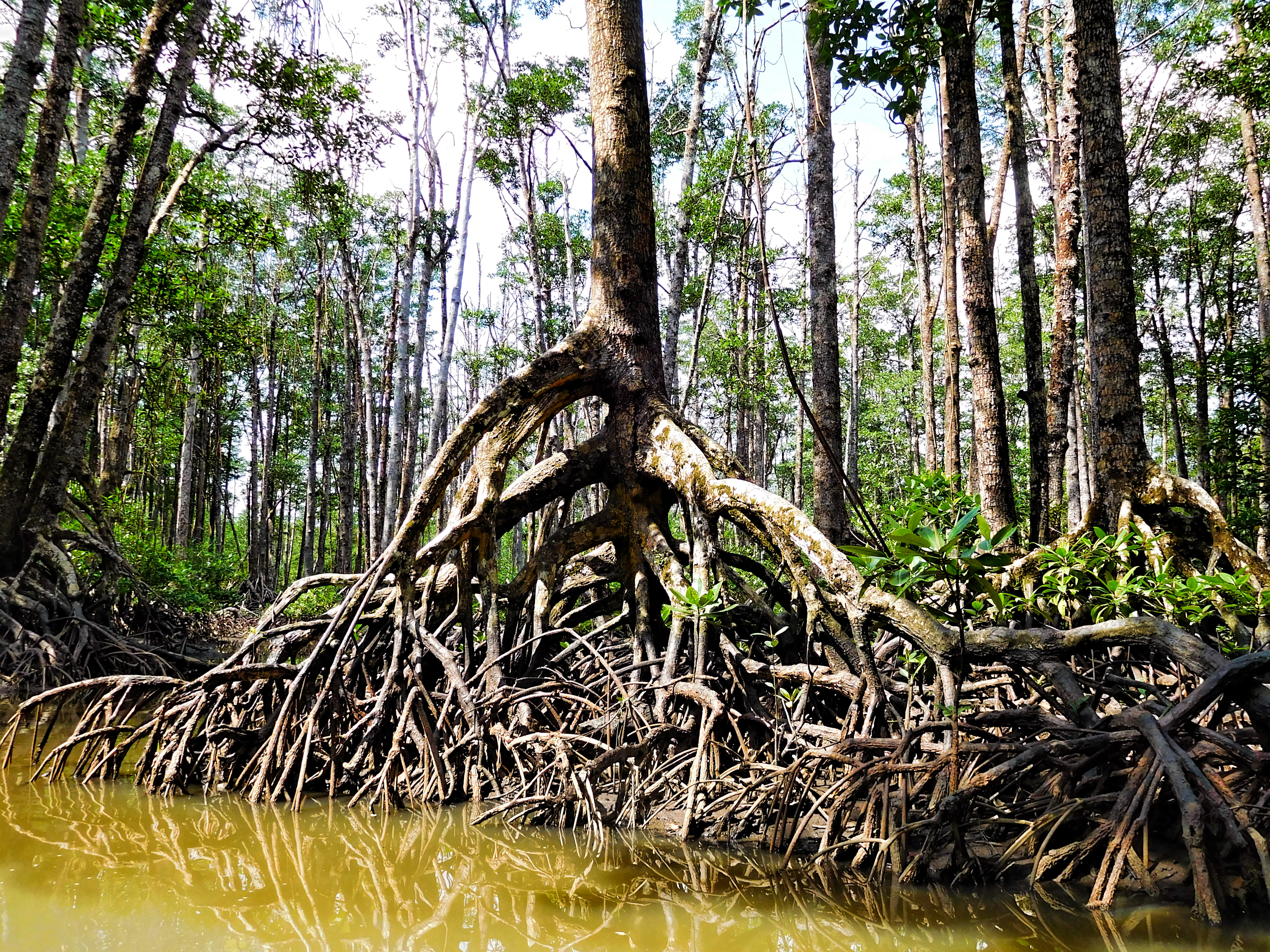
A mangrove is a shrub or tree that grows mainly in coastal saline water, saline or brackish water. Mangroves grow in an equatorial climate, typically along coastlines and tidal rivers. They have particular adaptations to take in extra oxygen and remove salt, allowing them to tolerate conditions that kill most plants. The term is also used for tropical coastal vegetation consisting of such species. Mangroves are taxonomically diverse due to convergent evolution in several plant families. They occur worldwide in the tropics and subtropics and even some temperate coastal areas, mainly between latitudes 30° N and 30° S, with the greatest mangrove area within 5° of the equator. Mangrove plant families first appeared during the Late Cretaceous to Paleocene epochs and became widely distributed in part due to the plate tectonics, movement of tectonic plates. The oldest known fossils of Nypa fruticans, mangrove palm date to 75 million years ago. Mangroves are salt-tolerant ... [...More Info...] [...Related Items...] OR: [Wikipedia] [Google] [Baidu] |
Motorized Tricycle (Philippines)
In the Philippines, motorized tricycles, or simply tricycles ( Filipino: ''traysikel''; Cebuano: ''traysikol''), refer to a type of motorized vehicle consisting of a motorcycle and a passenger cab (ie, a sidecar) attached to it. Along with the jeepney, the Philippine tricycle is one of the most common means of public or private transportation in the country, especially in rural areas. These public utility vehicles either ply a set route or are for-hire, like taxis. Philippine tricycles are built in a variety of styles, which differ from city to city, and are usually made locally by building a sidecar and affixing it to an imported motorcycle. Usually both the cycle and sidecar are covered, but not always by the same roof. Larger companies, such as Fitcor Marketing, also manufacture passenger tricycles. They are built with more seats, with the motor situated at the back rather than below the driver as per a motorcycle. Philippine tricycles are often confused with the simil ... [...More Info...] [...Related Items...] OR: [Wikipedia] [Google] [Baidu] |
Occidental Mindoro
Occidental Mindoro (), officially the Province of Occidental Mindoro ( or ''Lalawigan ng Occidental Mindoro''), is a province in the Philippines located in the Mimaropa region. The province occupies the western half of the island of Mindoro. Its capital is Mamburao, but the most populous municipality is San Jose. Sablayan is its largest municipality in terms of area, occupying almost half of the entire province. As of 2020, Occidental Mindoro has 525,354 inhabitants. The province is bordered on the east by the province of Oriental Mindoro, and on the south by the Mindoro Strait. The South China Sea is to the west of the province and Palawan is located to the southwest, across the Mindoro Strait. Batangas is to the north, separated by the Verde Island Passage, a protected marine area and the center of the world's marine biodiversity. History Early history Mindoro Island was originally known to the ancients as ''Ma-i''. It was formally called ''Mait'', and known to the Chi ... [...More Info...] [...Related Items...] OR: [Wikipedia] [Google] [Baidu] |
San Jose, Occidental Mindoro
San Jose, officially the Municipality of San Jose (), is a municipality of the Philippines, municipality in the Philippine Province, province of Occidental Mindoro, Philippines. According to the 2020 census, it has a population of 153,267, representing a third of the provincial population, and is the largest among cities (excluding Puerto Princesa City) and municipalities in the Mimaropa region. It is also the most populous town in Occidental Mindoro. San Jose has the province's largest commercial port and airport, the most banking, business, dining and commercial establishments in Occidental Mindoro, and has become a center of trade in the Mimaropa region. Its major local and international exports include rice, salt and processed milkfish. It was ranked 13th in "overall competitiveness" among Philippine local government units in the 2017 Cities and Municipalities Competitiveness Index (CMCI). In pre-colonial times, it was named Pandurucan by the indigenous Mangyans after the ... [...More Info...] [...Related Items...] OR: [Wikipedia] [Google] [Baidu] |


