|
Pembina Escarpment
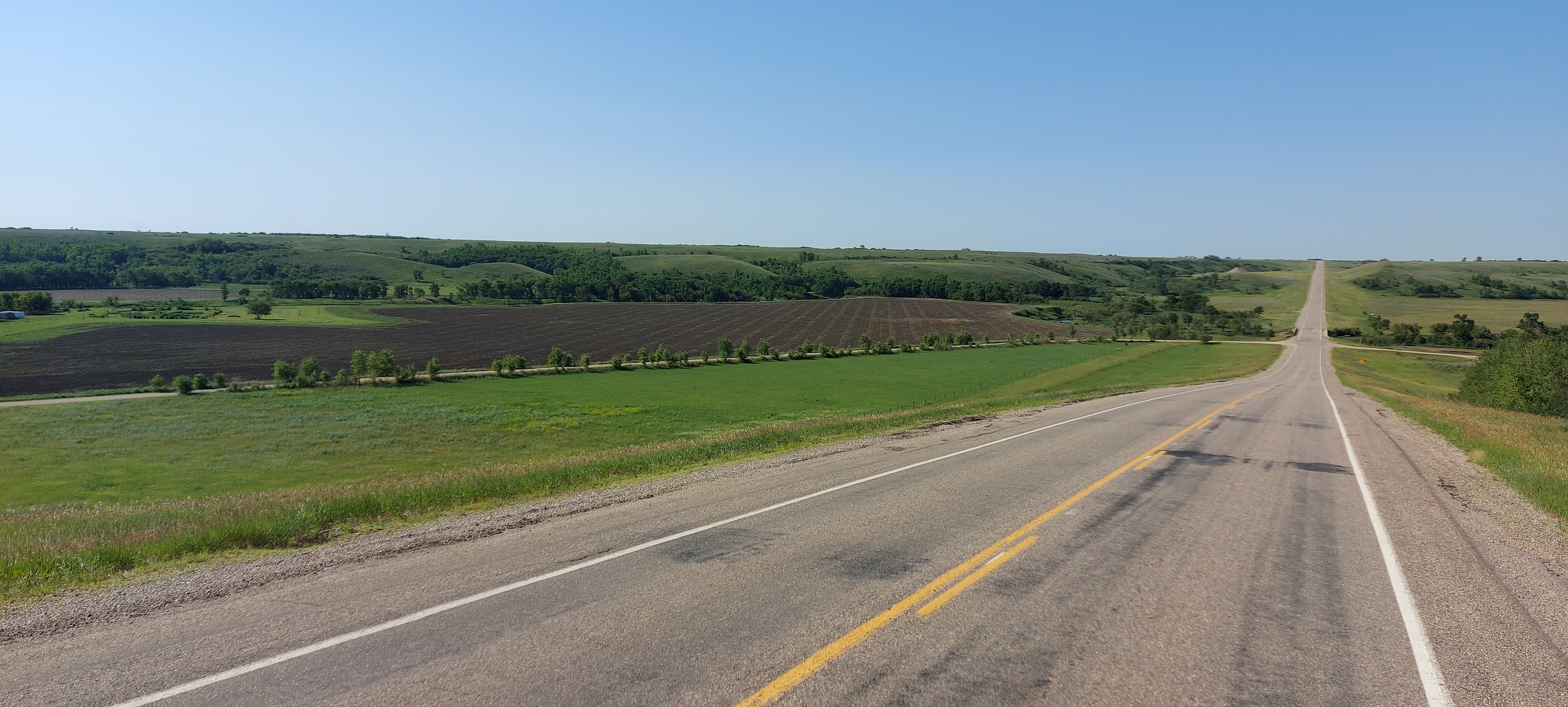
The Pembina Escarpment is a scarp that runs from South Dakota to Manitoba, and forms the western wall of the Red River Valley. The height of the escarpment above the river valley is . Geology The escarpment was originally formed by the undercutting of Cretaceous sandstones (the Dakota Formation) by the ancestral Red River. The escarpment was later steepened by glacial scouring. The escarpment is preserved due to a layer of erosion-resistant shale (the Pierre Formation) on top of the sandstone. The vista today, of wooded hills with small farms tucked into valleys (such as the Pembina Valley), is reminiscent of pastoral sections of New England. Streams flowing off the escarpment have high gradients and a cobble substrate. The final form of the escarpment we know today was not created until the end of the last ice age around 12,000 years ago. During the ice age, much of North America was covered by the Laurentide Ice Sheet. As the ice sheet began to melt and recede, the m ... [...More Info...] [...Related Items...] OR: [Wikipedia] [Google] [Baidu] |
Ice Sheet
In glaciology, an ice sheet, also known as a continental glacier, is a mass of glacial ice that covers surrounding terrain and is greater than . The only current ice sheets are in Antarctica and Greenland; during the Last Glacial Period at Last Glacial Maximum, the Laurentide Ice Sheet covered much of North America, the Weichselian ice sheet covered Northern Europe and the Patagonian Ice Sheet covered southern South America. Ice sheets are bigger than ice shelves or alpine glaciers. Masses of ice covering less than 50,000 km2 are termed an ice cap. An ice cap will typically feed a series of glaciers around its periphery. Although the surface is cold, the base of an ice sheet is generally warmer due to geothermal heat. In places, melting occurs and the melt-water lubricates the ice sheet so that it flows more rapidly. This process produces fast-flowing channels in the ice sheet — these are ice streams. The present-day polar ice sheets are relatively young in ... [...More Info...] [...Related Items...] OR: [Wikipedia] [Google] [Baidu] |
Souris River
The Souris River (; french: rivière Souris) or Mouse River (as it is alternatively known in the U.S., a calque of its French name) is a river in central North America. It is about in length and drains about . It rises in the Yellow Grass Marshes north of Weyburn, Saskatchewan. It wanders south through North Dakota beyond Minot to its most southern point at the city of Velva, and then back north into Manitoba. The river passes through the communities of Melita, Hartney, Souris and Wawanesa and on to its confluence with the Assiniboine River near Treesbank, about southeast of Brandon. The main tributaries which flow into the Souris in Manitoba are the Antler River, the Gainsborough, and Plum Creeks. At the end of the last ice age over 10,000 years ago the rapid draining of former Glacial Lake Regina eroded a large channel that is now occupied by the much smaller contemporary Souris River. Also, much of the drainage basin is fertile silt and clay deposited by another fo ... [...More Info...] [...Related Items...] OR: [Wikipedia] [Google] [Baidu] |
Assiniboine River
The Assiniboine River (''; french: Rivière Assiniboine'') is a river that runs through the prairies of Western Canada in Saskatchewan and Manitoba. It is a tributary of the Red River. The Assiniboine is a typical meandering river with a single main channel embanked within a flat, shallow valley in some places and a steep valley in others. Its main tributaries are the Qu'Appelle, Souris and Whitesand Rivers. For early history and exploration see Assiniboine River fur trade. The river takes its name from the Assiniboine First Nation. Robert Douglas of the Geographical Board of Canada (1933) made several comments as to its origin: "The name commemorates the Assiniboine natives called by La Vérendrye in 1730 'Assiniboils' and by Governor Knight in 1715 of the Hudson's Bay Company 'stone Indians.' Assiniboine is the name of an Indian tribe and is derived from 'assine' a stone and 'bwan' native name of the Sioux, hence Stony Sioux name was possibly given because they used heate ... [...More Info...] [...Related Items...] OR: [Wikipedia] [Google] [Baidu] |
Saskatchewan
Saskatchewan ( ; ) is a province in western Canada, bordered on the west by Alberta, on the north by the Northwest Territories, on the east by Manitoba, to the northeast by Nunavut, and on the south by the U.S. states of Montana and North Dakota. Saskatchewan and Alberta are the only landlocked provinces of Canada. In 2022, Saskatchewan's population was estimated at 1,205,119. Nearly 10% of Saskatchewan’s total area of is fresh water, mostly rivers, reservoirs and lakes. Residents primarily live in the southern prairie half of the province, while the northern half is mostly forested and sparsely populated. Roughly half live in the province's largest city Saskatoon or the provincial capital Regina. Other notable cities include Prince Albert, Moose Jaw, Yorkton, Swift Current, North Battleford, Melfort, and the border city Lloydminster. English is the primary language of the province, with 82.4% of Saskatchewanians speaking English as their first language. Saskatchewan h ... [...More Info...] [...Related Items...] OR: [Wikipedia] [Google] [Baidu] |
Manitoba Escarpment
The Manitoba Escarpment, or the Western Manitoba Uplands, are a range of hills along the Saskatchewan-Manitoba border. The eastern slopes of the range are considered to be a scarp. They were created by glacial scouring and formed the western shore of prehistoric Lake Agassiz. History The region was inhabited by several different aboriginal tribes before Europeans arrived including: Swampy Cree, Plains Cree, Assiniboine, and Saulteaux. The geography of the hills helped to demarcate the boundaries of the land controlled by different tribes, and the river valleys provided trade routes. The first European to explore the region was Henry Kelsey, who travelled with a group of Cree traders from York Fort to the Red Deer River to encourage the aboriginal people there to trade with the Hudson's Bay Company. Throughout the 18th and 19th centuries, the fur trade brought many Europeans to the region who established trading posts and communities. In the 1890s, the Canadian Northe ... [...More Info...] [...Related Items...] OR: [Wikipedia] [Google] [Baidu] |
Turtle Mountain (plateau)
Turtle Mountain, or the Turtle Mountains, is an area in central North America, in the north-central portion of the U.S. state of North Dakota and southwestern portion of the Canadian province of Manitoba, approximately south of the city of Brandon on provincial highway 10. It is a plateau 2,000 ft (600 m) above sea level, 300 ft to 400 ft (90 m to 120 m) above the surrounding countryside, extending 20 mi (32 km) from north to south and 40 mi (64 km) from east to west. Rising , North Dakota's most prominent peak, Boundary Butte, is located at the western edge of the plateau. It has timber, numerous lakes, and small deposits of low-grade manganese. One of the largest lakes in the Turtle Mountains is Lake Metigoshe, which straddles the international border, with about one-eighth of the lake in Canada. The region is home to Turtle Mountain Provincial Park, a state park, two historic sites, and various hunting and fishing opportunities. Turtle Mo ... [...More Info...] [...Related Items...] OR: [Wikipedia] [Google] [Baidu] |
Canada
Canada is a country in North America. Its ten provinces and three territories extend from the Atlantic Ocean to the Pacific Ocean and northward into the Arctic Ocean, covering over , making it the world's second-largest country by total area. Its southern and western border with the United States, stretching , is the world's longest binational land border. Canada's capital is Ottawa, and its three largest metropolitan areas are Toronto, Montreal, and Vancouver. Indigenous peoples have continuously inhabited what is now Canada for thousands of years. Beginning in the 16th century, British and French expeditions explored and later settled along the Atlantic coast. As a consequence of various armed conflicts, France ceded nearly all of its colonies in North America in 1763. In 1867, with the union of three British North American colonies through Confederation, Canada was formed as a federal dominion of four provinces. This began an accretion of provinces an ... [...More Info...] [...Related Items...] OR: [Wikipedia] [Google] [Baidu] |
Northern Glaciated Plains
The Northern Mixed Grasslands is one of 867 terrestrial ecoregions defined by the World Wide Fund for Nature. This ecoregion includes parts of the Canadian provinces of Alberta, Saskatchewan, and Manitoba, north-central and eastern (except extreme eastern) North Dakota, most of east South Dakota, and north-central Nebraska in the American Great Plains. The United States Environmental Protection Agency (EPA) defines this ecoregion as the Northern Glaciated Plains. Setting This is a transition zone between the ecoregions of the Northern tall grasslands to the east and the Northern short grasslands to the west, while to the north lie the cooler Canadian boreal forests and a much shorter growing season. Environment ;Flora The Mixed Grass prairie was recognized as a mixture of the tallgrass and shortgrass prairies. The dominant grasses found here include grama (''Bouteloua gracilis''), little bluestem (''Schizachyrium scoparium''), needle-and-thread grass (''Stipa comata''), whe ... [...More Info...] [...Related Items...] OR: [Wikipedia] [Google] [Baidu] |
Ecoregion
An ecoregion (ecological region) or ecozone (ecological zone) is an ecologically and geographically defined area that is smaller than a bioregion, which in turn is smaller than a biogeographic realm. Ecoregions cover relatively large areas of land or water, and contain characteristic, geographically distinct assemblages of natural communities and species. The biodiversity of flora, fauna and ecosystems that characterise an ecoregion tends to be distinct from that of other ecoregions. In theory, biodiversity or conservation ecoregions are relatively large areas of land or water where the probability of encountering different species and communities at any given point remains relatively constant, within an acceptable range of variation (largely undefined at this point). Three caveats are appropriate for all bio-geographic mapping approaches. Firstly, no single bio-geographic framework is optimal for all taxa. Ecoregions reflect the best compromise for as many taxa as possible. ... [...More Info...] [...Related Items...] OR: [Wikipedia] [Google] [Baidu] |
United States
The United States of America (U.S.A. or USA), commonly known as the United States (U.S. or US) or America, is a country primarily located in North America. It consists of 50 states, a federal district, five major unincorporated territories, nine Minor Outlying Islands, and 326 Indian reservations. The United States is also in free association with three Pacific Island sovereign states: the Federated States of Micronesia, the Marshall Islands, and the Republic of Palau. It is the world's third-largest country by both land and total area. It shares land borders with Canada to its north and with Mexico to its south and has maritime borders with the Bahamas, Cuba, Russia, and other nations. With a population of over 333 million, it is the most populous country in the Americas and the third most populous in the world. The national capital of the United States is Washington, D.C. and its most populous city and principal financial center is New York City. Paleo-Americ ... [...More Info...] [...Related Items...] OR: [Wikipedia] [Google] [Baidu] |
University Of Manitoba
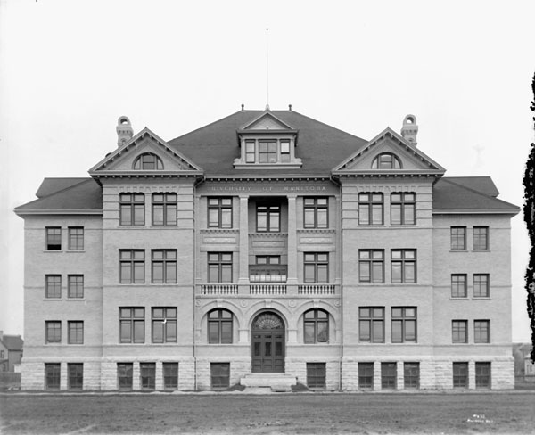
The University of Manitoba (U of M, UManitoba, or UM) is a Canadian public research university in the province of Manitoba.''University of Manitoba Act'', C.C.S.M. c. U60. Retrieved on July 15, 2008 Founded in 1877, it is the first of . Both by total student enrolment and campus area, the U of M is the largest university in the province of Manitoba and the 17th-largest in all of Canada. Its main campus is located in the [...More Info...] [...Related Items...] OR: [Wikipedia] [Google] [Baidu] |


