|
Olang
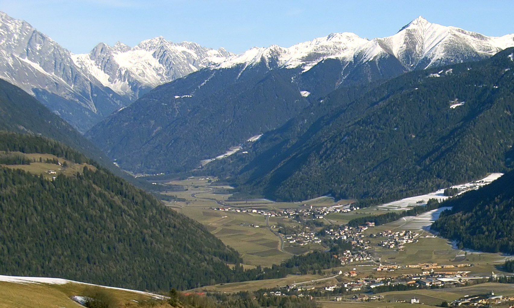
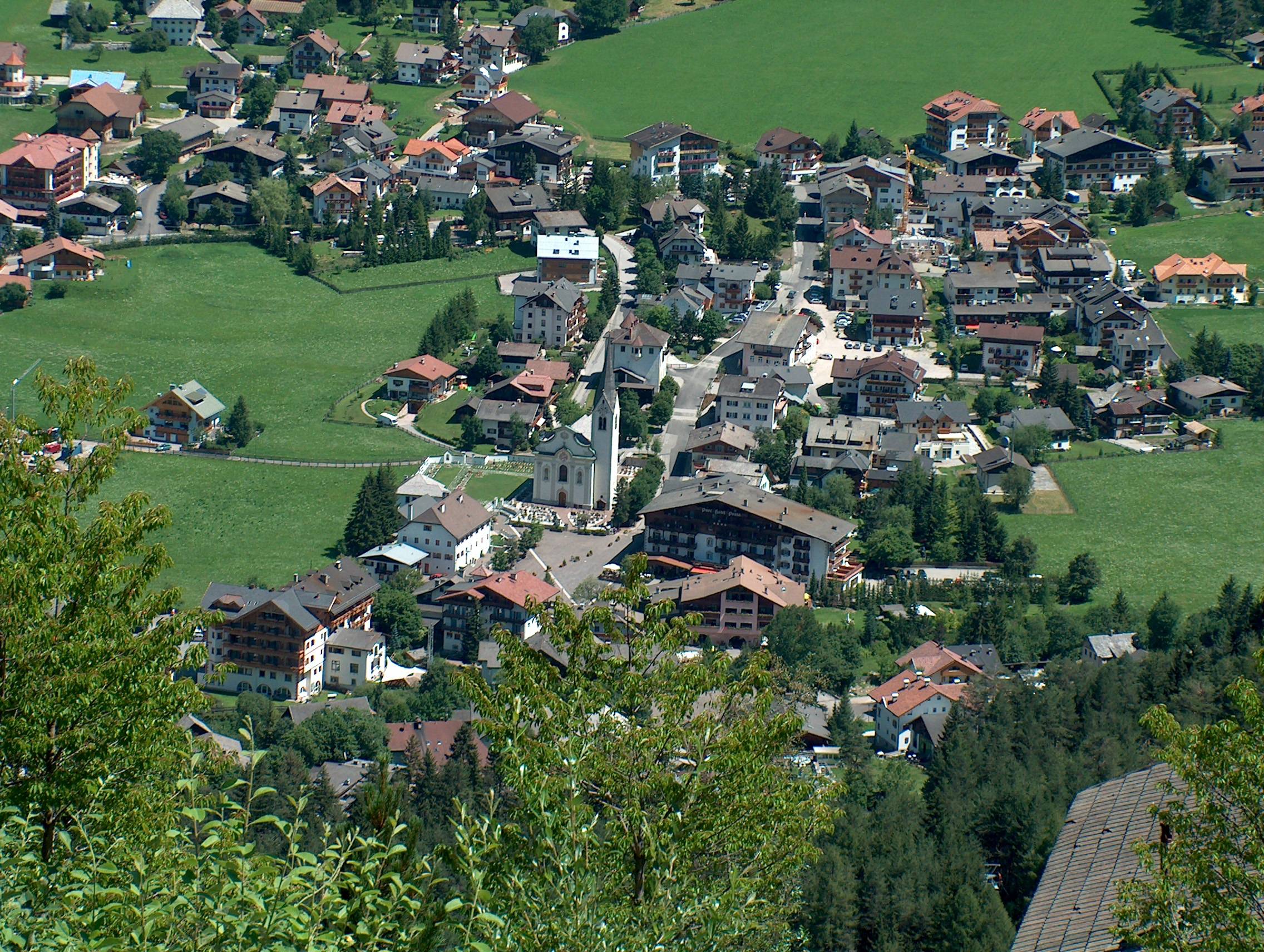
Olang (; it, Valdaora ) is a ''comune'' (municipality) in South Tyrol in northern Italy, located about northeast of the city of Bolzano. Geography As of 31 December 2015, it had a population of 3,132 and an area of .All demographics and other statistics: Italian statistical institute Istat. Olang borders the following municipalities: Bruneck, Mareo, Prags, Rasen-Antholz, and Welsberg-Taisten. Frazioni The municipality of Olang contains the ''frazioni'' (subdivisions, mainly villages and hamlets) Geiselsberg (Sorafurcia), Mitterolang (Valdaora di Mezzo), Niederolang (Valdaora di Sotto) and Oberolang (Valdaora di Sopra). History Coat-of-arms The emblem is argent a bend vert on which are represented three cart’s wheels. The wheels symbolize the villages of Mitterolang, Oberolang and Niederolang and their disposition in the valley. The emblem was granted in 1968. Society Linguistic distribution According to the 2011 census, 96.47% of the population speak German, 3.18% ... [...More Info...] [...Related Items...] OR: [Wikipedia] [Google] [Baidu] |
Rasen-Antholz
Rasen-Antholz (; it, Rasun-Anterselva ) is a municipality in South Tyrol in northern Italy. Geography The municipal area stretches along the Antholz valley, a northern side valley of the larger Puster Valley. In the northeast, the Staller Saddle mountain pass, at a height of leads into the Defereggen Valley in East Tyrol, Austria. The Antholz valley is confined by the mountains of the Rieserferner Group in the north and the Villgraten Mountains in the east, both part of the High Tauern range in the Central Eastern Alps. Notable peaks include the Hochgall, at , and the Wildgall (Collaspro), at , as well as the Ohrenspitzen massif, at , in the northeast. Large parts of the northern and western mountain ranges belong to the Rieserferner-Ahrn Nature Park established in 1988. The Antholzer Bach stream runs through the valley from Antholzer See (Lago di Anterselva) down to its confluence with the Rienz (Rienza) river at Olang. Rasen-Antholz is located east of Bruneck, the admini ... [...More Info...] [...Related Items...] OR: [Wikipedia] [Google] [Baidu] |
Prags
Prags (; it, Braies ; Ladin: ''Braies'') is a '' comune'' (municipality) in South Tyrol in northern Italy, located about northeast of Bolzano. Geography As of 30 November 2010, it had a population of 657 and an area of .All demographics and other statistics: Italian statistical institute Istat. Prags is located in the Prags valley in the northern Dolomites. The valley is split into two branches, the western one ending at the Pragser Wildsee, a mountain lake, the eastern one at the Plätzwiese, an extended alpine pasture. Prags borders the following municipalities: Cortina d'Ampezzo, Toblach, Mareo, Welsberg-Taisten, Olang, and Niederdorf. Frazioni The municipality of Prags contains the ''frazioni'' (subdivisions, mainly villages and hamlets) Außerprags (Braies di Fuori), Innerprags (Braies di Dentro), Schmieden (Ferrara) and St. Veit (San Vito). History Coat-of-arms The emblem represents a stag on a mountain with three vert peaks, crossed by a wavy stream of argent. T ... [...More Info...] [...Related Items...] OR: [Wikipedia] [Google] [Baidu] |
Mareo
Mareo ( it, Marebbe ; german: Enneberg ) is a ''comune'' (municipality) in South Tyrol in northern Italy, located about northeast of Bolzano. Geography As of 30 November 2010, it had a population of 2,911 and an area of .All demographics and other statistics: Italian statistical institute Istat. Mareo borders the following municipalities: Badia, Prags, Bruneck, Cortina d'Ampezzo, La Val, Lüsen, St. Lorenzen, San Martin de Tor and Olang. Frazioni The municipality of Mareo contains the ''frazioni'' (subdivisions, mainly villages and hamlets) Curt (Corte/Hof), Mantena, La Pli de Mareo, Pliscia (Plisa/Plaiken), Al Plan (San Vigilio/St. Vigil), Rina (Welschellen), and Longega (Zwischenwasser). History Coat of arms The shield is parted quarterly: the first part represents the Tyrolean Eagle on argent; the second the insignia of Austria. The third shows the head's dog of argent, with an or collar on gules, which represents the arms of the Lords of ''Ros'' that in thirteenth ce ... [...More Info...] [...Related Items...] OR: [Wikipedia] [Google] [Baidu] |
Welsberg-Taisten
Welsberg-Taisten (; it, Monguelfo-Tesido ) is a ''comune'' (municipality) in the province of South Tyrol in northern Italy, located about northeast of the city of Bolzano. Geography As of November 30, 2010, it had a population of 2,809 and an area of . Welsberg-Taisten borders the following municipalities: Prags, Rasen-Antholz, Olang, Gsies, and Niederdorf. Frazioni The municipality of Welsberg-Taisten contains the ''frazioni'' (parishes) Ried (Novale), Wiesen (Prati), Unterrain (Riva di Sotto) and Taisten (Tesido). Taisten lies above sea level in the Puster Valley, east of Bruneck. History Coat-of-arms The emblem is quarterly argent and sable. It is the arms of the Earls of ''Welsberg'', whose castle was in the municipality, which gave to the village its name. The emblem was adopted in 1932. Society Linguistic distribution According to the 2011 census, 95.08% of the population speak German, 4.57% Italian and 0.35% Ladin Ladin may refer to: *Ladin language, a lang ... [...More Info...] [...Related Items...] OR: [Wikipedia] [Google] [Baidu] |
Italian Language
Italian (''italiano'' or ) is a Romance language of the Indo-European language family that evolved from the Vulgar Latin of the Roman Empire. Together with Sardinian, Italian is the least divergent language from Latin. Spoken by about 85 million people (2022), Italian is an official language in Italy, Switzerland ( Ticino and the Grisons), San Marino, and Vatican City. It has an official minority status in western Istria ( Croatia and Slovenia). Italian is also spoken by large immigrant and expatriate communities in the Americas and Australia.Ethnologue report for language code:ita (Italy) – Gordon, Raymond G., Jr. (ed.), 2005. Ethnologue: Languages of the World, Fifteenth edition. Dallas, Tex.: SIL International. Online version [...More Info...] [...Related Items...] OR: [Wikipedia] [Google] [Baidu] |
German Language
German ( ) is a West Germanic language mainly spoken in Central Europe. It is the most widely spoken and official or co-official language in Germany, Austria, Switzerland, Liechtenstein, and the Italian province of South Tyrol. It is also a co-official language of Luxembourg and Belgium, as well as a national language in Namibia. Outside Germany, it is also spoken by German communities in France (Bas-Rhin), Czech Republic (North Bohemia), Poland (Upper Silesia), Slovakia (Bratislava Region), and Hungary (Sopron). German is most similar to other languages within the West Germanic language branch, including Afrikaans, Dutch, English, the Frisian languages, Low German, Luxembourgish, Scots, and Yiddish. It also contains close similarities in vocabulary to some languages in the North Germanic group, such as Danish, Norwegian, and Swedish. German is the second most widely spoken Germanic language after English, which is also a West Germanic language. German is one of the ... [...More Info...] [...Related Items...] OR: [Wikipedia] [Google] [Baidu] |
Vert (heraldry)
In classical heraldry, vert () is the tincture equivalent to the colour "green". It is one of the five dark tinctures (''colours''). The word ''vert'' is simply the French for "green". It is used in English in the sense of a heraldic tincture since the early 16th century. In Modern French, ''vert'' is not used as a heraldic term. Instead, the French heraldic term for green tincture is ''sinople''. This has been the case since c. the 16th century. In medieval French heraldry, ''vert'' also meant "green" while ''sinople'' was a shade of red. Vert is portrayed by the conventions of heraldic "hatching" (in black and white engravings) by lines at a 45-degree angle from upper left to lower right, or indicated by the abbreviation vt. when a coat of arms is tricked. The colour green is commonly found in modern flags and coat of arms, and to a lesser extent also in the classical heraldry of the Late Middle Ages and the Early Modern period. Green flags were historically carried by Otto ... [...More Info...] [...Related Items...] OR: [Wikipedia] [Google] [Baidu] |
Bend (heraldry)
In heraldry, a bend is a band or strap running from the upper dexter (the bearer's right side and the viewer's left) corner of the shield to the lower sinister (the bearer's left side, and the viewer's right). Authorities differ as to how much of the field it should cover, ranging from one-fifth (if shown between other charges) up to one-third (if charged alone). The supposed rule that a bend should occupy a maximum of one-third of the field appears to exclude the possibility of three bends being shown together, but contrary examples exist. Variations A bend can be modified by most of the lines of partition, such as the ''bend engrailed'' in the ancient arms of Fortescue and the ''bend wavy'' in the ancient coat of Wallop, Earls of Portsmouth. Diminutives The diminutives of the bend, being narrower versions, are as follows, in descending order of width: *Bendlet: One-half as wide as a bend, as in the ancient arms of Churchill family, and the arms of Byron. A ''bendlet ... [...More Info...] [...Related Items...] OR: [Wikipedia] [Google] [Baidu] |
Argent
In heraldry, argent () is the tincture of silver, and belongs to the class of light tinctures called "metals". It is very frequently depicted as white and usually considered interchangeable with it. In engravings and line drawings, regions to be tinctured ''argent'' are either left blank, or indicated with the abbreviation ''ar''. The name derives from Latin ''argentum'', translated as " silver" or "white metal". The word ''argent'' had the same meaning in Old French ''blazon'', whence it passed into the English language. In some historical depictions of coats of arms, a kind of silver leaf was applied to those parts of the device that were argent. Over time, the silver content of these depictions has tarnished and darkened. As a result, it can sometimes be difficult to distinguish regions that were intended as "argent" from those that were " sable". This leaves a false impression that the rule of tincture has been violated in cases where, when applied next to a dark colou ... [...More Info...] [...Related Items...] OR: [Wikipedia] [Google] [Baidu] |
Frazione
A ''frazione'' (plural: ) is a type of subdivision of a '' comune'' (municipality) in Italy, often a small village or hamlet outside the main town. Most ''frazioni'' were created during the Fascist era (1922–1943) as a way to consolidate territorial subdivisions in the country. In the autonomous region of the Aosta Valley, a ''frazione'' is officially called an ''hameau'' in French. Description Typically the term ''frazioni'' applies to the villages surrounding the main town ('' capoluogo'') of a '' comune''. Subdivision of a ''comune'' is optional; some ''comuni'' have no ''frazioni'', but others have several dozen. The ''comune'' usually has the same name of the ''capoluogo'', but not always, in which case it is called a ''comune sparso''. In practice, most ''frazioni'' are small villages or hamlets, occasionally just a clump of houses. Not every hamlet is classified as a ''frazione''; those that are not are often referred to as '' località'', for example, in the telepho ... [...More Info...] [...Related Items...] OR: [Wikipedia] [Google] [Baidu] |
Trentino-Alto Adige/Südtirol
it, Trentino (man) it, Trentina (woman) or it, Altoatesino (man) it, Altoatesina (woman) or it, Sudtirolesegerman: Südtiroler (man)german: Südtirolerin (woman) , population_note = , population_blank1_title = Official languages , population_blank1 = ItalianGerman (South Tyrol) , population_blank2_title = Other languages , population_blank2 = in some municipalities:Ladin MochenoCimbrian , demographics_type1 = Citizenship , demographics1_footnotes = , demographics1_title1 = Italian , demographics1_info1 = 93% , timezone1 = CET , utc_offset1 = +1 , timezone1_DST = CEST , utc_offset1_DST = +2 , postal_code_type = , postal_code = , area_code_type = ISO 3166 code , area_code = IT-32 , blank_name_sec1 ... [...More Info...] [...Related Items...] OR: [Wikipedia] [Google] [Baidu] |
South Tyrol
it, Provincia Autonoma di Bolzano – Alto Adige lld, Provinzia Autonoma de Balsan/Bulsan – Südtirol , settlement_type = Autonomous province , image_skyline = , image_alt = , image_caption = , image_flag = Flag_of_South_Tyrol.svg , flag_alt = , image_shield = Suedtirol CoA.svg , shield_size = x100px , shield_alt = Coat of arms of Tyrol , anthem = , image_map = Bolzano in Italy.svg , map_alt = , map_caption = Map highlighting the location of the province of South Tyrol in Italy (in red) , coordinates = , coordinates_footnotes = , subdivision_type = Country , subdivision_name = Italy , subdivision_type1 = ... [...More Info...] [...Related Items...] OR: [Wikipedia] [Google] [Baidu] |


