|
Marienheide
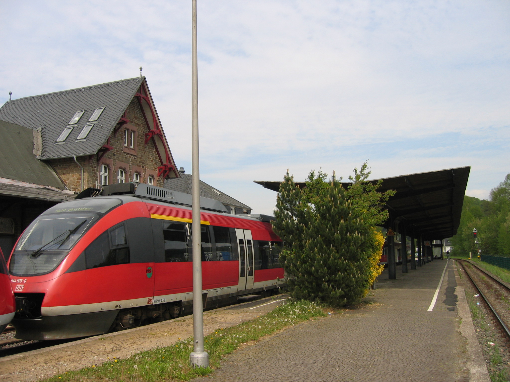
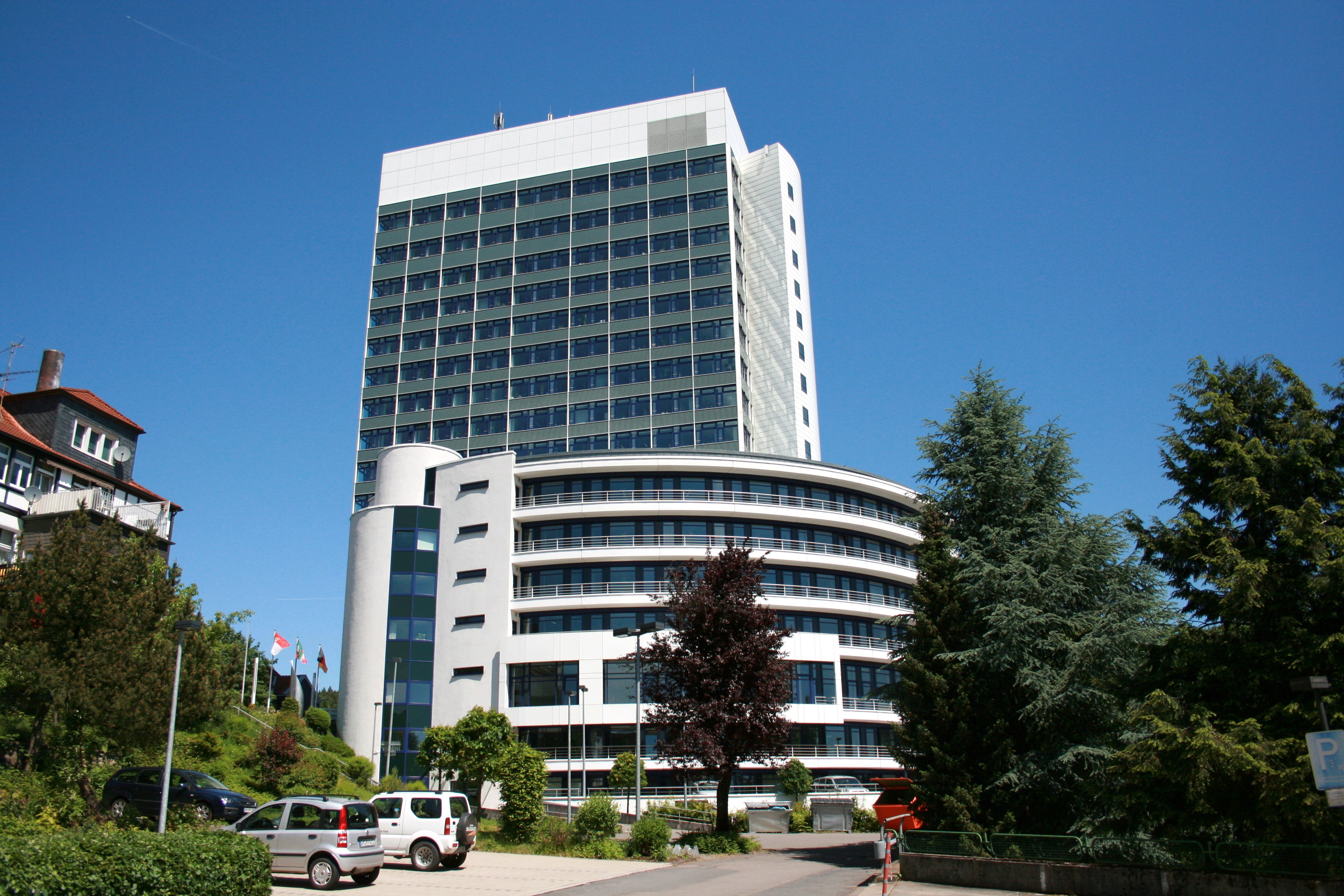
Marienheide is a municipality in the Oberbergischer Kreis, in North Rhine-Westphalia, Germany. Geography Marienheide is located about 50 km east of Cologne. Neighbouring places The neighbouring towns are Gummersbach and Wipperfürth as well as in Märkischer Kreis - Meinerzhagen and Kierspe, and the neighbouring municipalities are Engelskirchen and Lindlar. Division of the municipality History The first documentary mention of the place was in 1417 " in a sales document is called Heydenreich of our dear Mrs. Knecht on the Mergenheyde " (Documentary first namings of oberbergischer places v. Klaus Pampus). The manner of writing of the first naming was: Mergenheyde. On the altar lights of the old pilgrimage church a signed coat of arms of 1601 which carries the name "Mergenheyd" is to be seen. An old brochure of the Catholic vicarage Marienheide states: " The origin of the mercy place Marienheide dates back to 1420 and to one particular man. " This person, a simple man call ... [...More Info...] [...Related Items...] OR: [Wikipedia] [Google] [Baidu] |
Hagen–Dieringhausen Railway
The Hagen–Dieringhausen railway (also called the ''Volmetalbahn'': Volme Valley Railway) is a mostly single-track (continuously double track as far as Lüdenscheid-Brügge) and non-electrified railway line from Hagen Hauptbahnhof via Lüdenscheid-Brügge, Meinerzhagen and Gummersbach to Gummersbach-Dieringhausen in the German state of North Rhine-Westphalia. The ''Volmetalbahn'' is also the name of the trains running on this line as Regionalbahn service RB 52, from Lüdenscheid via Hagen to Dortmund. The RB 25 ( Oberbergische Bahn) service runs from Lüdenscheid via Lüdenscheid-Brügge and Marienheide to Cologne on the line. The railway and the Regionalbahn service are both named after the Volme river, which they both follow for most of their route. History The route was studied in the 1840s as an alternative to the route of the Ruhr–Sieg railway. In May 1870, the Bergisch-Märkische Railway Company (''Bergisch-Märkischen Eisenbahn-Gesellschaft'', BME) began cons ... [...More Info...] [...Related Items...] OR: [Wikipedia] [Google] [Baidu] |
Oberbergische Bahn
The Oberbergische Bahn (RB 25) is a Regionalbahn rail service running between Cologne Hansaring and Lüdenscheid in the German state of North Rhine-Westphalia (NRW). This service is operated by DB Regio NRW with Alstom Coradia LINT 54 and 81 railcars. Route The RB 25 service starts at Cologne Hansaring and runs over the tracks of the S-Bahn line to the Cologne–Overath railway to Overath then on the Siegburg–Olpe railway (also called the Agger Valley Railway) to Gummersbach-Dieringhausen, continuing over the Hagen–Dieringhausen railway (Volme Valley Railway) and Lüdenscheid-Brügge to its terminus at Lüdenscheid. The RB 25 service runs on the section between Cologne Hansaring and Gummersbach every half hour. Trains continue from Gummersbach to Lüdenscheid hourly. Fares Fares on the entire line are regulated by Verkehrsverbund Rhein-Sieg (Rhine-Sieg Transport Association). Extension to Lüdenscheid Oliver Wittke, the former NRW transport minister, turne ... [...More Info...] [...Related Items...] OR: [Wikipedia] [Google] [Baidu] |
Wipperfürth
310px, Map of the city 250px, Town hall Wipperfürth () is a municipality in the Oberbergischer Kreis of North Rhine-Westphalia, Germany, about 40 km north-east of Cologne, and the oldest town in the Bergischen Land. History The eldest documentary mention dates from 1131. In the Siegburger Mirakelbuch the place is already designated Oppidum(=town). Manner of writing of the first naming: "Weperevorthe". Wipperfürth received town rights between 1217 and 1222. Since 1283 the administration of the town was governed by count Adolf V. von Berg. Already in 1275 king Rudolf von Habsburg allowed the count to move his mint from Wildberg to Wipperfürth. Here, Pfennige were stamped according to Cologne model. In 1328, with the privilege of king Louis the Bavarian the first coinage of Groschen in Germany began in Wipperfürth. Since the 14th century the town was a member of the Hanse. Businesspeople of the town traveled to Stockholm, Dorpat, Malmö, Novgorod, Reval and Lübeck. ... [...More Info...] [...Related Items...] OR: [Wikipedia] [Google] [Baidu] |
Lindlar
Lindlar ( ) is a municipality in the Oberbergischer Kreis, in North Rhine-Westphalia, Germany. It is located about 30 km east of Cologne. Geography Lindlar is located between latitudes 50°58' and 51°5' N. and longitudes 7°15' and 7°28' E. The highest point at 361.8 ms is found near Oberlichtinghagen, the lowest at 110 ms near Oberbilstein. Neighbouring places Neighbouring towns are Gummersbach, Wipperfürth, Overath and Bergisch Gladbach, and the neighbouring municipalities are Engelskirchen, Marienheide and Kürten. Division of the municipality The municipality of Lindlar is made up of these main villages: Lindlar (local centre), Frielingsdorf, Linde, Hohkeppel, Schmitzhöhe, Hartegasse/Kapellensüng. The coat of arms of Lindlar The arms were granted on 6 August 1935. The arms show in the upper part the lion of the Counts of Berg and in the lower the balance as a symbol of justice. Lindlar had its own court in the County Berg. The arms are based on the old seal of ... [...More Info...] [...Related Items...] OR: [Wikipedia] [Google] [Baidu] |
Meinerzhagen
Meinerzhagen (sometimes spelled Meinertzhagen; ) is a town in the Märkischer Kreis, North Rhine-Westphalia, Germany. Geography Meinerzhagen is located in the hills of the Sauerland. The highest elevation is the Nordhelle with 652 m above sea level, the lowest elevation at the Lister dam with 319m. 56% of the town area is covered by forests. Neighbouring municipalities Division of the town The town consists of the following villages and places: History In 1765 Meinerzhagen received city rights from King Frederick II of Prussia, however in 1865 the city abandoned them to save administrative costs. In 1846 the ''Amt Meinerzhagen'' was formed, covering both Meinerzhagen and the municipality of Valbert. On September 19, 1964, Meinerzhagen received city rights again. In the communal reform of the district Altena in 1969, Meinerzhagen was merged with Valbert, the ''Amt Meinerzhagen'' was dissolved. The family name of the British World War I officer Richard Meinertzhagen rec ... [...More Info...] [...Related Items...] OR: [Wikipedia] [Google] [Baidu] |
Oberbergischer Kreis
The Oberbergischer Kreis ( ksh, Boverbärjische Kreiß) is a ''Kreis'' (district) in the state of North Rhine-Westphalia, Germany. Neighboring districts are Ennepe-Ruhr, Märkischer Kreis, Olpe, Altenkirchen, Rhein-Sieg, Rheinisch-Bergischer Kreis, and the urban districts Remscheid and Wuppertal. Name The district was named after the region known as ''Bergisches Land'', which belonged to the County of Berg for most of the medieval era. What is called "Oberbergisch" ("upper Bergian") lies in the southeast of that earldom. By 1740, descriptions of the area distinguished between "Niederbergisch", which was north of the river Wupper, and "Oberbergisch" to its south. In 1816, after the entire Rhineland was annexed to Prussia, the districts of Waldbröl, Homburg, Gimborn, Wipperfürth, and Lennep were created within the area now covered by the district. In 1825 the districts Gimborn and Homburg were merged into the district Gummersbach. In 1932 it was merged with the district of W ... [...More Info...] [...Related Items...] OR: [Wikipedia] [Google] [Baidu] |
Märkischer Kreis
The Märkischer Kreis is a district ('' Kreis'') in central North Rhine-Westphalia, Germany. Neighbouring districts are Unna, Soest, Hochsauerland, Olpe, Oberbergischer Kreis, Ennepe-Ruhr, and the city of Hagen. History The district was created in 1975 as part of the reorganization of North Rhine-Westphalian districts. The former districts of Lüdenscheid and Iserlohn, together with the City of Iserlohn, previously an urban district, plus the area around Balve (previously part of Arnsberg District) were amalgamated to form the new district. Lüdenscheid District itself had been created just a few years earlier, in 1968, when the city of Lüdenscheid was merged with Altena District (originally created in 1753). The name Märkischer Kreis was chosen in recognition of the fact that most of its territory formerly belonged to the county of the Mark. Twinning Twinning with Wrexham County Borough (Wales, United Kingdom) dates from 1970 and was initiated by the precursor district, I ... [...More Info...] [...Related Items...] OR: [Wikipedia] [Google] [Baidu] |
Cloister
A cloister (from Latin ''claustrum'', "enclosure") is a covered walk, open gallery, or open arcade running along the walls of buildings and forming a quadrangle or garth. The attachment of a cloister to a cathedral or church, commonly against a warm southern flank, usually indicates that it is (or once was) part of a monastic foundation, "forming a continuous and solid architectural barrier... that effectively separates the world of the monks from that of the serfs and workmen, whose lives and works went forward outside and around the cloister." Cloistered (or ''claustral'') life is also another name for the monastic life of a monk or nun. The English term ''enclosure'' is used in contemporary Catholic church law translations to mean cloistered, and some form of the Latin parent word "claustrum" is frequently used as a metonymic name for ''monastery'' in languages such as German. History of the cloister Historically, the early medieval cloister had several antecedents: the ... [...More Info...] [...Related Items...] OR: [Wikipedia] [Google] [Baidu] |
Germany
Germany,, officially the Federal Republic of Germany, is a country in Central Europe. It is the second most populous country in Europe after Russia, and the most populous member state of the European Union. Germany is situated between the Baltic and North seas to the north, and the Alps to the south; it covers an area of , with a population of almost 84 million within its 16 constituent states. Germany borders Denmark to the north, Poland and the Czech Republic to the east, Austria and Switzerland to the south, and France, Luxembourg, Belgium, and the Netherlands to the west. The nation's capital and most populous city is Berlin and its financial centre is Frankfurt; the largest urban area is the Ruhr. Various Germanic tribes have inhabited the northern parts of modern Germany since classical antiquity. A region named Germania was documented before AD 100. In 962, the Kingdom of Germany formed the bulk of the Holy Roman Empire. During the 16th ce ... [...More Info...] [...Related Items...] OR: [Wikipedia] [Google] [Baidu] |
Lennep
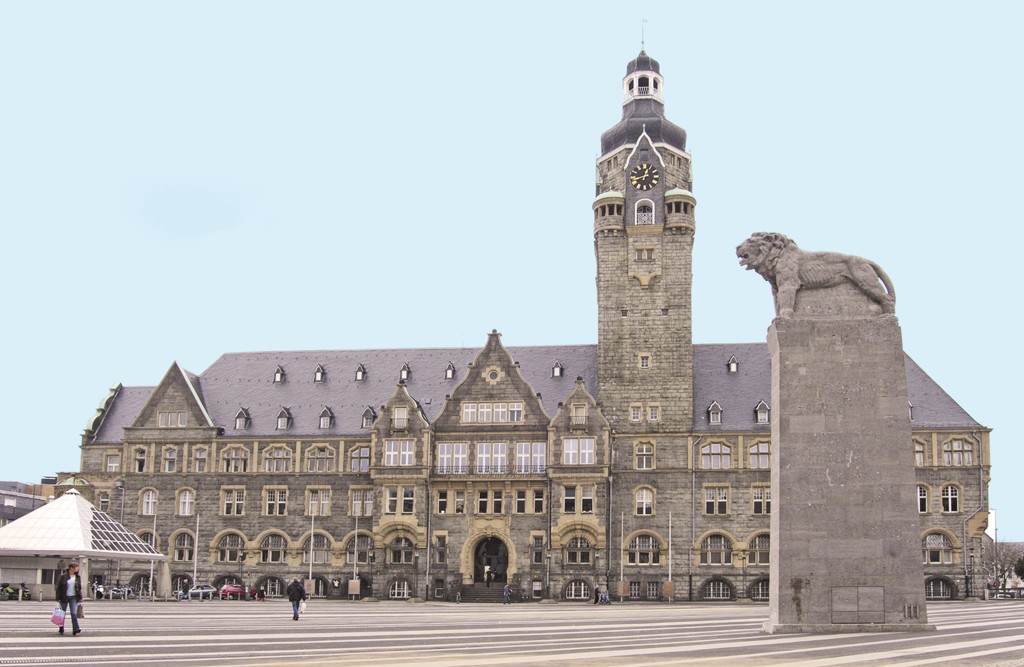
Remscheid () is a city in North Rhine-Westphalia, Germany. It is, after Wuppertal and Solingen, the third-largest municipality in Bergisches Land, being located on the northern edge of the region, on the south side of the Ruhr area. Remscheid had around 109,000 inhabitants in 2015. At the end of 2019 it had 113,703 inhabitants. Geography Remscheid comprises four boroughs, ''Alt-Remscheid'', ''Remscheid-Süd'', ''Lennep'', and Lüttringhausen. Its highest point is the Brodtberg (378 m). History Remscheid was founded in the 12th century, but remained a small village until the 19th century. Early spellings for the city included ''Remissgeid'' (1217), ''Rymscheyd'' (1351), ''Reymscheyd'' (1487) and ''Rembscheid'' (1639). The economic growth of the entire Rhine-Ruhr region led to an increase of the population of Remscheid. Mechanical engineering and toolmaking were the main industries practised within the town. This is carried on today with the Hazet tool company which has two f ... [...More Info...] [...Related Items...] OR: [Wikipedia] [Google] [Baidu] |
Remscheid
Remscheid () is a city in North Rhine-Westphalia, Germany. It is, after Wuppertal and Solingen, the third-largest municipality in Bergisches Land, being located on the northern edge of the region, on the south side of the Ruhr area. Remscheid had around 109,000 inhabitants in 2015. At the end of 2019 it had 113,703 inhabitants. Geography Remscheid comprises four boroughs, ''Alt-Remscheid'', ''Remscheid-Süd'', ''Lennep'', and Lüttringhausen. Its highest point is the Brodtberg (378 m). History Remscheid was founded in the 12th century, but remained a small village until the 19th century. Early spellings for the city included ''Remissgeid'' (1217), ''Rymscheyd'' (1351), ''Reymscheyd'' (1487) and ''Rembscheid'' (1639). The economic growth of the entire Rhine-Ruhr region led to an increase of the population of Remscheid. Mechanical engineering and toolmaking were the main industries practised within the town. This is carried on today with the Hazet tool company which has two fac ... [...More Info...] [...Related Items...] OR: [Wikipedia] [Google] [Baidu] |
.jpg)


