|
Limagne
The Limagne () is large plain in the Auvergne region of France in the valley of the Allier river, on the edge of the Massif Central. It lies entirely within the ''département'' of Puy-de-Dôme. The term is sometimes used to include this, and three other less extensive plains, that lie along the valley of the Allier, in which case the first is known as ''Grande Limagne'' to distinguish it from the others. The name is derived from the Latin ''Lacus Magnus'', or large lake. Geology The Limagne plain is a graben, downthrown from the Massif Central by a series of normal faults that border the western edge of the plain. It contains about 2 km of sediments, and the amount of stretching of the crust is estimated as 1.2–1.3. The rifting started in the Late Eocene and the main phase of subsidence continued into the Late Oligocene. The Limagne Graben forms part of a system of linked rifts, including the Rhine Graben, known as the European Cenozoic Rift System, that formed in r ... [...More Info...] [...Related Items...] OR: [Wikipedia] [Google] [Baidu] |
European Cenozoic Rift System
The European Cenozoic Rift System (ECRIS) is a long system of rifts formed in the foreland of the Alps as the lithosphere responded to the effects of the Alpine and Pyrenean orogenies. The system began to form during the Late Eocene and parts (particularly the Upper and Lower Rhine Grabens) remain seismically active today and are responsible for most of the larger earthquakes in Europe, north of the Alps. Extent The ECRIS consists of a series of rifts and associated transfer faults extending from the Mediterranean to the North Sea. Limagne Graben This north-south trending rift structure formed in the middle Eocene creating a lake that is now the Limagne plain. The main phase of subsidence continued until the Late Oligocene. The graben is controlled by faults on its western side and is filled with Cenozoic sediments up to 2 km thick. Bresse Graben The Bresse Graben lies to the east of the Limagne Graben. Rifting started during the Eocene, pausing from the Late Oligocene ... [...More Info...] [...Related Items...] OR: [Wikipedia] [Google] [Baidu] |
Peperite
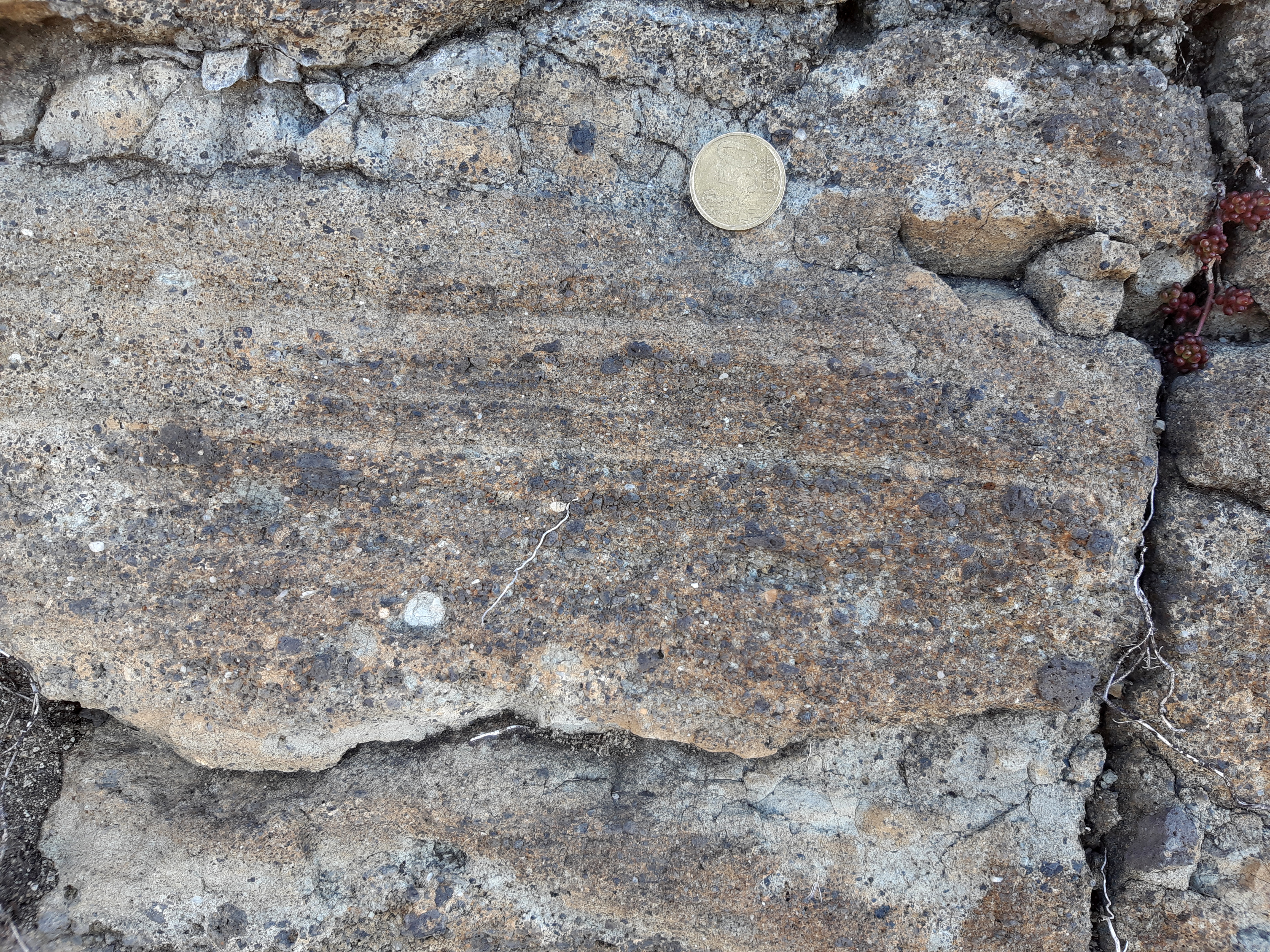
A peperite is a type of volcaniclastic rock consisting of sedimentary rock that contains fragments of younger igneous material and is formed when magma comes into contact with wet sediments. The term was originally used to describe rocks from the Limagne region of France, from the similarity in appearance of the granules of dark basalt in the light-coloured limestone to black pepper. Typically the igneous fragments are glassy and show chilled-margins to the sedimentary matrix, distinguishing them from clasts with a sedimentary origin. Terminology The term has been used to describe a wide variety of rocks that are interpreted to have formed by the interaction between magma and sediments. This usage has led to overlap with other terms such as hyaloclastite. In the most recent edition of 'Igneous rocks' by Le Maître et al. the definition is given as "A local term for a tuff or breccia, formed by the intrusion of magma into wet sediments. Usually consists of glassy fragments of ign ... [...More Info...] [...Related Items...] OR: [Wikipedia] [Google] [Baidu] |
Massif Central
The (; oc, Massís Central, ; literally ''"Central Massif"'') is a highland region in south-central France, consisting of mountains and plateaus. It covers about 15% of mainland France. Subject to volcanism that has subsided in the last 10,000 years, these central mountains are separated from the Alps by a deep north–south cleft created by the Rhône river and known in French as the ' (literally "Rhône furrow"). The region was a barrier to transport within France until the opening of the A75 motorway, which not only made north–south travel easier, but also opened access to the massif itself. Geography and geology The is an old massif, formed during the Variscan orogeny, consisting mostly of granitic and metamorphic rocks. It was powerfully raised and made to look geologically younger in the eastern section by the uplift of the Alps during the Paleogene period and in the southern section by the uplift of the Pyrenees. The massif thus presents a strongly a ... [...More Info...] [...Related Items...] OR: [Wikipedia] [Google] [Baidu] |
Pleistocene
The Pleistocene ( , often referred to as the ''Ice age'') is the geological epoch that lasted from about 2,580,000 to 11,700 years ago, spanning the Earth's most recent period of repeated glaciations. Before a change was finally confirmed in 2009 by the International Union of Geological Sciences, the cutoff of the Pleistocene and the preceding Pliocene was regarded as being 1.806 million years Before Present (BP). Publications from earlier years may use either definition of the period. The end of the Pleistocene corresponds with the end of the last glacial period and also with the end of the Paleolithic age used in archaeology. The name is a combination of Ancient Greek grc, label=none, πλεῖστος, pleīstos, most and grc, label=none, καινός, kainós (latinized as ), 'new'. At the end of the preceding Pliocene, the previously isolated North and South American continents were joined by the Isthmus of Panama, causing a faunal interchange between the two reg ... [...More Info...] [...Related Items...] OR: [Wikipedia] [Google] [Baidu] |
Romanesque Architecture
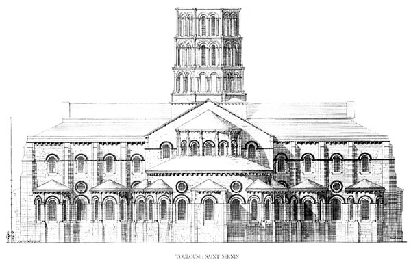
Romanesque architecture is an architectural style of medieval Europe characterized by semi-circular arches. There is no consensus for the beginning date of the Romanesque style, with proposals ranging from the 6th to the 11th century, this later date being the most commonly held. In the 12th century it developed into the Gothic style, marked by pointed arches. Examples of Romanesque architecture can be found across the continent, making it the first pan-European architectural style since Imperial Roman architecture. The Romanesque style in England and Sicily is traditionally referred to as Norman architecture. Combining features of ancient Roman and Byzantine buildings and other local traditions, Romanesque architecture is known by its massive quality, thick walls, round arches, sturdy pillars, barrel vaults, large towers and decorative arcading. Each building has clearly defined forms, frequently of very regular, symmetrical plan; the overall appearance is one of simplic ... [...More Info...] [...Related Items...] OR: [Wikipedia] [Google] [Baidu] |
Middle Ages
In the history of Europe, the Middle Ages or medieval period lasted approximately from the late 5th to the late 15th centuries, similar to the post-classical period of global history. It began with the fall of the Western Roman Empire and transitioned into the Renaissance and the Age of Discovery. The Middle Ages is the middle period of the three traditional divisions of Western history: classical antiquity, the medieval period, and the modern period. The medieval period is itself subdivided into the Early, High, and Late Middle Ages. Population decline, counterurbanisation, the collapse of centralized authority, invasions, and mass migrations of tribes, which had begun in late antiquity, continued into the Early Middle Ages. The large-scale movements of the Migration Period, including various Germanic peoples, formed new kingdoms in what remained of the Western Roman Empire. In the 7th century, North Africa and the Middle East—most recently part of the Ea ... [...More Info...] [...Related Items...] OR: [Wikipedia] [Google] [Baidu] |
Auzon
Auzon (; oc, Auson) is a commune in the Haute-Loire department in south-central France. Population See also *Communes of the Haute-Loire department *Franks Casket The Franks Casket (or the Auzon Casket) is a small Anglo-Saxon whale's bone (not "whalebone" in the sense of baleen) chest from the early 8th century, now in the British Museum. The casket is densely decorated with knife-cut narrative scenes ... References Communes of Haute-Loire {{HauteLoire-geo-stub ... [...More Info...] [...Related Items...] OR: [Wikipedia] [Google] [Baidu] |
Châteaugay
Châteaugay (; oc, label=Auvergnat, Chasteugai) is a commune in the Puy-de-Dôme department in Auvergne-Rhône-Alpes in central France. Population See also *Communes of the Puy-de-Dôme department The following is a list of the 464 communes of the Puy-de-Dôme department of France. Intercommunalities The communes cooperate in the following intercommunalities (as of 2020):Communes of Puy-de-Dôme {{PuyDôme-geo-stub ... [...More Info...] [...Related Items...] OR: [Wikipedia] [Google] [Baidu] |
Corent
Corent is a commune in the Puy-de-Dôme department in Auvergne-Rhône-Alpes in central France. It sits approximately 2 miles north of Les Martres-de-Veyre on the side of the old volcanic Puy de Corent. In 2001 excavation began on a Gallic (Celtic) and later Gallo-Roman Oppidum found in a field atop the puy. To this date, vast quantities of land have been excavated revealing the site as a main political, religious and economic center. Corent was an important fortified Celtic oppidum during the pre-Roman La Tène period (Late Iron Age), and there was already a dense fortified/walled settlement on the plateau during the Late Bronze Age Urnfield period. Gallic oppidum File:Corent oppidum 1.jpg, Reconstruction of the Corent oppidum, La Tène period. File:Mise en valeur du sanctuaire de Corent.png, Corent sanctuary. SeeDigital reconstructionFile:Corent 11.jpg, Sanctuary File:Corent fosse à libations 01.JPG, Sanctuary - libation pit File:Corent 2013 (2).jpg, Excavations File:Co ... [...More Info...] [...Related Items...] OR: [Wikipedia] [Google] [Baidu] |
Vineyard
A vineyard (; also ) is a plantation of grape-bearing vines, grown mainly for winemaking, but also raisins, table grapes and non-alcoholic grape juice. The science, practice and study of vineyard production is known as viticulture. Vineyards are often characterised by their ''terroir'', a French term loosely translating as "a sense of place" that refers to the specific geographical and geological characteristics of grapevine plantations, which may be imparted to the wine itself. History The earliest evidence of wine production dates from between 6000 and 5000 BC. Wine making technology improved considerably with the ancient Greeks but it wasn't until the end of the Roman Empire that cultivation techniques as we know them were common throughout Europe. In medieval Europe the Church was a staunch supporter of wine, which was necessary for the celebration of the Mass. During the lengthy instability of the Middle Ages, the monasteries maintained and developed viticultura ... [...More Info...] [...Related Items...] OR: [Wikipedia] [Google] [Baidu] |
Sugar Beet
A sugar beet is a plant whose root contains a high concentration of sucrose and which is grown commercially for sugar production. In plant breeding, it is known as the Altissima cultivar group of the common beet ('' Beta vulgaris''). Together with other beet cultivars, such as beetroot and chard, it belongs to the subspecies ''Beta vulgaris'' subsp. ''vulgaris.'' Its closest wild relative is the sea beet (''Beta vulgaris'' subsp. ''maritima''). Sugar beets are grown in climates that are too cold for sugar cane. The low sugar content of the beets makes growing them a marginal proposition unless prices are relatively high. In 2020, Russia, the United States, Germany, France and Turkey were the world's five largest sugar beet producers. In 2010–2011, Europe, and North America except Arctic territories failed to supply the overall domestic demand for sugar and were all net importers of sugar. The US harvested of sugar beets in 2008. In 2009, sugar beets accounted for 20% of ... [...More Info...] [...Related Items...] OR: [Wikipedia] [Google] [Baidu] |


