|
Knockfarrel
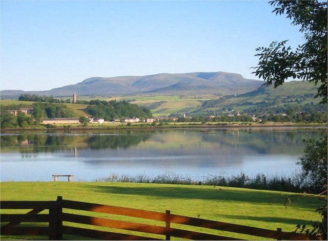
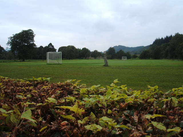
Knockfarrel ( gd, Cnoc Fearghalaigh) is a village, 1 mile east of Strathpeffer, in Dingwall in Ross-shire, Scottish Highlands and is in the Scottish council area of Highland. Knockfarrel or Knock Farrel, or indeed Knock Farril (stone fort) is a vitrified pictish Iron Age fort which lies on the knockfarrel hill, immediately to the north of the village, and which it gave its name to the village. The walk up to the fort is a popular tourist attraction. The village once had a large enough population to have its own shinty club which then amalgamated with Strathpeffer's to create Caberfeidh Caberfeidh Camanachd Club is a shinty team based in Strathpeffer, Ross and Cromarty, Scotland. Consisting of two teams, Caberfeidh currently play in the Marine Harvest Premiership having been promoted from the National Division after the 2017 s ... in 1886. References External links * Populated places in Ross and Cromarty {{Highland-geo-stub ... [...More Info...] [...Related Items...] OR: [Wikipedia] [Google] [Baidu] |
Dingwall
Dingwall ( sco, Dingwal, gd, Inbhir Pheofharain ) is a town and a royal burgh in the Highland council area of Scotland. It has a population of 5,491. It was an east-coast harbour that now lies inland. Dingwall Castle was once the biggest castle north of Stirling. On the town's present-day outskirts lies Tulloch Castle, parts of which may date back to the 12th century. In 1411 the Battle of Dingwall is said to have taken place between the Clan Mackay and the Clan Donald. History Its name, derived from the Scandinavian (field or meeting-place of the '' thing'', or local assembly; compare Tynwald, Tingwall, Thingwall in the British Isles alone, plus many others across northern Europe), preserves the Viking connections of the town; Gaels call it (), meaning "the mouth of the Peffery" or meaning "cabbage town". The site of the , and of the medieval Moothill, thought to have been established by the Vikings after they invaded in the 8th century, lies beneath the Cromartie ... [...More Info...] [...Related Items...] OR: [Wikipedia] [Google] [Baidu] |
Caberfeidh
Caberfeidh Camanachd Club is a shinty team based in Strathpeffer, Ross and Cromarty, Scotland. Consisting of two teams, Caberfeidh currently play in the Marine Harvest Premiership having been promoted from the National Division after the 2017 season. The Caberfeidh 2nd's currently play in the Marine Harvest North Division 2. The name Caberfeidh comes from the Scots Gaelic for a stag's antlers, ''Cabar Feidh'' which is the symbol of Ross-shire. History The club was founded in 1886 in the Spa Pavilion in Strathpeffer, celebrating its 125th anniversary in 2011. It was an amalgamation of the Strathpeffer club and the Knockfarrel clu The name "Caberfeidh" was proposed by W.F. Gunn, who also represented the club at the inaugural AGM of the Camanachd Associationbr> In the early 1920s, the club became a junior side for two years due to a dearth of experienced players after the World War I, Great War but in 1926 the club defeated Beauly in the MacGillivray Cup Final and this be ... [...More Info...] [...Related Items...] OR: [Wikipedia] [Google] [Baidu] |
Highland (council Area)
Highland ( gd, A' Ghàidhealtachd, ; sco, Hieland) is a council area in the Scottish Highlands and is the largest local government area in the United Kingdom. It was the 7th most populous council area in Scotland at the 2011 census. It shares borders with the council areas of Aberdeenshire, Argyll and Bute, Moray and Perth and Kinross. Their councils, and those of Angus and Stirling, also have areas of the Scottish Highlands within their administrative boundaries. The Highland area covers most of the mainland and inner-Hebridean parts of the historic counties of Inverness-shire and Ross and Cromarty, all of Caithness, Nairnshire and Sutherland and small parts of Argyll and Moray. Despite its name, the area does not cover the entire Scottish Highlands. Name Unlike the other council areas of Scotland, the name ''Highland'' is often not used as a proper noun. The council's website only sometimes refers to the area as being ''Highland'', and other times as being '' ... [...More Info...] [...Related Items...] OR: [Wikipedia] [Google] [Baidu] |
Strathpeffer
Strathpeffer ( gd, Srath Pheofhair) is a village and spa town in Ross and Cromarty, Highland, Scotland, with a population of 1,469. Geography It lies in a strath west of Dingwall, with the elevation ranging from above sea level. Sheltered on the west and north, it has a comparatively dry and warm climate. History The strategic location of the village has led to several battles being fought in the area : *Blar Nan Ceann (battle (field) of the heads), lies at the western end of the modern village (). Very little is known about the battle there, not even its date, other than the MacKenzies of Seaforth defeated the MacDonells of Glengarry and some incident took place at a well near the battlefield, subsequently called Tobar a' Chinn (well of the head). * Battle of Blar Na Pairce (battle (field) of the park), in approximately 1486 saw the local MacKenzies, under their chief Kenneth MacKenzie, defeat a large invading force of MacDonalds. The battlefield lies south-west of the m ... [...More Info...] [...Related Items...] OR: [Wikipedia] [Google] [Baidu] |
Ross-shire
Ross-shire (; gd, Siorrachd Rois) is a historic county in the Scottish Highlands. The county borders Sutherland to the north and Inverness-shire to the south, as well as having a complex border with Cromartyshire – a county consisting of numerous enclaves or exclaves scattered throughout Ross-shire's territory. Ross-shire includes most of Ross along with Lewis in the Outer Hebrides. Dingwall is the traditional county town. The area of Ross-shire is based on that of the historic province of Ross, but with the exclusion of the many enclaves that form Cromartyshire. For shreival purposes the area was first separated from the authority of the sheriff of Inverness by Act of Parliament during the reign of King James IV, the sheriff to sit at Tain or Dingwall. Sheriffs were seldom appointed, and further acts of 1649 and 1661 restated its separation from Inverness. The 1661 act also clarified the area encompassed, based on the pre-Reformation Diocese of Ross. Sir Geor ... [...More Info...] [...Related Items...] OR: [Wikipedia] [Google] [Baidu] |
Scottish Highlands
The Highlands ( sco, the Hielands; gd, a’ Ghàidhealtachd , 'the place of the Gaels') is a historical region of Scotland. Culturally, the Highlands and the Lowlands diverged from the Late Middle Ages into the modern period, when Lowland Scots replaced Scottish Gaelic throughout most of the Lowlands. The term is also used for the area north and west of the Highland Boundary Fault, although the exact boundaries are not clearly defined, particularly to the east. The Great Glen divides the Grampian Mountains to the southeast from the Northwest Highlands. The Scottish Gaelic name of ' literally means "the place of the Gaels" and traditionally, from a Gaelic-speaking point of view, includes both the Western Isles and the Highlands. The area is very sparsely populated, with many mountain ranges dominating the region, and includes the highest mountain in the British Isles, Ben Nevis. During the 18th and early 19th centuries the population of the Highlands rose to around 300, ... [...More Info...] [...Related Items...] OR: [Wikipedia] [Google] [Baidu] |
Scotland
Scotland (, ) is a Countries of the United Kingdom, country that is part of the United Kingdom. Covering the northern third of the island of Great Britain, mainland Scotland has a Anglo-Scottish border, border with England to the southeast and is otherwise surrounded by the Atlantic Ocean to the north and west, the North Sea to the northeast and east, and the Irish Sea to the south. It also contains more than 790 Islands of Scotland, islands, principally in the archipelagos of the Hebrides and the Northern Isles. Most of the population, including the capital Edinburgh, is concentrated in the Central Belt—the plain between the Scottish Highlands and the Southern Uplands—in the Scottish Lowlands. Scotland is divided into 32 Subdivisions of Scotland, administrative subdivisions or local authorities, known as council areas. Glasgow, Glasgow City is the largest council area in terms of population, with Highland (council area), Highland being the largest in terms of area. Limi ... [...More Info...] [...Related Items...] OR: [Wikipedia] [Google] [Baidu] |
Highland Council Area
Highland ( gd, A' Ghàidhealtachd, ; sco, Hieland) is a council area in the Scottish Highlands and is the largest local government area in the United Kingdom. It was the 7th most populous council area in Scotland at the 2011 census. It shares borders with the council areas of Aberdeenshire, Argyll and Bute, Moray and Perth and Kinross. Their councils, and those of Angus and Stirling, also have areas of the Scottish Highlands within their administrative boundaries. The Highland area covers most of the mainland and inner-Hebridean parts of the historic counties of Inverness-shire and Ross and Cromarty, all of Caithness, Nairnshire and Sutherland and small parts of Argyll and Moray. Despite its name, the area does not cover the entire Scottish Highlands. Name Unlike the other council areas of Scotland, the name ''Highland'' is often not used as a proper noun. The council's website only sometimes refers to the area as being ''Highland'', and other times as being ''the High ... [...More Info...] [...Related Items...] OR: [Wikipedia] [Google] [Baidu] |
Pict
The Picts were a group of peoples who lived in what is now northern and eastern Scotland (north of the Firth of Forth) during Late Antiquity and the Early Middle Ages. Where they lived and what their culture was like can be inferred from early medieval texts and Pictish stones. Their Latin name, , appears in written records from the 3rd to the 10th century. Early medieval sources report the existence of a distinct Pictish language, which today is believed to have been an Insular Celtic language, closely related to the Brittonic spoken by the Britons who lived to the south. Picts are assumed to have been the descendants of the Caledonii and other Iron Age tribes that were mentioned by Roman historians or on the world map of Ptolemy. The Pictish kingdom, often called Pictland in modern sources, achieved a large degree of political unity in the late 7th and early 8th centuries through the expanding kingdom of Fortriu, the Iron Age Verturiones. By the year 900, the resulting Pi ... [...More Info...] [...Related Items...] OR: [Wikipedia] [Google] [Baidu] |
Shinty
Shinty ( gd, camanachd, iomain) is a team game played with sticks and a ball. Shinty is now played mainly in the Scottish Highlands and amongst Highland migrants to the big cities of Scotland, but it was formerly more widespread in Scotland, and was even played in northern England into the second half of the 20th century and other areas in the world where Scottish Highlanders migrated. While comparisons are often made with field hockey the two games have several important differences. In shinty a player is allowed to play the ball in the air and is allowed to use both sides of the stick, called a ''caman'', which is wooden and slanted on both sides. The stick may also be used to block and to tackle, although a player may not come down on an opponent's stick, a practice called hacking. Players may also tackle using the body as long as it is shoulder-to-shoulder. The game was derived from the same root as the Irish game of hurling and the Welsh game of bando, but has developed u ... [...More Info...] [...Related Items...] OR: [Wikipedia] [Google] [Baidu] |


