|
Kelapur
Kelapur (also called as Pandharkawda) is a census town, tehsil and subdivision of Yavatmal district in the state of Maharashtra, India. It is located on Srinagar - Nagpur - Hyderabad - Bangalore - Kanyakumari National Highway 44. It is famous for the Jagadamba Bhavani Mata Temple. The temple is the oldest one in this region, and devotees come from not only Maharashtra State but also from states like Telangana Telangana (; , ) is a state in India situated on the south-central stretch of the Indian peninsula on the high Deccan Plateau. It is the eleventh-largest state and the twelfth-most populated state in India with a geographical area of and 3 .... This Bhavani Mata is considered the Tuljapur Bhavani Mata with a different name. Pandharkawada is also famous for dalfry. References Cities and towns in Yavatmal district Talukas in Maharashtra {{Yavatmal-geo-stub ... [...More Info...] [...Related Items...] OR: [Wikipedia] [Google] [Baidu] |
Yavatmal District
Yavatmal district , əʋət̪maːɭformerly known as Yeotmal, is a district of the Indian state of Maharashtra. It is located in the region of Vidarbha, in the east-central part of the state. It is Vidarbha's third-largest district by population, after Nagpur and Amravati. Yavatmal city is the administrative headquarters of the district. History It is believed that Yavatmal, along with the rest of the former Berar province, was part of the legendary kingdom of Vidarbha mentioned in the ''Mahabharata''. Berar also formed part of the Mauryan Empire during the reign of Ashoka (272 to 231 BCE). Berar later came under the rule of the Satavahana dynasty ( to ), the Vakataka dynasty (3rd to 6th centuries), the Chalukya dynasty (6th to 8th centuries), the Rashtrakuta dynasty (8th to 10th centuries), the Western Chalukya (10th to 12th centuries), and finally the Yadava dynasty of Devagiri (late 12th to early 14th centuries). A period of Muslim rule began when Ala ud din Khilji, ... [...More Info...] [...Related Items...] OR: [Wikipedia] [Google] [Baidu] |
Wani, Maharashtra
Wani () is a 3rd largest city in Yavatmal district in the Indian state of Maharashtra., United States National Geospatial-Intelligence Agency Wani is located in eastern part of Yavatmal district and borders Chandrapur district. Despite being a taluka, Wani is important commercial hub for nearby area due to its strong market and its crucial location. Yavatmal city is 110 kmy from Wani and Chandrapur is only 55 km. Nagpur is 130 km from Wani and Wardha is 110 km by road connectivity. History Wani has age old rock cut temples, including the Rangnath Swami Mandir, Kala Ram Mandir and Narsimha Mandir present in the southern part of the city. In past, Wani was known as 'Wun'. Wani was a district headquarters in Berar Province during British Raj. Later on, Wani became a taluka with Yavatmal as district head. Demographics As of the 2011 census of India, Wani had a population of 58,840 excluding the outer part of the city. Villages like Ganeshpur, Chikhalgaon, Waghdara, Lalguda are i ... [...More Info...] [...Related Items...] OR: [Wikipedia] [Google] [Baidu] |
Ghatanji
Ghatanji is a very old city and municipal council in Yavatmal district in the state of Maharashtra, India. It is also known as 'Cotton City', because in this area farmer produces a fine quality of cotton. It is also a place of pilgrimage of 'Brahmalin Shree Sant Maroti Maharaj' having Devasthan near the bank of river 'Waghadi'. Every year, in January–February, a fair in the name of 'Brahmalin Shree Sant Maroti Maharaj' takes place at the 'Azad Maidan'. The day on which 'Dahi Handi' is being celebrated, is the main occasion in one month fair. Ghatanji is a composition of name 'Ghati' and 'Anji', nearby suburbs, and is one of the main towns in Yavatmal District. There is a historical temple of ' Lord Nrusimha' (also called 'Lord Narsimha'), which was built in Hemadpanti architecture (named after 1259-1274 CE prime minister Hemadpant from the court of Seuna Yadavas of Devagiri). People from all the corners of Maharashtra, Andhra Pradesh, Telangana, and other nearby states come her ... [...More Info...] [...Related Items...] OR: [Wikipedia] [Google] [Baidu] |
States And Territories Of India
India is a federal union comprising 28 states and 8 union territories, with a total of 36 entities. The states and union territories are further subdivided into districts and smaller administrative divisions. History Pre-independence The Indian subcontinent has been ruled by many different ethnic groups throughout its history, each instituting their own policies of administrative division in the region. The British Raj mostly retained the administrative structure of the preceding Mughal Empire. India was divided into provinces (also called Presidencies), directly governed by the British, and princely states, which were nominally controlled by a local prince or raja loyal to the British Empire, which held '' de facto'' sovereignty ( suzerainty) over the princely states. 1947–1950 Between 1947 and 1950 the territories of the princely states were politically integrated into the Indian union. Most were merged into existing provinces; others were organi ... [...More Info...] [...Related Items...] OR: [Wikipedia] [Google] [Baidu] |
Kanyakumari (town)
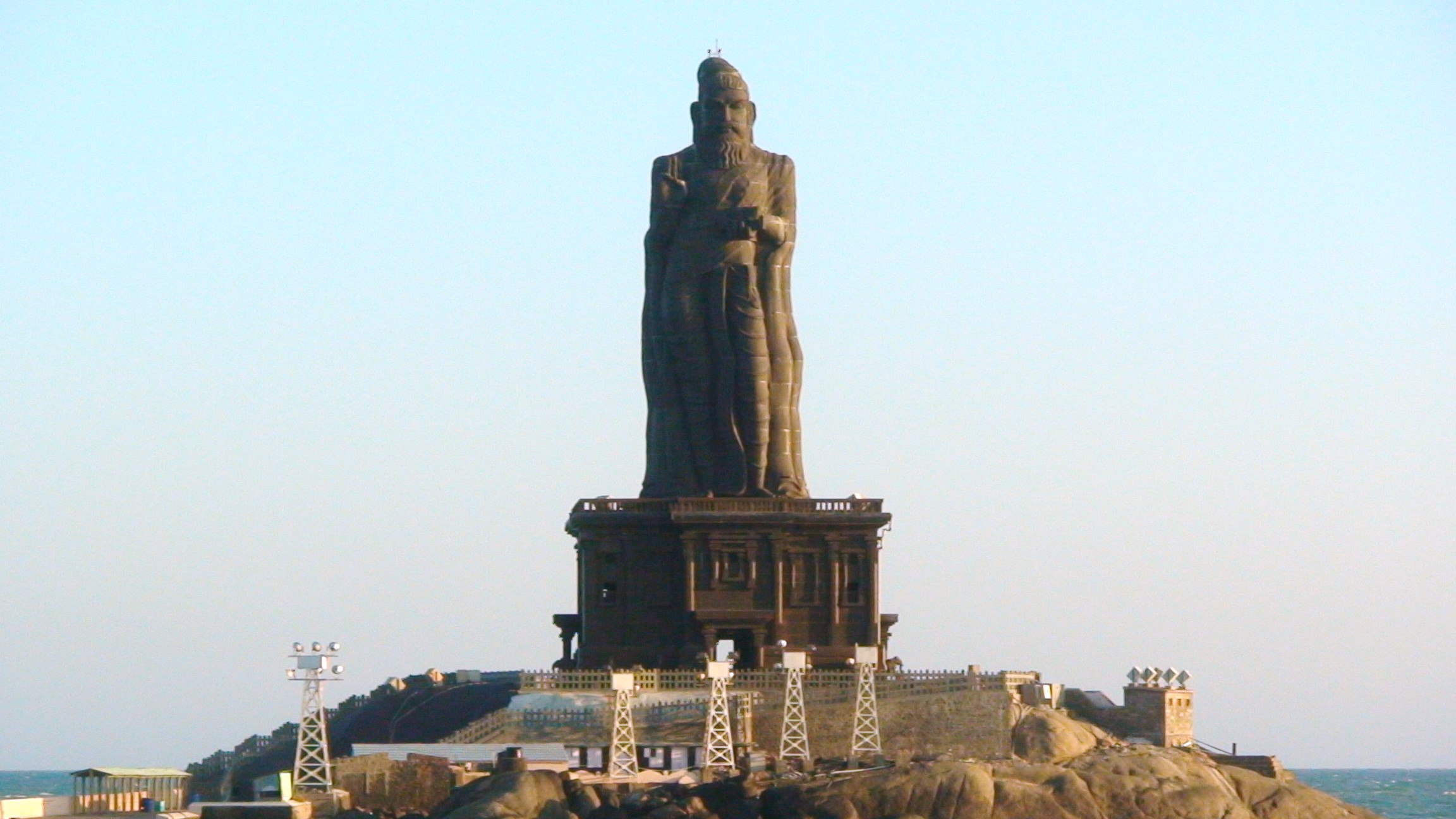
Kanniyakumari (; , referring to Devi Kanya Kumari), also known as Cape Comorin, is a city in Kanyakumari district, Kanniyakumari district in the state of Tamil Nadu, India. It is the southern tip of the Indian subcontinent and the southernmost city in mainland India, thus referred to as 'The Land's End'. The city is situated south of Thiruvananthapuram city, and about south of Nagercoil, the headquarters of Kanyakumari district, Kanniyakumari district. Kanniyakumari is a popular tourist destination and pilgrimage centre in India. Notable tourist spots include its unique sunrise and sunset points, the Thiruvalluvar Statue and Vivekananda Rock Memorial off the coast. Lying at the tip of peninsular India, the town is bordered on the west, south and east by the Laccadive Sea. It has a coastal line of stretched on the three sides. On the shores of the city is a temple dedicated to Goddess Kanniyakumari (the virgin Goddess), after which the town is named.https://thehi ... [...More Info...] [...Related Items...] OR: [Wikipedia] [Google] [Baidu] |
Parwa
Parwa is a village in Phagwara Tehsil in Kapurthala district of Punjab State, India. It is located from Kapurthala, from Phagwara. The village is administrated by a Sarpanch who is an elected representative of village as per the constitution of India and Panchayati raj. Transport Phagwara Junction Railway Station, Mauli Halt Railway Station are the nearby railway stations to Parwa. Jalandhar City Rail Way station is 24 km away from the village. The village is 117 km away from Sri Guru Ram Dass Jee International Airport in Amritsar. Another nearby airport is Sahnewal Airport in Ludhiana which is located 36 km away from the village. Phagwara, Jandiala, Jalandhar, Phillaur Phillaur is a city and a municipal council as well as a tehsil in Jalandhar district in the Indian States and territories of India, state of Punjab, India, Punjab. Overview Phillaur is the railway junction on the border line of Ludhiana Main ... are the nearby cities to Parwa vil ... [...More Info...] [...Related Items...] OR: [Wikipedia] [Google] [Baidu] |
Andhra Pradesh State
Andhra Pradesh (, abbr. AP) is a state in the south-eastern coastal region of India. It is the seventh-largest state by area covering an area of and tenth-most populous state with 49,386,799 inhabitants. It is bordered by Telangana to the north-west, Chhattisgarh to the north, Odisha to the north-east, Tamil Nadu to the south, Karnataka to the west and the Bay of Bengal to the east. It has the second longest coastline in India after Gujarat, of about . Andhra State was the first state to be formed on a linguistic basis in India on 1 October 1953. On 1 November 1956, Andhra State was merged with the Telugu-speaking areas (ten districts) of the Hyderabad State to form United Andhra Pradesh. ln 2014 these merged areas of Hyderabad State are bifurcated from United Andhra Pradesh to form new state Telangana . Present form of Andhra similar to Andhra state.but some mandalas like Bhadrachalam still with Telangana. Visakhapatnam, Guntur, Kurnool is People Capital of Andhra ... [...More Info...] [...Related Items...] OR: [Wikipedia] [Google] [Baidu] |
Adilabad
Adilabad is a city which serves as the headquarters of Adilabad district, in the Indian state of Telangana. Telugu language, Telugu is the native language of Adilabad. Adilabad is famous for its rich cultivation of cotton. Hence, Adilabad is also referred as "White Gold City". It is located about north of the state capital, Hyderabad, India, Hyderabad, from Nizamabad, Telangana, Nizamabad and from Nagpur. Adilabad is called as the "Gateway to South India". History The earlier name of Adilabad was Edlabad during the rule of Qutub Shahis. Adilabad derives its name from the erstwhile ruler of Bijapur, Muhammad Yusuf Adil Shah. It wasn't a homogenous unit for a long period. Adilabad was ruled by many dynasties like the Kakatiyas, Mauryas, Satavahanas, Chalukyas, Qutub Shahis , Asaf Jahis and by Gond Rajas of earlier sub-districts Sirpur and Chanda. It was created in 1872 by the ruler and In 1905 it was declared to be an independent district with a prominent headquarters. Late ... [...More Info...] [...Related Items...] OR: [Wikipedia] [Google] [Baidu] |
Wardha District
Wardha district (Marathi pronunciation: �əɾd̪ʰaː is in the state of Maharashtra in western India. This district is a part of Nagpur Division. The city of Wardha is the administrative headquarters of the district. Hinganghat, Pulgaon, Arvi and Wardha are the major cities in the district. The district had a population of 1,300,774, of which 26.28% were urban as of 2011. History The history of the Wardha district dates back to ancient times. It was included in the empires of the Mauryas, Shungas, Satavahanas and Vakatakas. Pravarpur, now modern-day Pavnar, was once the capital of the Vakataka dynasty. Vakatakas were contemporaries of the Imperial Guptas. The daughter of Chandragupta II, Prabhavatigupta, was married to the Vakataka ruler Rudrasena II. The Vakataka Dynasty lasted from the 2nd to the 5th centuries AD. Their state stretched from the Arabian Sea in the west to the Bay of Bengal in the east and from the Narmada River in the north to the Krishna-Godavari Delta ... [...More Info...] [...Related Items...] OR: [Wikipedia] [Google] [Baidu] |
Hinganghat
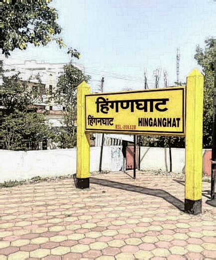
Hinganghat is a city in Wardha district of the Indian state of Maharashtra. Hinganghat is the biggest city in Wardha district, in terms of area and population as well. The city is administered by a municipal council and is located about from Wardha and from Maharashtra's second capital Nagpur. Hinganghat is surrounded on two sides by the wana River, which provides natural resources. National Highway 44(old Name NH7), a part of the North-South Corridor, passes through the city. Hinganghat is located in the fertile Wardha Valley; it was historically a center of the Indian cotton trade and a major centre for grains. The tehsil of Hinganghat comprises about 76 villages. The main language spoken in Hinganghat is Marathi. Hinganghat is the ninth biggest city in Vidharbha the region of Maharashtra and ranks 436 in India ccording to the 2011 census Baba Amte, the social worker who helped people suffering from leprosy, was born in Hinganghat. Hinganghat has the highest literacy ra ... [...More Info...] [...Related Items...] OR: [Wikipedia] [Google] [Baidu] |
Telangana
Telangana (; , ) is a state in India situated on the south-central stretch of the Indian peninsula on the high Deccan Plateau. It is the eleventh-largest state and the twelfth-most populated state in India with a geographical area of and 35,193,978 residents as per 2011 census. On 2 June 2014, the area was separated from the northwestern part of Andhra Pradesh as the newly formed state with Hyderabad as its capital. Its other major cities include Warangal, Nizamabad, Khammam, Karimnagar and Ramagundam. Telangana is bordered by the states of Maharashtra to the north, Chhattisgarh to the northeast, Karnataka to the west, and Andhra Pradesh to the east and south. The terrain of Telangana consists mostly of the Deccan Plateau with dense forests covering an area of . As of 2019, the state of Telangana is divided into 33 districts. Throughout antiquity and the Middle Ages, the region now known as Telangana was ruled by multiple major Indian powers such as the Mauryans, ... [...More Info...] [...Related Items...] OR: [Wikipedia] [Google] [Baidu] |
National Highway 44 (India)
National Highway 44 (NH 44) is a major north–south National Highway in India and is the longest in the country. It passes through the Union Territory of Jammu and Kashmir, in addition to the states of Punjab, Haryana, Delhi, Uttar Pradesh, Rajasthan, Madhya Pradesh, Maharashtra, Telangana, Andhra Pradesh, Karnataka, and Tamil Nadu. It came into being by merging seven national highways, in full or part, starting with the Jammu-Srinagar National Highway (former NH 1A) from Srinagar in Jammu and Kashmir, former NH 1 in Punjab and Haryana ending at Delhi, part of former NH 2 starting from Delhi and ending at Agra, former NH 3 (popularly known as Agra- Bombay National Highway) from Agra to Gwalior, former NH 75 and former NH 26 to Jhansi, and former NH 7 via Lakhnadon, Seoni, Nagpur, Hinganghat, Adilabad, Nirmal, Hyderabad, Kurnool, Anantapur, Chikkaballapur, Bangalore, Hosur, Krishnagiri, Dharmapuri, Salem, Namakkal, Karur, Dindigul, Madurai, Virudhunagar a ... [...More Info...] [...Related Items...] OR: [Wikipedia] [Google] [Baidu] |


