|
Duloch
Duloch ( ), or Duloch Park, is a residential suburb of Dunfermline, in Fife, Scotland. The closest railway stations are Rosyth, Dunfermline Queen Margaret, Dunfermline City, Dalgety Bay and Inverkeithing. The lower price of large homes compared to homes across the Forth, as well as its proximity to the M90 motorway, has attracted many Edinburgh commuters. Local amenities include two large supermarkets (Tesco and Aldi) and a small shopping area. The nearby 'Fife Leisure Park' contains a cinema, gym, bowling alley, other leisure facilities and restaurants. Three primary schools serve the area - Masterton, Duloch and Carnegie Primaries. The campus of Duloch Primary school contains a large public library, café, gym, astro turf, several halls used for sports and community classes and Calaiswood, a special needs school. Duloch Park and Calais Muir Wood form the heart of the Duloch suburb, the latter being an ancient woodland owned by Fife Council and maintained by the Fife ... [...More Info...] [...Related Items...] OR: [Wikipedia] [Google] [Baidu] |
Dunfermline
Dunfermline (; sco, Dunfaurlin, gd, Dùn Phàrlain) is a city, parish and former Royal Burgh, in Fife, Scotland, on high ground from the northern shore of the Firth of Forth. The city currently has an estimated population of 58,508. According to the National Records of Scotland, the Greater Dunfermline area has a population of 76,210. The earliest known settlements in the area around Dunfermline probably date as far back as the Neolithic period. The area was not regionally significant until at least the Bronze Age. The town was first recorded in the 11th century, with the marriage of Malcolm III, King of Scots, and Saint Margaret at the church in Dunfermline. As his Queen consort, Margaret established a new church dedicated to the Holy Trinity, which evolved into an Abbey under their son, David I in 1128. During the reign of Alexander I, the church – later to be known as Dunfermline Abbey – was firmly established as a prosperous royal mausoleum for the Scottish C ... [...More Info...] [...Related Items...] OR: [Wikipedia] [Google] [Baidu] |
M90 Motorway
The M90 is a motorway in Scotland. It runs from Junction 1A of the M9 motorway, south of the Queensferry Crossing, to Perth. It is the northernmost motorway in the United Kingdom. The northern point goes to the western suburbs of Perth at Broxden. A small part of the M90 (across the Friarton Bridge to the southeast of Perth) was originally numbered as the M85 motorway. History The first section of the M90 opened in 1964 to coincide with the opening of the Forth Road Bridge and Masterton junction (Junction 2). The next section of the M90, the Crossgates – Kelty and Cowdenbeath Bypass, opened on 1 December 1969. The stretch between Kinross and the Milnathort Bypass opened in December 1971. The following two sections were due to begin construction around 1973 and 1974, however, they were put on hold because of the 1973 oil crisis. The section from Arlary (Junction 8 with A91) to Arngask was opened in March 1977. Arngask (Glenfarg) to Muirmont opened in August 1980, conne ... [...More Info...] [...Related Items...] OR: [Wikipedia] [Google] [Baidu] |
Doocot
A dovecote or dovecot , doocot ( Scots) or columbarium is a structure intended to house pigeons or doves. Dovecotes may be free-standing structures in a variety of shapes, or built into the end of a house or barn. They generally contain pigeonholes for the birds to nest. Pigeons and doves were an important food source historically in the Middle East and Europe and were kept for their eggs and dung. History and geography The oldest dovecotes are thought to have been the fortress-like dovecotes of Upper Egypt, and the domed dovecotes of Iran. In these regions, the droppings were used by farmers for fertilizing. Pigeon droppings were also used for leather tanning and making gunpowder. In some cultures, particularly Medieval Europe, the possession of a dovecote was a symbol of status and power and was consequently regulated by law. Only nobles had this special privilege, known as ''droit de colombier''. Many ancient manors in France and the United Kingdom have a dovecote s ... [...More Info...] [...Related Items...] OR: [Wikipedia] [Google] [Baidu] |
Pitreavie Castle
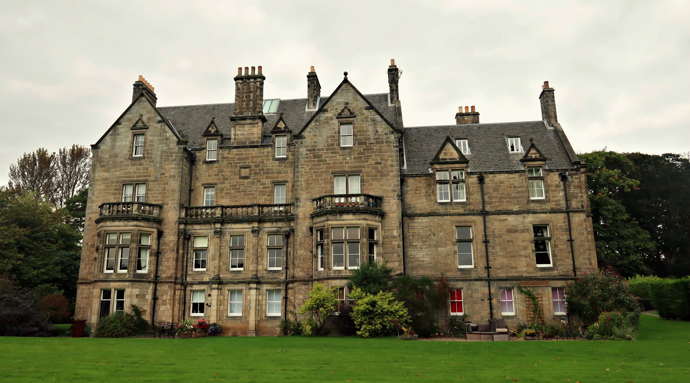
Pitreavie Castle is a country house, located between Rosyth and Dunfermline in Fife, Scotland. It was built in the early 17th century, and was extensively remodelled in 1885. The house remained in private hands until 1938, when it was acquired by the Air Ministry, and became RAF Pitreavie Castle. The RAF station closed in 1996, and the building was converted into residential apartments. IN 1986, the large underground cellar was still operated by the RAF as the Command and Control Centre of the then Northern Command for dispatching and coordinating all air and maritime search and rescue assets, primarily RAF aircraft over the North Sea area. History The Pitreavie estate was owned by Lady Christina Bruce, sister of Robert the Bruce, in the 14th century. Henry Wardlaw of Balmule (later Sir Henry Wardlaw, 1st Baronet of Pitreavie) bought the estate in 1608 for 10,000 merks Scottish from James Kellock and his wife. Wardlaw was Chamberlain to Queen Anne, wife of James VI of Scot ... [...More Info...] [...Related Items...] OR: [Wikipedia] [Google] [Baidu] |
Listed Building
In the United Kingdom, a listed building or listed structure is one that has been placed on one of the four statutory lists maintained by Historic England in England, Historic Environment Scotland in Scotland, in Wales, and the Northern Ireland Environment Agency in Northern Ireland. The term has also been used in the Republic of Ireland, where buildings are protected under the Planning and Development Act 2000. The statutory term in Ireland is " protected structure". A listed building may not be demolished, extended, or altered without special permission from the local planning authority, which typically consults the relevant central government agency, particularly for significant alterations to the more notable listed buildings. In England and Wales, a national amenity society must be notified of any work to a listed building which involves any element of demolition. Exemption from secular listed building control is provided for some buildings in current use for worship, ... [...More Info...] [...Related Items...] OR: [Wikipedia] [Google] [Baidu] |
Shops At Duloch, Dunfermline
Shop or shopping refers to: Business and commerce * A casual word for a commercial establishment or for a place of business * Machine shop, a workshop for machining *"In the shop", referring to a car being at an automotive repair shop *A wood shop * Retail shop, possibly within a marketplace * Shopping, e.g.: ** Christmas shopping ** Comparison shopping ** Grocery shopping ** Online shopping ** Window shopping Arts, entertainment, and media * ''The Shop'', an American television talk show * "Shops", an essay by the Hong Kong writer Xi Xi * The Shop, a fictional government agency which appears in various works by Stephen King, including '' Firestarter'' and '' Golden Years'' * The Shoppe, an American country music group * The Shopping Channel, a Canadian home shopping channel * "Shop", a track from the soundtrack of the 2015 video game ''Undertale'' by Toby Fox Brands and enterprises * SHoP Architects, a New York-based architectural firm * Shop.ca, a Canadian online e-commer ... [...More Info...] [...Related Items...] OR: [Wikipedia] [Google] [Baidu] |
Calais
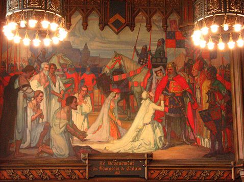
Calais ( , , traditionally , ) is a port city in the Pas-de-Calais department, of which it is a subprefecture. Although Calais is by far the largest city in Pas-de-Calais, the department's prefecture is its third-largest city of Arras. The population of the city proper is 72,929; that of the urban area is 149,673 (2018).Comparateur de territoire: Aire d'attraction des villes 2020 de Calais (073), Commune de Calais (62193) INSEE Calais overlooks the Strait of Dover, the narrowest point in the |
Scottish Gaelic
Scottish Gaelic ( gd, Gàidhlig ), also known as Scots Gaelic and Gaelic, is a Goidelic language (in the Celtic branch of the Indo-European language family) native to the Gaels of Scotland. As a Goidelic language, Scottish Gaelic, as well as both Irish and Manx, developed out of Old Irish. It became a distinct spoken language sometime in the 13th century in the Middle Irish period, although a common literary language was shared by the Gaels of both Ireland and Scotland until well into the 17th century. Most of modern Scotland was once Gaelic-speaking, as evidenced especially by Gaelic-language place names. In the 2011 census of Scotland, 57,375 people (1.1% of the Scottish population aged over 3 years old) reported being able to speak Gaelic, 1,275 fewer than in 2001. The highest percentages of Gaelic speakers were in the Outer Hebrides. Nevertheless, there is a language revival, and the number of speakers of the language under age 20 did not decrease between the 200 ... [...More Info...] [...Related Items...] OR: [Wikipedia] [Google] [Baidu] |
William Roy
Major-General William Roy (4 May 17261 July 1790) was a Scottish military engineer, surveyor, and antiquarian. He was an innovator who applied new scientific discoveries and newly emerging technologies to the accurate geodetic mapping of Great Britain. His masterpiece is usually referred to as Roy's Map of Scotland. It was Roy's advocacy and leadership that led to the creation of the Ordnance Survey in 1791, the year after his death. His technical work in the establishment of a surveying baseline won him the Copley Medal in 1785. His maps and drawings of Roman archaeological sites in Scotland were the first accurate and systematic study of the subject, and have not been improved upon even today. Roy was a fellow of the Royal Society and a member of the Society of Antiquaries of London. Life and works Early life and family Roy was born at Milton Head in Carluke parish in South Lanarkshire on 4 May 1726. His father was a factor in the service of the Gordons/Hamilton ... [...More Info...] [...Related Items...] OR: [Wikipedia] [Google] [Baidu] |
Joan Blaeu
Joan Blaeu (; 23 September 1596 – 21 December 1673) was a Dutch cartographer born in Alkmaar, the son of cartographer Willem Blaeu. Life In 1620, Blaeu became a doctor of law but he joined the work of his father. In 1635, they published the '' Atlas Novus'' (full title: ''Theatrum orbis terrarum, sive, Atlas novus'') in two volumes. Joan and his brother Cornelius took over the studio after their father died in 1638. Blaeu became the official cartographer of the Dutch East India Company like his father before him. Blaeu died in Amsterdam on 21 December 1673. He is buried in the Westerkerk there. Maps Blaeu's world map, ''Nova et Accuratissima Terrarum Orbis Tabula,'' incorporating the discoveries of Abel Tasman, was published in 1648. This map was revolutionary in that it "depicts the solar system according to the heliocentric theories of Nicolaus Copernicus, which show the earth revolving around the sun.... Although Copernicus's groundbreaking book ''On the Revol ... [...More Info...] [...Related Items...] OR: [Wikipedia] [Google] [Baidu] |
Atlas Maior
The ''Atlas Maior'' is the final version of Joan Blaeu's atlas, published in Amsterdam between 1662 and 1672, in Latin (11 volumes), French (12 volumes), Dutch (9 volumes), German (10 volumes) and Spanish (10 volumes), containing 594 maps and around 3,000 pages of text. It was the largest and most expensive book published in the seventeenth century. Earlier, much smaller versions, titled ''Theatrum Orbis Terrarum, sive, Atlas Novus'', were published from 1634 onwards. Like Abraham Ortelius's '' Theatrum Orbis Terrarum'' (1570), the ''Atlas Maior'' is widely considered a masterpiece of the Golden Age of Dutch/Netherlandish cartography (approximately 1570s–1670s). History Somewhere around 1604 Willem Blaeu settled down in Amsterdam and opened a shop on the Damrak, where he produced and sold scientific instruments, globes and maps. He was also a publisher, editor and engraver. In 1629, Willem Blaeu bought the copperplates of several dozens of maps from Jodocus Hondius II's ... [...More Info...] [...Related Items...] OR: [Wikipedia] [Google] [Baidu] |


.jpg)
