|
Curtis Island (Queensland)
Curtis Island is a locality in the Gladstone Region, Queensland, Australia. In the , Curtis Island had a population of 323 people. The towns of Beachton and Southend are within the locality. Geography Curtis Island occupies almost all of the island from which it takes its name, except for a very small area in the south of the island which is included in the locality of Gladstone Harbour. Most of the island is protected from development. Most of ocean-facing eastern side of the island is within either the Curtis Island National Park or the Curtis Island Conservation Park. Most of the mainland-facing western side of the island is within the Curtis Island State Forest. The town Beachton is on the northern-western coast of the island () Beachton has some housing along the beachfront but many of its blocks of land are undeveloped. On the south western coast there is an industrial area consisting of three liquid natural gas facilities () with port facilities for export. On th ... [...More Info...] [...Related Items...] OR: [Wikipedia] [Google] [Baidu] |
Electoral District Of Gladstone
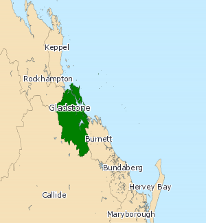
Gladstone is an electoral district of the Legislative Assembly in the Australian state of Queensland. The seat was created as a reconfigured version of Port Curtis for the 1992 election. It consists of the city of Gladstone and some of the towns of the former Shire of Calliope. This includes the localities of Ambrose, Benaraby, Boyne Island, Builyan, Mount Larcom, Tannum Sands and Ubobo. The town of Calliope is now part of the Callide electoral district. The current member is Labor MP Glenn Butcher. Butcher won the seat following the retirement of long-serving independent Liz Cunningham, who won the seat on National Party preferences after defeating then Labor MP Neil Bennett at the 1995 election. Cunningham was a well-known local figure, having previously been Mayor of the Shire of Calliope prior to entering State politics. Her 1995 victory made her the first non-Labor member for Gladstone and its predecessors since 1932, and only the second since 1915. Even t ... [...More Info...] [...Related Items...] OR: [Wikipedia] [Google] [Baidu] |
Fitzroy River (Queensland)
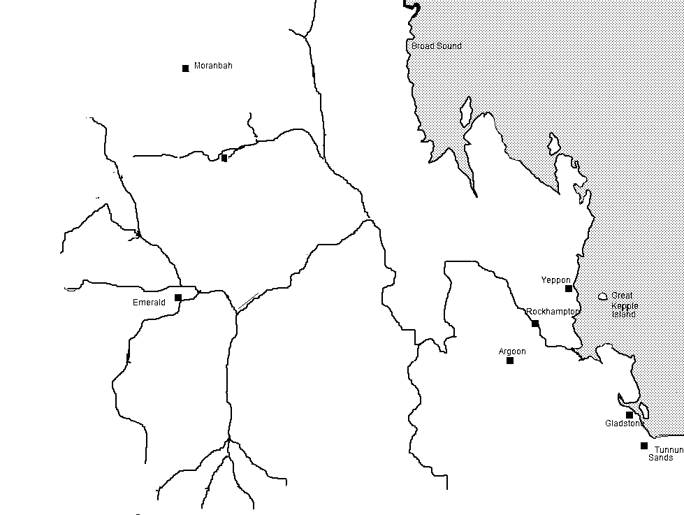
The Fitzroy River (Darumbal: ''Toonooba'') is a river located in Central Queensland, Australia. Its catchment covers an area of , making it the largest river catchment flowing to the eastern coast of Australia. It is also the largest river basin that discharges onto the Great Barrier Reef. Course and features Formed by the confluence of the Mackenzie and Dawson rivers that drain the Expedition Range and the Carnarvon Range respectively, the Fitzroy River rises near Duaringa and flows initially north by east, then northward near the Goodedulla National Park. The river then flows in an easterly direction near the Lake Learmouth State Forest and parallel with the Bruce Highway through the settlement of , before turning south to where the river is crossed by the Bruce Highway. After flowing through Rockhampton, the river flows south by east past the Berserker Range past Humbug Point to the south of the Flat Top Range and eventually discharging into Keppel Bay in the Coral Sea ... [...More Info...] [...Related Items...] OR: [Wikipedia] [Google] [Baidu] |
Rockhampton
Rockhampton is a city in the Rockhampton Region of Central Queensland, Australia. The population of Rockhampton in June 2021 was 79,967, Estimated resident population, 30 June 2018. making it the fourth-largest city in the state outside of the cities of South East Queensland, and the 22nd-largest city in Australia. Today, Rockhampton is an industrial and agricultural centre of the north, and is the regional centre of Central Queensland. Rockhampton is one of the oldest cities in Queensland and in Northern Australia. In 1853, Charles and William Archer came across the Toonooba river, which is now also known as the Fitzroy River, which they claimed in honour of Sir Charles FitzRoy. The Archer brothers took up a run near Gracemere in 1855, and more settlers arrived soon after, enticed by the fertile valleys. The town of Rockhampton was proclaimed in 1858, and surveyed by William Henry Standish, Arthur F Wood and Francis Clarke, the chosen street design closely resembled th ... [...More Info...] [...Related Items...] OR: [Wikipedia] [Google] [Baidu] |
Canoona Gold Rush
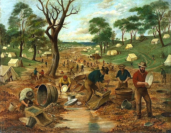
During the Australian gold rushes, starting in 1851, significant numbers of workers moved from elsewhere in Australia and overseas to where gold had been discovered. Gold had been found several times before, but the colonial government of New South Wales (Victoria did not become a separate colony until 1 July 1851) had suppressed the news out of the fear that it would reduce the workforce and so destabilise the economy. After the California Gold Rush began in 1848, many people went there from Australia, so the New South Wales government sought approval from the British Colonial Office for the exploitation of mineral resources, and offered rewards for finding gold. History of discovery The first gold rush in Australia began in May 1851 after prospector Edward Hargraves claimed to have discovered payable gold near Orange, at a site he called Ophir. Hargraves had been to the Californian goldfields and had learned new gold prospecting techniques such as panning and cradling. ... [...More Info...] [...Related Items...] OR: [Wikipedia] [Google] [Baidu] |
HMS Investigator (1801)
HMS ''Investigator'' was the mercantile ''Fram'', launched in 1795, which the Royal Navy purchased in 1798 and renamed HMS ''Xenophon'', and then in 1801 converted to a survey ship under the name HMS ''Investigator''. In 1802, under the command of Matthew Flinders, she was the first ship to circumnavigate Australia. The Navy sold her in 1810 and she returned to mercantile service under the name ''Xenophon''. She was probably broken up c.1872. Background ''Fram'' was built in Sunderland as a collier. She operated off the north-east coast of England before the Royal Navy purchased her in 1798. Pitcher, of Northfield refitted her between 27 April and 24 May 1798. She then went to Deptford Dockyard on 6 August. The Navy armed her with 22 carronades to serve as an escort vessel, and renamed her HMS ''Xenophon''. Commander George Sayer commissioned ''Xenophon'' as an armed ship for the North Sea. In 1799 he brought the Irish rebel James Napper Tandy and some of his associates ... [...More Info...] [...Related Items...] OR: [Wikipedia] [Google] [Baidu] |
Roger Curtis
Admiral Sir Roger Curtis, 1st Baronet, GCB (4 June 1746 – 14 November 1816) was an officer of the British Royal Navy, who saw action in several battles during an extensive career that was punctuated by a number of highly controversial incidents. Curtis served during the American Revolutionary War and the French Revolutionary Wars and was highly praised in the former conflict for his bravery under fire at the Great Siege of Gibraltar, where he saved several hundred Spanish lives at great risk to his own. His career suffered however in the aftermath of the Glorious First of June, when he was heavily criticised for his conduct by several influential figures, including Cuthbert Collingwood. His popularity fell further due to his involvement in two highly controversial courts-martial, those of Anthony Molloy in 1795 and James Gambier in 1810. Ultimately Curtis' career stalled as more popular and successful officers secured active positions; during the Napoleonic Wars, Curtis was ... [...More Info...] [...Related Items...] OR: [Wikipedia] [Google] [Baidu] |
Matthew Flinders
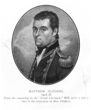
Captain Matthew Flinders (16 March 1774 – 19 July 1814) was a British navigator and cartographer who led the first inshore circumnavigation of mainland Australia, then called New Holland. He is also credited as being the first person to utilise the name ''Australia'' to describe the entirety of that continent including Van Diemen's Land (now Tasmania), a title he regarded as being "more agreeable to the ear" than previous names such as ''Terra Australis''. Flinders was involved in several voyages of discovery between 1791 and 1803, the most famous of which are the circumnavigation of Australia and an earlier expedition when he and George Bass confirmed that Van Diemen's Land was an island. While returning to Britain in 1803, Flinders was arrested by the French governor at Isle de France (Mauritius). Although Britain and France were at war, Flinders thought the scientific nature of his work would ensure safe passage, but he remained under arrest for more than six years. I ... [...More Info...] [...Related Items...] OR: [Wikipedia] [Google] [Baidu] |
Port Curtis (bay)
Port Curtis is a both a port and a pastoral district in Queensland, Australia. It is located off the coast of the present-day city of Gladstone and was the original name of the township. The Port Curtis pastoral district in and around Gladstone was gazetted on 23 March 1868. History Port Curtis (the bay) was named by Matthew Flinders on 1 August 1802 after Vice Admiral Sir Roger Curtis of the Royal Navy. Curtis had assisted Flinders with repairs to HMS Investigator in Cape Town in October 1801. Port Curtis was the capital of North Australia, a short-lived British colony established in 1846 and extinguished the following year. North Australia consisted of modern day Northern Territory and Queensland north of 26th parallel. See also * Electoral district of Port Curtis Port Curtis was an Queensland Legislative Assembly electoral districts, electoral district of the Legislative Assembly of Queensland, Legislative Assembly in the Australian state of Queensland from 1860 to 1 ... [...More Info...] [...Related Items...] OR: [Wikipedia] [Google] [Baidu] |
Tropic Of Capricorn
The Tropic of Capricorn (or the Southern Tropic) is the circle of latitude that contains the subsolar point at the December (or southern) solstice. It is thus the southernmost latitude where the Sun can be seen directly overhead. It also reaches 90 degrees below the horizon at solar midnight on the June Solstice. Its northern equivalent is the Tropic of Cancer. The Tropic of Capricorn is one of the five major circles of latitude marked on maps of Earth. Its latitude is currently south of the Equator, but it is very gradually moving northward, currently at the rate of 0.47 arcseconds, or 15 metres, per year. Less than 3% of the world's population lives south of it; this is equivalent to about 30% of the population of the Southern Hemisphere. Name When this line of latitude was named in the last centuries BC, the Sun was in the constellation Capricornus at the December solstice. This is the date each year when the Sun reaches zenith at this latitude, the southernmost ... [...More Info...] [...Related Items...] OR: [Wikipedia] [Google] [Baidu] |
Captain Cook
James Cook (7 November 1728 Old Style date: 27 October – 14 February 1779) was a British explorer, navigator, cartographer, and captain in the British Royal Navy, famous for his three voyages between 1768 and 1779 in the Pacific Ocean and to New Zealand and Australia in particular. He made detailed maps of Newfoundland prior to making three voyages to the Pacific, during which he achieved the first recorded European contact with the eastern coastline of Australia and the Hawaiian Islands, and the first recorded circumnavigation of New Zealand. Cook joined the British merchant navy as a teenager and joined the Royal Navy in 1755. He saw action in the Seven Years' War and subsequently surveyed and mapped much of the entrance to the St. Lawrence River during the siege of Quebec, which brought him to the attention of the Admiralty and the Royal Society. This acclaim came at a crucial moment for the direction of British overseas exploration, and it led to his commission in 176 ... [...More Info...] [...Related Items...] OR: [Wikipedia] [Google] [Baidu] |
Queensland Government
The Queensland Government is the democratic administrative authority of the Australian state of Queensland. The Government of Queensland, a parliamentary constitutional monarchy was formed in 1859 as prescribed in its Constitution, as amended from time to time. Since the Federation of Australia in 1901, Queensland has been a State of Australia, with the Constitution of Australia regulating the relationships between all state and territory governments and the Australian Government. Under the Australian Constitution, all states and territories (including Queensland) ceded powers relating to certain matters to the federal government. The government is influenced by the Westminster system and Australia's federal system of government. The Governor of Queensland, as the representative of Charles III, King of Australia, holds nominal executive power, although in practice only performs ceremonial duties. In practice executive power lies with the Premier and Cabinet. The Cabinet o ... [...More Info...] [...Related Items...] OR: [Wikipedia] [Google] [Baidu] |
Sea Hill Light
Sea Hill Lighthouse, also known as Sea Hill Point Light or Little Sea Hill Light, is a lighthouse on the northwest point of Curtis Island, Gladstone Region, Queensland, Australia. Its purpose was to mark the east side of the entrance to Keppel Bay, on passage to Fitzroy River and Port Alma. The first lighthouse at the locations was constructed in 1873 or 1876, moved in the 1920s, and is now on display at the Gladstone Maritime Museum. A second lighthouse was constructed in 1895 and its state is unclear. History First lighthouse The need for a lighthouse at this location was identified in 1864. The first lighthouse, constructed in 1873 or 1876, was the first in Queensland of its design, made of a hardwood frame clad with corrugated iron. This design was then used in seven more lighthouses, by order of establishment, Grassy Hill Light, Goods Island Light, Bay Rock Light, Old Caloundra Light, North Point Hummock Light (demolished), Gatcombe Head Light (demolished) and B ... [...More Info...] [...Related Items...] OR: [Wikipedia] [Google] [Baidu] |


