|
Bardera Polytechnic
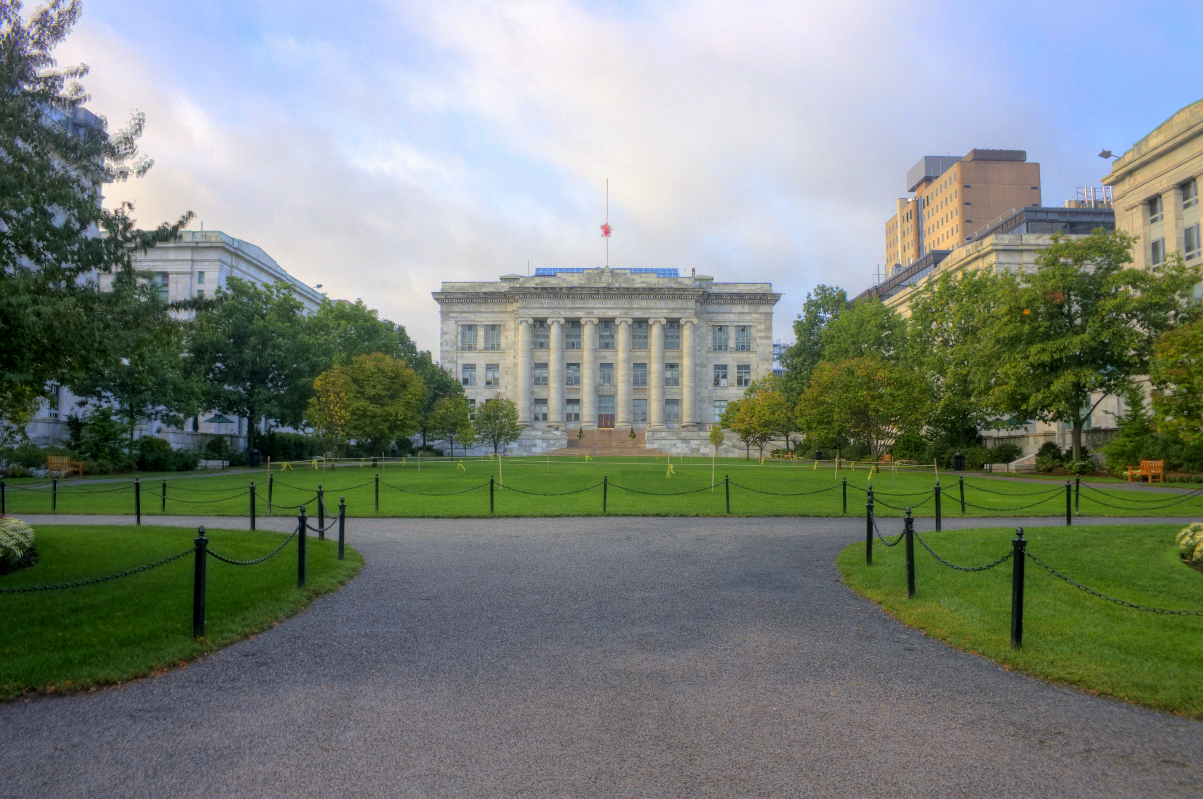
Bardera Polytechnic ( so, Kuliyada Farsamada Baardheere, ar, كلية لعلوم التطبيقية بارطيرآ) is a non-profit tertiary polytechnic education centre located in Bardera, Somalia. The college's full name is Bardera Polytechnic College (BPC). Bardera Polytechnic is the first post-secondary institution in Bardera and the larger Gedo region. Bardera Polytechnic is the first post civil war vocational training school in southern Somalia. Background: Bardera as a center of Islamic study For ages, Bardera was a center of higher learning. Bardera city is famously associated with the study of Islamic jurisprudence, Arabic grammar and syntax. Bardera Islamic centers are famous and students seeking knowledge as well as moalims (teachers) seeking employment used to come from across Somalia. For centuries, Sufi students traveled from far distances and from all points on the Horn as a whole. Every Somali who came of age before the 1950s, knows the importance of Bardera as ... [...More Info...] [...Related Items...] OR: [Wikipedia] [Google] [Baidu] |
Private University
Private universities and private colleges are institutions of higher education, not operated, owned, or institutionally funded by governments. They may (and often do) receive from governments tax breaks, public student loans, and grants. Depending on their location, private universities may be subject to government regulation. Private universities may be contrasted with public universities and national universities. Many private universities are nonprofit organizations. Africa Egypt Egypt currently has 20 public universities (with about two million students) and 23 private universities (60,000 students). Egypt has many private universities, including The American University in Cairo, the German University in Cairo, the British University in Egypt, the Arab Academy for Science, Technology and Maritime Transport, Misr University for Science and Technology, Misr International University, Future University in Egypt and Modern Sciences and Arts University. In ad ... [...More Info...] [...Related Items...] OR: [Wikipedia] [Google] [Baidu] |
Garissa
Garissa ( so, Gaarrisa) is the capital of Garissa County, Kenya. It is situated in the former North Eastern Province. Geography The Tana River, which rises in Mount Kenya east of Nyeri, flows through the Garissa. The Bour-Algi Giraffe Sanctuary, situated 5 km south of Garissa, is home to endangered wildlife including the Rothschild giraffe, gerenuk and other herbivores including Kirk's dik-dik, lesser kudu, warthog and waterbuck. Demographics The town recorded a population of 119,696 in the 2009 census, which rose to 163,399 in 2019. Most of Garissa's inhabitants are ethnic Somali. Economy Garissa is a market centre and the commercial hub of the Garissa County. The town has a university, Garissa University College and a number of colleges including Medical College. In December 2019, the Garissa Solar Power Station was inaugurated, providing grid power to Garissa town. Banks with a presence in Garissa include the Gulf African Bank situated in the Al-Wayf Quran ... [...More Info...] [...Related Items...] OR: [Wikipedia] [Google] [Baidu] |
Tana River (Kenya)
The ca. 1000 km long Tana River is the longest river in Kenya, and gives its name to the Tana River County.Nakaegawa T., Wachana C. and KAKUSHIN Team-3 Modeling Group. (2012). "First impact assessment of hydrological cycle in the Tana River Basin, Kenya, under a changing climate in the late 21st Century,''Hydrological Research Letters'', 6, pp. 29-34 Its catchment covers ca. 100,000 km² and can be divided into the headwaters and the lower Tana consisting of the section downstream of Kora where the river flows for ca. 700 km through semi-arid plains. Its tributaries include the Thika, Ragati River from Mt.Kenya as well as several smaller rivers that flow only during the rainy season. The river rises in the Aberdare Mountains to the west of Nyeri. Initially it runs east before turning south around the massif of Mount Kenya. A series of hydroelectric dams (the Seven Forks Hydro Stations or the Seven Forks Scheme) has been constructed along the river. These include (in ... [...More Info...] [...Related Items...] OR: [Wikipedia] [Google] [Baidu] |
Jubba River
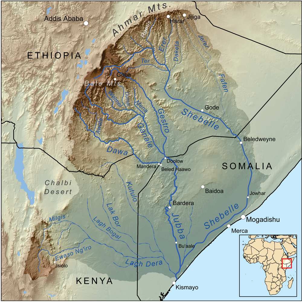
The Jubba River or Juba River ( so, Wabiga Jubba) is a river in southern Somalia which flows through the autonomous region of Jubaland. It begins at the border with Ethiopia, where the Dawa and Ganale Dorya rivers meet, and flows directly south to the Somali Sea, where it empties at the ''Goobweyn'' juncture. The Jubba basin covers an area of . The Somali regional state of Jubaland, formerly called ''Trans-Juba'', is named after the river. History Ajuran Empire The Jubba River has a rich history of a once-booming sophisticated civilization and trade network conducted by the powerful Somalis that held sway over the Jubba river. During the Middle Ages Jubba river was under the Ajuran Empire of the Horn of Africa which utilized the Jubba River for its plantations and was the only hydraulic empire in Africa. A hydraulic empire that rose in the 13th century AD, Ajuran monopolized the water resources of the Jubba River and Shebelle. Through hydraulic engineering, it also constru ... [...More Info...] [...Related Items...] OR: [Wikipedia] [Google] [Baidu] |
Border
Borders are usually defined as geographical boundaries, imposed either by features such as oceans and terrain, or by political entities such as governments, sovereign states, federated states, and other subnational entities. Political borders can be established through warfare, colonization, or mutual agreements between the political entities that reside in those areas; the creation of these agreements is called boundary delimitation. Some borders—such as most states' internal administrative borders, or inter-state borders within the Schengen Area—are open and completely unguarded. Most external political borders are partially or fully controlled, and may be crossed legally only at designated border checkpoints; adjacent border zones may also be controlled. Buffer zones may be setup on borders between belligerent entities to lower the risk of escalation. While ''border'' refers to the boundary itself, the area around the border is called the frontier. History In the ... [...More Info...] [...Related Items...] OR: [Wikipedia] [Google] [Baidu] |
Kenya
) , national_anthem = " Ee Mungu Nguvu Yetu"() , image_map = , map_caption = , image_map2 = , capital = Nairobi , coordinates = , largest_city = Nairobi , official_languages = Constitution (2009) Art. 7 ational, official and other languages"(1) The national language of the Republic is Swahili. (2) The official languages of the Republic are Swahili and English. (3) The State shall–-–- (a) promote and protect the diversity of language of the people of Kenya; and (b) promote the development and use of indigenous languages, Kenyan Sign language, Braille and other communication formats and technologies accessible to persons with disabilities." , languages_type = National language , languages = Swahili , ethnic_groups = , ethnic_groups_year = 2019 census , religion = , religion_year = 2019 census , demonym ... [...More Info...] [...Related Items...] OR: [Wikipedia] [Google] [Baidu] |
North Eastern Province, Kenya
The North Eastern Province ( so, Gobolka Woqooyi Bari, 𐒌𐒙𐒁𐒙𐒐𐒏𐒖 𐒓𐒙𐒎𐒝𐒕𐒘 𐒁𐒖𐒇𐒘) is one of the former provinces in Kenya. It has a land area of 127,358.5 km2, with its capital at Garissa. Previously known as the Northern Frontier District (NFD), the North Eastern Province territory was carved out of the present-day southern Somalia during the colonial period. However, during negotiations for Kenya's independence, Britain granted administration of the NFD to Kenyan nationalists despite an informal plebiscite showing the overwhelming desire of the region's population to join the newly formed Somali Republic. It is, and has historically been, mostly inhabited by ethnic Somalis.Rhoda E. Howard, ''Human Rights in Commonwealth Africa'', (Rowman & Littlefield Publishers, Inc.: 1986), p.95 History The Northern Frontier District came into being in 1925, when it was carved out of the present-day southern Somalia. At the time under Briti ... [...More Info...] [...Related Items...] OR: [Wikipedia] [Google] [Baidu] |
Lower Shabeelle
Lower Shabelle ( so, Shabeellaha Hoose, Maay: ''Shibelithy Hoosy'', ar, شبيلي السفلى, it, Basso Scebeli) is an administrative region ('' gobol'') in southern Somalia. Geography Lower Shabelle is bordered by the regions of Banaadir, Middle Shabelle (Shabeellaha Dhexe), Hiran, Bay, Middle Jubba (Jubbada Dhexe) and by the Somali Sea. It is named after the Shebelle River, which passes through it. Until 1984, when the regions were reassigned, it was part of the larger Benadir region and its capital was Mogadishu. Its capital is now Merca. Districts Lower Shabelle Region is divided into eleven districts: * Afgooye District * Barawa District * Kurtunwarrey District * Merca District * Qoryooley District * Sablaale District * Wallaweyn District * Awdheegle District * Jannaale District * Shalambood District * Buulo marer District Major towns Major towns include *Afgooye *Merca *Qoryoley *Barawa *Awdheegle *Wanlaweyn *Sablale * Jannaale * Mubaarak *Buulo Mareer ... [...More Info...] [...Related Items...] OR: [Wikipedia] [Google] [Baidu] |
Forestry
Forestry is the science and craft of creating, managing, planting, using, conserving and repairing forests, woodlands, and associated resources for human and environmental benefits. Forestry is practiced in plantations and natural stands. The science of forestry has elements that belong to the biological, physical, social, political and managerial sciences. Forest management play essential role of creation and modification of habitats and affect ecosystem services provisioning. Modern forestry generally embraces a broad range of concerns, in what is known as multiple-use management, including: the provision of timber, fuel wood, wildlife habitat, natural water quality management, recreation, landscape and community protection, employment, aesthetically appealing landscapes, biodiversity management, watershed management, erosion control, and preserving forests as " sinks" for atmospheric carbon dioxide. Forest ecosystems have come to be seen as the most important c ... [...More Info...] [...Related Items...] OR: [Wikipedia] [Google] [Baidu] |
Livestock
Livestock are the domesticated animals raised in an agricultural setting to provide labor and produce diversified products for consumption such as meat, eggs, milk, fur, leather, and wool. The term is sometimes used to refer solely to animals who are raised for consumption, and sometimes used to refer solely to farmed ruminants, such as cattle, sheep, goats and pigs. Horses are considered livestock in the United States. The USDA classifies pork, veal, beef, and lamb (mutton) as livestock, and all livestock as red meat. Poultry and fish are not included in the category. The breeding, maintenance, slaughter and general subjugation of livestock, called '' animal husbandry'', is a part of modern agriculture and has been practiced in many cultures since humanity's transition to farming from hunter-gatherer lifestyles. Animal husbandry practices have varied widely across cultures and time periods. It continues to play a major economic and cultural role in numerous communities. ... [...More Info...] [...Related Items...] OR: [Wikipedia] [Google] [Baidu] |
Jubba Valley
The Jubba Valley ( so, Dooxada Jubbada) is a valley in East Africa. It follows the line of the Jubba River north from the Indian Ocean to the Somalia-Ethiopia border. The valley then splits, one branch following the Dawa River west along the Ethiopia-Kenya frontier, then north into Ethiopia, and the other branch follows the Ganale Dorya River north into Ethiopia. Along with the Shebelle Valley The Shebelle Valley ( so, Dooxada Shabeelle), also spelled Shabeelle Valley, is a valley in the Horn of Africa. It follows the line of the Shebelle River north from the Somali Sea through Somalia and into Ethiopia. Along with the Jubba Valley and ..., and nearby lakes Chamo and Abaya, the Jubba Valley is considered an Endemic Bird Area by Birdlife International. The Somali section of the Jubba Valley is known as Jubaland. See also * Nugaal Valley ReferencesJubba and Shabeelle valleys Jubba River Valleys of Ethiopia Valleys of Somalia Valleys of Kenya {{Kenya-geo-stub ... [...More Info...] [...Related Items...] OR: [Wikipedia] [Google] [Baidu] |


