|
Berezanka
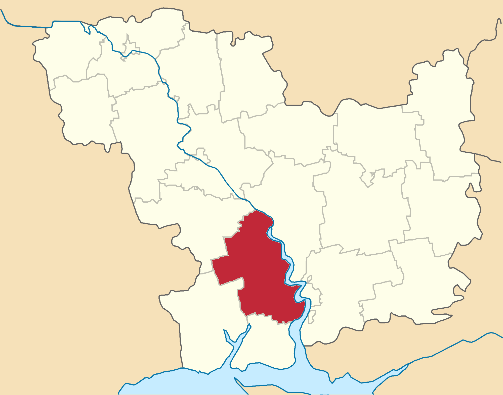
Berezanka ( uk, Березанка, russian: Береза́нка) is an urban-type settlement in Mykolaiv Raion in the south of Mykolaiv Oblast, Ukraine. It hosts the administration of Berezanka settlement hromada, one of the hromadas of Ukraine. Population: Berezanka is located on the banks of the Sasik, a tributary of the Black Sea. History The settlement was founded in 1866 by German settlers as Alexanderfeld. It belonged to Odessky Uyezd of Kherson Governorate and was the administrative center of Aleksandrfeldskaya Volost. In 1914, after the start of World War I, it was renamed Suvorovo, to commemorate Alexander Suvorov, in a wave of eliminating German names. On 16 April 1920, Odessa Governorate split off, and Odessky Uyezd was moved to Odessa Governorate. In 1923, uyezds in Ukrainian Soviet Socialist Republic were abolished, and the governorates were divided into okruhas. In 1923, Suvorovo was renamed Tylihulo-Berezanka, and in 1966 Berezanka. In 1923, Tylihu ... [...More Info...] [...Related Items...] OR: [Wikipedia] [Google] [Baidu] |
Berezanka Raion
Berezanka Raion ( uk, Березанський район) was a subdivision of Mykolaiv Oblast of Ukraine. Its administrative center was the urban-type settlement of Berezanka. The raion was abolished on 18 July 2020 as part of the administrative reform of Ukraine, which reduced the number of raions of Mykolaiv Oblast to four. The area of Berezanka Raion was merged into Mykolaiv Raion. The last estimate of the raion population was History In the 19th century, the area belonged to Odessky Uyezd of Kherson Governorate. On 16 April 1920, Odessa Governorate split off, and Odessky Uyezd was moved to Odessa Governorate. In 1923, uyezds in Ukrainian Soviet Socialist Republic were abolished, and the governorates were divided into okruhas. In 1923, Anatolivka Raion of Odessa Okruha, with the administrative center in Anatolivka, was established. In the same year, the center of the raion was moved to Tylihulo-Berezanka, and later raion was renamed Tylihulo-Berezanka. In 1925, the g ... [...More Info...] [...Related Items...] OR: [Wikipedia] [Google] [Baidu] |
Mykolaiv Raion, Mykolaiv Oblast
Mykolaiv Raion ( uk, Миколаївський район) is located in Mykolaiv Oblast of Ukraine. Its administrative center is the city of Mykolaiv. Population: History In the 19th century, the area belonged to Kherson Governorate. In December 1920, it was renamed Nikolayev Governorate, and in 1921 it was merged into Odessa Governorate. In 1923, governorates were abolished in the Ukrainian Soviet Socialist Republic. In 1923, Mykolaiv Raion of Mykolaiv Okruha, with the administrative center in Mykolaiv, was established. The city of Mykolaiv belonged to the raion. In 1925, the governorates were abolished, and okruhas were directly subordinated to Ukrainian SSR. In 1930, okruhas were abolished, and Mykolaiv Raion was abolished. The area was transferred to Varvarivka Raion. On 27 February 1932, Odessa Oblast was established, and the area was transferred to Odessa Oblast. On 22 September 1937, Mykolaiv Oblast was established on lands which previously belonged to Dnipropetrovsk ... [...More Info...] [...Related Items...] OR: [Wikipedia] [Google] [Baidu] |
Mykolaiv Oblast
Mykolaiv Oblast ( uk, Микола́ївська о́бласть, translit=Mykoláyivsʹka óblastʹ, ), also referred to as Mykolaivshchyna ( uk, Микола́ївщина, Mykoláivshchyna, ) is an oblast (province) of Ukraine. The administrative center of the oblast is the city of Mykolaiv. At the most recent estimate, the population of the oblast stood at . History During the 2022 Russian invasion of Ukraine, the Russian army invaded the province from Kherson Oblast, attacking as far northwest as Voznesensk. However, at Voznesensk, the Russian forces were repulsed, and the attempt to take Mykolaiv also ended in failure. From April 2022, almost all of the province was under Ukrainian control, apart from the extreme south-east and the Kinburn peninsula. When Russia annexed Kherson Oblast in September 2022, it incorporated the occupied areas of Mykolaiv Oblast. A Ukrainian military official announced a Russian withdrawal from Mykolaiv Oblast on 10 November 2022. On 4-5 J ... [...More Info...] [...Related Items...] OR: [Wikipedia] [Google] [Baidu] |
Valeriy Pustovoitenko
Valeriy Pavlovych Pustovoitenko ( uk, Валерій Павлович Пустовойтенко; born 23 February 1947) is a Ukrainian politician who served as prime minister of Ukraine from 1997 to 1999. He resigned in connection with Leonid Kuchma Leonid Danylovych Kuchma ( uk, Леоні́д Дани́лович Ку́чма; born 9 August 1938) is a Ukrainian politician who was the second president of Ukraine from 19 July 1994 to 23 January 2005. Kuchma's presidency saw numerous corrup ...'s re-election for a new term. He is a former leader of the People's Democratic Party of Ukraine. References 1947 births Living people People from Mykolaiv Oblast Mayors of Dnipro People's Democratic Party (Ukraine) politicians Prime Ministers of Ukraine First convocation members of the Verkhovna Rada Fourth convocation members of the Verkhovna Rada Transport ministers of Ukraine Cabinet Office ministers of Ukraine Football Federation of Ukraine chairmen Reci ... [...More Info...] [...Related Items...] OR: [Wikipedia] [Google] [Baidu] |
List Of Sovereign States
The following is a list providing an overview of sovereign states around the world with information on their status and recognition of their sovereignty. The 206 listed states can be divided into three categories based on membership within the United Nations System: 193 member states of the United Nations, UN member states, 2 United Nations General Assembly observers#Present non-member observers, UN General Assembly non-member observer states, and 11 other states. The ''sovereignty dispute'' column indicates states having undisputed sovereignty (188 states, of which there are 187 UN member states and 1 UN General Assembly non-member observer state), states having disputed sovereignty (16 states, of which there are 6 UN member states, 1 UN General Assembly non-member observer state, and 9 de facto states), and states having a political status of the Cook Islands and Niue, special political status (2 states, both in associated state, free association with New Zealand). Compi ... [...More Info...] [...Related Items...] OR: [Wikipedia] [Google] [Baidu] |
Ukrainian Soviet Socialist Republic
The Ukrainian Soviet Socialist Republic ( uk, Украї́нська Радя́нська Соціалісти́чна Респу́бліка, ; russian: Украи́нская Сове́тская Социалисти́ческая Респу́блика, group=note), abbreviated as the Ukrainian SSR, UkrSSR, or UkSSR, and also known as Soviet Ukraine, was one of the Republics of the Soviet Union, constituent republics of the Soviet Union from 1922 until 1991. In the anthem of the Ukrainian Soviet Socialist Republic, anthem of the Ukrainian SSR, it was referred to simply as ''History of Ukraine, Ukraine''. Under the Soviet One-party state, one-party model, the Ukrainian SSR was governed by the Communist Party of the Soviet Union through its Soviet democracy, republican branch: the Communist Party of Ukraine (Soviet Union), Communist Party of Ukraine. The first iterations of the Ukrainian SSR were established during the Russian Revolution, particularly after the October Revol ... [...More Info...] [...Related Items...] OR: [Wikipedia] [Google] [Baidu] |
European Route E58
European route E 58 is a road part of the International E-road network. It begins in Vienna, Austria and ends in Rostov-na-Donu, Russia. It is approximately long. Route * **: Vienna - Fischamend - Bruck an der Leitha **: Bruck an der Leitha - / border * **: / border (Start of Concurrency with ) - Bratislava **: (Start of Concurrency with ) Bratislava - Senec - Trnava **: (End of Concurrency with ) Trnava - Nitra - Zvolen **: Zvolen - Vigľaš - Lučenec - Rimavská Sobota - Figa **: Figa - Tornaľa **: Tornaľa - Rožňava - Košice (End of Concurrency with ) **: (Start of Concurrency with ) Košice **: Košice - Michalovce - / border * **: / border - Uzhorod **: (End of Concurrency with ) Uzhorod - Serednje - Mukachevo **: (Start of Concurrency with ) Mukachevo - Berehove **: Berehove - Bene - Vylok **: Vylok - Pyiterfolovo - Nevetlenfolu - / border * **: / border - Dragușeni (End of Concurrency with )- Baia Mare - - Bizușa-Băi - Dej **: Dej ... [...More Info...] [...Related Items...] OR: [Wikipedia] [Google] [Baidu] |
Mykolaiv
Mykolaiv ( uk, Миколаїв, ) is a city and municipality in Southern Ukraine, the administrative center of the Mykolaiv Oblast. Mykolaiv city, which provides Ukraine with access to the Black Sea, is the location of the most downriver bridge crossing of the Southern Bug river. This city is one of the main shipbuilding centers of the Black Sea. Aside from three shipyards within the city, there are a number of research centers specializing in shipbuilding such as the State Research and Design Shipbuilding Center, Zoria-Mashproekt and others. As of 2021, the city has a population of Mykolaiv holds the honorary title Hero City of Ukraine. The city serves as a transportation hub for Ukraine, containing a sea port, commercial port, river port, highway, railway junction, and airport. Much of Mykolaiv's land area consists of parks. Park Peremohy (''Victory'') is a large park on the peninsula just north of the city center of Mykolaiv, on the north side of the Inhul river. ... [...More Info...] [...Related Items...] OR: [Wikipedia] [Google] [Baidu] |
Odessa
Odesa (also spelled Odessa) is the third most populous city and municipality in Ukraine and a major seaport and transport hub located in the south-west of the country, on the northwestern shore of the Black Sea. The city is also the administrative centre of the Odesa Raion and Odesa Oblast, as well as a multiethnic cultural centre. As of January 2021 Odesa's population was approximately In classical antiquity a large Greek settlement existed at its location. The first chronicle mention of the Slavic settlement-port of Kotsiubijiv, which was part of the Grand Duchy of Lithuania, dates back to 1415, when a ship was sent from here to Constantinople by sea. After a period of Lithuanian Grand Duchy control, the port and its surroundings became part of the domain of the Ottomans in 1529, under the name Hacibey, and remained there until the empire's defeat in the Russo-Turkish War of 1792. In 1794, the modern city of Odesa was founded by a decree of the Russian empress Cather ... [...More Info...] [...Related Items...] OR: [Wikipedia] [Google] [Baidu] |
Highway M14 (Ukraine)
Highway M14 is a Ukrainian international highway ( M-highway) connecting Odessa to the Russian border east of Mariupol, where it continues into Russia as the A280. General overview The M14 is a major transnational corridor and along with the M16 combines into the southern branch of European route E58 in Ukraine (another one in Zakarpattia). The highway is also part of the Eurasian transportation corridor and the Black-Sea Economic Association transportation corridor (ChES). It runs along the coastal line of Black and Azov seas, connecting two major ports of Ukraine in Odessa and Mariupol. The M14 connects two major European routes: E95 and E105. Main Route Main route and connections to/intersections with other highways in Ukraine. See also * Roads in Ukraine * Ukraine Highways * International E-road network The international E-road network is a numbering system for roads in Europe developed by the United Nations Economic Commission for Europe, United Nations E ... [...More Info...] [...Related Items...] OR: [Wikipedia] [Google] [Baidu] |
Odessa Oblast
Odesa Oblast ( uk, Оде́ська о́бласть, translit=Odeska oblast), also referred to as Odeshchyna ( uk, Оде́щина) is an oblast (province) of southwestern Ukraine, located along the northern coast of the Black Sea. Its administrative centre is the city of Odesa ( uk, Одеса). Population: The length of coastline (sea-coast and estuaries) reaches , while the state border stretches for .Tell about Ukraine. Odessa Oblast 24 Kanal (youtube). The region has eight seaports, over of vineyards, and five of the biggest lakes in Ukraine. One of the largest, Yalpuh Lake, is as large as the city of Odesa it ... [...More Info...] [...Related Items...] OR: [Wikipedia] [Google] [Baidu] |


