|
Almyros
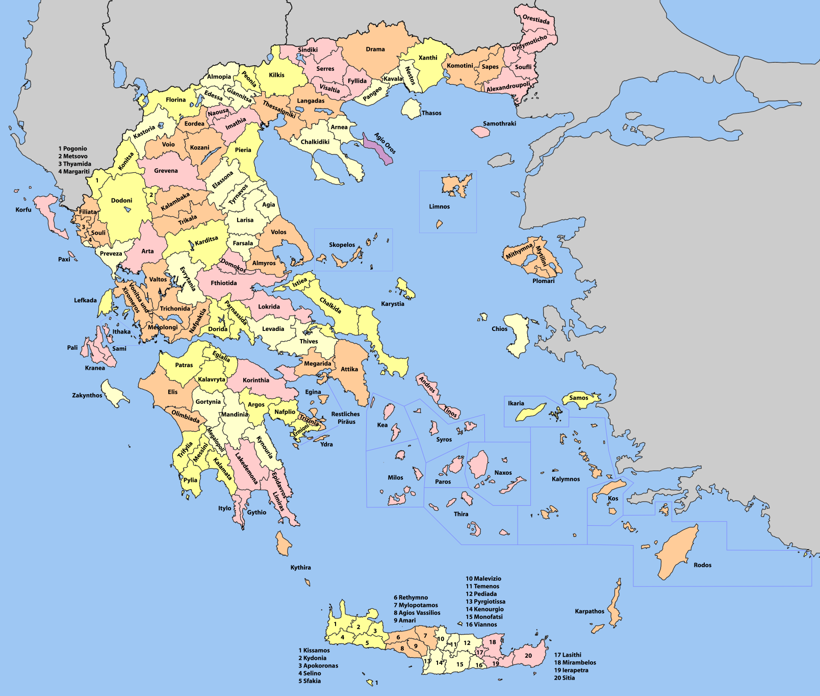
Almyros or Halmyros ( el, Αλμυρός, , , ) is a town and a municipality of the regional unit of Magnesia, region of Thessaly, Greece. It lies in the center of prosperous fertile plain known as 'Krokio Pedio', which is crossed by torrents. Almyros is an important agricultural and commercial center of Magnesia, and is also developing as a tourist center for the area. The main agricultural products are tomatoes, cotton, wheat, almonds, peanuts and pistachio nuts. History The history of Almyros begins with the ancient city of Alos (about 10 km .2 misouth of Almyros), the ruins of which can still be visited. Alos was a very important and populous town, famous for its port and for its role in the Persian Wars. After the Byzantine Empire, because of pirate raids, they built the town in the place that it is today. Halmyros was the site of the decisive Battle of Halmyros on 15 March 1311, where the Catalan Company shattered the assembled feudal armies of Frankish Greece ... [...More Info...] [...Related Items...] OR: [Wikipedia] [Google] [Baidu] |
Magnesia (regional Unit)
Magnesia ( el, Μαγνησία, ''Magnisía'', , Ancient Greek: ''Magnēsía'', deriving from the tribe name '' Magnetes'') is one of the regional units of Greece. It is part of the region of Thessaly. Its capital is the city of Volos. About 70% of the population of Magnesia live in the Greater Volos area, which is the second-largest city in Thessaly and the third busiest commercial port in Greece. According to the most recent census (2011), the population stands at 190,010. The regional unit hosts 2,000,000 tourists annually. Magnesia is represented in the Greek Parliament by six seats. Its main agricultural products are wheat, cotton, tomatoes, grapes, olives, apples and honey. Geography A prominent geographic feature of Magnesia is the Pagasetic Gulf, a bay of the Aegean Sea. The Pelion mountain range closes off the Gulf on the east and south side, leaving only a narrow channel near Trikeri. The highest peak of the wooded Pelion is ''Pourianos Stavros'' or ''Xeforti'', (a ... [...More Info...] [...Related Items...] OR: [Wikipedia] [Google] [Baidu] |
Archaeological Museum Of Almyros
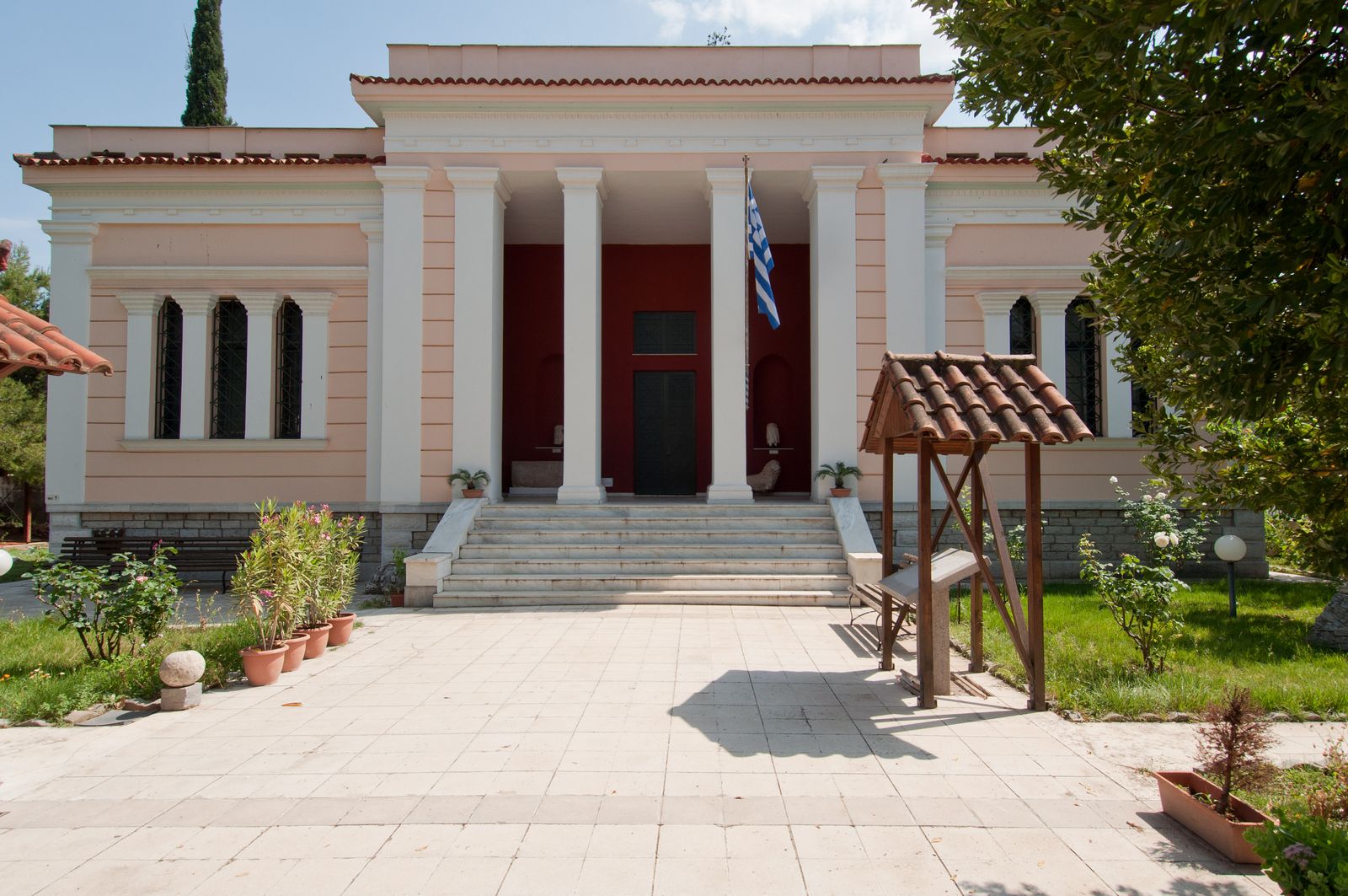
The Archaeological Museum of Almyros is a museum in Almyros, Greece. It was built by and belonged to, until the 1950s, by the ''Othrys, Filarchaeos Etaireia Almyrou'', a non-profit local organization found in the beginning of 20th century. Now it belongs to the Hellenic Ministry of Culture. The museum includes local artifacts and other exhibits from the Neolithic period, through Mycenean, Geometric, Classical, Hellenistic periods, and later Roman years. Retrieved February 27, 2014. Opposite the museum is the old High School, the Gymnasium of Almyros, which is a classic monumental building from the beginning of 20th century. The Museum and Gymnasium are the oldest buildings in the area and had suffered great damages during the 1980 earthquake. References External l ...
|
Anavra
Anavra ( el, Ανάβρα) is a village and a former community in Magnesia, Thessaly, Greece. Since the 2011 local government reform, it has been part of the municipality Almyros, of which it is a municipal unit. The municipal unit has an area of 121.859 km2. According to the census of 2011, the population of Anavra was 584 citizens. The village of Anavra is located on the west side of Mount Othrys, at a height of above sea level, from Magnesia's administrative center of Volos and close to the border of Phthiotis. The Enipeas river, which is a tributary of the Pineios, starts at the springs of Anavra and passes through the village for two kilometres. According to mythology, Anavra is connected with livestock activities. Almost all the inhabitants are employed in farming and herding. Economy In the 1970s mules were the only form of transport available in Anavra, and the nearest school, in Lamia, was a 6-hour ride away. Since the 1990s the village has been transformed b ... [...More Info...] [...Related Items...] OR: [Wikipedia] [Google] [Baidu] |
Efxeinoupoli
Efxeinoupoli (Greek: Ευξεινούπολη) is a small town in the Municipality of Almyros, Magnesia regional unit, Thessaly, Greece. Efxeinoupoli counts 2293 residents (2011). History Efxeinoupoli was created in 1906. The first residents that came in the area were Greeks, refugees from Eastern Rumelia (de facto a part of Bulgaria). Firstly they were established in Almyros. The building of the town started on 29 September 1907. After the Greco-Turkish war (1919-1922) Greek refugees from Asia Minor came to the town of Efxeinoupoli. The name of the town had been chosen to denote the origin of all those refugees from regions across the ''Euxeinos Pontos'' (Black Sea The Black Sea is a marginal mediterranean sea of the Atlantic Ocean lying between Europe and Asia, east of the Balkans, south of the East European Plain, west of the Caucasus, and north of Anatolia. It is bounded by Bulgaria, Georgia, Rom ...). Sports The town is the home of the Athletic Club A.E Dim ... [...More Info...] [...Related Items...] OR: [Wikipedia] [Google] [Baidu] |
Sourpi
Sourpi ( el, Σούρπη) is a village and a former municipality in Magnesia, Thessaly, Greece. It is predominantly populated by Aromanians (Vlachs "Vlach" ( or ), also "Wallachian" (and many other variants), is a historical term and exonym used from the Middle Ages until the Modern Era to designate mainly Romanians but also Aromanians, Megleno-Romanians, Istro-Romanians and other E ...). Since the 2011 local government reform it is part of the municipality Almyros, of which it is a municipal unit. The municipal unit has an area of 191.335 km2. Population 2,867 (2011). References Populated places in Magnesia (regional unit) Aromanian settlements in Greece {{Thessaly-geo-stub ... [...More Info...] [...Related Items...] OR: [Wikipedia] [Google] [Baidu] |
Pteleos
Pteleos ( el, Πτελεός) is a village and a former municipality in the southern part of Magnesia, Thessaly, Greece. Since the 2011 local government reform, it has been part of the municipality of Almyros, of which it is a municipal unit. The municipal unit has an area of 118.230 km2, and a population of 2,485 in 2011. The area has been populated already since the prehistoric times; the ancient city of Pteleon is mentioned in Homer's ''Iliad'', and several tombs from the Mycenean period survive between Pteleos and Agioi Theodoroi. The current settlement lies to the north and land-inward of the ancient and medieval settlements in the area. An ancient settlement, which survived until early Byzantine times, was located on the southern coast of the Bay of Pteleos near the modern village of Achilleion, where a mosaic floor and remains of two early Christian basilicas have been found. The medieval settlement was located on the northern part of the Bay, near the modern vill ... [...More Info...] [...Related Items...] OR: [Wikipedia] [Google] [Baidu] |
Battle Of Halmyros
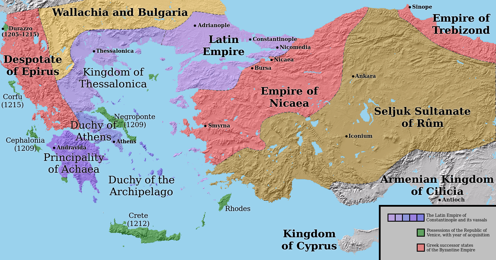
The Battle of Halmyros, known by earlier scholars as the Battle of the Cephissus or Battle of Orchomenos, was fought on 15 March 1311, between the forces of the Frankish Duchy of Athens and its vassals under Walter of Brienne against the mercenaries of the Catalan Company, resulting in a decisive victory for the mercenaries. Engaged in conflict with their original employers, the Byzantine Empire, the Catalan Company had traversed the southern Balkans and arrived in southern Greece in 1309. The new Duke of Athens, Walter of Brienne, hired them to attack the Greek ruler of neighbouring Thessaly. Although the Catalans conquered much of the region for him, Walter refused to pay them and prepared to forcibly expel them from their gains. The two armies met at Halmyros in southern Thessaly (or at the Boeotic Cephissus, near Orchomenos, according to an earlier interpretation). The Catalans were considerably outnumbered and weakened by the reluctance of their Turkish auxiliaries to f ... [...More Info...] [...Related Items...] OR: [Wikipedia] [Google] [Baidu] |
Thessaly
Thessaly ( el, Θεσσαλία, translit=Thessalía, ; ancient Thessalian: , ) is a traditional geographic and modern administrative region of Greece, comprising most of the ancient region of the same name. Before the Greek Dark Ages, Thessaly was known as Aeolia (, ), and appears thus in Homer's ''Odyssey''. Thessaly became part of the modern Greek state in 1881, after four and a half centuries of Ottoman rule. Since 1987 it has formed one of the country's 13 regions and is further (since the Kallikratis reform of 2011) sub-divided into five regional units and 25 municipalities. The capital of the region is Larissa. Thessaly lies in northern Greece and borders the regions of Macedonia on the north, Epirus on the west, Central Greece on the south, and the Aegean Sea on the east. The Thessaly region also includes the Sporades islands. Name and etymology Thessaly is named after the ''Thessaloi'', an ancient Greek tribe. The meaning of the name of this tribe is unk ... [...More Info...] [...Related Items...] OR: [Wikipedia] [Google] [Baidu] |
Provinces Of Greece
The provinces of Greece ( el, επαρχία, " eparchy") were sub-divisions of some the country's prefectures. From 1887, the provinces were abolished as actual administrative units, but were retained for some state services, especially financial and educational services, as well as for electoral purposes. Before the Second World War, there were 139 provinces, and after the war, with the addition of the Dodecanese Islands, their number grew to 147. According to the Article 7 of the Code of Prefectural Self-Government (Presidential Decree 30/1996), the provinces constituted a "particular administrative district" within the wider "administrative district" of the prefectures. The provinces were finally abolished after the 2006 local elections, in line with Law 2539/1997, as part of the wide-ranging administrative reform known as the " Kapodistrias Project", and replaced by enlarged municipalities (''demoi''). Organization Provincial administration consisted of two parts: a col ... [...More Info...] [...Related Items...] OR: [Wikipedia] [Google] [Baidu] |
Mount Othrys
Mount Othrys ( el, όρος Όθρυς – ''oros Othrys'', also Όθρη – ''Othri'') is a mountain range of central Greece, in the northeastern part of Phthiotis and southern part of Magnesia. Its highest summit, ''Gerakovouni'', situated on the border of Phthiotis and Magnesia, is above sea level. The population density in the mountains is low: there are a few small villages, including Anavra in the northwest, Kokkotoi in the northeast, Palaiokerasia in the south and Neraida in the southwest. The length from west to east is about and the width from north to south is about . The Pagasetic Gulf lies to the northeast, and the Malian Gulf lies to the south. The summit Gerakovouni lies south of Almyros, northeast of Lamia and southwest of Volos. The peaks of the range are above the tree line. The main mineral constituent of the rock is ophiolite. A Natura 2000 protected area has been has been defined over much, but not all, of the range according to the Birds Directive. Of ... [...More Info...] [...Related Items...] OR: [Wikipedia] [Google] [Baidu] |
Frankish Greece
The ''Frankokratia'' ( el, Φραγκοκρατία, la, Francocratia, sometimes anglicized as Francocracy, "rule of the Franks"), also known as ''Latinokratia'' ( el, Λατινοκρατία, la, Latinocratia, "rule of the Latins") and, for the Venetian domains, ''Venetokratia'' or ''Enetokratia'' ( el, Βενετοκρατία or Ενετοκρατία, la, Venetocratia, "rule of the Venetians"), was the period in Greek history after the Fourth Crusade (1204), when a number of primarily French and Italian states were established by the '' Partitio terrarum imperii Romaniae'' on the territory of the dissolved Byzantine Empire. The terms Frankokratia and Latinokratia derive from the name given by the Orthodox Greeks to the Western French and Italians who originated from territories that once belonged to the Frankish Empire. The Frankish Empire being the political entity which ruled much of the former Western Roman Empire after the collapse of Roman authority and power. ... [...More Info...] [...Related Items...] OR: [Wikipedia] [Google] [Baidu] |
Regional Units Of Greece
The 74 regional units of Greece ( el, περιφερειακές ενότητες, ; sing. , ) are the country's Seventy-four second-level Administrative divisions of Greece, administrative units. They are divisions of the country's 13 Modern regions of Greece, regions, and are further divided into municipalities of Greece, municipalities. They were introduced as part of the Kallikratis Plan, Kallikratis administrative reform on 1 January 2011 and are comparable in area and, in the mainland, coterminous with the 'pre-Kallikratis' prefectures of Greece. List References {{Articles on second-level administrative divisions of European countries Regional units of Greece, Lists of subdivisions of Greece, Regional units Greece transport-related lists Subdivisions of Greece ... [...More Info...] [...Related Items...] OR: [Wikipedia] [Google] [Baidu] |


