|
Addlestone
Addlestone ( or ) is a town in Surrey, England. It is located approximately southwest of London. The town is the administrative centre of the Runnymede (borough), Borough of Runnymede, of which it is the largest settlement. Geography Addlestone is approximately northeast of Guildford and southwest of London. Narrow buffer zone, green buffers separate the town from Weybridge, Chertsey and Ottershaw. There is no precisely defined southern boundary with New Haw. Addlestone is home to the ancient Crouch Oak tree, under which it is said Queen Elizabeth I picnicked. It also marked the edge of Windsor Forest and Great Park, Windsor Forest before it was largely cut down for fields and settlements. Elevation, soil and geology Elevations range between and . The maximum is on Row Hill recreation ground, Row Town, Addlestone; a ridge that continues to the northwest of Row Town where it is known as Ongar/Spinney Hill, where Great Grove Farm in its centre also reaches this height; the ... [...More Info...] [...Related Items...] OR: [Wikipedia] [Google] [Baidu] |
New Haw
New Haw is a village which is part of the Runnymede (borough), Borough of Runnymede in Surrey, England. It is located approximately south of Addlestone and boxing the compass, southwest by west of London. Geography New Haw borders Byfleet, Addlestone, Weybridge, Ottershaw, West Byfleet and Woodham, Surrey, Woodham. The Animal Health and Veterinary Laboratories Agency, an executive agency of Department for Environment, Food and Rural Affairs, DEFRA, has its central laboratories in a semi-rural part of New Haw. The laboratory is notable as being one of the principal test centres for the H5N1 virus. New Haw stands on an irregular south-west border close to Woking, the River Wey, the start of the Basingstoke Canal, and the River Bourne, Addlestone, (River Bourne, Addlestone Branch). The Wey and Godalming Navigations, Wey Navigation rises through three steep locks in the relatively short New Haw section. History "Haw" is an Old English word for "lock gate", and it is possible th ... [...More Info...] [...Related Items...] OR: [Wikipedia] [Google] [Baidu] |
Runnymede (borough)
The Borough of Runnymede is a local government district with borough status in Surrey, England. Its council is based in Addlestone and the borough also includes the towns of Chertsey and Egham. The borough is named after Runnymede, a water meadow on the banks of the River Thames near Egham, which is connected with the sealing of Magna Carta by King John in 1215. It is a prosperous part of the London commuter belt, having some of the most expensive housing in the United Kingdom outside central London, such as the Wentworth Estate at Virginia Water. The M25 motorway which encircles London runs through the borough, with Addlestone, Chertsey and Egham Hythe being inside the M25. At the 2021 Census, the population of the borough was 87,739. With a GDP per capita of £87,277 it is the sixth wealthiest borough in the UK, being the wealthiest outside of London. The UK Competitiveness Index ranks it as the 8th most economically competitive area in the UK, with only London borough ... [...More Info...] [...Related Items...] OR: [Wikipedia] [Google] [Baidu] |
Runnymede And Weybridge (UK Parliament Constituency)
Runnymede and Weybridge is a constituency in Surrey represented in the House of Commons of the UK Parliament since 2019 by Ben Spencer, a Conservative. The constituency was created for the 1997 general election and represented from then until 2019 by Philip Hammond, who served as Foreign Secretary from 2014 to 2016 and Chancellor of the Exchequer from 2016 to 2019. Hammond sat as a Conservative before becoming an Independent backbencher for the last two months of his final term. Boundaries 1997–2024 *'' The Borough of Runnymede:'' Addlestone North; Addlestone South; Chertsey Riverside; Chertsey St Ann's; Egham Hythe; Egham Town; Englefield Green East; Englefield Green West; Longcross, Lyne and Chertsey South; New Haw; Ottershaw; Thorpe; Virginia Water; Woodham and Rowtown *'' The Borough of Elmbridge:'' Oatlands and Burwood Park; Weybridge Riverside; Weybridge St George's Hill Since 1997 and until 2024 the constituency and comprised the whole of the area of the Bo ... [...More Info...] [...Related Items...] OR: [Wikipedia] [Google] [Baidu] |
Chertsey
Chertsey is a town in the Borough of Runnymede, Surrey, England, southwest of central London. It grew up around Chertsey Abbey, founded in AD 666 by Earconwald, St Erkenwald, and gained a municipal charter, market charter from Henry I of England, Henry I. A bridge across the River Thames first appeared in the early 15th century. The River Bourne, Chertsey, River Bourne through the town meets the Thames at Weybridge. The Anglicanism, Anglican church has a medieval tower and chancel roof. The 18th-century listed buildings include the current stone Chertsey Bridge and Botleys Mansion. A curfew bell, rung at 8pm on weekdays from Michaelmas to Lady Day ties with the romantic local legend of Blanche Heriot, marked by a statue of her and the bell at Chertsey Bridge. Green areas include the Thames Path National Trail, Chertsey Meads and a round knoll (St Ann's Hill) with remains of a prehistoric Hillfort, hill fort known as Eldebury Hill. Pyrcroft House dates from the 18th century and ... [...More Info...] [...Related Items...] OR: [Wikipedia] [Google] [Baidu] |
Weybridge
Weybridge () is a town in the Borough of Elmbridge, Elmbridge district in Surrey, England, around southwest of central London. The settlement is recorded as ''Waigebrugge'' and ''Weibrugge'' in the 7th century and the name derives from a crossing point of the River Wey, which flows into the River Thames to the north of the town centre. The earliest evidence of human activity is from the Bronze Age. During the Anglo-Saxon and Middle Ages, medieval periods, Weybridge was held by Chertsey Abbey. In 2011 it had a population of 15,449. In the 1530s, Henry VIII constructed Oatlands Palace to the north of the town centre, which he intended to be the residence of his fourth wife, Anne of Cleves. He married Catherine Howard there in July 1540 and the palace remained a royal residence until the English Civil War, Civil War. The buildings were demolished in the early 1650s and a new mansion, Oatlands House, was constructed to the east of Weybridge later the same century. Prince Frederic ... [...More Info...] [...Related Items...] OR: [Wikipedia] [Google] [Baidu] |
Ottershaw
Ottershaw is a village in the Borough of Runnymede in Surrey, England, approximately southwest of central London. The village developed in the mid-19th century from a number of separate hamlets and became a parish in its own right in 1871. The nearest town is Addlestone, approximately to the east. The M25 is accessible via junction 11. Economy and transport Ottershaw is largely a mixture of a London commuter belt and a retirement settlement. Its nearest passenger trains to London leave from Addlestone railway station, centred east, on a branch line, with two others on a main line a slightly greater distance to the south —; the principal one which has frequent, semi-fast services to London being West Byfleet. Amenities A significant landmark is Christ Church. Sir Edward Colebrooke (1813–90), who bought the Ottershaw Park estate in 1859, built the church on his estate as a memorial to his deceased son and heir. From its consecration in 1864, it was opened to the lo ... [...More Info...] [...Related Items...] OR: [Wikipedia] [Google] [Baidu] |
Surrey
Surrey () is a Ceremonial counties of England, ceremonial county in South East England. It is bordered by Greater London to the northeast, Kent to the east, East Sussex, East and West Sussex to the south, and Hampshire and Berkshire to the west. The largest settlement is Woking. The county has an area of and a population of 1,214,540. Much of the north of the county forms part of the Greater London Built-up Area, which includes the Suburb, suburbs within the M25 motorway as well as Woking (103,900), Guildford (77,057), and Leatherhead (32,522). The west of the county contains part of Farnborough/Aldershot built-up area, built-up area which includes Camberley, Farnham, and Frimley and which extends into Hampshire and Berkshire. The south of the county is rural, and its largest settlements are Horley (22,693) and Godalming (22,689). For Local government in England, local government purposes Surrey is a non-metropolitan county with eleven districts. The county historically includ ... [...More Info...] [...Related Items...] OR: [Wikipedia] [Google] [Baidu] |
Woodham, Surrey
Woodham is a suburban village in Surrey next to New Haw and contiguous with two suburbs of Woking: Sheerwater and West Byfleet. Amenities Railway All parts of the settlement are within north of West Byfleet or neighbouring Byfleet & New Haw stations which have South West Main Line trains (to/from London Waterloo station), a major and minor stop respectively. Roads The local roads form a complex grid north of Woking bypassing most residential roads, including the east-west access way of the A245 road to the south of Woodham which links Woking to the A3 at Cobham via Brooklands. Two similar roads north-south skirt to the east and west of Woodham linking Woking, and Brooklands respectively, to the M25 motorway. The grid avoids the need for dual carriageways in an area close to the eight-lane motorway which is elevated above the level of immediately surrounding streets, east of Woodham. Schools There are no schools in Woodham itself but there are nursery schools, infant sch ... [...More Info...] [...Related Items...] OR: [Wikipedia] [Google] [Baidu] |
Buffer Zone
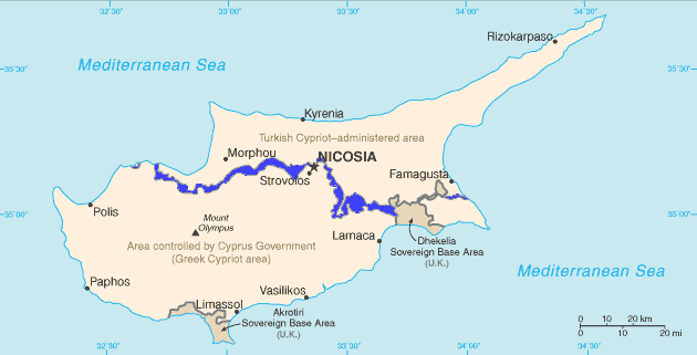
A buffer zone, also historically known as a march, is a neutral area that lies between two or more bodies of land; usually, between countries. Depending on the type of buffer zone, it may serve to separate regions or conjoin them. Common types of buffer zones are demilitarized zones, border zones and certain restrictive easement zones and green belts. Such zones may be comprised by a sovereign state, forming a buffer state. Buffer zones have various purposes, politically or otherwise. They can be set up for a multitude of reasons, such as to prevent violence, protect the environment, shield residential and commercial zones from industrial accidents or natural disasters, or even isolate prisons. Buffer zones often result in large uninhabited regions that are themselves noteworthy in many increasingly developed or crowded parts of the world that unintentionally create a de facto wildlife sanctuary. Conservation For use in nature conservation, a buffer zone is often create ... [...More Info...] [...Related Items...] OR: [Wikipedia] [Google] [Baidu] |
Pleistocene
The Pleistocene ( ; referred to colloquially as the ''ice age, Ice Age'') is the geological epoch (geology), epoch that lasted from to 11,700 years ago, spanning the Earth's most recent period of repeated glaciations. Before a change was finally confirmed in 2009 by the International Union of Geological Sciences, the cutoff of the Pleistocene and the preceding Pliocene was regarded as being 1.806 million years Before Present (BP). Publications from earlier years may use either definition of the period. The end of the Pleistocene corresponds with the end of the last glacial period and also with the end of the Paleolithic age used in archaeology. The name is a combination of Ancient Greek () 'most' and (; Latinized as ) 'new'. The aridification and cooling trends of the preceding Neogene were continued in the Pleistocene. The climate was strongly variable depending on the glacial cycle, oscillating between cold Glacial period, glacial periods and warmer Interglacial, int ... [...More Info...] [...Related Items...] OR: [Wikipedia] [Google] [Baidu] |
Ecclesiastical Parish
A parish is a territorial entity in many Christianity, Christian denominations, constituting a division within a diocese. A parish is under the pastoral care and clerical jurisdiction of a priest#Christianity, priest, often termed a parish priest, who might be assisted by one or more curates, and who operates from a parish church. Historically, a parish often covered the same geographical area as a Manorialism, manor. Its association with the parish church remains paramount. By extension the term ''parish'' refers not only to the territorial entity but to the people of its community or congregation as well as to church property within it. In England this church property was technically in ownership of the parish priest ''Ex officio member, ex officio'', vested in him on his institution to that parish. Etymology and use First attested in English in the late 13th century, the word ''parish'' comes from the Old French , in turn from , the Romanization of Greek, Romanisation of ... [...More Info...] [...Related Items...] OR: [Wikipedia] [Google] [Baidu] |
Anglo-Saxon Settlement Of Britain
The settlement of Great Britain by Germanic peoples from continental Europe led to the development of an Anglo-Saxons, Anglo-Saxon cultural identity and a shared Germanic language—Old English—whose closest known relative is Old Frisian, spoken on the other side of the North Sea. The first Germanic speakers to settle Britain permanently are likely to have been soldiers recruited by the Roman administration in the 4th century AD, or even earlier. In the early 5th century, during the end of Roman rule in Britain and the breakdown of the Roman economy, larger numbers arrived, and their impact upon local culture and politics increased. There is Historiography of the Anglo-Saxon settlement of Britain, ongoing debate about the scale, timing and nature of the Anglo-Saxon settlements and also about what happened to the existing populations of the regions where the migrants settled. The available evidence includes a small number of medieval texts which emphasize Saxons, Saxon settle ... [...More Info...] [...Related Items...] OR: [Wikipedia] [Google] [Baidu] |


