|
ß╣Č─übatum
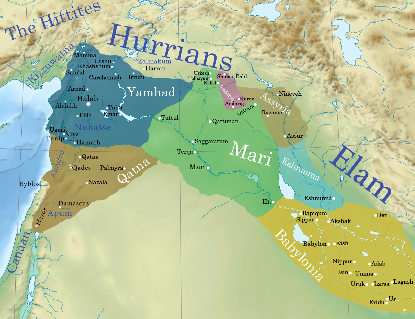
Tell Taban is an archaeological site in north-eastern Syria in the Al-Hasakah Governorate. It is the site of the ancient city of ß╣Č─übetu. Archaeology The site was first excavated from 1997 until 1999 as a salvage operation in response to the effects of the Hassake dam. A number of inscribed objects, mostly building inscriptions, were found. The site was again excavated in 2005 through 2010. More inscriptions and an archive containing over 100 cuneiform tablets were found, dating to the Old Babylonian and Middle Assyrian Periods. History ß╣Č─übetu The city was mentioned in 18th century BC as a regional center named ß╣Č─übatum in the tablets of the kingdom of Mari, and was destroyed by Samsu-Iluna of Babylon. Afterward the city come under the control of Terqa for a time. A few centuries later it came under the rule of the Assyrians after the fall of the Mittani. Autonomous kingdom An autonomous dynasty ruled the city between the 14th and 12th centuries BC under the suzerainty ... [...More Info...] [...Related Items...] OR: [Wikipedia] [Google] [Baidu] |
Cities Of The Ancient Near East
The earliest cities in history were in the ancient Near East, an area covering roughly that of the modern Middle East: its history began in the 4th millennium BC and ended, depending on the interpretation of the term, either with the conquest by the Achaemenid Empire in the 6th century BC or with that by Alexander the Great in the 4th century BC. The largest cities of the Bronze Age Near East housed several tens of thousands of people. Memphis in the Early Bronze Age, with some 30,000 inhabitants, was the largest city of the time by far. Ebla is estimated to have had a population of 40,000 inhabitants in the Intermediate Bronze age. Ur in the Middle Bronze Age is estimated to have had some 65,000 inhabitants; Babylon in the Late Bronze Age similarly had a population of some 50,000ÔÇô60,000. Niniveh had some 20,000ÔÇô30,000, reaching 100,000 only in the Iron Age (around 700 BC). In Akkadian and Hittite orthography, URU became a determinative sign denoting a city, or combine ... [...More Info...] [...Related Items...] OR: [Wikipedia] [Google] [Baidu] |
Syria
Syria, officially the Syrian Arab Republic, is a country in West Asia located in the Eastern Mediterranean and the Levant. It borders the Mediterranean Sea to the west, Turkey to SyriaÔÇôTurkey border, the north, Iraq to IraqÔÇôSyria border, the east and southeast, Jordan to JordanÔÇôSyria border, the south, and Israel and Lebanon to LebanonÔÇôSyria border, the southwest. It is a republic under Syrian transitional government, a transitional government and comprises Governorates of Syria, 14 governorates. Damascus is the capital and largest city. With a population of 25 million across an area of , it is the List of countries and dependencies by population, 57th-most populous and List of countries and dependencies by area, 87th-largest country. The name "Syria" historically referred to a Syria (region), wider region. The modern state encompasses the sites of several ancient kingdoms and empires, including the Eblan civilization. Damascus was the seat of the Umayyad Caliphate and ... [...More Info...] [...Related Items...] OR: [Wikipedia] [Google] [Baidu] |
Sinjar Mountains
The Sinjar Mountains (, , ), are a mountain range that runs east to west, rising above the surrounding alluvial steppe plains in northwestern Iraq to an elevation of . The highest segment of these mountains, about long, lies in the Nineveh Governorate. The western and lower segment of these mountains lies in Syria and is about long. The city of Sinjar is just south of the range.Edgell, H. S. 2006. ''Arabian Deserts: Nature, Origin, and Evolution.'' Springer, Dordrecht, The Netherlands. 592 pp. Numan, N. M. S., and N. K. AI-Azzawi. 2002. ''Progressive Versus Paroxysmal Alpine Folding in Sinjar Anticline Northwestern Iraq.'' Iraqi Journal of Earth Science. vol. 2, no.2, pp.59-69. These mountains are regarded as sacred by the Yazidis. Geology The Sinjar Mountains are a breached anticlinal structure. These mountains consist of an asymmetrical, doubly plunging anticline, which is called the "Sinjar Anticline", with a steep northern limb, gentle southern limb and a northerly ... [...More Info...] [...Related Items...] OR: [Wikipedia] [Google] [Baidu] |
Bronze Age Sites In Syria
Bronze is an alloy consisting primarily of copper, commonly with about 12ÔÇô12.5% tin and often with the addition of other metals (including aluminium, manganese, nickel, or zinc) and sometimes non-metals (such as phosphorus) or metalloids (such as arsenic or silicon). These additions produce a range of alloys some of which are harder than copper alone or have other useful properties, such as strength, ductility, or machinability. The archaeological period during which bronze was the hardest metal in widespread use is known as the Bronze Age. The beginning of the Bronze Age in western Eurasia is conventionally dated to the mid-4th millennium BCE (~3500 BCE), and to the early 2nd millennium BCE in China; elsewhere it gradually spread across regions. The Bronze Age was followed by the Iron Age, which started about 1300 BCE and reaching most of Eurasia by about 500 BCE, although bronze continued to be much more widely used than it is in modern times. Because historical artworks ... [...More Info...] [...Related Items...] OR: [Wikipedia] [Google] [Baidu] |
Archaeological Sites In Al-Hasakah Governorate
Archaeology or archeology is the study of human activity through the recovery and analysis of material culture. The archaeological record consists of artifacts, architecture, biofacts or ecofacts, sites, and cultural landscapes. Archaeology can be considered both a social science and a branch of the humanities. It is usually considered an independent academic discipline, but may also be classified as part of anthropology (in North America ÔÇô the four-field approach), history or geography. The discipline involves surveying, excavation, and eventually analysis of data collected, to learn more about the past. In broad scope, archaeology relies on cross-disciplinary research. Archaeologists study human prehistory and history, from the development of the first stone tools at Lomekwi in East Africa 3.3 million years ago up until recent decades. Archaeology is distinct from palaeontology, which is the study of fossil remains. Archaeology is particularly important for learnin ... [...More Info...] [...Related Items...] OR: [Wikipedia] [Google] [Baidu] |
Former Populated Places In Syria
A former is an object, such as a template, gauge or cutting die, which is used to form something such as a boat's hull. Typically, a former gives shape to a structure that may have complex curvature. A former may become an integral part of the finished structure, as in an aircraft fuselage, or it may be removable, being used in the construction process and then discarded or re-used. Aircraft formers Formers are used in the construction of aircraft fuselage, of which a typical fuselage has a series from the nose cone to the empennage, typically perpendicular to the longitudinal axis of the aircraft. The primary purpose of formers is to establish the shape of the fuselage and reduce the column length of stringers to prevent instability. Formers are typically attached to longerons, which support the skin of the aircraft. The "former-and-longeron" technique (also called stations and stringers) was adopted from boat construction, and was typical of light aircraft built u ... [...More Info...] [...Related Items...] OR: [Wikipedia] [Google] [Baidu] |
Amorites
The Amorites () were an ancient Northwest Semitic languages, Northwest Semitic-speaking Bronze Age people from the Levant. Initially appearing in Sumerian records c. 2500 BC, they expanded and ruled most of the Levant, Mesopotamia and parts of Egypt from the 21st century BC to the late 17th century BC. The Amorites established several prominent city-states in various locations, such as Isin, Kurda, Larsa, Mari, Syria, Mari, and Ebla, and later founded Babylon and the Old Babylonian Empire. They also founded the Fourteenth Dynasty of Egypt during the fragmented era of the Second Intermediate Period of Egypt, Second Intermediate Period in the Nile Delta, which was characterized by rulers bearing Amorite names such as Yakbim Sekhaenre, and were likely part of the later Hyksos. The term in Akkadian and Sumerian texts refers to the Amorites, Amurru (god), their principal deity, and Amurru kingdom, an Amorite kingdom. The Amorites are mentioned in the Hebrew Bible as inhabitants of Ca ... [...More Info...] [...Related Items...] OR: [Wikipedia] [Google] [Baidu] |
Nuzi
Nuzi (Hurrian Nuzi/Nuzu; Akkadian Gasur) at modern Yorghan Tepe (also Yorgan Tepa and Jorgan Tepe), Iraq was an ancient Mesopotamian city 12 kilometers southwest of the city of Arrapha (modern Kirkuk) and 70 kilometers southwest of S─ütu Qala, located near the Tigris river. It was occupied from the Ubaid period in the 5th millennium BC until late in the 2nd millennium BC then, after a period of abandonment, in the Parthian era. It reached major importance in the Akkadian Empire period when it was known as Gasur and again in the Mitanni period when its name was Nuzi. History The site has about 15 occupational layers with 12 major strata several of which have subdivisions. The majority of excavation work at the site was on the Late Bronze Age levels with only some soundings to the older strata. Traces of Parthian era occupation were found on the surface.Pfeiffer, Robert H., "The Excavations at Nuzi: Preliminary Report of the Fourth Campaign", Bulletin of the American Schools of ... [...More Info...] [...Related Items...] OR: [Wikipedia] [Google] [Baidu] |
Mitanni
Mitanni (ÔÇô1260 BC), earlier called ߪ¬abigalbat in old Babylonian texts, ; Hanigalbat or Hani-Rabbat in Assyrian records, or in Ancient Egypt, Egyptian texts, was a Hurrian language, Hurrian-speaking state in northern Syria (region), Syria and southeast Anatolia (modern-day Turkey) with Indo-Aryan languages, Indo-Aryan Indo-Aryan superstrate in Mitanni, linguistic and political influences. Since no histories, royal annals or chronicles have yet been found in its excavated sites, knowledge about Mitanni is sparse compared to the other powers in the area, and dependent on what its neighbours commented in their texts. The Hurrians were in the region as of the late 3rd millennium BC. A king of Urkesh with a Hurrian name, Tupkish, was found on a clay sealing dated at Tell Mozan.Salvini, Mirjo. "The earliest evidences of the Hurrians before the formation of the reign of Mittanni." Urkesh and the Hurrians Studies in Honor of Lloyd Cotsen. Urkesh/Mozan Studies Bibliotheca Mesopotamic ... [...More Info...] [...Related Items...] OR: [Wikipedia] [Google] [Baidu] |
Hurrian
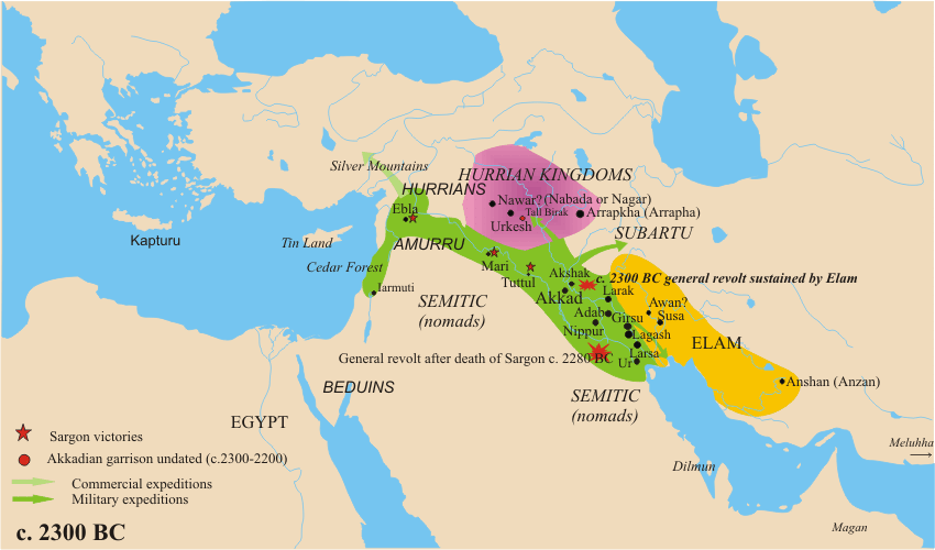
The Hurrians (; ; also called Hari, Khurrites, Hourri, Churri, Hurri) were a people who inhabited the Ancient Near East during the Bronze Age. They spoke the Hurro-Urartian language, Hurrian language, and lived throughout northern Syria (region), Syria, Northern Mesopotamia, upper Mesopotamia and southeastern Anatolia. The Hurrians were first documented in the city of Urkesh, where they built their first kingdom. Their largest and most influential Hurrian kingdom was Mitanni. The population of the Hittite Empire in Anatolia included a large population of Hurrians, and there is significant Hurrian influence in Hittite mythology. By the Early Iron Age, the Hurrians had been assimilated with other peoples. The state of Urartu later covered some of the same area. A related people to the Hurrians are the Urarteans. History Early Bronze Age The Khabur River valley became the heart of the Hurrian lands for a millennium. The first known Hurrian kingdom emerged around the city of Urkesh ... [...More Info...] [...Related Items...] OR: [Wikipedia] [Google] [Baidu] |
Adad-nirari III
Adad-n─źr─ür─ź III (also Adad-n─ür─ür─ź, meaning "Adad (the storm god) is my help") was a King of Assyria from 811 to 783 BC. Family Adad-n─źr─ür─ź was a son and successor of king Shamshi-Adad V, and was apparently quite young at the time of his accession, because for the first five years of his reign, his mother Shammuramat was highly influential, which has given rise to the legend of Semiramis. It is widely rejected that his mother acted as regent, but she was surprisingly influential for the time period.''Ancient Near Eastern History and Culture'' by William H. Stiebing Jr. He was the father of kings Ashur-nirari V, Shalmaneser IV, and Ashur-dan III. Tiglath-Pileser III described himself as a son of Adad-n─źr─ür─ź in his inscriptions, but it is uncertain if this is true. Biography Adad-n─źr─ür─ź's youth, and the struggles his father had faced early in his reign, caused a serious weakening of Assyrian rulership over their indigenous Mesopotamia, and made way for the ... [...More Info...] [...Related Items...] OR: [Wikipedia] [Google] [Baidu] |
Al-Hasakah Governorate
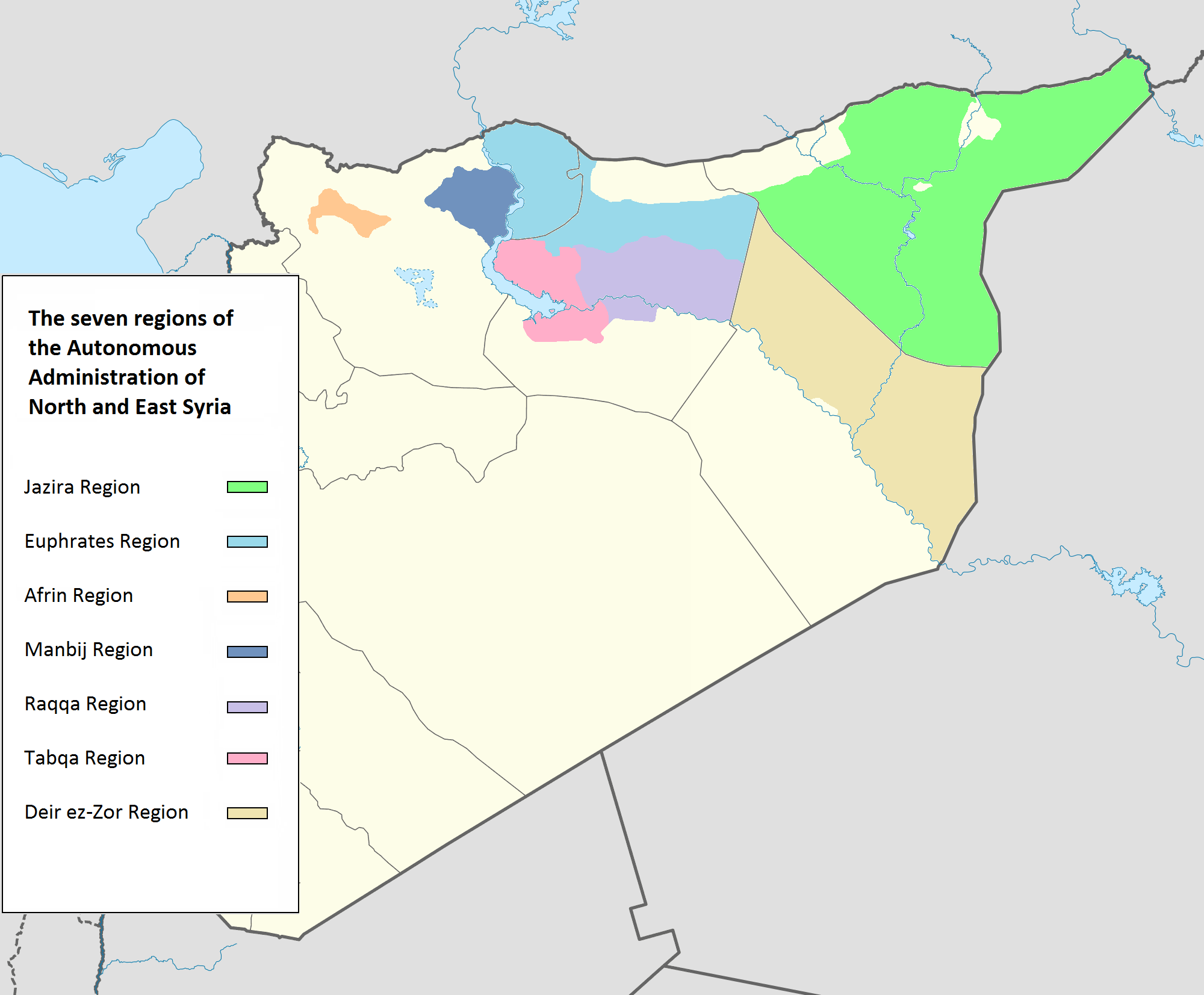
Al-Hasakah Governorate (; ; , also known as , ''Gozarto'') is one of the fourteen Governorates of Syria, governorates (provinces) of Syria. It is located in the far north-east corner of Syria and distinguished by its fertile lands, plentiful water, natural environment, and more than one hundred archaeological sites. It was formerly known as Al-Jazira Province. Prior to the Syrian Civil War nearly half of Syria's oil was extracted from the region. It is the lower part of Upper Mesopotamia. Most of the territory is controlled by the Autonomous Administration of North and East Syria (AANES), which as part of the ongoing Rojava conflict, on 21 January 2014 declared democratic autonomy on the area of Al-Hasakah Governorate as the Jazira Region, the largest of the Regions of Rojava, three original regions of AANES. Geography During the Abbasid era, the area that makes this province used to be part of the Diyar Rabi'a administrative unit, corresponding to the southern part of Upper M ... [...More Info...] [...Related Items...] OR: [Wikipedia] [Google] [Baidu] |

