Simla District on:
[Wikipedia]
[Google]
[Amazon]
Shimla district, known as Simla district until 1972, is one of the twelve districts of the state of


Official website of the Shimla district
District Profile
Cultural & tourism heritage of the district
{{DEFAULTSORT:Shimla District Districts of Himachal Pradesh
Himachal Pradesh
Himachal Pradesh (; Sanskrit: ''himācāl prādes;'' "Snow-laden Mountain Province") is a States and union territories of India, state in the northern part of India. Situated in the Western Himalayas, it is one of the thirteen Indian Himalayan ...
in northern India. Its headquarters is the state capital of Shimla
Shimla, also known as Simla ( the official name until 1972), is the capital and the largest city of the northern Indian state of Himachal Pradesh. In 1864, Shimla was declared the summer capital of British India. After independence, the city ...
. Neighbouring districts are Mandi and Kullu
Kullu () is a municipal council town that serves as the administrative headquarters of the Kullu district of the Indian state of Himachal Pradesh. It is located on the banks of the Beas River in the Kullu Valley about north of the airport ...
in the north, Kinnaur in the east, Uttarakhand
Uttarakhand (, ), also known as Uttaranchal ( ; List of renamed places in India, the official name until 2007), is a States and union territories of India, state in North India, northern India. The state is bordered by Himachal Pradesh to the n ...
in the southeast, Solan
Solan is a city in the Indian state of Himachal Pradesh and the district headquarters of Solan district. It is located south of the state capital, Shimla. Solan has an average elevation of . The city is situated between Chandigarh (joint cap ...
to the southwest and Sirmaur in the south. The elevation of the district ranges from to .
As of 2011, it is the third most populated district of Himachal Pradesh (out of 12), after Kangra and Mandi. It is the most urbanized district of Himachal Pradesh.
Administrative structure
History
Shimla district was obtained by the British in 1815.Access

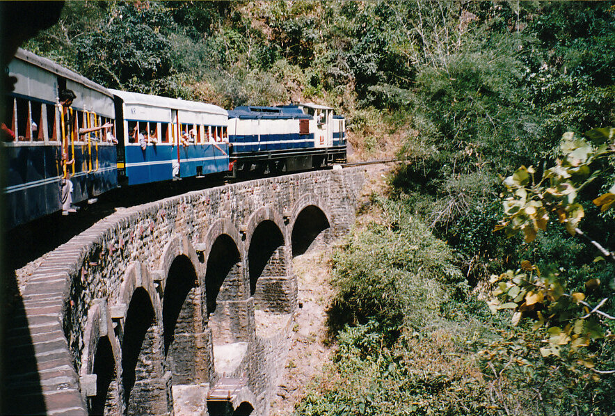
By road
Shimla is connected by road to all the major towns. Distance between the major towns and Shimla: *Kalka
Kalka is a town in the Panchkula district of Haryana, India. It is near Panchkula city. The name of the town is derived from the Hindu goddess Kali. Kalka is situated in the foothills of the Himalayas and is a gateway to the neighbouring st ...
- 80 km
* Patiala
Patiala () is a city in southeastern Punjab, India, Punjab, northwestern India. It is the fourth largest city in the state and is the administrative capital of Patiala district. Patiala is located around the ''Qila Mubarak, Patiala, Qila Mubar ...
- 172 km
* Chandigarh
Chandigarh is a city and union territory in northern India, serving as the shared capital of the states of Punjab and Haryana. Situated near the foothills of the Shivalik range of Himalayas, it borders Haryana to the east and Punjab in the ...
- 119 km
* Ambala
Ambala () is a city and a municipal corporation in Ambala district in the state of Haryana, India, located on the border with the Indian state of Punjab (India), Punjab and in proximity to both states capital Chandigarh. Politically, Ambala ...
- 166 km
* Delhi
Delhi, officially the National Capital Territory (NCT) of Delhi, is a city and a union territory of India containing New Delhi, the capital of India. Straddling the Yamuna river, but spread chiefly to the west, or beyond its Bank (geography ...
- 380 km
* Agra
Agra ( ) is a city on the banks of the Yamuna river in the Indian state of Uttar Pradesh, about south-east of the national capital Delhi and 330 km west of the state capital Lucknow. With a population of roughly 1.6 million, Agra is the ...
- 568 km
* Amritsar
Amritsar, also known as Ambarsar, is the second-List of cities in Punjab, India by population, largest city in the India, Indian state of Punjab, India, Punjab, after Ludhiana. Located in the Majha region, it is a major cultural, transportatio ...
- 342 km
* Jammu
Jammu () is a city in Indian-administered Jammu and Kashmir (union territory), Jammu and Kashmir in the disputed Kashmir region.The application of the term "administered" to the various regions of Kashmir and a mention of the Kashmir dispute ...
(via Pathankot
Pathankot () is a city and the district headquarters of the Pathankot district in Punjab, India. Pathankot is the sixth most populous city of Punjab, after Ludhiana, Amritsar, Jalandhar, Patiala and Bathinda. Its local government is a municipal ...
) - 482 km
* Srinagar
Srinagar (; ) is a city in Indian-administered Jammu and Kashmir in the disputed Kashmir region.The application of the term "administered" to the various regions of Kashmir and a mention of the Kashmir dispute is supported by the tertiary ...
- 787 km
* Jaipur
Jaipur (; , ) is the List of state and union territory capitals in India, capital and the List of cities and towns in Rajasthan, largest city of the north-western States and union territories of India, Indian state of Rajasthan. , the city had ...
- 629 km
* Dharmsala (via Mandi) - 290 km
* Dharamsala (via Hamirpur) - 235 km
* Dalhousie - 345 km
* Chamba - 401 km
* Kullu
Kullu () is a municipal council town that serves as the administrative headquarters of the Kullu district of the Indian state of Himachal Pradesh. It is located on the banks of the Beas River in the Kullu Valley about north of the airport ...
- 235 km
* Manali - 280 km
* Mandi - 153 km
* Palampur - 270 km
* Dehradoon - 275 km
* Rampur - 132 km
* Kumarsain
Kumarsain (; ), also known as Kumharsain, is a town in Shimla District in the States and territories of India, Indian state of Himachal Pradesh. Formerly under the British Raj, it was the capital of princely state of Kumharsain, which was one of ...
- 80 km
* Narkanda
Narkanda is a town and a nagar panchayat in Kumarsain Subdivision (India), subdivision of Shimla district in the Indian state of Himachal Pradesh. It is at an elevation of 2708 meters on the Hindustan-Tibet Road (National Highway 5 (India), NH 5) ...
- 60 km
* Rohru
Rohru is a town and a municipal committee in Shimla district in the Indian state of Himachal Pradesh. It is at the banks of the Pabbar River, and it is about 115 km from Shimla city. Rohru is at . It has an average elevation of 1,525 &nb ...
- 129 km
* Theog
Theog is a town and a municipal committee as well as a tehsil in Shimla district in the Indian state of Himachal Pradesh. It is 30 km from state capital Shimla and 37 km from ISBT Shimla. First settlements were in 1902.
Demographics
Ind ...
- 28 km
* Chaupal - 100 km
Climate
Demographics
According to the 2011 census, the district had a population of 814,010. This gives it a ranking of 483rd in India (out of a total of640
Year 640 ( DCXL) was a leap year starting on Saturday of the Julian calendar. The denomination 640 for this year has been used since the early medieval period, when the Anno Domini calendar era became the prevalent method in Europe for naming y ...
). The district has a population density of . Its population growth rate
Population growth is the increase in the number of people in a population or dispersed group. The global population has grown from 1 billion in 1800 to 8.2 billion in 2025. Actual global human population growth amounts to around 70 million annu ...
over the decade 2001-2011 was 12.67%. Shimla has a sex ratio
A sex ratio is the ratio of males to females in a population. As explained by Fisher's principle, for evolutionary reasons this is typically about 1:1 in species which reproduce sexually. However, many species deviate from an even sex ratio, ei ...
of 915 females
An organism's sex is female (symbol: ♀) if it produces the ovum (egg cell), the type of gamete (sex cell) that fuses with the male gamete (sperm cell) during sexual reproduction.
A female has larger gametes than a male. Females and male ...
for every 1000 males, and a literacy rate
Literacy is the ability to read and write, while illiteracy refers to an inability to read and write. Some researchers suggest that the study of "literacy" as a concept can be divided into two periods: the period before 1950, when literacy was ...
of 83.64%. 24.74% of the population lives in urban areas. Scheduled Castes and Scheduled Tribes make up 26.51% and 1.08% of the population respectively.Religion
Language
At the time of the 2011 census of India, 67.61% of the population recorded their language as Pahari, 20.31%Hindi
Modern Standard Hindi (, ), commonly referred to as Hindi, is the Standard language, standardised variety of the Hindustani language written in the Devanagari script. It is an official language of India, official language of the Government ...
, 4.63% Nepali, 1.39% Punjabi and 1.05% Kangri as their first language.
Notable people
* Priety Zinta, a bollywood actressNotes
References
External links
Official website of the Shimla district
District Profile
Cultural & tourism heritage of the district
{{DEFAULTSORT:Shimla District Districts of Himachal Pradesh