North Brunswick Street on:
[Wikipedia]
[Google]
[Amazon]
 North Brunswick Street is a street on the northside of
 North Brunswick Street is a street on the northside of
 Dublin
Dublin is the capital and largest city of Republic of Ireland, Ireland. Situated on Dublin Bay at the mouth of the River Liffey, it is in the Provinces of Ireland, province of Leinster, and is bordered on the south by the Dublin Mountains, pa ...
, Ireland
Ireland (, ; ; Ulster Scots dialect, Ulster-Scots: ) is an island in the North Atlantic Ocean, in Northwestern Europe. Geopolitically, the island is divided between the Republic of Ireland (officially Names of the Irish state, named Irelan ...
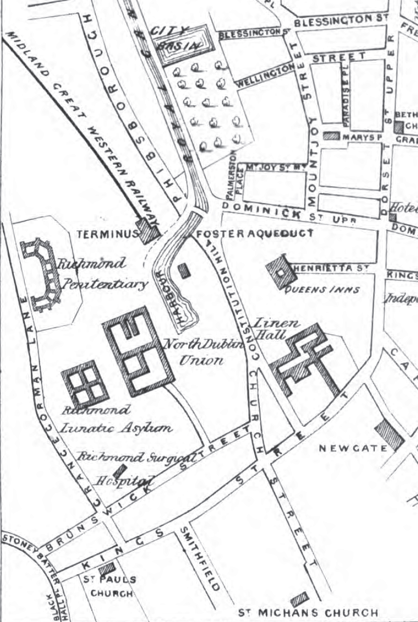
. It runs from the junction of Stoneybatter in the east to Church Street in the west and runs parallel to North King Street further south. It is located between the areas of Grangegorman
Grangegorman () is an inner suburb on the Northside, Dublin, northside of Dublin city, Republic of Ireland, Ireland. The area is administered by Dublin City Council. It was best known for decades as the location of St. Brendan's Hospital (Gra ...
to the north and Smithfield to the south. The street is named for the House of Brunswick, holders of the British and Irish crown from 1714 to 1901.
It was formerly named Channel Row () which likely originated from a channel connected with the Bradogue River
The Bradogue River is a small river in Dublin that rises in Cabra and flows into the River Liffey, with its primary outfall at Ormond Quay. It is culverted for its entire course.
Names and etymology
The river has mainly been known as the Br ...
.
It is not to be confused with Great Brunswick Street
Pearse Street () is a major street in Dublin. It runs from College Street in the west to MacMahon Bridge in the east, and is one of the city's longest streets. It has several different types of residential and commercial property along its le ...
(later renamed Pearse Street) on the south side of the city.
History
The street formed from medieval times as a natural connecting point between two of the main routes out of the city before the River Liffey's tidal estuary. It is likely partially shown as a laneway off Church Street just north of St. Michan's Church onJohn Speed's Map of Dublin (1610)
John Speed's Map of Dublin (1610) was one of the first detailed maps of Dublin and the first published map of Dublin produced by cartographer John Speed around 1610 and printed first in London in 1611.
It appeared as an inset in a map of the Pro ...
.
The area around the street was already connected with institutional use from the building of the nearby Linehall in 1728.
By the time of John Rocques's map of 1756, it is firmly shown as Channel Row with buildings taking up most of both its northern and southern sides.
In 1773, Dublin's second house of industry opened in a former malthouse on the street. By 1790 the building was deemed to be in danger of collapse and a new building was designed and built to the plans of the architect Richard Johnston with work commencing in September 1791.
By the 19th century, the street and surrounding area became the location of various medical, penal and welfare institutions including Hardwicke Fever Hospital (1803), Richmond Surgical Hospital (1810), St. Brendan's Hospital, Dublin (1815), Whitworth Hospital (1816), Richmond General Penitentiary
The Richmond General Penitentiary was a prison established in 1820 in Grangegorman, Dublin, Ireland as an alternative to transportation. It was part of an experiment into a penitentiary system which also involved Millbank Penitentiary, London. ...
(1820), North Dublin Union (1840) and the Carmichael School of Medicine
Carmichael School of Medicine was a medical school in Dublin, Ireland.
History
The school was founded in 1864 with funds bequeathed by Richard Carmichael. Designed in 1864 as a school of medicine beside the then three northside hospitals ( ...
(1864).
Many of the buildings now form elements of the Grangegorman
Grangegorman () is an inner suburb on the Northside, Dublin, northside of Dublin city, Republic of Ireland, Ireland. The area is administered by Dublin City Council. It was best known for decades as the location of St. Brendan's Hospital (Gra ...
campus of the Technological University Dublin
Technological University Dublin () or TU Dublin is Ireland's first technological university. It was established on 1 January 2019, with a history going back to 1887 through the amalgamated Dublin Institute of Technology which progressed from t ...
.
External links
References
Streets in Dublin (city) Grangegorman {{Streets in Dublin city, state=collapsed