Mouda on:
[Wikipedia]
[Google]
[Amazon]
 Mouda, (or Mauda) is a town and a
 Mouda, (or Mauda) is a town and a
 Tehsil
A tehsil (, also known as tahsil, taluk, or taluka () is a local unit of administrative division in India and Pakistan. It is a subdistrict of the area within a Zila (country subdivision), district including the designated populated place that ser ...
in the Ramtek
Ramtek is a city and municipal council in Nagpur district of Maharashtra, India.
Religious significance
Ramtek hosts a historic temple of Rama. It is believed that Ramtek was the place where Rama, the Hindu god, rested while he was in exile, ...
subdivision of the Nagpur district
Nagpur district (Marathi pronunciation: Help:IPA/Marathi, aːɡpuːɾ is a Districts of Maharashtra, district in the Vidarbha region of Maharashtra state in central India. The city of Nagpur is the district administrative centre. The district ...
in the Nagpur Revenue Division. It is situated in the Berar
Berar may refer to:
*Vidarbha, the eastern region of Maharashtra, India, historically known as Berar
* Berar Sultanate (1490–1596), one of the Deccan sultanates
*Berar Subah (1596–1724), a subah (province) of the Mughal Empire
*Berar Province ( ...
region in the state of Maharashtra
Maharashtra () is a state in the western peninsular region of India occupying a substantial portion of the Deccan Plateau. It is bordered by the Arabian Sea to the west, the Indian states of Karnataka and Goa to the south, Telangana to th ...
, India
India, officially the Republic of India, is a country in South Asia. It is the List of countries and dependencies by area, seventh-largest country by area; the List of countries by population (United Nations), most populous country since ...
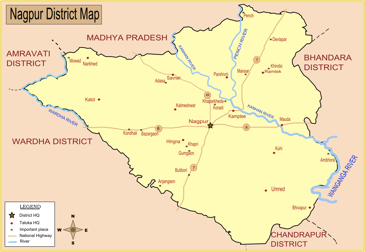
. The total area covered under this Tehsil is around 61,293.17 hectares. The population of this tehsil is around 37,554 (19,566 male, 17,978 female)according to the 1991 census. The nearest city to Mouda is Nagpur, which is 38 km away. The total number of villages in this tehsil is 41. Mouda is famous for its fertile agricultural land. Therefore, the main occupation is farming. The average rainfall here is estimated to be around 1223.3mm. It is located on the banks of the Kanhan River
The Kanhan River is an important right bank tributary of the Wainganga River draining a large area lying south of Satpura range in central India. Along its 275 km run through the Indian States of Maharashtra and Madhya Pradesh, it receives ...
and near National Highway 6.
Villages
References
{{reflist Cities and towns in Nagpur district Nagpur district Talukas in Maharashtra