Kangra Valley on:
[Wikipedia]
[Google]
[Amazon]
 Kangra Valley is a river valley situated in the
''
''
"Himachal Pradesh Kangri Language"
, India Mapped – Languages in India, accessed 18 April 2015
 Kangra Valley Railway is a 164 km long narrow gauge railway line that connects the valley with
 Gaggal Airport, alternatively known as Kangra Airport or Dharamsala-Kangra Airport, is an airport located at Gaggal in Kangra Valley. It is located 14 km southwest of Dharamshala.
"Kangra Valley"
 Kangra Valley is a river valley situated in the
 Western Himalayas
The Western Himalayas are the western half of the Himalayas, in northwestern India and northern Pakistan. Four of the five tributaries of the Indus River in Punjab ( Beas, Chenab, Jhelum, and Ravi) rise in the Western Himalayas; while the fi ...
.Earthquakes''
The Imperial Gazetteer of India
''The Imperial Gazetteer of India'' was a gazetteer of the British Indian Empire, and is now a historical reference work. It was first published in 1881. Sir William Wilson Hunter made the original plans of the book, starting in 1869.< ...
'', v. 1, ''p. 98.'' It lies in the state of Himachal Pradesh
Himachal Pradesh (; Sanskrit: ''himācāl prādes;'' "Snow-laden Mountain Province") is a States and union territories of India, state in the northern part of India. Situated in the Western Himalayas, it is one of the thirteen Indian Himalayan ...
in India
India, officially the Republic of India, is a country in South Asia. It is the List of countries and dependencies by area, seventh-largest country by area; the List of countries by population (United Nations), most populous country since ...
, and is a popular tourist destination. The Kangri language
Kangri (Takri: ) is an Indo-Aryan language, spoken in northern India, predominantly in the Kangra, Una and Hamirpur districts of Himachal Pradesh as well as in some parts of Mandi and Chamba districts of Himachal Pradesh and Gurdaspur, ...
is spoken there.
Dharamshala, the headquarters of Kangra district
Kangra district is the most populous district of Himachal Pradesh, India. Dharamshala is the administrative headquarters of the district.
History
Kangra is known for having one of the oldest serving Royal Dynasty in the world, the Katoch of ...
and the main city of the valley, lies on the southern spur
A spur is a metal tool designed to be worn in pairs on the heels of riding boots for the purpose of directing a horse or other animal to move forward or laterally while riding. It is usually used to refine the riding aids (commands) and to ba ...
(lateral ridge) of Dhauladhar
Dhauladhar () () is a mountain range which is part of a Lower Himalayan Range, lesser Himalayan chain of mountains in northern India. It rises from the Siwalik Hills, Shivalik hills, to the north of Kangra, Himachal Pradesh, Kangra and Mandi, ...
.
History
The valley witnessed a devastating 7.8 magnitude earthquake at 6:19 am on 4 April 1905, as a result of which about 19,800 people were killed and thousands were injured in the Kangra area. Most buildings in towns of Kangra, Mcleodganj and Dharamshala were destroyed. the Tedha Mandir, in Jawalamukhi is also a victim of Earthquake 1905.Geography
The valley is filled with numerousperennial stream
A stream is a continuous body of surface water flowing within the bed and banks of a channel. Depending on its location or certain characteristics, a stream may be referred to by a variety of local or regional names. Long, large stream ...
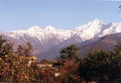
s, which irrigate the valley, and the river Beas flows through this valley. The valley has an average elevation of 2000 ft. Kangra Valley is a strike valley and extends from the foot of the Dhauladhar range to the south of river Beas. The highest peak on the Dhauladhar, White Mountain, marks the boundary between the valley and Chamba, and reaches . The peaks of the range are approximately above the valley floor, rising sharply from its base with no low hills in between.Dhaula Dhar''
The Imperial Gazetteer of India
''The Imperial Gazetteer of India'' was a gazetteer of the British Indian Empire, and is now a historical reference work. It was first published in 1881. Sir William Wilson Hunter made the original plans of the book, starting in 1869.< ...
'', v. 11, ''p. 287.''
Climate
Most of the valley has ahumid subtropical climate
A humid subtropical climate is a subtropical -temperate climate type, characterized by long and hot summers, and cool to mild winters. These climates normally lie on the southeast side of all continents (except Antarctica), generally between ...
(Cwa). Summer starts in early April and peaks in May. From June to mid-September is the monsoon
A monsoon () is traditionally a seasonal reversing wind accompanied by corresponding changes in precipitation but is now used to describe seasonal changes in Atmosphere of Earth, atmospheric circulation and precipitation associated with annu ...
season, when the valley receives very high amounts of rainfall. Autumn is mild and lasts from October to the end of November. Winters are cold and last till late February. Snowfall
Snow consists of individual ice crystals that grow while suspended in the atmosphere—usually within clouds—and then fall, accumulating on the ground where they undergo further changes.
It consists of frozen crystalline water througho ...
is common in the hills and higher reaches of the valley during this time. Snow in the lower elevations of the valley is rare, but has been recorded occasionally. Western disturbances cause winter precipitation. Winters are followed by a short, pleasant spring.
Language
A distinct regional dialect, Kangri, is spoken in Kangra valley., India Mapped – Languages in India, accessed 18 April 2015
Important towns
* Baijnath * Dharamshala * Kangra * Palampur * Nagrota Bagwan * YolTransport
Road
National highways 154 and 503 are the national highways that pass through the valley, connecting it with other parts of Himachal Pradesh and the neighbouring state of Punjab. Severalstate highways
A state highway, state road, or state route (and the equivalent provincial highway, provincial road, or provincial route) is usually a road that is either Route number, numbered or maintained by a sub-national state or province. A road numbered ...
also connect the valley.
Railway
 Kangra Valley Railway is a 164 km long narrow gauge railway line that connects the valley with
 Pathankot
Pathankot () is a city and the district headquarters of the Pathankot district in Punjab, India. Pathankot is the sixth most populous city of Punjab, after Ludhiana, Amritsar, Jalandhar, Patiala and Bathinda. Its local government is a municipal ...
, the nearest railhead on broad gauge
A broad-gauge railway is a railway with a track gauge (the distance between the rails) broader than the used by standard-gauge railways.
Broad gauge of , more known as Russian gauge, is the dominant track gauge in former Soviet Union countries ...
railway network.
Airport
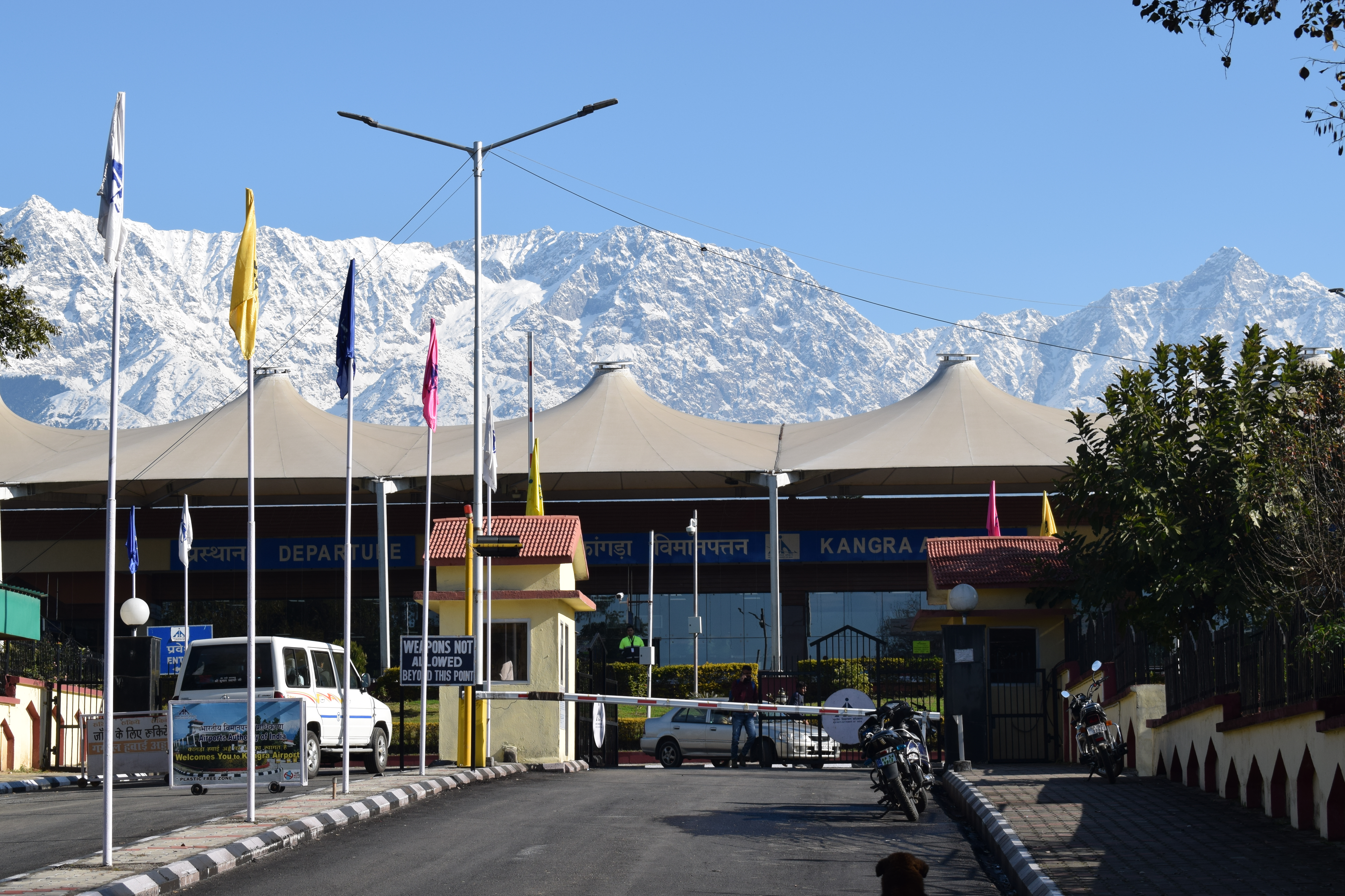
 Gaggal Airport, alternatively known as Kangra Airport or Dharamsala-Kangra Airport, is an airport located at Gaggal in Kangra Valley. It is located 14 km southwest of Dharamshala.
Tourism
The main town in the valley and the capital of the district, Dharamshala, is one of the most visited hill stations in Himachal Pradesh and India. It also acts as a base for several Himalayan treks in the Dhauladhars, includingTriund
Triund is a small hill station in the Kangra district in the state of Himachal Pradesh, India. Triund is a part of Dharamkot. Triund is at the foot of the Dhauladhar ranges and is at a height of .
See also
* List of hill stations in India
...
which is one of the most famous treks in India. Mcleodganj is the current residence of the Dalai Lama
The Dalai Lama (, ; ) is the head of the Gelug school of Tibetan Buddhism. The term is part of the full title "Holiness Knowing Everything Vajradhara Dalai Lama" (圣 识一切 瓦齐尔达喇 达赖 喇嘛) given by Altan Khan, the first Shu ...
and the centre of Tibetan community in exile in India, and draws tourists from all over the world. Palampur and Dharamshala are also famous for their tea gardens where Kangra tea is grown. Bir is well known for adventure sports, particularly paragliding
Paragliding is the recreational and competitive adventure sport of flying paragliders: lightweight, free-flying, foot-launched glider aircraft with no rigid primary structure. The pilot sits in a harness or in a cocoon-like 'pod' suspended be ...
.
References
Further reading
*Hutchinson, J. & J. PH Vogel (1933). ''History of the Panjab Hill States'', Vol. I. 1st edition: Govt. Printing, Punjab, Lahore, 1933. Reprint 2000. Department of Language and Culture, Himachal Pradesh. Chapter IV Kangra State, pp. 98–198.External links
"Kangra Valley"
Kangra District
Kangra district is the most populous district of Himachal Pradesh, India. Dharamshala is the administrative headquarters of the district.
History
Kangra is known for having one of the oldest serving Royal Dynasty in the world, the Katoch of ...
official website.
{{Authority control
Geography of Kangra district
Valleys of Himachal Pradesh