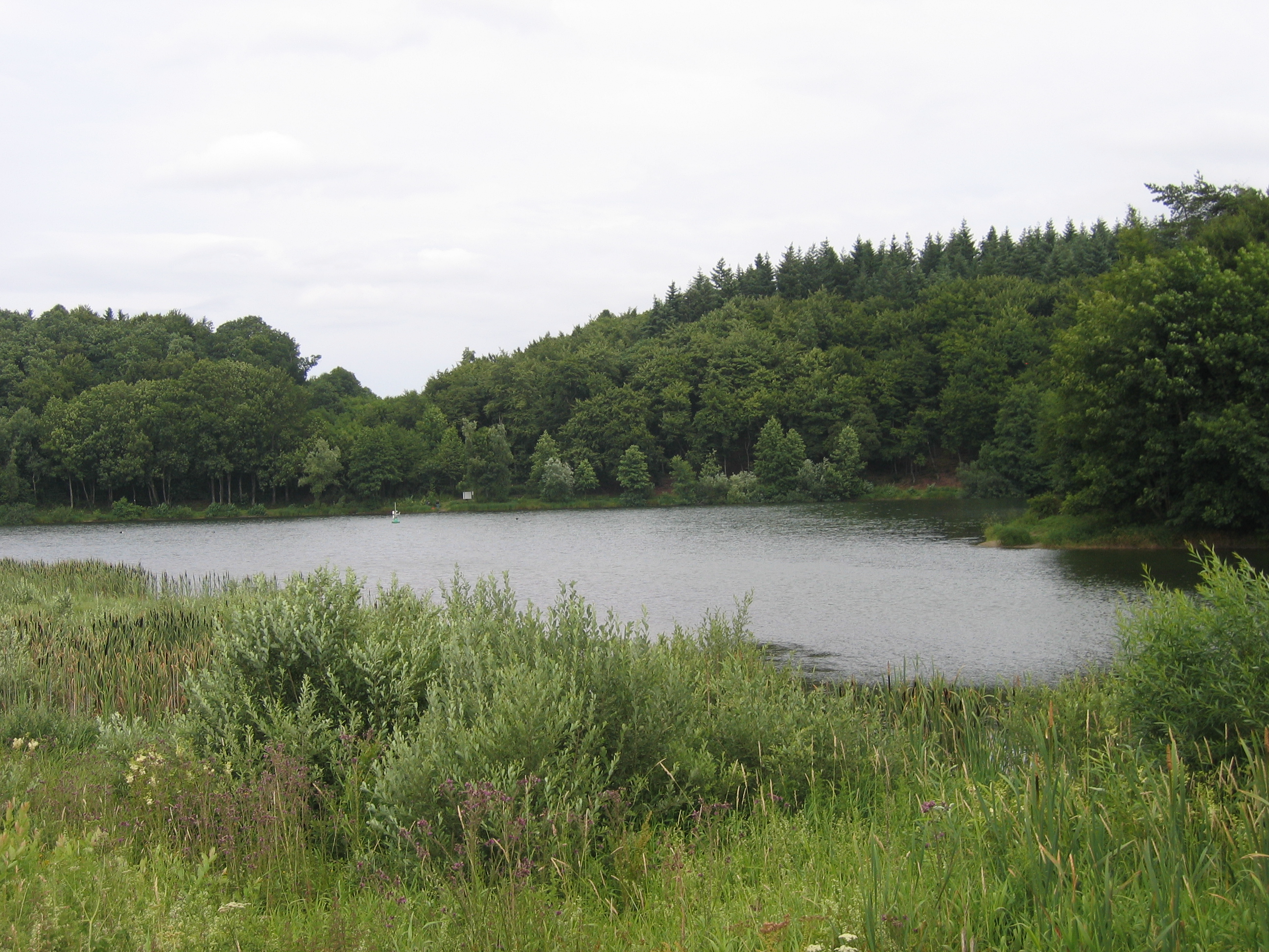
Holzmaar on:
[Wikipedia]
[Google]
[Amazon]
 The Holzmaar lies in the
Rezension zum Forschungsbericht ''Paläoklimatische Bedeutung laminierter Sedimente – Holzmaar (Eifel, Deutschland), Lake C2 (Nordwest-Territorien, Kanada) und Lago Grande di Monticchio (Basilicata, Italien).'' 1998
Bogs of Rhineland-Palatinate Maars of the Eifel Nature reserves in Rhineland-Palatinate Vulkaneifel
 The Holzmaar lies in the
 Volcanic Eifel
The Volcanic Eifel or Vulkan Eifel () consists of three areas of volcanic activity, known as the West Eifel, High Eifel, and East Eifel volcanic fields. Volcanic Eifel is a region in the Eifel Mountains in Germany that is defined to a large e ...
in the German state of Rhineland-Palatinate
Rhineland-Palatinate ( , ; ; ; ) is a western state of Germany. It covers and has about 4.05 million residents. It is the ninth largest and sixth most populous of the sixteen states. Mainz is the capital and largest city. Other cities are ...
almost halfway between Gillenfeld (2.5 km away to the southwest) and Eckfeld. The maar
A maar is a broad, low-relief volcanic crater caused by a phreatomagmatic eruption (an explosion which occurs when groundwater comes into contact with hot lava or magma). A maar characteristically fills with water to form a relatively shallow ...
has an area of about , a diameter of and a depth of and lies within a nature reserve
A nature reserve (also known as a wildlife refuge, wildlife sanctuary, biosphere reserve or bioreserve, natural or nature preserve, or nature conservation area) is a protected area of importance for flora, fauna, funga, or features of geologic ...
, almost completely surrounded by woods. It is one of the two maars making up the Gillenfeld Maars, the other being the Pulvermaar.
The Holzmaar is fed by a headstream of the Sammetbach which crosses the maar. In the immediate vicinity is another maar, the Dürres Maar __NOTOC__
The Dürres Maar is a maar located in the vicinity of the village of Gillenfeld, Germany in the West Eifel mountains about 400 metres northwest of the Holzmaar. The Dürres Maar ist a dry maar, the original maar lake has silted u ...
.
On its south and southwest shores, the maar has silted up with sediment
Sediment is a solid material that is transported to a new location where it is deposited. It occurs naturally and, through the processes of weathering and erosion, is broken down and subsequently sediment transport, transported by the action of ...
s, core sample
A core sample is a cylindrical section of (usually) a naturally-occurring substance. Most core samples are obtained by drilling with special drills into the substance, such as sediment or rock, with a hollow steel tube, called a core drill. The ...
s from which give a comprehensive picture of the climate going back to the last cold period. The sediments of the Holzmaar go back 23,200 years. This assessment was made possible by comparing the sequence and radiometric dating
Radiometric dating, radioactive dating or radioisotope dating is a technique which is used to Chronological dating, date materials such as Rock (geology), rocks or carbon, in which trace radioactive impurity, impurities were selectively incorporat ...
obtained in the maar basin with that of the Meerfelder Maar. The time of the maximum of the last glaciation derived from varve
A varve is an annual layer of sediment or sedimentary rock.
The word 'varve' derives from the Swedish word ''varv'' whose meanings and connotations include 'revolution', 'in layers', and 'circle'.
Of the many rhythmites in the geological record ...
chronology is in close agreement with data from the Greenland Ice Sheet Project
The Greenland Ice Sheet Project (GISP) was a decade-long project to drill ice cores in Greenland that involved scientists and funding agencies from Denmark, Switzerland and the United States. Besides the U.S. National Science Foundation (NSF), f ...
(GISP2), but are somewhat at odds with those of the Greenland Ice Core Project
The Greenland Ice Core Project (GRIP) was a research project organized through the European Science Foundation (ESF). The project ran from 1989 to 1995, with drilling seasons from 1990 to 1992. In 1988, the project was accepted as an ESF-associat ...
(GRIP).
In the sequence of sediments three zones of strata were found, when the most dust was deposited in the crater lake. If these dust-laden layers correspond to the ice advances of the northern German inland ice sheet, by comparing them with the exact chronological sequence of the dust layers in the Maar sediments an equally accurate age for local terminal moraines may be possible at suitable locations in northern Germany.
References
Literature
* Werner D´hein: ''Natur- und Kulturführer Vulkanlandeifel. Mit 26 Stationen der "Deutschen Vulkanstraße".'' Gaasterland-Verlag, Düsseldorf. 2006, * H. Wolfgang Wagner et al., 2012: ''Trier und Umgebung, Sammlung geologischer Führer'', Bd. 60, 3. Auflage, Bornträger, , (see:) http://www.schweizerbart.de/publications/detail/artno/011006040 * Bernd Zolitschka, ''Paläoklimatische Bedeutung laminierter Sedimente: Holzmaar (Eifel, Deutschland), Lake C2 (Nordwest-Territorien, Kanada) und Lago Grande di Monticchio (Basilicata, Italien)''. Relief Boden Palaeoklima, Vol. 13, 1998.External links
Rezension zum Forschungsbericht ''Paläoklimatische Bedeutung laminierter Sedimente – Holzmaar (Eifel, Deutschland), Lake C2 (Nordwest-Territorien, Kanada) und Lago Grande di Monticchio (Basilicata, Italien).'' 1998
Bogs of Rhineland-Palatinate Maars of the Eifel Nature reserves in Rhineland-Palatinate Vulkaneifel