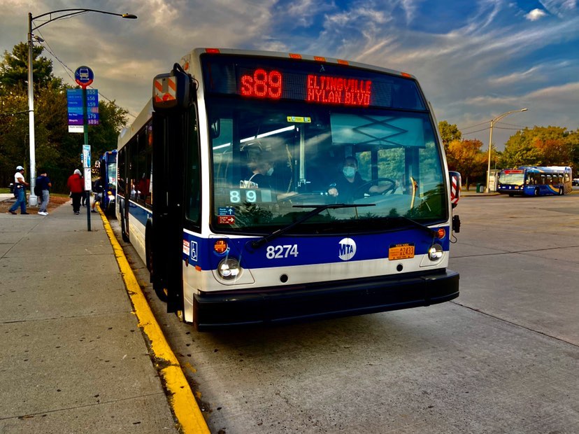
Eltingville Transit Center on:
[Wikipedia]
[Google]
[Amazon]
Eltingville Transit Center is a


 *:
*: 
Staten Island Bus Schedules
{{MTA RBO Transportation buildings and structures in Staten Island Bus stations in New York City MTA Regional Bus Operations Transit centers in the United States Transportation in Staten Island 2004 establishments in New York City
park and ride
A park and ride, also known as incentive parking or a commuter lot, is a parking lot with public transport connections that allows commuters and other people heading to city centres to leave their vehicles and transfer to a bus, Rail transport, r ...
transit center that is located in Eltingville, Staten Island
Eltingville is a neighborhood in the Staten Island borough of New York City, United States. It is located on Staten Island's South Shore, Staten Island, South Shore, immediately to the south of Great Kills, Staten Island, Great Kills and north ...
. It is located at the intersection of Arthur Kill Road and Richmond Avenue, at the end of the Korean War Veterans Parkway. The transit center was completed in 2004. Amenities include schedules, maps
A map is a symbolic depiction of interrelationships, commonly spatial, between things within a space. A map may be annotated with text and graphics. Like any graphic, a map may be fixed to paper or other durable media, or may be displayed on ...
, free parking
Parking is the act of stopping and disengaging a vehicle and usually leaving it unoccupied. Parking on one or both sides of a road is often permitted, though sometimes with restrictions. Some buildings have parking facilities for use of the bu ...
, and vending machines for soda, snacks, OMNY
OMNY ( , short for One Metro New York) is a contactless payment, contactless fare payment system, currently being implemented for use on transportation in New York City, public transit in the New York metropolitan area. OMNY can currently be u ...
, and MetroCards. The center is halfway between the Eltingville Staten Island Railway station and the Staten Island Mall, another (de jure) transit center, including the adjacent Yukon Depot.
History
On December 12, 2022, theMetropolitan Transportation Authority
The Metropolitan Transportation Authority (MTA) is a New York state public benefit corporations, public benefit corporation in New York (state), New York State responsible for public transportation in the New York metropolitan area, New York Ci ...
announced that work would begin that week on a project to increase the number of spots at the center 34 percent from 437 to 586 spaces. The new spaces will be added to the west side of the existing parking lot. As part of the project, new lighting, a new curb, and new drainage systems will be installed. The project will cost $4.3 million and be completed in spring 2023.
Services
The following bus routes stop at the Eltingville Transit Center:
Local
*: Staten Island Mall to Rossville via Annadale Road *: Staten Island Mall to Tottenville High School via Arden Avenue *: Port Richmond to Eltingville (with a peak extension to Tottenville) */ Limited: St. George Ferry Terminal to Bricktown Mall via Richmond and Arthur Kill Roads *: Staten Island Mall toBay Ridge
Bay Ridge is a neighborhood in the southwest corner of the New York City borough of Brooklyn. It is bounded by Sunset Park to the north, Dyker Heights to the east, the Narrows and the Belt Parkway to the west, and Fort Hamilton Army Base an ...
via Hylan Boulevard
* Limited: 34th Street HBLR station (Bayonne, NJ) to Eltingville via Richmond Avenue

Express
 *:
*: Lower Manhattan
Lower Manhattan, also known as Downtown Manhattan or Downtown New York City, is the southernmost part of the Boroughs of New York City, New York City borough of Manhattan. The neighborhood is History of New York City, the historical birthplace o ...
via Church Street and Broadway
*: Midtown Manhattan
Midtown Manhattan is the central portion of the New York City borough of Manhattan, serving as the city's primary central business district. Midtown is home to some of the city's most prominent buildings, including the Empire State Building, the ...
via Fifth Avenue
Fifth Avenue is a major thoroughfare in the borough (New York City), borough of Manhattan in New York City. The avenue runs south from 143rd Street (Manhattan), West 143rd Street in Harlem to Washington Square Park in Greenwich Village. The se ...
and Sixth Avenue
Sixth Avenue, also known as Avenue of the Americas, is a major thoroughfare in the New York City borough of Manhattan. The avenue is commercial for much of its length, and traffic runs northbound, or uptown.
Sixth Avenue begins four blocks b ...
*: Lower Manhattan via Church Street and Broadway
*: Midtown Manhattan via Fifth Avenue and Madison Ave
Madison Avenue is a north-south avenue in the borough of Manhattan in New York City, New York, that carries northbound one-way traffic. It runs from Madison Square (at 23rd Street) to meet the southbound Harlem River Drive at 142nd Street, ...
*: Lower Manhattan via Water Street
*: Midtown Manhattan via Lexington Avenue and Madison Avenue
*: Union Square via Sixth Avenue, Broadway, and West Street
*: Midtown Manhattan via New Jersey and 42nd Street
*: Midtown Manhattan via Fifth Avenue and Sixth Avenue
*: Lower Manhattan Downtown Loop via Church Street and Water Street
*: Midtown Manhattan via New Jersey and 42nd Street
*: Midtown Manhattan via Fifth Avenue and Madison Avenue

References
External links
*Staten Island Bus Schedules
{{MTA RBO Transportation buildings and structures in Staten Island Bus stations in New York City MTA Regional Bus Operations Transit centers in the United States Transportation in Staten Island 2004 establishments in New York City