Clachnaharry on:
[Wikipedia]
[Google]
[Amazon]
 Clachnaharry (; ) is a former
  The
The  A monument here commemorates the
 Clachnaharry (; ) is a former
 fishing village
A fishing village is a village, usually located near a fishing ground, with an economy based on catching fish and harvesting seafood. The continents and islands around the world have coastlines totalling around 356,000 kilometres (221,000 ...
, now part of the city of Inverness
Inverness (; ; from the , meaning "Mouth of the River Ness") is a city in the Scottish Highlands, having been granted city status in 2000. It is the administrative centre for The Highland Council and is regarded as the capital of the Highland ...
in the Highland
Highlands or uplands are areas of high elevation such as a mountainous region, elevated mountainous plateau or high hills. Generally, ''upland'' refers to a range of hills, typically from up to , while ''highland'' is usually reserved for range ...
council area of Scotland
Scotland is a Countries of the United Kingdom, country that is part of the United Kingdom. It contains nearly one-third of the United Kingdom's land area, consisting of the northern part of the island of Great Britain and more than 790 adjac ...
. Clachnaharry is situated on the south shore of the Beauly Firth
The Beauly Firth () is a firth in northern Scotland. It is the outlet for both the River Beauly and River Ness. The Beauly Firth is bounded at its western end by the town of Beauly and its eastern by Inverness, where it empties into the Moray Fi ...
, about west of the city centre.
The village was often wrongly said to have derived its name from the Gaelic ''Clach na Faire'', 'watchman's stone' which refers to nearby rocks used as a look out post by the townsfolk of Inverness. The recent book "The Gaelic Place Names and Heritage of Inverness" by Roddy Maclean, however, has pointed out the name in fact derives from ''Clach na h-Aithrigh'', Stone of Repentance.
 The
The Caledonian Canal
The Caledonian Canal connects the Scottish east coast at Inverness with the west coast at Corpach near Fort William in Scotland. The canal was constructed in the early nineteenth century by Scottish engineer Thomas Telford.
Route
The can ...
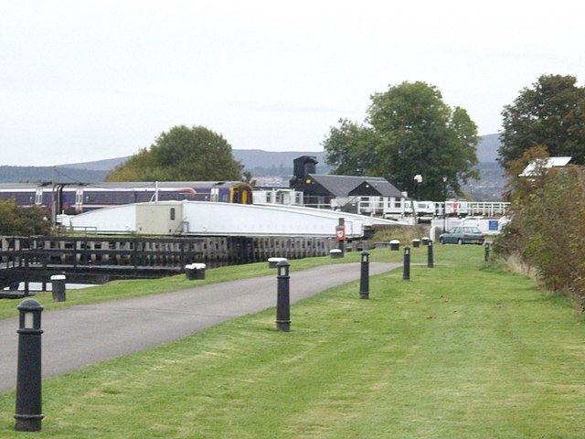
begins at Clachnaharry, connecting to the Beauly Firth via a sea lock. The Far North Line
The Far North Line is a rural railway line entirely within the Highland area of Scotland, extending from Inverness to Thurso and Wick. As the name suggests, it is the northernmost railway in the United Kingdom. The line is entirely single-tra ...
also passes through, crossing the canal on a swing bridge. Clachnaharry used to have a railway station
Rail transport (also known as train transport) is a means of transport using wheeled vehicles running in railway track, tracks, which usually consist of two parallel steel railway track, rails. Rail transport is one of the two primary means of ...
. This station opened in 1869 on the Inverness and Ross-shire Railway
The Inverness and Ross-shire Railway was a Scottish railway company formed in 1860 to build a line from Inverness to Invergordon. It opened in 1862 as far as Dingwall and in 1863 to Invergordon. It was extended to a Bonar Bridge station in 1864 ...
, and was the first stop after leaving Inverness, but closed in 1913.
Battle of Clachnaharry
The Battle of Clachnaharry was a Scottish clan battle that took place in the year 1454. It was fought between the Clan Munro and the Clan Mackintosh (Chattan Confederation) on the south bank of the Beauly Firth at Clachnaharry, on the outskirts ...
between the Clan Munro
Clan Munro (; ) is a Highland Scottish clan. Historically the clan was based in Easter Ross in the Scottish Highlands. Traditional origins of the clan give its founder as Donald Munro who came from the north of Ireland and settled in Scotland i ...
and the Clan Chattan
Clan Chattan ( or ), also sometimes referred to as "Clan Dhugaill" (Quehele) after its progenitor Dougall-Dall, is a unique confederation of Highland clans. This distinctive allied community comprised at its greatest extent seventeen separate ...
in 1454.
References
Areas of Inverness {{Inverness-geo-stub