|
Far North Line
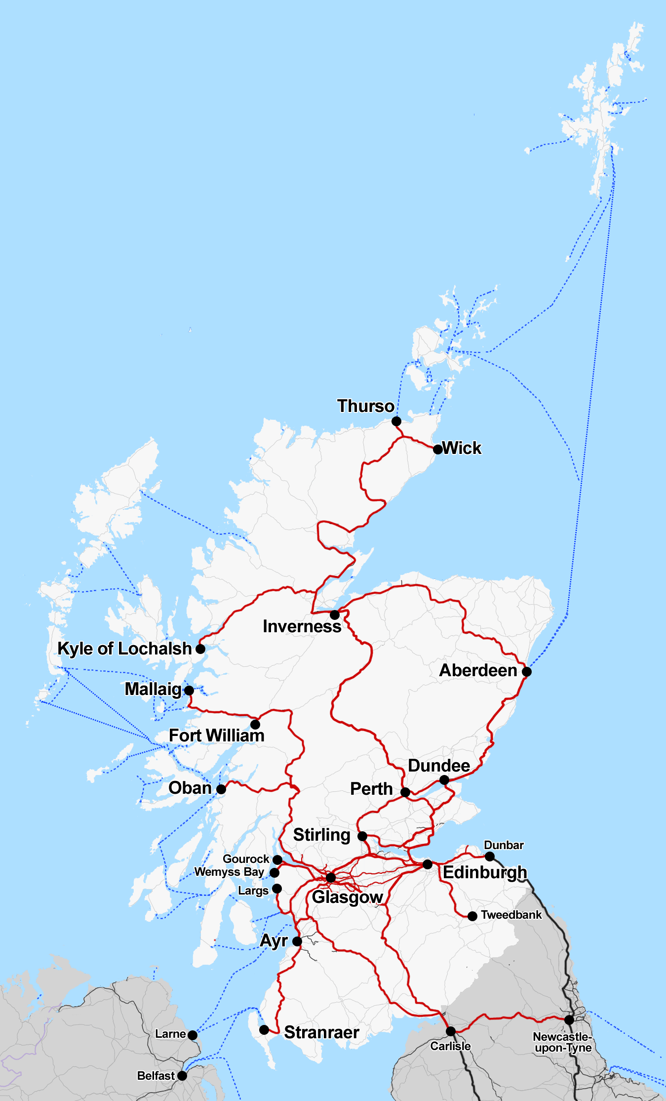
The Far North Line is a rural railway line entirely within the Highland area of Scotland, extending from Inverness to Thurso and Wick. As the name suggests, it is the northernmost railway in the United Kingdom. The line is entirely single-track, with only passing loops at some intermediate stations allowing trains to pass each other. Like other railway lines in the Highlands and northern Lowlands, it is not electrified and all trains are diesel-powered. Route The line links the city of Inverness, the largest city in the Scottish Highlands, with the towns of Wick and Thurso at the northeastern tip of Britain. Like the A9 trunk road north of Inverness, the Far North Line broadly follows the east-facing coastline of the Moray Firth, with all three termini located on the coast. As such, the railway links many of the same places as the road. Many more places were served by both the railway and the road before three new road bridges were built: across the Beauly Firth (betw ... [...More Info...] [...Related Items...] OR: [Wikipedia] [Google] [Baidu] |
Abellio ScotRail
Abellio ScotRail, operating services under the name ScotRail, was the national train operating company of Scotland. A subsidiary of the Netherlands-based transport conglomerate Abellio (transport company), Abellio, it operated the ScotRail (brand), ScotRail franchise between 1 April 2015 and 31 March 2022. In October 2014, Abellio was selected by Transport Scotland to take over the franchise from the incumbent operator First ScotRail. On 1 April 2015, Abellio ScotRail commenced operations. On 6 September 2015, it ran the first services on the newly-opened Borders Railway. In conjunction with the wider Edinburgh to Glasgow Improvement Programme, Abellio ScotRail introduced the British Rail Class 385, Class 385 electric trains, which were faster and had more capacity than preceding diesel traction on the route; however, short-term difficulties with the new fleet led to disruption and delays. The operator was also unable to introduce its new Intercity timetable due to the late tha ... [...More Info...] [...Related Items...] OR: [Wikipedia] [Google] [Baidu] |
Moray Firth
The Moray Firth (; , or ) is a roughly triangular inlet (or firth) of the North Sea, north and east of Inverness, which is in the Highland council area of the north of Scotland. It is the largest firth in Scotland, stretching from Duncansby Head (near John o' Groats) in the north, in the Highland council area, and Fraserburgh in the east, in the Aberdeenshire council area, to Inverness and the Beauly Firth in the west. Therefore, three council areas have Moray Firth coastline: Highland to the west and north of the Moray Firth and Highland, Moray and Aberdeenshire to the south. The firth has more than of coastline, much of which is cliff. Etymology The firth is named after the 10th-century Province of Moray, whose name in turn is believed to derive from the sea of the firth itself. The local names ''Murar'' or ''Morar'' are suggested to derive from , the Gaelic for sea, whilst ''Murav'' and ''Morav'' are believed to be rooted in Celtic words (sea) and (side), co ... [...More Info...] [...Related Items...] OR: [Wikipedia] [Google] [Baidu] |
Highland Main Line
The Highland Main Line is a railway line in Scotland. It is long and runs through the central Scottish Highlands, mainly following the route of the A9 road (Scotland), A9, and linking a series of small towns and villages with Perth, Scotland, Perth at one end and Inverness at the other. Today, services between Inverness and Edinburgh, Glasgow and London use the line. At Inverness the line connects with the Far North Line, the Aberdeen to Inverness Line, Aberdeen-Inverness Line and the Kyle of Lochalsh Line. Much of the Highland Main Line is Single track (rail), single track, and trains coming in opposite directions are often timed to arrive at stations at the same time, where Passing loop, crossing loops permit them to pass. Journey times between Inverness and Edinburgh or Glasgow are approximately three and a half hours.Highland Main Line timetables at https://www.scotrail.co.uk/sites/default/files/assets/download_ct/edinburgh_glasgow_-_inverness_0.pdf History The vast ... [...More Info...] [...Related Items...] OR: [Wikipedia] [Google] [Baidu] |
British National Grid Reference System
The Ordnance Survey National Grid reference system (OSGB), also known as British National Grid (BNG), is a system of geographic grid references, distinct from latitude and longitude, whereby any location in Great Britain can be described in terms of its distance from the origin (0, 0), which lies to the west of the Isles of Scilly. The Ordnance Survey (OS) devised the national grid reference system, and it is heavily used in its survey data, and in maps based on those surveys, whether published by the Ordnance Survey or by commercial map producers. Grid references are also commonly quoted in other publications and data sources, such as guide books and government planning documents. A number of different systems exist that can provide grid references for locations within the British Isles: this article describes the system created solely for Great Britain and its outlying islands (including the Isle of Man). The Irish grid reference system is a similar system created by th ... [...More Info...] [...Related Items...] OR: [Wikipedia] [Google] [Baidu] |
Ordnance Survey
The Ordnance Survey (OS) is the national mapping agency for Great Britain. The agency's name indicates its original military purpose (see Artillery, ordnance and surveying), which was to map Scotland in the wake of the Jacobite rising of 1745. There was also a more general and nationwide need in light of the potential threat of invasion during the Napoleonic Wars. Since 1 April 2015, the Ordnance Survey has operated as Ordnance Survey Ltd, a state-owned enterprise, government-owned company, 100% in public ownership. The Ordnance Survey Board remains accountable to the Secretary of State for Science, Innovation and Technology. It was also a member of the Public Data Group. Paper maps represent only 5% of the company's annual revenue. It produces digital map data, online route planning and sharing services and mobile apps, plus many other location-based products for business, government and consumers. Ordnance Survey mapping is usually classified as either "Scale (map), lar ... [...More Info...] [...Related Items...] OR: [Wikipedia] [Google] [Baidu] |
Inverness Railway Station
Inverness railway station serves the Scottish city of Inverness. It is the terminus of the Highland Main Line, the Aberdeen–Inverness line (of which the Inverness and Nairn Railway is now a part), the Kyle of Lochalsh line and the Far North Line. The Aberdeen and Perth lines diverge at ''Millburn Junction'' a short distance beyond Welsh's Bridge. Platforms 1–4 are from (measured via ); Millburn Junction, from Perth (or via ). The station is the zero point for the Far North Line and platforms 5–7 are along this line; Rose Street Junction, along the line, is from Perth. History Inverness station was opened on 5 November 1855 as the western terminus of the Inverness and Nairn Railway to designs by the architect, Joseph Mitchell. The station originally comprised a single covered passenger platform with three lines of rails, one for arrivals, one for departures and a spare line for carriages. In 1857 the railway company erected a clock in front of the station fac ... [...More Info...] [...Related Items...] OR: [Wikipedia] [Google] [Baidu] |
Flow Country
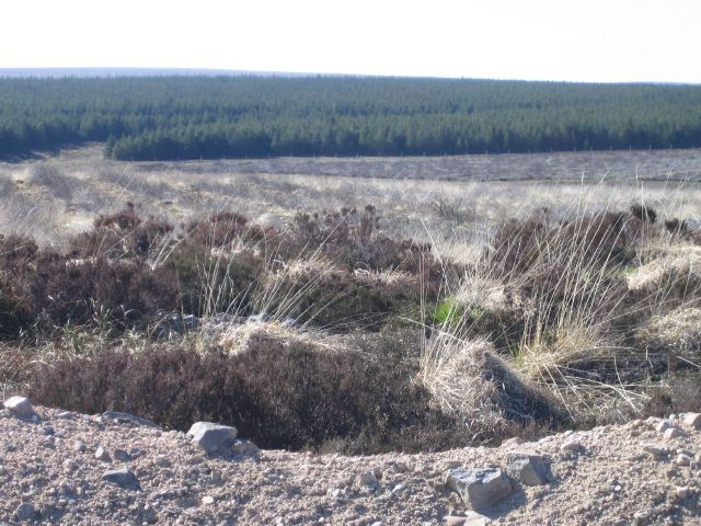
The Flow Country () is a vast area of bog peatland in Caithness and Sutherland, northern Scotland. It is the largest blanket bog in Europe, and covers about . It is an area of deep peat, dotted with bog pools, and is a very important habitat for wildlife. As peat is largely made up of the remains of plants, which are themselves made up of carbon, it locks up large stores of carbon for thousands of years. This carbon would otherwise be released to the atmosphere and contribute to global warming. In 2024 the Flow Country was awarded World Heritage status by UNESCO on account of its unparalleled blanket bog habitat. It includes the Forsinard Flows National Nature Reserve and the Caithness and Sutherland Peatlands. Wildlife The Flow Country is home to a rich variety of wildlife, and is used as a breeding ground for many different species of birds, including greenshank, dunlin, merlin and golden plover. Birds of prey found in the Flow Country include the buzzard and hen harr ... [...More Info...] [...Related Items...] OR: [Wikipedia] [Google] [Baidu] |
Helmsdale
Helmsdale (, ) is a village on the east coast of Sutherland, in the Highland council area of Scotland. The modern village was planned in 1814 to resettle communities that had been removed from the surrounding straths as part of the Highland Clearances. Toponymy The River Helmsdale ( Gaelic ''Ilidh'') was noted by Ptolemy as ''Ila'', which remains an obscure name. The Gaelic name for the village, ''Bun Ilidh'', means ''Ilie-foot''. Norse settlers called the strath ''Hjalmundal'', meaning ''Dale of the Helmet'', from which the modern village name ''Helmsdale'' is derived. History The remains of Helmsdale Castle were demolished in the 1970s in order to build the new A9 road bridge. The castle was the location of the murder of the 11th Earl of Sutherland and his Countess, Marion Seton, in 1567. They were poisoned by Isobel Sinclair, the wife of Gordon of Gartly. Isobel Sinclair's own son also died, but the fifteen-year-old heir of Sutherland, Alexander, was unharmed. He was ma ... [...More Info...] [...Related Items...] OR: [Wikipedia] [Google] [Baidu] |
Lairg
Lairg (, meaning "the shank/shin") is a village and parish in Sutherland, Scotland. It has a population of 891 and is at the south-eastern end of Loch Shin. Lairg is unusual in the northern Highlands in being a large settlement that is not on the coast. One of the reasons that Lairg is slightly bigger than other non-coastal Highland villages is its central location within the county of Sutherland. Having four roads which meet in the village, it used to be known as "The Crossroads of the North". In the 19th century, it was provided with a railway station (at ), on what is now the Far North Line. This development means that the north-west of Sutherland is now easier to reach. (The Far North Line links Inverness in the south with Thurso and Wick in the north.) Sheep sales Lairg is the location of the largest single-day sheep sale in Europe. These auctions take place in August and bring people from all over Scotland to buy or sell their animals. Gala Week In July, Lairg hold ... [...More Info...] [...Related Items...] OR: [Wikipedia] [Google] [Baidu] |
Golspie
Golspie ( , ) is a village and parish in Sutherland, Scottish Highlands, Highland, Scotland, which lies on the North Sea coast in the shadow of Ben Bhraggie. It has a population of around 1,350. History The name derives from the Old Norse, Norse for "gully village". The parish of Golspie was anciently called Kilmaly or Kilmalie, with its parish church at Kirkton, west of the modern village. A chapel dedicated to St Andrew existed at Golspie from at least 1330, and in 1619 the chapel at Golspie was made the parish church, after which the parish became known instead as Golspie and the old church at Kirkton was abandoned. St Andrew's Church was largely rebuilt in 1738. Planned village Much of the modern village of Golspie was laid out in the nineteenth century as a planned village. During a series of visits from the Elizabeth Leveson-Gower, Duchess of Sutherland, Right Honourable Elizabeth Countess of Sutherland plans were drawn up for the regulations that were written in to ... [...More Info...] [...Related Items...] OR: [Wikipedia] [Google] [Baidu] |
Tain
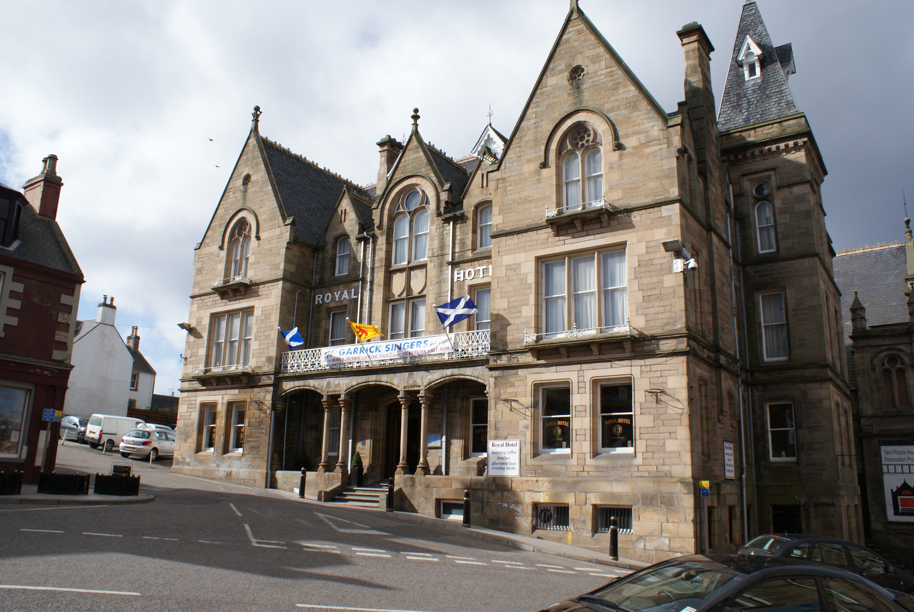
Tain ( ) is a royal burgh and parish in the County of Ross, in the Scottish Highlands, Highlands of Scotland. Etymology The name derives from the nearby River Tain, the name of which comes from an Indo-European root meaning 'flow'. The Gaelic name, ''Baile Dubhthaich'', means 'Duthac's town', after a local saint also known as Saint Duthac, Duthus. History Tain was granted its first royal charter in 1066, making it Scotland's oldest royal burgh, commemorated in 1966 with the opening of the Rose Garden by Elizabeth Bowes-Lyon, Queen Elizabeth, the Queen Mother. The 1066 charter, granted by King Malcolm III of Scotland, Malcolm III, confirmed Tain as a sanctuary, where people could claim the protection of the church, and an immunity, in which resident merchants and traders were exempt from certain taxes. Little is known of earlier history although the town owed much of its importance to Duthac. He was an early Christian figure, perhaps 8th or 9th century, whose shrine had become s ... [...More Info...] [...Related Items...] OR: [Wikipedia] [Google] [Baidu] |
Dornoch Firth
The Dornoch Firth (, ) is a firth on the east coast of Highland, in northern Scotland. It forms part of the boundary between Ross and Cromarty, to the south, and Sutherland, to the north. The firth is designated as a national scenic area, one of 40 such areas in Scotland. The national scenic area covers in total, of which is the marine area of the firth below low tide. A review of the national scenic areas by Scottish Natural Heritage in 2010 commented: Together with Loch Fleet it is a designated as a Special Protection Area (SPA) for wildlife conservation purposes. Additionally, together with Morrich More, it has the designation of Special Area of Conservation (SAC). The total SPA hosts significant populations of the following birds: *Breeding season: osprey (''Pandion haliaetus'') *Overwintering: bar-tailed godwit (''Limosa lapponica''), greylag goose (''Anser anser''), wigeon (''Anas penelope''), curlew (''Numenius arquata''), dunlin (''Calidris alpina alpina''), oyste ... [...More Info...] [...Related Items...] OR: [Wikipedia] [Google] [Baidu] |


