Beam Reach on:
[Wikipedia]
[Google]
[Amazon]
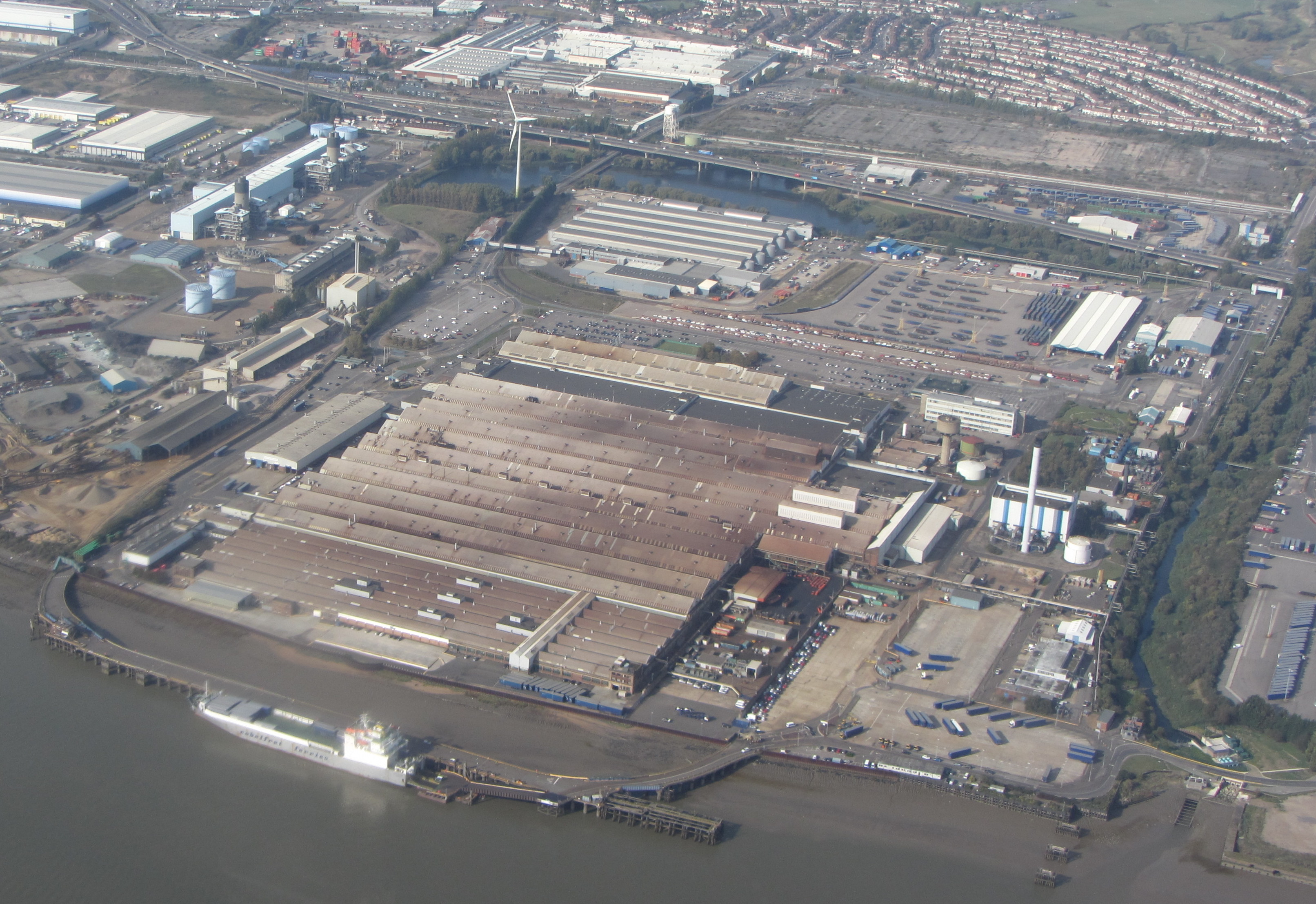
 Beam Reach is a redevelopment area in
Beam Reach
{{coord, 51.5199, 0.1688, display=title Thames Gateway Areas of London Geography of the London Borough of Havering
 Beam Reach is a redevelopment area in
 London
London is the capital and List of urban areas in the United Kingdom, largest city of England and the United Kingdom, with a population of just under 9 million. It stands on the River Thames in south-east England at the head of a estuary dow ...
, England and part of the London Riverside
The London Riverside is a redevelopment area on the north side of the River Thames in East London, England and part of the larger Thames Gateway redevelopment zone. The London Riverside area forms part of the Green Enterprise District, a project ...
section of the Thames Gateway
Thames Gateway is a term applied to an area around the Thames Estuary in the context of discourse around regeneration and further urbanisation. The term was first coined by the UK government and applies to an area of land stretching east from ...
. It is an industrial area adjacent to the new neighbourhood of Beam Park
Beam Park is a new neighbourhood in the south of the London Borough of Barking and Dagenham and the London Borough of Havering. It is named after the River Beam which forms the boundary between the boroughs. It will be served by Beam Park railwa ...
.
Geography
It is located in the southern part of theLondon Borough of Havering
The London Borough of Havering () in East London, England, forms part of Outer London. It has a population of 259,552 inhabitants; the principal town is Romford, while other communities are Hornchurch, Upminster, Collier Row and Rainham. Th ...
, next to the River Thames
The River Thames ( ), known alternatively in parts as the River Isis, is a river that flows through southern England including London. At , it is the longest river entirely in England and the second-longest in the United Kingdom, after the ...
and the River Beam
The River Rom, also known as the River Beam below its confluence with the Ravensbourne, is a tributary of the River Thames in England that flows through east London suburbs surrounding the metropolitan centre of Romford, part of it forming a sec ...
. GLA Land and Property
GLA Land and Property (GLAP) is a subsidiary company of the Greater London Authority. It was formed on 1 April 2012 as a replacement for the London Development Agency (LDA) as an arms length corporate body to take on the assets of the LDA and oth ...
owns 40 hectares of land in the area and promotes it for intensification of manufacturing companies, to complement the nearby commercial and residential redevelopment areas, including Beam Park
Beam Park is a new neighbourhood in the south of the London Borough of Barking and Dagenham and the London Borough of Havering. It is named after the River Beam which forms the boundary between the boroughs. It will be served by Beam Park railwa ...
. Beam Reach is the location of Centre for Engineering and Manufacturing Excellence.
Transport
TheA1306 road
List of A roads in zone 1 in Great Britain beginning north of the River Thames
The River Thames ( ), known alternatively in parts as the River Isis, is a river that flows through southern England including London. At , it is the lon ...
forms the northern perimeter and the A13 road This is a list of roads designated A13. Roads entries are sorted in the countries alphabetical order.
* ''A13 highway (Australia)'' may refer to:
** South Australian route A13, including Main South Road and Victor Harbor Road
* A13 motorway (Au ...
runs through the site east to west. Havering London Borough Council propose that Beam Park railway station
Beam Park railway station is a planned railway station to serve the new community of Beam Park. Intended to serve a redeveloped former industrial area with extremely poor access to public transport, plans for the station have been in development ...
should be built in the area, to be served by trains.
References
External links
Beam Reach
{{coord, 51.5199, 0.1688, display=title Thames Gateway Areas of London Geography of the London Borough of Havering