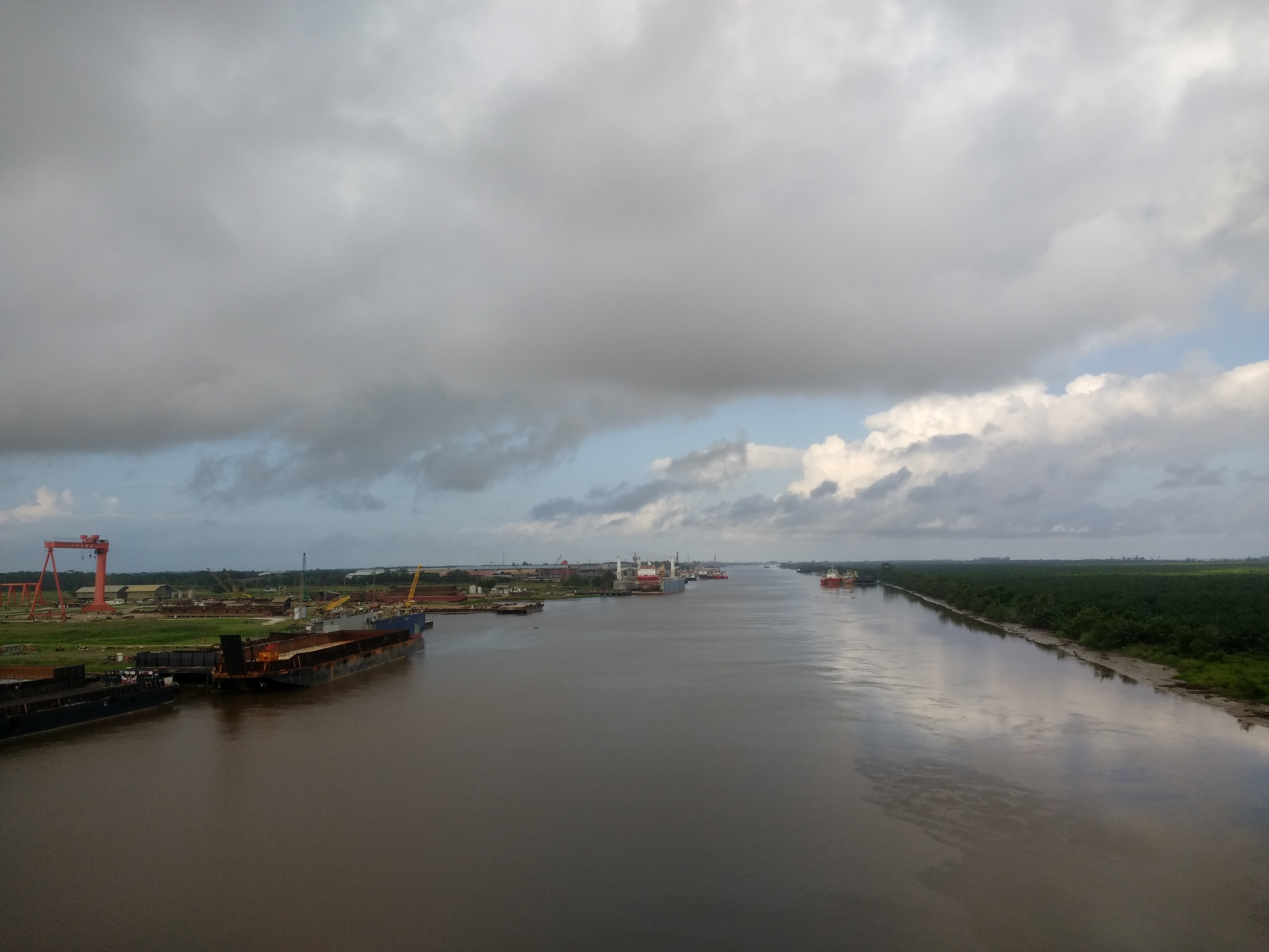
Baram River on:
[Wikipedia]
[Google]
[Amazon]
 The Baram River () is a river in
Sarawak government websiteWWF Heart of Borneo conservation initiative
{{Coord, 4, 35, 18, N, 113, 58, 13, E, name=South China Sea-Baram, display=title Rivers of Sarawak Rivers of Malaysia
 The Baram River () is a river in
 Sarawak
Sarawak ( , ) is a States and federal territories of Malaysia, state of Malaysia. It is the largest among the 13 states, with an area almost equal to that of Peninsular Malaysia. Sarawak is located in East Malaysia in northwest Borneo, and is ...
on the island of Borneo
Borneo () is the List of islands by area, third-largest island in the world, with an area of , and population of 23,053,723 (2020 national censuses). Situated at the geographic centre of Maritime Southeast Asia, it is one of the Greater Sunda ...
. The river originates in the Kelabit Highlands
The Kelabit Highlands are a mountain range located in the northernmost part of Sarawak, Malaysia in the Miri Division. It hosts the Bario village. The highest mountains in this range are Mount Murud at , Bukit Batu Buli at , and Bukit Batu Lawi at ...
, a watershed demarcated by the Iran Mountains of East Kalimantan, which form a natural border with Sarawak
Sarawak ( , ) is a States and federal territories of Malaysia, state of Malaysia. It is the largest among the 13 states, with an area almost equal to that of Peninsular Malaysia. Sarawak is located in East Malaysia in northwest Borneo, and is ...
.
Geography
The Baram river basin, an area of some , has been part of Sarawak since it was ceded to the White Rajah ofSarawak
Sarawak ( , ) is a States and federal territories of Malaysia, state of Malaysia. It is the largest among the 13 states, with an area almost equal to that of Peninsular Malaysia. Sarawak is located in East Malaysia in northwest Borneo, and is ...
by the then sultan of Brunei in 1882, for a perpetual annual payment of 6,000 dollars.
The river flows westwards through tropical rainfores (Köppen climate classification
The Köppen climate classification divides Earth climates into five main climate groups, with each group being divided based on patterns of seasonal precipitation and temperature. The five main groups are ''A'' (tropical), ''B'' (arid), ''C'' (te ...
''Af'' type) to the South China Sea
The South China Sea is a marginal sea of the Western Pacific Ocean. It is bounded in the north by South China, in the west by the Indochinese Peninsula, in the east by the islands of Taiwan island, Taiwan and northwestern Philippines (mainly Luz ...
. The Baram catchment receives around 3,800 mm of rainfall per year. The Baram River terminates in a delta
Delta commonly refers to:
* Delta (letter) (Δ or δ), the fourth letter of the Greek alphabet
* D (NATO phonetic alphabet: "Delta"), the fourth letter in the Latin alphabet
* River delta, at a river mouth
* Delta Air Lines, a major US carrier ...
, which is subdivided into two units: East Barma Delta of Middle-Late Miocene
The Miocene ( ) is the first epoch (geology), geological epoch of the Neogene Period and extends from about (Ma). The Miocene was named by Scottish geologist Charles Lyell; the name comes from the Greek words (', "less") and (', "new") and mea ...
age and West Baram Delta of Late Miocene-Quaternary
The Quaternary ( ) is the current and most recent of the three periods of the Cenozoic Era in the geologic time scale of the International Commission on Stratigraphy (ICS), as well as the current and most recent of the twelve periods of the ...
age. The western unit is composed of mudstones enriched in organic components ( total organic carbon content is more than 1.0 wt.%) which constitute substantial oil and gas reserves.
The river is crossed not far from its mouth by the Miri-Baram Highway, Federal Route 22, on the Batang Baram Bridge opened in 2003. Some 100 km upstream lies the town of Marudi.
Etymology
''Batang'' (meaning "trunk" in Malay) is the name used for the main river in the river system such as "Batang Baram" (Baram river). For upriver areas, such as the areas surrounding the headwaters, the place is named as "Ulu" (which means "upriver"). For example, "Ulu Baram" is the upriver part of the Baram river. "Long" meaning "confluence" is used by the Orang Ulu (upriver people). It is used to name the places located at the confluence between the smaller tributaries and the major river, same way as the Malay usage of the name "Kuala" (meaning river delta). The name "Pa'" (meaning "village") is exclusively used in theKelabit Highlands
The Kelabit Highlands are a mountain range located in the northernmost part of Sarawak, Malaysia in the Miri Division. It hosts the Bario village. The highest mountains in this range are Mount Murud at , Bukit Batu Buli at , and Bukit Batu Lawi at ...
such as " Pa Umor" village in Bario
Bario is a community of 13 to 16 villages located on the Kelabit Highlands in Miri Division, Sarawak, Malaysia, lying at an altitude of 1000 m (3280 ft) above sea level. It is located close to the Sarawak-Kalimantan border, 178 k ...
.
History
The Baram river flood happened in May 1962.References
External links
Sarawak government website
{{Coord, 4, 35, 18, N, 113, 58, 13, E, name=South China Sea-Baram, display=title Rivers of Sarawak Rivers of Malaysia