|
Street-running
A street running train is a train which runs on a Railway track, track built on public streets. The rails are embedded in the roadway, and the train shares the street with other users, such as pedestrians, cars and cyclists, thus often being referred to as running in mixed traffic. Tram and light rail systems frequently run on streets, with light rail lines typically separated from other traffic. For safety, street running trains travel more slowly than trains on dedicated rights-of-way. Needing to share the right-of-way with motor vehicles can cause delays and pose a safety risk. Stations on such routes are rare and may appear similar in style to a tram stop, but often lack platforms, pedestrian islands, or other amenities. In some cases, passengers may be required to wait on a distant sidewalk, and then board or disembark by crossing the traffic. The last street-station in the United States was 11th Street station (Indiana), 11th Street in Michigan City, Indiana, Michigan Ci ... [...More Info...] [...Related Items...] OR: [Wikipedia] [Google] [Baidu] |
11th Street Station (Indiana)
Michigan City/11th Street station is a train station in the central city neighborhood of Michigan City, Indiana. It serves the South Shore Line commuter rail line and is one of two active stations in Michigan City, the other being Carroll Avenue station. It is located adjacent to the location of the historic 11th Street station of the former Chicago, South Shore and South Bend Railroad station (now demolished), which operated the station from 1927 until 1987. Prior to the May 2021 closure, the station was composed of a passenger shelter and a sign on the northwest corner of East 11th Street and Pine Street; boarding and alighting was done from the street itself. A more modern station with two tracks and high-level platforms opened in October 2023. History Before NICTD The Chicago, South Shore and South Bend was one of the last interurban railroads to operate profitably in the United States. Aggressive management, led by financier Samuel Insull, reconceptualized the ''South S ... [...More Info...] [...Related Items...] OR: [Wikipedia] [Google] [Baidu] |
Tram
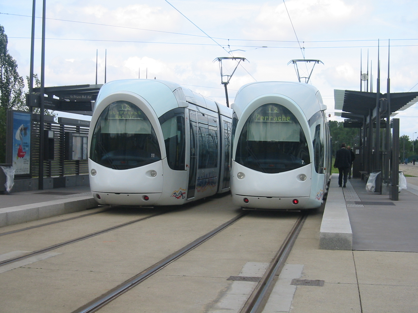
A tram (also known as a streetcar or trolley in Canada and the United States) is an urban rail transit in which Rolling stock, vehicles, whether individual railcars or multiple-unit trains, run on tramway tracks on urban public streets; some include segments on segregated Right-of-way (property access), right-of-way. The tramlines or tram networks operated as public transport are called tramways or simply trams/streetcars. Because of their close similarities, trams are commonly included in the wider term ''light rail'', which also includes systems separated from other traffic. Tram vehicles are usually lighter and shorter than Main line (railway), main line and rapid transit trains. Most trams use electrical power, usually fed by a Pantograph (transport), pantograph sliding on an overhead line; older systems may use a trolley pole or a bow collector. In some cases, a contact shoe on a third rail is used. If necessary, they may have dual power systems—electricity in city stre ... [...More Info...] [...Related Items...] OR: [Wikipedia] [Google] [Baidu] |
Tram Stop
A tram stop, tram station, streetcar stop, or light rail station is a place designated for a tram, streetcar, or light rail vehicle to stop so passengers can board or alight it. Generally, tram stops share most characteristics of bus stops, but because trams operate on rails, they often include railway platforms, especially if stepless entries are provided for accessibility. However, trams may also be used with bus stop type flags and with mid-street pavements as platforms, in street running mode. Types of tram stops Tram stops without platforms Many tram or streetcar stops, especially on older tram lines street-running on narrower streets, have no dedicated platforms. Instead, stops are located in the middle of the roadway. Passengers need to cross lanes for motor vehicles to board or alight from trams. Examples of systems with this type of stops include: North America * Toronto, ON, Canada: Most stops on all Toronto streetcar system, TTC streetcar routes except 509, 51 ... [...More Info...] [...Related Items...] OR: [Wikipedia] [Google] [Baidu] |
South Shore 512 (3542718093)
South is one of the cardinal directions or Points of the compass, compass points. The direction is the opposite of north and is perpendicular to both west and east. Etymology The word ''south'' comes from Old English ''sūþ'', from earlier Proto-Germanic language, Proto-Germanic ''*sunþaz'' ("south"), possibly related to the same Proto-Indo-European language, Proto-Indo-European root that the word ''sun'' derived from. Some languages describe south in the same way, from the fact that it is the direction of the sun at noon (in the Northern Hemisphere), like Latin meridies 'noon, south' (from medius 'middle' + dies 'day', ), while others describe south as the right-hand side of the rising sun, like Biblical Hebrew תֵּימָן teiman 'south' from יָמִין yamin 'right', Aramaic תַּימנַא taymna from יָמִין yamin 'right' and Syriac ܬܰܝܡܢܳܐ taymna from ܝܰܡܝܺܢܳܐ yamina (hence the name of Yemen, the land to the south/right of the Levant). South is s ... [...More Info...] [...Related Items...] OR: [Wikipedia] [Google] [Baidu] |
Nambour
Nambour is a rural town and Suburbs and localities (Australia), locality in the Sunshine Coast Region, Queensland, Australia. In the , the locality of Nambour had a population of 12,145 people. Geography Nambour is north of the state capital, Brisbane. The town lies in the sub-tropical hinterland of the Sunshine Coast, Queensland, Sunshine Coast at the foot of the Blackall Range It was the administrative centre and capital of the Shire of Maroochy, Maroochy Shire and is now the administrative centre of the Sunshine Coast Region. The greater Nambour region includes surrounding suburbs such as Burnside, Queensland, Burnside, Coes Creek, Queensland, Coes Creek, and Perwillowen, Queensland, Perwillowen. Nambour–Mapleton Road exits to the west and Nambour–Bli Bli Road to the east. Etymology The name is derived from the Indigenous Australians, Aboriginal word "naamba", referring to the red-flowering Callistemon, bottle brush ''Callistemon viminalis''. History In 1862 ... [...More Info...] [...Related Items...] OR: [Wikipedia] [Google] [Baidu] |
Moreton Central Sugar Mill Cane Tramway
Moreton Central Sugar Mill Cane Tramway is a heritage-listed tramway at Mill Street, Currie Street, and Howard Street, in Nambour, Queensland, Nambour, Sunshine Coast Region, Queensland, Australia. It was built . It was added to the Queensland Heritage Register on 7 February 2005. History The Moreton Central Sugar Mill opened for crushing in 1897. The tramway network that connected the mill with cane farms developed over many years and was in use until late 2003. It was a key factor in the success of the mill and the development of Nambour. Sugar cane was first brought to Australia in 1788, but subsequent plantings at Sydney, Port Macquarie and Norfolk Island failed to be commercially viable. Captain Louis Hope grew a cane crop successfully in Queensland in 1862. By 1864 the first commercial sugar mill in Australia had been established by him at Ormiston, Queensland, Ormiston and interest in growing sugar cane spread rapidly, encouraged by the Queensland Government. By 1867 ... [...More Info...] [...Related Items...] OR: [Wikipedia] [Google] [Baidu] |
Bli Bli
Bli Bli ( ) is a rural town and Suburbs and localities (Australia), locality in the Sunshine Coast Region, Queensland, Australia. In the , the locality of Bli Bli had a population of 10,138 people. Geography A few kilometres inland from the Maroochydore urban area, Bli Bli rises above the wetlands which were, for many years, the home of the Sunshine Coast, Queensland, Sunshine Coast sugarcane industry. Whilst this industry is all but gone, state government legislation ensures the wetlands will remain an undeveloped Green Space. The Maroochy River flows through the locality from north-east (Marcoola, Queensland, Marcoola) to south-east (Pacific Paradise, Queensland, Pacific Paradise/Maroochydore). The Yandina-Bli Bli Road enters from the north and the Nambour–Bli Bli Road enters from the west. History The name ''Bli Bli'' is believed to be derived from the Gubbi Gubbi people, Kabi word ''bilai'' meaning ''sheoak tree'' (Casuarina glauca). Bli Bli Provisional School o ... [...More Info...] [...Related Items...] OR: [Wikipedia] [Google] [Baidu] |
Port Pirie
Port Pirie is a small city on the east coast of the Spencer Gulf in South Australia, north of the state capital, Adelaide. Port Pirie is the largest city and the main retail centre of the Mid North region of South Australia. The city has an expansive history which dates back to 1845. Port Pirie was the first proclaimed regional city in South Australia, and is currently the second most important and second busiest port in SA. At the 2021 Australian census, 2021 Census, Port Pirie had a population of 13,896. Port Pirie is the eighth List of places in South Australia by population, most populous city in South Australia after Adelaide, Mount Gambier, Gawler, Mount Barker, South Australia, Mount Barker, Whyalla, Murray Bridge, South Australia, Murray Bridge and Port Lincoln. The city's economy is dominated by one of the world's largest lead Lead smelting, smelters, [...More Info...] [...Related Items...] OR: [Wikipedia] [Google] [Baidu] |
Yass Junction Railway Station
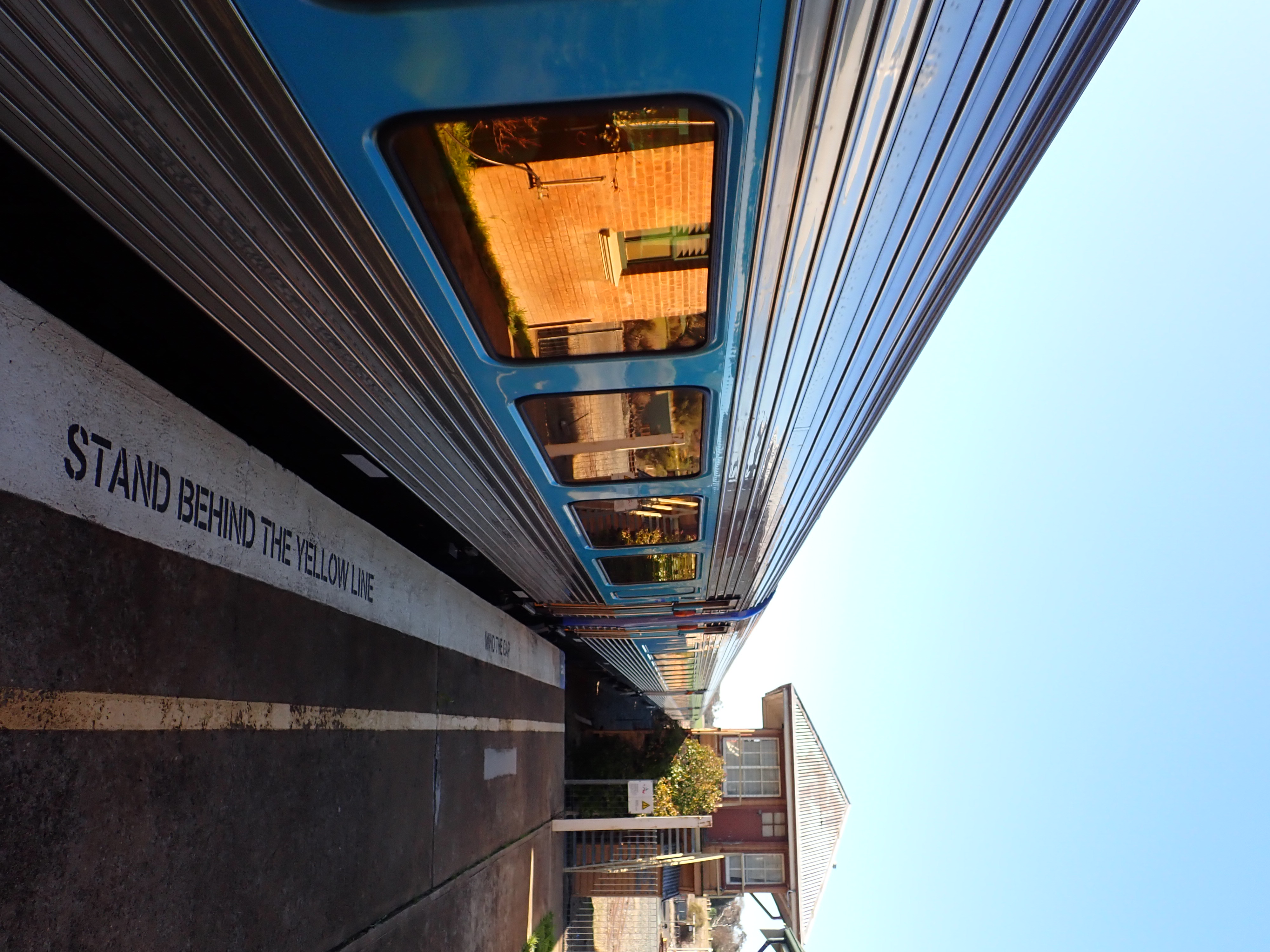
Yass Junction railway station is a heritage-listed railway station on the Main Southern railway line, Main Southern line in New South Wales, Australia. It serves the town of Yass, New South Wales, Yass. The station is not in the town itself but is located approximately four kilometres away near the Hume Highway. The station was listed on the New South Wales State Heritage Register on 2 April 1999. History Yass Junction station is located outside of Yass, New South Wales, Yass due to the refusal of the Engineer-in-Chief of the New South Wales Government Railways, New South Wales Railways, John Whitton to build the Main Southern railway line, Main South line through the middle of Yass itself. After a visit on 8 December 1871, to investigate possible routes for the extension of the line from Goulburn railway station, Goulburn, Whitton remarked that "to bring the station to North Yass would increase the length of the line by about three quarters of a mile; that the cost would be ... [...More Info...] [...Related Items...] OR: [Wikipedia] [Google] [Baidu] |
Railway Transportation
''Railway Transportation'' was a Sydney-based monthly trade magazine covering rail transport in Australia. It was regularly used for promotion and advertising by railway organisations and businesses. Overview ''Railway Transportation'' was established in October 1951 by Frank Shennen. Shennen Publishing already published ''Truck & Bus Transportation ''Truck & Bus Transportation'' was a Sydney-based monthly trade magazine covering aspects of transport in Australia. Overview ''Truck & Bus Transportation'' was established in July 1936 by Frank Shennen as ''Transportation''. It was renamed '' ...'' and, in 1967, established '' Freight & Container Transportation'' magazine. After being re-branded ''Railway & Urban Transportation'' in January 1974, publication of the magazine ceased in December 1974. Nati ... [...More Info...] [...Related Items...] OR: [Wikipedia] [Google] [Baidu] |
Yass, New South Wales
Yass () is a town on the periphery of the Southern Tablelands and South West Slopes of New South Wales, Australia. The name appears to have been derived from an Australian Aboriginal, Aboriginal word, "Yarrh" (or "Yharr"), said to mean 'running water'. Yass is located 280 km south-west of Sydney, on the Hume Highway, and is 59 km from Canberra. It lies at an elevation of 505 metres. The Yass River, which is a tributary of the Murrumbidgee River, flows through the town. Yass has a historic High Street, high street, with well-preserved 19th-century verandah post pubs (mostly converted to other uses). It is popular with tourists, some from Canberra and others taking a break from the Hume Highway. History Aboriginal overview The area around Yass is the land of the Ngunawal tribe. They knew the area as ''yarrh'', which means "running water." The final "rr" sound was spelled in English with a double-S, apparently after being misheard as such due to its "sharp and forcib ... [...More Info...] [...Related Items...] OR: [Wikipedia] [Google] [Baidu] |


