|
Somma
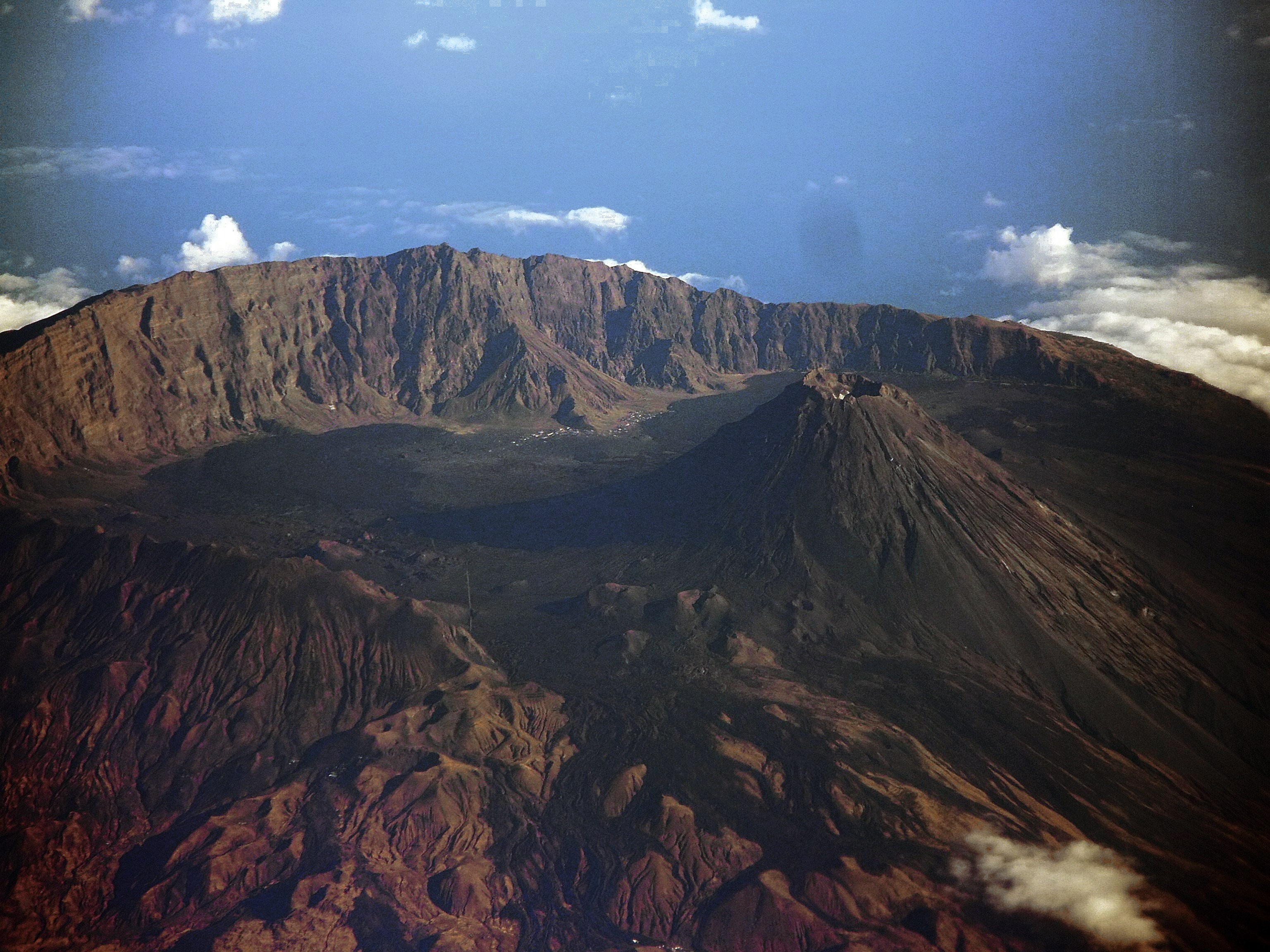
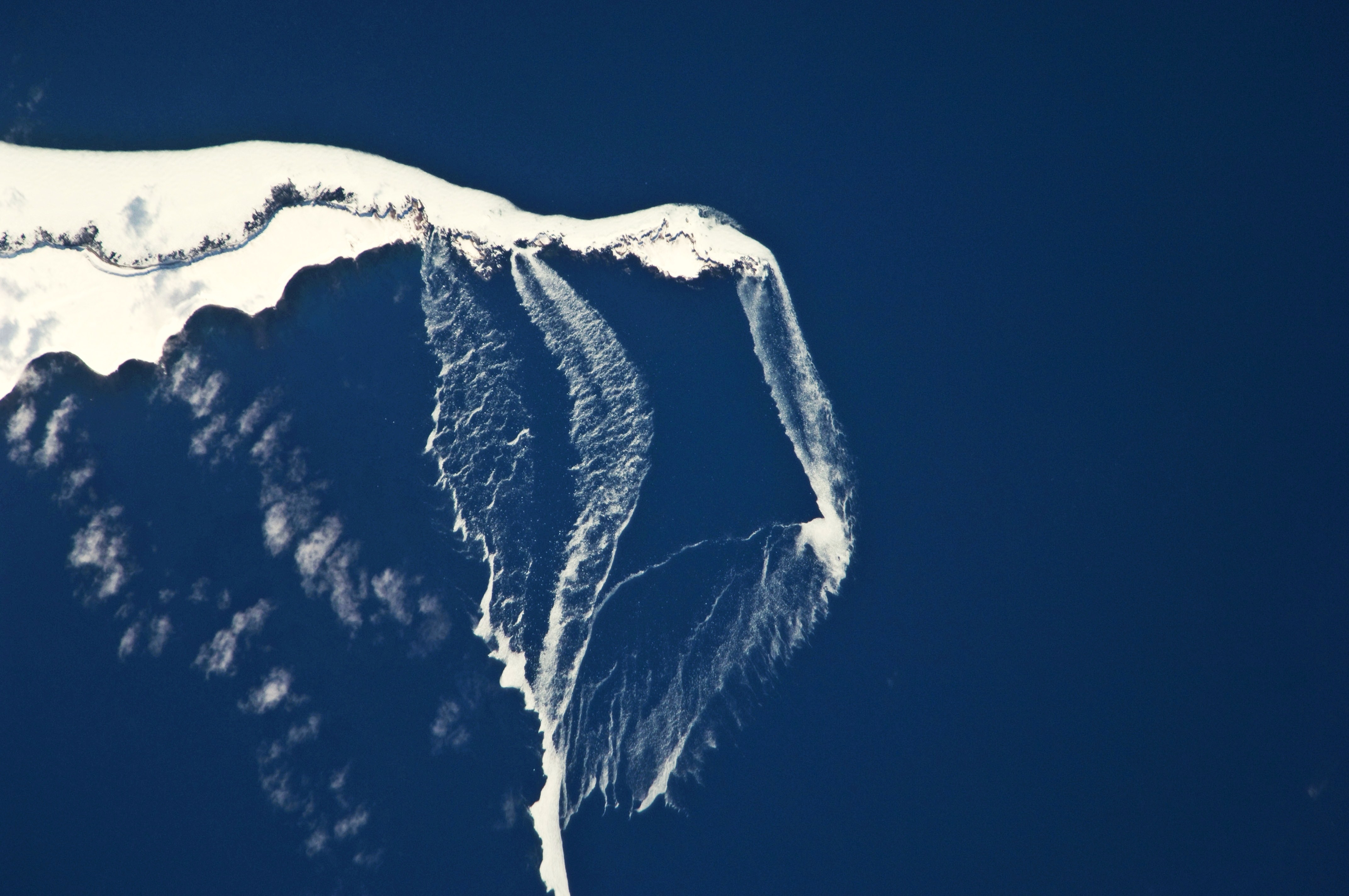
A somma volcano (also known as a sommian) is a volcanic caldera that has been partially filled by a new central cone. The name comes from Mount Somma, a stratovolcano in southern Italy with a summit caldera in which the upper cone of Mount Vesuvius has grown. A number of Earth's best examples of somma volcanoes are found on Russia's Kamchatka Peninsula and the Kuril Islands that stretch south from Kamchatka to Hokkaidō (Japan). Some examples of somma volcanoes are the following: * Africa ** Pico do Fogo ( Fogo Island, Cape Verde) ** Teide (Tenerife, Canary Islands, Spain) * Americas ** Cosigüina (Chinandega, Nicaragua) ** Wizard Island (Oregon, United States) ** Lava domes (Mount St. Helens, Washington, United States) * Asia ** Ebeko (Paramushir Island, Kuril Islands, Russia) ** Gunung Baru Jari (Segara Anak caldera, Lombok, Indonesia) ** Kolokol Group: Kolokol, Berg, Borzov, Trezubetz (Urup Island, Kuril Islands, Russia) ** Anak Krakatoa (Krakatoa archipelago, Sunda Strait ... [...More Info...] [...Related Items...] OR: [Wikipedia] [Google] [Baidu] |
Mount Vesuvius
Mount Vesuvius ( ; it, Vesuvio ; nap, 'O Vesuvio , also or ; la, Vesuvius , also , or ) is a somma- stratovolcano located on the Gulf of Naples in Campania, Italy, about east of Naples and a short distance from the shore. It is one of several volcanoes forming the Campanian volcanic arc. Vesuvius consists of a large cone partially encircled by the steep rim of a summit caldera, resulting from the collapse of an earlier, much higher structure. The eruption of Mount Vesuvius in AD 79 destroyed the Roman cities of Pompeii, Herculaneum, Oplontis, Stabiae, and several other settlements. The eruption ejected a cloud of stones, ashes and volcanic gases to a height of , erupting molten rock and pulverized pumice at the rate of per second. More than 1,000 people are thought to have died in the eruption, though the exact toll is unknown. The only surviving eyewitness account of the event consists of two letters by Pliny the Younger to the historian Tacitus. Vesuvi ... [...More Info...] [...Related Items...] OR: [Wikipedia] [Google] [Baidu] |
Kolokol Group
Kolokol Group (russian: Группа Колокола, Gruppa Kolokola) is a group of somma volcanoes located in the central part of Urup Island, Kuril Islands, Russia. The group is named after its highest volcano but also includes volcanoes called Berg, Trezubetz (which erupted in 1924) and Borzov. The most active in the group is Berg, while Borzov is the oldest. See also * List of volcanoes in Russia This is a list of active and extinct volcanoes in Russia. European Russia Kamchatka Volcanoes of the Kamchatka Peninsula of the northwestern Pacific Ocean and the Russian Far East. Kuril Islands Volcanoes of the Kuril Islands, in the ... References * Urup Active volcanoes Volcanoes of the Kuril Islands {{SakhalinOblast-geo-stub ... [...More Info...] [...Related Items...] OR: [Wikipedia] [Google] [Baidu] |
Ebeko
Ebeko (russian: Эбеко) is a highly active somma volcano located on the northern end of Paramushir Island, Kuril Islands, Russia. It is one of the most active volcanoes of the Kuril Islands. Eleven eruptions have been recorded between 1793 and 1991. Most of the eruptions are small (VEI=1) with the exception of the 1859 eruption (VEI=3). Most eruptions were phreatic and explosive. See also *List of volcanoes in Russia This is a list of active and extinct volcanoes in Russia. European Russia Kamchatka Volcanoes of the Kamchatka Peninsula of the northwestern Pacific Ocean and the Russian Far East. Kuril Islands Volcanoes of the Kuril Islands, in the ... References * Paramushir Active volcanoes Volcanoes of the Kuril Islands {{SakhalinOblast-geo-stub ... [...More Info...] [...Related Items...] OR: [Wikipedia] [Google] [Baidu] |
Cosigüina
Cosigüina (also spelt Cosegüina) is a stratovolcano A stratovolcano, also known as a composite volcano, is a conical volcano built up by many layers (strata) of hardened lava and tephra. Unlike shield volcanoes, stratovolcanoes are characterized by a steep profile with a summit crater and per ... located in the western part of Nicaragua. It forms a large peninsula extending into the Gulf of Fonseca. The summit is truncated by a large caldera, 2 x 2.4 km in diameter and 500 m deep, holding a substantial crater lake (Laguna Cosigüina). This cone has grown within an earlier caldera, forming a somma volcano. The earlier caldera rim is still exposed on the north side, but has been buried by the younger cone elsewhere. Activity The volcano last erupted in 1859, but its most famous activity occurred on January 20, 1835, during the presidency of José Núñez, when it produced the largest historical eruption in Nicaragua. Ash from the 1835 eruption has been foun ... [...More Info...] [...Related Items...] OR: [Wikipedia] [Google] [Baidu] |
Ilha Do Fogo Aerial Shot 1
Ilha (Portuguese for "island") may refer to the following places in Portugal or Mozambique: *Ilha (Santana), a parish in the municipality of Santana, Madeira *Ilha (Pombal) Ilha is a former civil parish in the municipality of Pombal, Portugal. In 2013, the parish merged into the new parish Guia, Ilha e Mata Mourisca Guia, Ilha e Mata Mourisca is a civil parish In England, a civil parish is a type of administ ..., a former parish in the municipality of Pombal * Island of Mozambique, an island and populated place of the coast of mainland Mozambique {{geodis ... [...More Info...] [...Related Items...] OR: [Wikipedia] [Google] [Baidu] |
Oregon
Oregon () is a state in the Pacific Northwest region of the Western United States. The Columbia River delineates much of Oregon's northern boundary with Washington, while the Snake River delineates much of its eastern boundary with Idaho. The 42° north parallel delineates the southern boundary with California and Nevada. Oregon has been home to many indigenous nations for thousands of years. The first European traders, explorers, and settlers began exploring what is now Oregon's Pacific coast in the early-mid 16th century. As early as 1564, the Spanish began sending vessels northeast from the Philippines, riding the Kuroshio Current in a sweeping circular route across the northern part of the Pacific. In 1592, Juan de Fuca undertook detailed mapping and studies of ocean currents in the Pacific Northwest, including the Oregon coast as well as the strait now bearing his name. Spanish ships – 250 in as many years – would typically not land before reaching Cape M ... [...More Info...] [...Related Items...] OR: [Wikipedia] [Google] [Baidu] |
Lampung
Lampung ( Lampung: ), officially the Province of Lampung ( id, Provinsi Lampung) is a province of Indonesia. It is located on the southern tip of the island of Sumatra. It has a short border with the province of Bengkulu to the northwest, and a longer border with the province of South Sumatra to the north. It is the original home of the Lampung people, who speak their own language, and possess their own written script. Its capital is Bandar Lampung. The province covers a land area of 35,376 sq.km and had a population of 7,608,405 at the 2010 census, 9,007,848 at the 2020 census, and 9,081,792 according to the official estimates for mid 2021,with three-quarters of that being descendants of Javanese, Madurese, and Balinese migrants. These migrants came from more densely populated islands, in search of available land, as well as being part of the national government's Indonesian transmigration program, of which Lampung was one of the earliest and most significant transmi ... [...More Info...] [...Related Items...] OR: [Wikipedia] [Google] [Baidu] |
Sunda Strait
The Sunda Strait ( id, Selat Sunda) is the strait between the Indonesian islands of Java and Sumatra. It connects the Java Sea with the Indian Ocean. Etymology The strait takes its name from the Sunda Kingdom, which ruled the western portion of Java (an area covering the present day West Java, Jakarta, Banten, and some of western Central Java) from 669 to around 1579."Sunda Islands". Concise Dictionary of World Place-Names. John Everett-Heath. Oxford University Press 2005. Oxford Reference Online. Oxford University Press. The name also alludes to the Sundanese people native to West Java and Banten, as distinct from the Javanese people, who live mostly in Central and East Java. Geography Extending in a roughly southwest/northeast orientation, with a minimum width of at its northeastern end between Cape Tua on Sumatra and Cape Pujat on Java, the strait is part of the Java Sea. It is essentially triangular in shape, with two large bays on its northern side. It is also very b ... [...More Info...] [...Related Items...] OR: [Wikipedia] [Google] [Baidu] |
Krakatoa Archipelago
The Krakatoa Archipelago is a small uninhabited archipelago of volcanic islands formed by the Krakatoa stratovolcano located in the Sunda Strait, nestled between the much larger islands of Java and Sumatra. As of 2018, the archipelago consists of four main islands: Verlaten (aka Sertung), Lang (aka Rakata Kecil, or Panjang), Rakata, and the currently volcanically active Anak Krakatoa. Together, the islands are a part of the Indonesian island arc system, created by the northeastward subduction of the Indo-Australian Plate. As part of a dynamic volcanic system, the islands have been continuously reshaped throughout recorded history, most notably in the 1883 eruption of Krakatoa. Politically, the Krakatoa Archipelago lies entirely within Lampung province of Indonesia, and forms a part of Ujung Kulon National Park. Geology Krakatoa is an active stratovolcano located in Indonesia, and lying on the far western rim of the Pacific Ring of Fire. Krakatoa is a notably powe ... [...More Info...] [...Related Items...] OR: [Wikipedia] [Google] [Baidu] |
Anak Krakatoa
Anak Krakatoa ( id, Anak Krakatau)English translation and common name: ''Child of Krakatoa'' is a volcanic island in Indonesia. On 29 December 1927, Anak Krakatoa first emerged from the caldera formed in 1883 by the explosive volcanic eruption that destroyed the island of Krakatoa. There has been sporadic eruptive activity at the site since the late 20th century, culminating with a large underwater collapse of the volcano that caused a deadly Tsunami in December 2018. There has been subsequent activity since. Due to its young age, the island is one of several in the area that are of interest to, and the subject of extensive study by, volcanologists. History Background After the cataclysmic eruption of Krakatoa in 1883, Krakatoa Island lost approximately two-thirds of its body on the northwest side, obliterating the peaks of Perbuwatan and Danan, and leaving only the southern half of the island, including the Rakata volcano, as the last remnant of the original island. The ... [...More Info...] [...Related Items...] OR: [Wikipedia] [Google] [Baidu] |
Urup Island
Urup ( ja, 得撫島, Uruppu-to; russian: Уру́п, Urúp, ain, ウルㇷ゚, Urup) is an uninhabited volcanic island in the Kuril Islands chain in the south of the Sea of Okhotsk, northwest Pacific Ocean. Its name is derived from the Ainu language word for salmon trout. It was formerly known as Company's Land. Geography and climate Urup has a roughly rectangular shape, measuring along its long axis and approximately along its narrow axis. It is the fourth largest of the Kuril Islands, with an area of . The highest point is Gora Ivao at . The strait between Urup and Iturup is known as the Vries Strait, after Dutch explorer Maarten Gerritsz Vries, the first recorded European to explore the area. The strait between Urup and Simushir is known as Bussol Strait, after the French word for "compass", which was the name of one of La Pérouse's vessels. This French mariner explored the area of the Kuril Islands in 1787. Urup consists of four major groups of active or dormant st ... [...More Info...] [...Related Items...] OR: [Wikipedia] [Google] [Baidu] |
Lombok
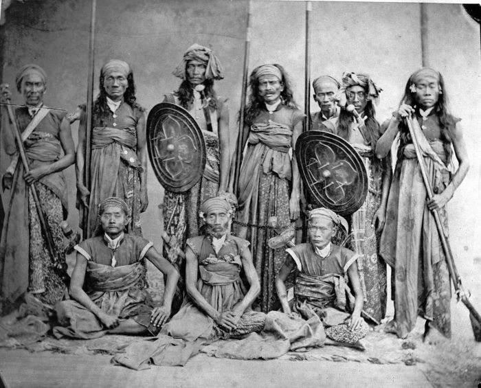
Lombok is an island in West Nusa Tenggara province, Indonesia. It forms part of the chain of the Lesser Sunda Islands, with the Lombok Strait separating it from Bali to the west and the Alas Strait between it and Sumbawa to the east. It is roughly circular, with a "tail" (Sekotong Peninsula) to the southwest, about across and a total area of about including smaller offshore islands. The provincial capital and largest city on the island is Mataram. Orang Lombok is some what similar in size and density, and shares some cultural heritage with the neighboring island of Bali to the west. However, it is administratively part of West Nusa Tenggara, along with the larger and more sparsely populated island of Sumbawa to the east. Lombok is surrounded by a number of smaller islands locally called Gili. The island was home to some 3,168,692 Indonesians as recorded in the decennial 2010 censusBiro Pusat Statistik, Jakarta, 2011. and 3,758,631 in the 2020 Census;Badan Pusat Stat ... [...More Info...] [...Related Items...] OR: [Wikipedia] [Google] [Baidu] |


.jpg)


