|
Hurricane Andrew
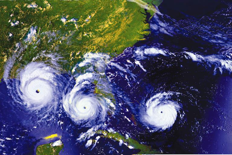
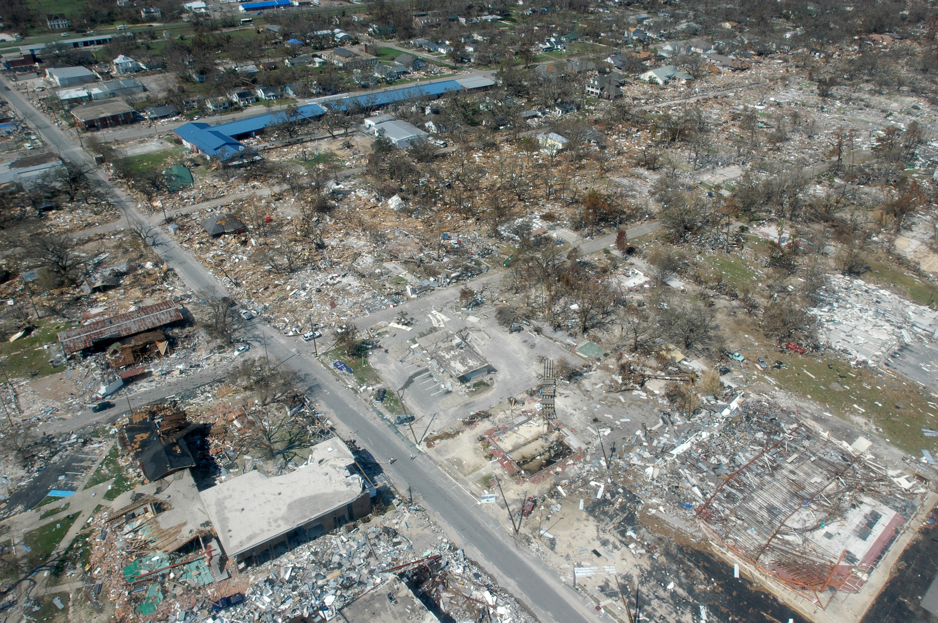
Hurricane Andrew was a compact, but very powerful and devastating tropical cyclone that struck the Bahamas, Florida, and Louisiana in August 1992. It was the most destructive hurricane to ever hit Florida in terms of structures damaged or destroyed, and remained the costliest in financial terms until Hurricane Irma surpassed it 2017 Atlantic hurricane season, 25 years later. Andrew was also the strongest landfalling hurricane in the United States in decades and the List of costliest Atlantic hurricanes, costliest hurricane to strike anywhere in the country, until it was surpassed by Hurricane Katrina, Katrina in 2005 Atlantic hurricane season, 2005. Andrew is one of only four tropical cyclones to make landfall in the continental United States as a Category 5, alongside the 1935 Labor Day hurricane, 1969 Atlantic hurricane season, 1969's Hurricane Camille, Camille, and 2018 Atlantic hurricane season, 2018's Hurricane Michael, Michael. While the storm also caused ... [...More Info...] [...Related Items...] OR: [Wikipedia] [Google] [Baidu] |
List Of Costliest Atlantic Hurricanes
This is a list of the costliest Atlantic hurricanes, with US$1 billion ( nominal) in property damage, broadly capturing the severity of the damage each tropical cyclone has caused. The list includes tropical storms, a tropical cyclone with a peak 1-minute maximum sustained wind in the range of 39–73 mph (63–118 km/h), placing them below the 74 mph (119 km/h) minimum needed to attain hurricane status. History The record of the costliest tropical cyclone in the Atlantic is held jointly by hurricanes Katrina (2005) and Harvey (2017), both of which resulted in approximately $125 billion in property damage during the year they occurred. These storms are also the costliest tropical cyclones recorded worldwide. The hurricane seasons of those two hurricanes, the 2005 and 2017 Atlantic hurricane seasons, are also the second costliest, and most costly hurricane seasons recorded. Most of the costliest Atlantic hurricanes in recorded history have peaked ... [...More Info...] [...Related Items...] OR: [Wikipedia] [Google] [Baidu] |
Hurricane Michael
Hurricane Michael was a powerful and destructive tropical cyclone that became the first Category 5 hurricane to make landfall in the contiguous United States since Andrew in 1992. It was the third-most intense Atlantic hurricane to make landfall in the contiguous United States in terms of pressure, behind the 1935 Labor Day hurricane and Hurricane Camille in 1969. Michael was the first Category 5 hurricane on record to impact the Florida Panhandle, the fourth-strongest landfalling hurricane in the contiguous United States in terms of wind speed, and the most intense hurricane on record to strike the United States in the month of October. The thirteenth named storm, seventh hurricane, and second major hurricane of the 2018 Atlantic hurricane season, Michael originated from a broad low-pressure area that formed in the southwestern Caribbean Sea on October 1. The disturbance became a tropical depression on October 7, after nearly a week of slow development. By the ... [...More Info...] [...Related Items...] OR: [Wikipedia] [Google] [Baidu] |
Hurricane Lester (1992)
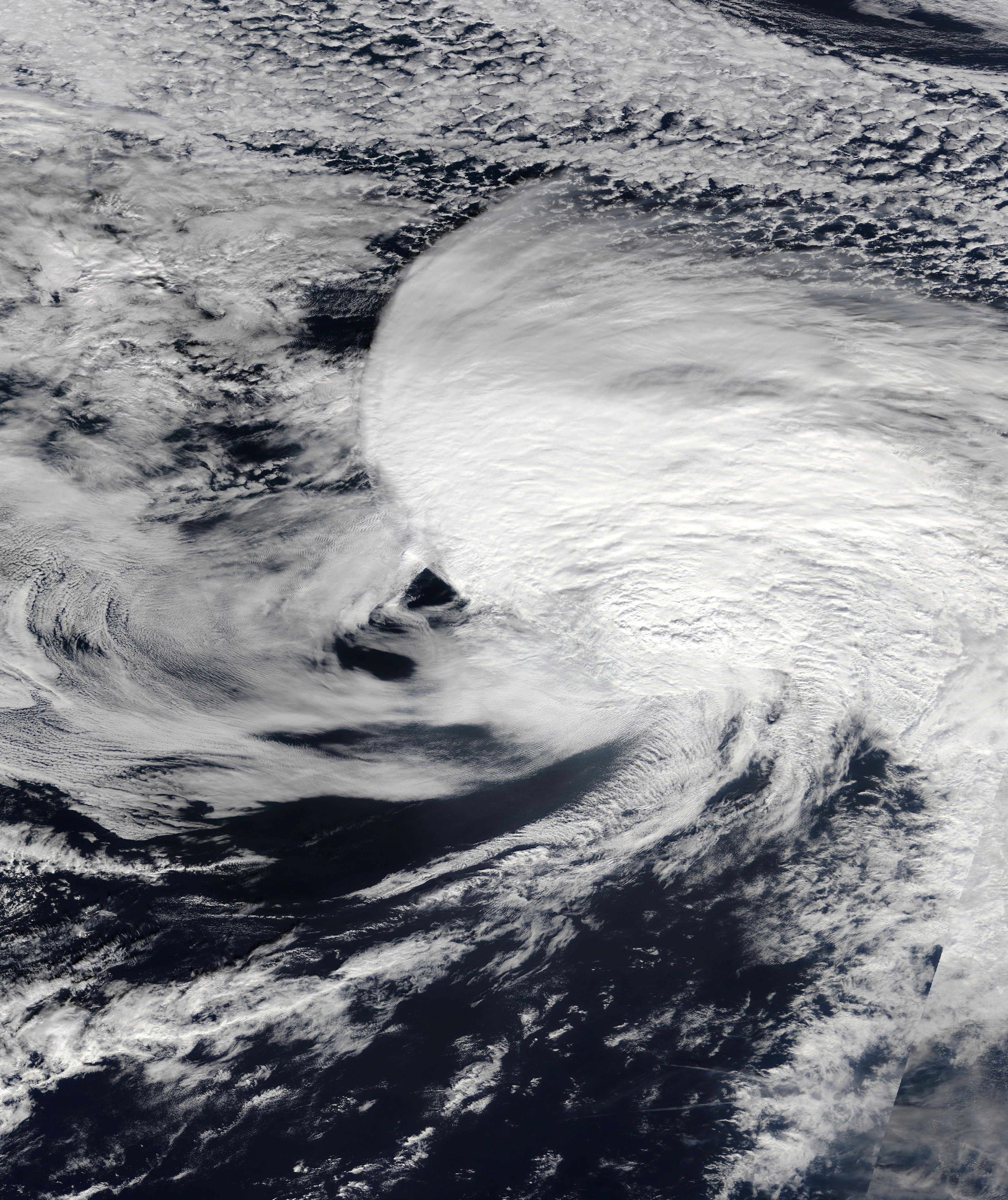
Hurricane Lester was the first Pacific tropical cyclone to enter the United States as a tropical storm since 1967. The fourteenth named storm and eighth hurricane of the 1992 Pacific hurricane season, Lester formed on August 20 from a tropical wave southwest of Mexico. The tropical storm moved generally northwestward while steadily intensifying. After turning to the north, approaching the Mexican coast, Lester attained hurricane status. The hurricane reached peak winds of before making landfall on west-central Baja California. The system weakened while moving across the peninsula and then over northwestern Mexico. Not long after entering Arizona, Lester weakened to a tropical depression, and degenerated into an extratropical low on August 24, 1992, over New Mexico. The storm's remnants later merged with the remnants of Hurricane Andrew and another frontal system on August 29. In Mexico, the hurricane resulted in $3 million in damage (1992 USD, $4.7 million 2011&nbs ... [...More Info...] [...Related Items...] OR: [Wikipedia] [Google] [Baidu] |
Extratropical
Extratropical cyclones, sometimes called mid-latitude cyclones or wave cyclones, are low-pressure areas which, along with the anticyclones of high-pressure areas, drive the weather over much of the Earth. Extratropical cyclones are capable of producing anything from cloudiness and mild showers to severe hail, thunderstorms, blizzards, and tornadoes. These types of cyclones are defined as large scale (synoptic) low pressure weather systems that occur in the middle latitudes of the Earth. In contrast with tropical cyclones, extratropical cyclones produce rapid changes in temperature and dew point along broad lines, called weather fronts, about the center of the cyclone. Terminology The term "cyclone" applies to numerous types of low pressure areas, one of which is the extratropical cyclone. The descriptor ''extratropical'' signifies that this type of cyclone generally occurs outside the tropics and in the middle latitudes of Earth between 30° and 60° latitude. They are term ... [...More Info...] [...Related Items...] OR: [Wikipedia] [Google] [Baidu] |
Morgan City, Louisiana
Morgan City is a small city in St. Mary Parish, Louisiana, United States, located in the Acadiana region. The population was 11,472 at the 2020 census. Known for being "right in the middle of everywhere", Morgan City is located southeast of Lafayette, south of Baton Rouge, and west of New Orleans. Morgan City sits on the banks of the Atchafalaya River near its intersection with the Intracoastal Waterway. The town was originally named "Tiger Island" by surveyors appointed by U.S. Secretary of War John Calhoun, because of a particular type of wild cat seen in the area. It was later changed for a time to "Brashear City", named after Walter Brashear, a prominent Kentucky physician who had purchased large tracts of land and acquired numerous sugar mills in the area. It was incorporated in 1860. Morgan City, and all of St. Mary Parish, is included in the Lafayette-Opelousas-Morgan City CSA. History Capture of Brashear City During the American Civil War, the Star Fort of F ... [...More Info...] [...Related Items...] OR: [Wikipedia] [Google] [Baidu] |
Gulf Coast Of The United States
The Gulf Coast of the United States, also known as the Gulf South or the South Coast, is the coastline along the Southern United States where they meet the Gulf of Mexico. The list of U.S. states and territories by coastline, coastal states that have a shoreline on the Gulf of Mexico are Texas, Louisiana, Mississippi, Alabama, and Florida, and these are known as the ''Gulf States''. The economy of the Gulf Coast area is dominated by industries related to energy, petrochemicals, fishing, aerospace, agriculture, and tourism. The large cities of the region are (from west to east) Brownsville, Texas, Brownsville, Corpus Christi, Texas, Corpus Christi, Houston, Galveston, Texas, Galveston, Beaumont, Texas, Beaumont, Lake Charles, Louisiana, Lake Charles, Lafayette, Louisiana, Lafayette, Baton Rouge, Louisiana, Baton Rouge, New Orleans, Gulfport, Mississippi, Gulfport, Biloxi, Mississippi, Biloxi, Mobile, Alabama, Mobile, Pensacola, Florida, Pensacola, Panama City, Florida, Panama Ci ... [...More Info...] [...Related Items...] OR: [Wikipedia] [Google] [Baidu] |
Gulf Of Mexico
The Gulf of Mexico () is an oceanic basin and a marginal sea of the Atlantic Ocean, mostly surrounded by the North American continent. It is bounded on the northeast, north, and northwest by the Gulf Coast of the United States; on the southwest and south by the Mexican states of Tamaulipas, Veracruz, Tabasco, Campeche, Yucatán, and Quintana Roo; and on the southeast by Cuba. The coastal areas along the Southern U.S. states of Texas, Louisiana, Mississippi, Alabama, and Florida, which border the Gulf on the north, are occasionally referred to as the "Third Coast" of the United States (in addition to its Atlantic and Pacific coasts), but more often as "the Gulf Coast". The Gulf of Mexico took shape about 300 million years ago (mya) as a result of plate tectonics. The Gulf of Mexico basin is roughly oval and is about wide. Its floor consists of sedimentary rocks and recent sediments. It is connected to part of the Atlantic Ocean through the Straits of Florida between the ... [...More Info...] [...Related Items...] OR: [Wikipedia] [Google] [Baidu] |
Elliott Key
Elliott Key is the northernmost of the true Florida Keys (those 'keys' which are ancient coral reefs lifted above the present sea level), and the largest key north of Key Largo. It is located entirely within Biscayne National Park, in Miami-Dade County, Florida, east of Homestead, Florida. It is bordered by the Atlantic Ocean to the east, Biscayne Bay to the west, Sands Key (across Sands Cut) to the north, and Old Rhodes Key (across Caesar Creek) to the south. Adams Key is just west of the southern end of Elliott Key. Elliott Key is about long. Its maximum width is about near the north end, and its average width is less than . The higher elevations on the island range from above sea level and occur generally along an unimproved road that runs longitudinally through the center of the island. The average elevation is about above sea level. The key is accessible only by boat. Elliott Key has a National Park Service campground, but is otherwise uninhabited. History Elliott Key w ... [...More Info...] [...Related Items...] OR: [Wikipedia] [Google] [Baidu] |
Rapidly Intensified
Rapid intensification (RI) is any process wherein a tropical cyclone strengthens very dramatically in a short period of time. Tropical cyclone forecasting agencies utilize differing thresholds for designating rapid intensification events, though the most widely used definition stipulates an increase in the maximum sustained winds of a tropical cyclone of at least in a 24-hour period. However, periods of rapid intensification often last longer than a day. About 20–30% of all tropical cyclones undergo rapid intensification, including a majority of tropical cyclones with peak wind speeds exceeding . Rapid intensification constitutes a major source of error for tropical cyclone forecasting, and its predictability is commonly cited as a key area for improvement. The specific physical mechanisms that underlie rapid intensification and the environmental conditions necessary to support rapid intensification are unclear due to the complex interactions between the environment surrou ... [...More Info...] [...Related Items...] OR: [Wikipedia] [Google] [Baidu] |
Tropical Depression
A tropical cyclone is a rapidly rotating storm system with a low-pressure area, a closed low-level atmospheric circulation, strong winds, and a spiral arrangement of thunderstorms that produce heavy rain and squalls. Depending on its location and strength, a tropical cyclone is called a hurricane (), typhoon (), tropical storm, cyclonic storm, tropical depression, or simply cyclone. A hurricane is a strong tropical cyclone that occurs in the Atlantic Ocean or northeastern Pacific Ocean. A typhoon is the same thing which occurs in the northwestern Pacific Ocean. In the Indian Ocean and South Pacific, comparable storms are referred to as "tropical cyclones". In modern times, on average around 80 to 90 named tropical cyclones form each year around the world, over half of which develop hurricane-force winds of or more. Tropical cyclones typically form over large bodies of relatively warm water. They derive their energy through the evaporation of water from the ocean surface ... [...More Info...] [...Related Items...] OR: [Wikipedia] [Google] [Baidu] |
United States Dollar
The United States dollar (Currency symbol, symbol: Dollar sign, $; ISO 4217, currency code: USD) is the official currency of the United States and International use of the U.S. dollar, several other countries. The Coinage Act of 1792 introduced the U.S. dollar at par with the Spanish dollar, Spanish silver dollar, divided it into 100 cent (currency), cents, and authorized the Mint (facility), minting of coins denominated in dollars and cents. U.S. banknotes are issued in the form of Federal Reserve Notes, popularly called greenbacks due to their predominantly green color. The U.S. dollar was originally defined under a bimetallism, bimetallic standard of (0.7734375 troy ounces) fine silver or, from Coinage Act of 1834, 1834, fine gold, or $20.67 per troy ounce. The Gold Standard Act of 1900 linked the dollar solely to gold. From 1934, its equivalence to gold was revised to $35 per troy ounce. In 1971 all links to gold were repealed. The U.S. dollar became an important intern ... [...More Info...] [...Related Items...] OR: [Wikipedia] [Google] [Baidu] |
Miami-Dade County, Florida
Miami-Dade County () is a County (United States), county located in the southeastern part of the U.S. state of Florida. The county had a population of 2,701,767 as of the 2020 United States census, 2020 census, making it the most populous county in Florida and the List of the most populous counties in the United States, seventh-most-populous county in the United States. It is Florida's third largest county in terms of land area with . The county seat is Miami, the core of the metropolitan statistical area, nation's ninth-largest and List of largest cities, world's 65th-largest metropolitan area with a 2020 population of 6.138 million people, List of U.S. states and territories by population, exceeding the population of 31 of the nation's 50 states as of 2022. As of 2022, Miami-Dade County has a gross domestic product of $184.5 billion, making the county's GDP the largest for any county in the State of Florida and the List of US counties with GDP over 50 billion US dollars, 14th ... [...More Info...] [...Related Items...] OR: [Wikipedia] [Google] [Baidu] |


