|
Geopotential
Geopotential (symbol ''W'') is the potential of the Earth's gravity field. It has SI units of square metre per square seconds (m2/s2). For convenience it is often defined as the of the potential energy per unit mass, so that the gravity vector is obtained as the gradient of the geopotential, without the negation. In addition to the actual potential (the geopotential), a theoretical normal potential (symbol ''U'') and their difference, the disturbing potential (), can also be defined. Concepts For geophysical applications, gravity is distinguished from gravitation. Gravity is defined as the resultant force of gravitation and the centrifugal force caused by the Earth's rotation. Likewise, the respective scalar potentials, gravitational potential and centrifugal potential, can be added to form an effective potential called the geopotential, W. The surfaces of constant geopotential or isosurfaces of the geopotential are called ''equigeopotential surfaces'' (sometimes a ... [...More Info...] [...Related Items...] OR: [Wikipedia] [Google] [Baidu] |
Normal Potential
Geopotential (symbol ''W'') is the potential of the Earth's gravity field. It has SI units of square metre per square seconds (m2/s2). For convenience it is often defined as the of the potential energy per unit mass, so that the gravity vector is obtained as the gradient of the geopotential, without the negation. In addition to the actual potential (the geopotential), a theoretical normal potential (symbol ''U'') and their difference, the disturbing potential (), can also be defined. Concepts For geophysical applications, gravity is distinguished from gravitation. Gravity is defined as the resultant force of gravitation and the centrifugal force caused by the Earth's rotation. Likewise, the respective scalar potentials, gravitational potential and centrifugal potential, can be added to form an effective potential called the geopotential, W. The surfaces of constant geopotential or isosurfaces of the geopotential are called ''equigeopotential surfaces'' (sometimes abbreviated a ... [...More Info...] [...Related Items...] OR: [Wikipedia] [Google] [Baidu] |
Gravitational Potential
In classical mechanics, the gravitational potential is a scalar potential associating with each point in space the work (energy transferred) per unit mass that would be needed to move an object to that point from a fixed reference point in the conservative gravitational field. It is analogous to the electric potential with mass playing the role of charge. The reference point, where the potential is zero, is by convention infinitely far away from any mass, resulting in a negative potential at any finite distance. Their similarity is correlated with both associated fields having conservative forces. Mathematically, the gravitational potential is also known as the Newtonian potential and is fundamental in the study of potential theory. It may also be used for solving the electrostatic and magnetostatic fields generated by uniformly charged or polarized ellipsoidal bodies. Potential energy The gravitational potential (''V'') at a location is the gravitational potential ener ... [...More Info...] [...Related Items...] OR: [Wikipedia] [Google] [Baidu] |
Geoid
The geoid ( ) is the shape that the ocean surface would take under the influence of the gravity of Earth, including gravitational attraction and Earth's rotation, if other influences such as winds and tides were absent. This surface is extended through the continents (such as might be approximated with very narrow hypothetical canals). According to Carl Friedrich Gauss, who first described it, it is the "mathematical figure of the Earth", a smooth but irregular surface whose shape results from the uneven distribution of mass within and on the surface of Earth. It can be known only through extensive gravitational measurements and calculations. Despite being an important concept for almost 200 years in the history of geodesy and geophysics, it has been defined to high precision only since advances in satellite geodesy in the late 20th century. The geoid is often expressed as a geoid undulation or geoidal height above a given reference ellipsoid, which is a slightly flattene ... [...More Info...] [...Related Items...] OR: [Wikipedia] [Google] [Baidu] |
Gravity Vector
The gravity of Earth, denoted by , is the net force, net acceleration that is imparted to objects due to the combined effect of gravitation (from mass distribution within Earth) and the centrifugal force (from the Earth's rotation). It is a Euclidean vector, vector quantity, whose direction coincides with a plumb bob and strength or magnitude is given by the Euclidean norm, norm g=\, \mathit\, . In International System of Units, SI units, this acceleration is expressed in metre per second squared, metres per second squared (in symbols, metre, m/second, s2 or m·s−2) or equivalently in Newton (unit), newtons per kilogram (N/kg or N·kg−1). Near Earth's surface, the acceleration due to gravity, accurate to 2 significant figures, is . This means that, ignoring the effects of drag (physics), air resistance, the speed of an object free fall, falling freely will increase by about every second. The precise strength of Earth's gravity varies with location. The agreed-upon value for ... [...More Info...] [...Related Items...] OR: [Wikipedia] [Google] [Baidu] |
Centrifugal Potential
Centrifugal force is a fictitious force in Newtonian mechanics (also called an "inertial" or "pseudo" force) that appears to act on all objects when viewed in a rotating frame of reference. It appears to be directed radially away from the axis of rotation of the frame. The magnitude of the centrifugal force ''F'' on an object of mass ''m'' at the perpendicular distance ''ρ'' from the axis of a rotating frame of reference with angular velocity is F = m\omega^2 \rho. This fictitious force is often applied to rotating devices, such as centrifuges, centrifugal pumps, centrifugal governors, and centrifugal clutches, and in centrifugal railways, planetary orbits and banked curves, when they are analyzed in a non–inertial reference frame such as a rotating coordinate system. The term has sometimes also been used for the ''reactive centrifugal force'', a real frame-independent Newtonian force that exists as a reaction to a centripetal force in some scenarios. History From 165 ... [...More Info...] [...Related Items...] OR: [Wikipedia] [Google] [Baidu] |
Centrifugal Force (fictitious)
Centrifugal force is a fictitious force in Newtonian mechanics (also called an "inertial" or "pseudo" force) that appears to act on all objects when viewed in a rotating frame of reference. It appears to be directed radially away from the axis of rotation of the frame. The magnitude of the centrifugal force ''F'' on an object of mass ''m'' at the perpendicular distance ''ρ'' from the axis of a rotating frame of reference with angular velocity is F = m\omega^2 \rho. This fictitious force is often applied to rotating devices, such as centrifuges, centrifugal pumps, centrifugal governors, and centrifugal clutches, and in centrifugal railways, planetary orbits and banked curves, when they are analyzed in a non–inertial reference frame such as a rotating coordinate system. The term has sometimes also been used for the '' reactive centrifugal force'', a real frame-independent Newtonian force that exists as a reaction to a centripetal force in some scenarios. History ... [...More Info...] [...Related Items...] OR: [Wikipedia] [Google] [Baidu] |
Sea Level
Mean sea level (MSL, often shortened to sea level) is an mean, average surface level of one or more among Earth's coastal Body of water, bodies of water from which heights such as elevation may be measured. The global MSL is a type of vertical datuma standardised geodetic datumthat is used, for example, as a chart datum in cartography and Navigation, marine navigation, or, in aviation, as the standard sea level at which atmospheric pressure is measured to Calibration, calibrate altitude and, consequently, aircraft flight levels. A common and relatively straightforward mean sea-level standard is instead a long-term average of tide gauge readings at a particular reference location. The term ''above sea level'' generally refers to the height above mean sea level (AMSL). The term APSL means above present sea level, comparing sea levels in the past with the level today. Earth's radius at sea level is 6,378.137 km (3,963.191 mi) at the equator. It is 6,356.752 km (3,94 ... [...More Info...] [...Related Items...] OR: [Wikipedia] [Google] [Baidu] |
Effective Potential
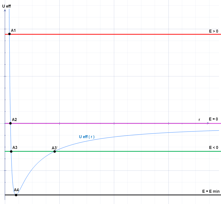
The effective potential (also known as effective potential energy) combines multiple, perhaps opposing, effects into a single potential. In its basic form, it is the sum of the "opposing" centrifugal potential energy with the potential energy of a dynamical system. It may be used to determine the orbits of planets (both Newtonian and relativistic) and to perform semi-classical atomic calculations, and often allows problems to be reduced to fewer dimensions. Definition The basic form of potential U_\text is defined as U_\text(\mathbf) = \frac + U(\mathbf), where : ''L'' is the angular momentum, : ''r'' is the distance between the two masses, : ''μ'' is the reduced mass of the two bodies (approximately equal to the mass of the orbiting body if one mass is much larger than the other), : ''U''(''r'') is the general form of the potential. The effective force, then, is the negative gradient of the effective potential: \begin \mathbf_\text &= -\nabla U_\text(\mathbf) \\ &= \fr ... [...More Info...] [...Related Items...] OR: [Wikipedia] [Google] [Baidu] |
Deflection Of The Vertical
The vertical deflection (VD) or deflection of the vertical (DoV), also known as deflection of the plumb line and astro-geodetic deflection, is a measure of how far the gravity direction at a given point of interest is rotated by local mass anomalies such as nearby mountains. They are widely used in geodesy, for surveying networks and for geophysical purposes. The vertical deflection are the angular components between the true zenith–nadir curve (plumb line) tangent line and the normal vector to the surface of the reference ellipsoid (chosen to approximate the Earth's sea-level surface). VDs are caused by mountains and by underground geological irregularities. Typically angle values amount to less than 10 arc-seconds in flat areas or up to 1 arc-minute in mountainous terrain. Components The deflection of the vertical has a north–south component ''ξ'' ( xi) and an east–west component ''η'' (eta). The value of ''ξ'' is the difference between the '' astronomic latit ... [...More Info...] [...Related Items...] OR: [Wikipedia] [Google] [Baidu] |
Plumb-line
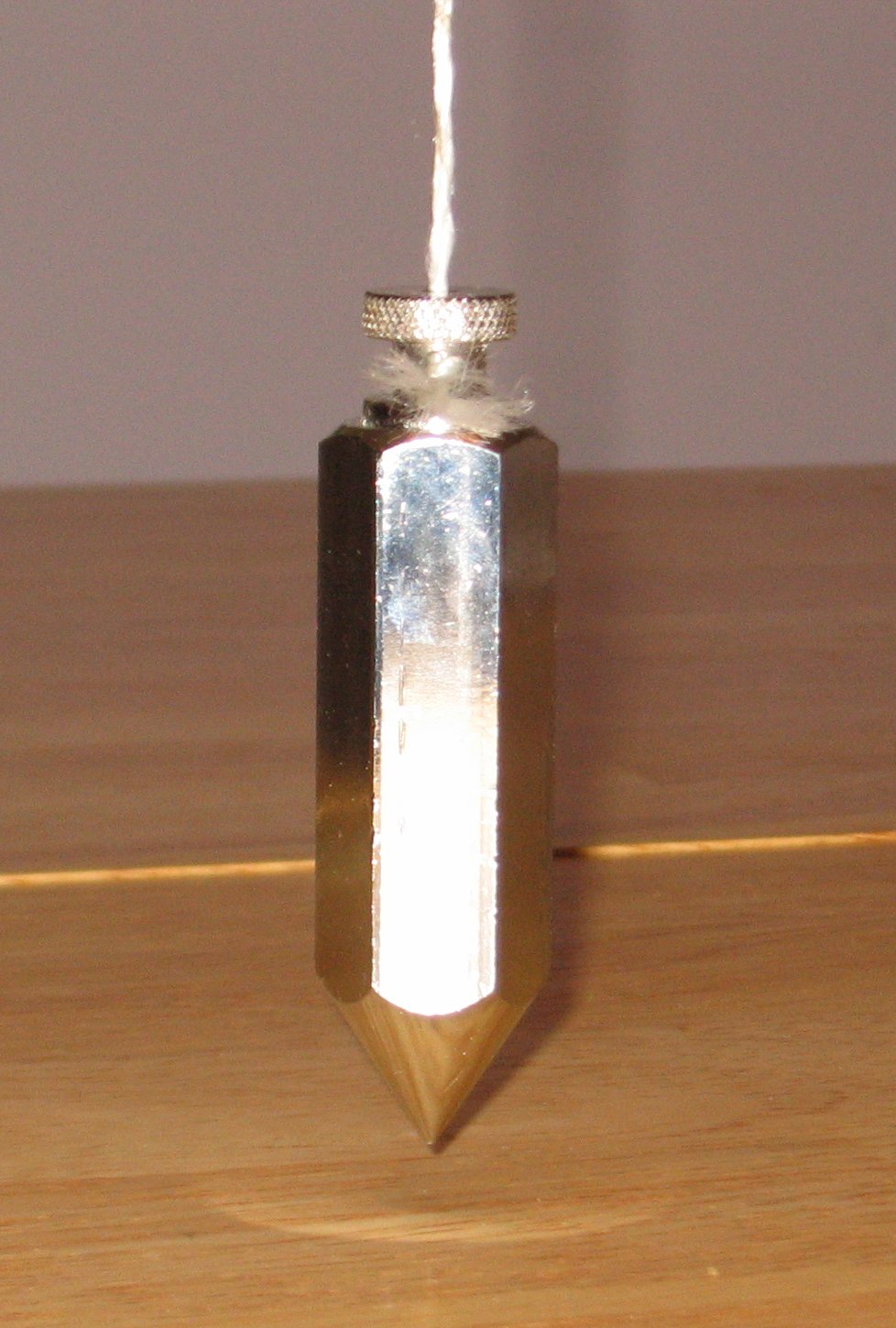
A plumb bob, plumb bob level, or plummet, is a weight, usually with a pointed tip on the bottom, suspended from a string and used as a vertical direction as a reference line, or plumb-line. It is a precursor to the spirit level and used to establish a vertical datum. It is typically made of stone, wood, or lead, but can also be made of other metals. If it is used for decoration, it may be made of bone or ivory. The instrument has been used since at least the time of ancient EgyptDenys A. Stocks. Experiments in Egyptian archaeology: stoneworking technology in Ancient Egypt'. Routledge; 2003. . p. 180. to ensure that constructions are " plumb", or vertical. It is also used in surveying, to establish the nadir (opposite of zenith) with respect to gravity of a point in space. It is used with a variety of instruments (including levels, theodolites, and steel tapes) to set the instrument exactly over a fixed survey marker or to transcribe positions onto the ground for placing ... [...More Info...] [...Related Items...] OR: [Wikipedia] [Google] [Baidu] |
GRS80
The Geodetic Reference System 1980 (GRS80) consists of a global reference ellipsoid and a normal gravity model. The GRS80 gravity model has been followed by the newer more accurate Earth Gravitational Models, but the GRS80 reference ellipsoid is still the most accurate in use for coordinate reference systems, e.g. for the international ITRS, the European ETRS89 and (with a 0,1 mm rounding error) for WGS 84 used for the American Global Navigation Satellite System (GPS). Background Geodesy is the scientific discipline that deals with the measurement and representation of the earth, its gravitational field and geodynamic phenomena (polar motion, earth tides, and crustal motion) in three-dimensional, time-varying space. The geoid is essentially the figure of the Earth abstracted from its topographic features. It is an idealized equilibrium surface of sea water, the mean sea level surface in the absence of currents, air pressure variations etc. and continued under the continental m ... [...More Info...] [...Related Items...] OR: [Wikipedia] [Google] [Baidu] |
Reference Ellipsoid
An Earth ellipsoid or Earth spheroid is a mathematical figure approximating the Earth's form, used as a reference frame for computations in geodesy, astronomy, and the geosciences. Various different ellipsoids have been used as approximations. It is a spheroid (an ellipsoid of revolution) whose minor axis (shorter diameter), which connects the geographical North Pole and South Pole, is approximately aligned with the Earth's axis of rotation. The ellipsoid is defined by the ''equatorial axis'' () and the ''polar axis'' (); their radial difference is slightly more than 21 km, or 0.335% of (which is not quite 6,400 km). Many methods exist for determination of the axes of an Earth ellipsoid, ranging from meridian arcs up to modern satellite geodesy or the analysis and interconnection of continental geodetic networks. Amongst the different set of data used in national surveys are several of special importance: the Bessel ellipsoid of 1841, the international Hayfo ... [...More Info...] [...Related Items...] OR: [Wikipedia] [Google] [Baidu] |


