|
Central Afghan Highlands
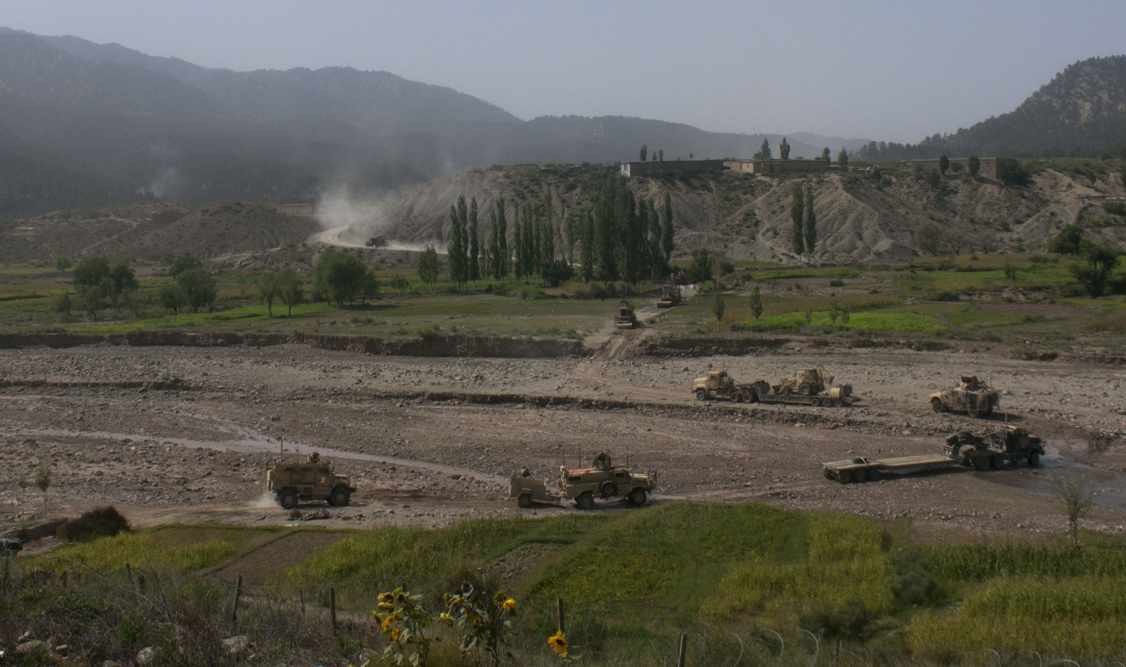
The central Afghan highlands, or the Afghan Highlands (Dari/; ), is a geographic region of Afghanistan. Stretching from the Sabzak Pass near Herat in the west to the Little Pamir in the northeast, it includes the main Hindu Kush range and forms a western extension of the Himalayas. It is a highland area of more than 1,500 m (4,900 ft) above sea level, mostly situated between 2,000 and 3,000 m (6,500 and 9,800 ft), with some peaks rising above 6,400 m (21,000 ft). Usually, the valley bottoms in the area are used for cereal and horticultural production, and the mountains and high plateaus are used as pasture in summer for grazing sheep, goats, cattle, and camels. Its total area is about 414,000 km2 (160,000 sq mi). The region contains about 225,000 km2 (87,000 sq mi) of summer pasture, which is used by both settled communities and nomadic pastoralists like the Kuchis. Major pastures in the region include the Nawur pasture in northern Ghazni Province (whose area is about 600 km2 at ... [...More Info...] [...Related Items...] OR: [Wikipedia] [Google] [Baidu] |
Ghazni
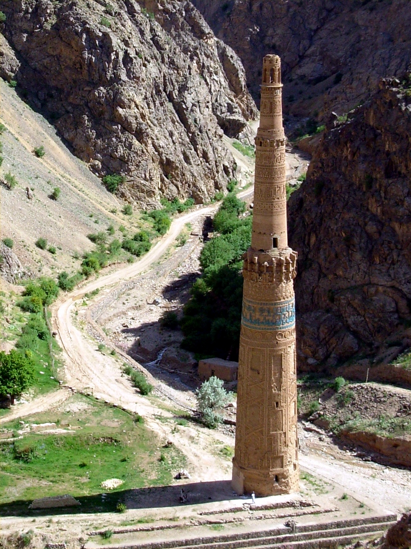
Ghazni (, ), historically known as Ghaznayn () or Ghazna (), also transliterated as Ghuznee, and anciently known as Alexandria in Opiana (), is a city in southeastern Afghanistan with a population of around 190,000 people. The city is strategically located along Highway 1 (Afghanistan), Highway 1, which follows the path that has served as the main road between Kabul and Kandahar for thousands of years. Situated on a plateau at 2,219 metres (7,280 ft) above sea level, the city is south of Kabul and is the capital of Ghazni Province. The name Ghazni derives from the Persian word ''ganj'', meaning "treasure." Citadel of Ghazni, Ghazni Citadel, the Ghazni Minarets, Minarets of Ghazni, the Palace of Sultan Mas'ud III, and several other cultural heritage sites have brought travelers and archeologists to the city for centuries. During the Pre-Islamic period of Afghanistan, pre-Islamic period, the area was inhabited by various tribes who practiced different religions including Zoro ... [...More Info...] [...Related Items...] OR: [Wikipedia] [Google] [Baidu] |
Nawur Pasture
Dasht-e Nāwar () is an archaeological site in Ghazni province in Afghanistan. It's situated at the northern end of the lake, on and around Tepe Qādagak, c. 60 km west of Ghazni. A brackish lake measuring c. 60 x 15 km. On the "beaches" to the east and north are several palaeolithic sites: Lower Palaeolithic on the east and Middle Palaeolithic on the north, which includes a large stone hill fortification and associated structures of uncertain date. The surface sites are covered in stone tools, 98% of which are obsidian. These include cleavers, large scrappers, choppers and microblades, some of which appear Lower Palaeolithic. The others bear similarities to the Darra-i Kūr industry. Collection: * BIAS Bias is a disproportionate weight ''in favor of'' or ''against'' an idea or thing, usually in a way that is inaccurate, closed-minded, prejudicial, or unfair. Biases can be innate or learned. People may develop biases for or against an individ ... – stone tools. ... [...More Info...] [...Related Items...] OR: [Wikipedia] [Google] [Baidu] |
Maidan Wardak Province
Wardak is one of the 34 provinces of Afghanistan, located in central Afghanistan. Its capital is the closest provincial city to Kabul. Wardak Have 8 District. Wardak or Wardag (Dari/Pashto: ), is one of the 34 provinces of Afghanistan, located in the central region of Afghanistan. It is divided into eight Districts of Afghanistan, districts and has a population of approximately 500,000. The capital of the province is Maidan Shar, Maidan Shar(Maidan City), while the most populous district in the province is Saydabad District. Wardak is known for one of its famous high peak mountain known as (Shah Foladi). In 2021, the Taliban gained control of the province during the 2021 Taliban offensive. History During the Communist Afghanistan, communist times, the people of Wardak never gave significant support to the communist government, but the people of Maidan Shahr did sympathize with them. Wardak has also threatened uprisings against the Taliban in Saydabad, numerous schooling system ... [...More Info...] [...Related Items...] OR: [Wikipedia] [Google] [Baidu] |
Parwan Province
Parwan also spelled Parvan () is one of the 34 provinces of Afghanistan. It is the largest province of the Greater Parwan region and has a population of about 751,000. The province is multi-ethnic and mostly rural society. The province is divided into ten Districts of Afghanistan, districts. The town of Charikar, Imam Abu Hanifa serves as the provincial capital. The province is located north of Kabul Province and south of Baghlan Province, west of Panjshir Province and Kapisa Province, and east of Maidan Wardak Province and Bamyan Province. The province's famous tourism attraction is the Golghondi Hill, also known as “the flower hill,” located in Imam Azam about an hour away from the capital city of Kabul. After Panjshir this province has been considered as one of the main raising points of Afghanistan War against Soviets. The name Parwan is also attributed to a town, the exact location of which is now unknown, that supposedly existed during prehistory, in the nearby Hindu K ... [...More Info...] [...Related Items...] OR: [Wikipedia] [Google] [Baidu] |
Panjshir Province
Panjshir (Dari: , literally "Five Lions," pronounced /pand͡ʒʃeːɾ/, also spelled as Panjsher) is one of the thirty-four provinces of Afghanistan, located in the northeastern part of the country containing the Panjshir Valley. The province is divided into seven districts and contains 512 villages. The main inhabitants of the province are Tajiks Shamali, who speak Persian language. As of 2021, the population of Panjshir province was about 334,940. Its current governor is Mohammad Agha Hakim. Panjshir became an independent province from neighboring Parwan Province in 2004. It is bordered by Baghlan and Takhar in the north, Badakhshan and Nuristan in the east, Laghman and Kapisa in the south, and Parwan in the west. History The territory fell to Babur in the early 16th century. It was later conquered by Ahmad Shah Durrani, and officially became part of the Durrani Empire. The rule of the Durranis was followed by that of the Barakzai dynasty. During th ... [...More Info...] [...Related Items...] OR: [Wikipedia] [Google] [Baidu] |
Paktika Province
Paktika (Pashto: ) is one of the 34 provinces of Afghanistan, located in the eastern part of the country. Forming part of the larger Loya Paktia region, Paktika has a population of about 789,000 residents, who are mostly ethnic Pashtuns but smaller communities of Tajiks and others may also be found in the province. The town of Sharana serves as the provincial capital, while the most populous city is Urgun. In 2021, the Taliban gained control of the province during the 2021 Taliban offensive. Geography Paktika sits adjacent to the Durand Line border between Pakistan and Afghanistan. It is bordered by the Khost and Paktia provinces to the north. The western border is shared with the provinces of Ghazni and Zabul. The South Waziristan and North Waziristan agencies are to the east of Paktika, while Zhob District of the Balochistan province of Pakistan borders it the southeast. The Shinkay Hills run through the center of Paktika; Toba Kakar Range runs along the border with Pa ... [...More Info...] [...Related Items...] OR: [Wikipedia] [Google] [Baidu] |
Paktia Province
Paktia (Pashto – ''Paktyā'') is one of the 34 provinces of Afghanistan, located in the east of the country. Forming part of the larger Loya Paktia region, Paktia Province is divided into 15 districts and has a population of roughly 623,000, which is mostly a tribal society living in rural areas. Pashtuns make up the majority of the population and a small percentage include Tajik people, Tajiks. Gardez is the provincial capital. The traditional food in Paktia is known as (dandakai) which is made from rice and mung bean or green gram. It's also significant for being the area where Operation Magistral by The Soviet Union took place. Late Nov, of 1987, to Jan, of 1988 is then it took place, when Soviet Forces retreated. In 2021, the Taliban gained control of the province during the 2021 Taliban offensive. History Paktia (pashto پکتیا - Paktya) is the land of Pakhtas, pakthas or pakth (pashto - پکهت), According to Mandala 7 of the Rigveda (RV 7.18.7), "Together ca ... [...More Info...] [...Related Items...] OR: [Wikipedia] [Google] [Baidu] |
Nuristan Province
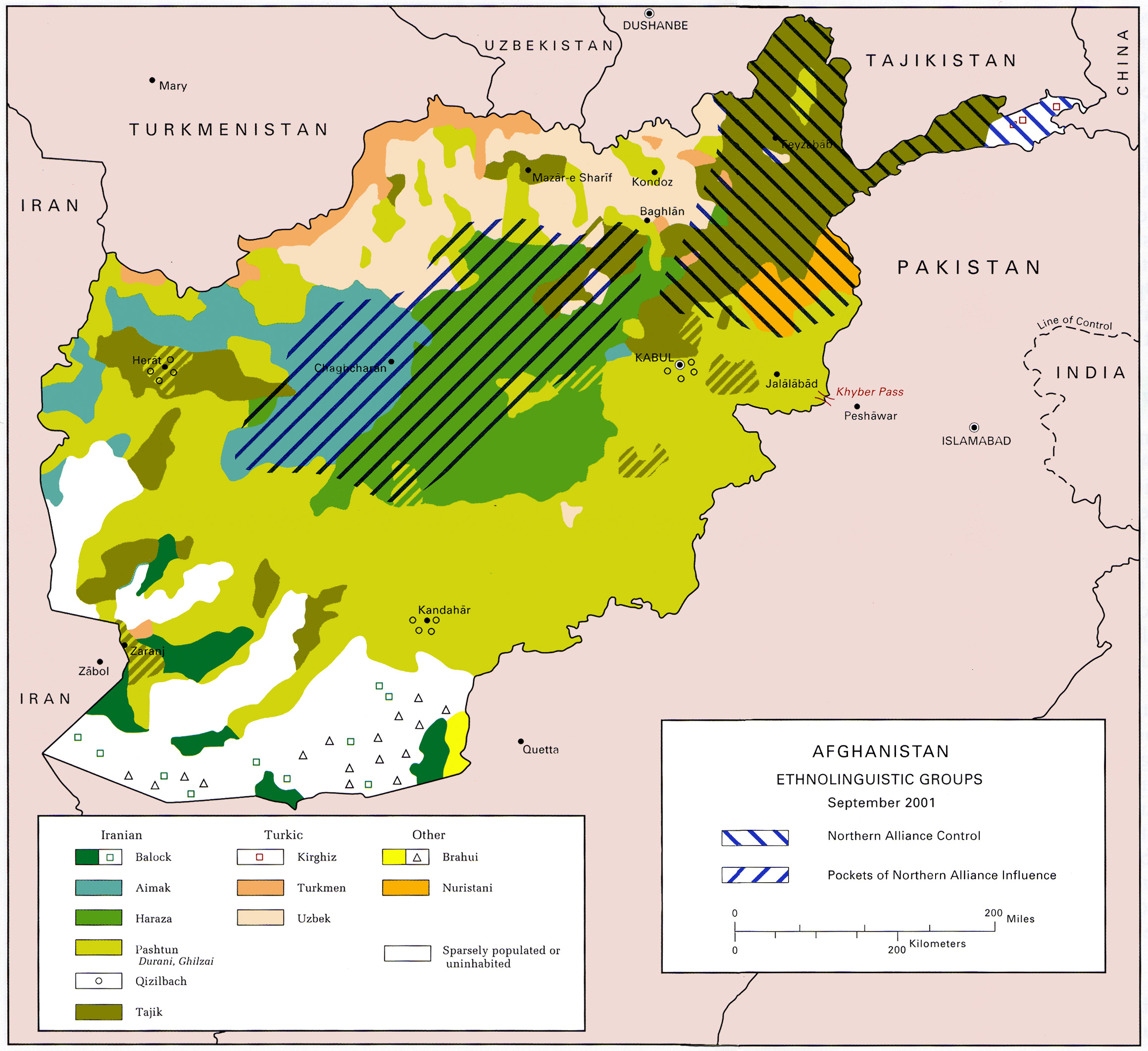
Nuristan, also spelled as Nurestan or Nooristan (Pashto: ; Katë: ), is one of the 34 provinces of Afghanistan, located in the eastern part of the country. It is divided into seven districts and is Afghanistan's least populous province, with a population of around 167,000. Parun serves as the provincial capital. Nuristan is bordered on the south by Laghman and Kunar provinces, on the north by Badakhshan province, on the west by Panjshir province, and on the east by Pakistan. The origin of the local Nuristani people has been disputed, ranging from being the indigenous inhabitants forced to flee to this region after refusing to surrender to invaders, to being linked to various ancient groups of people and the Turk Shahi kings. Some Nuristanis claim being descendants of the Greek occupying forces of Alexander the Great. It was formerly called Kafiristan () ("Land of the Infidels") until the inhabitants were forcibly converted from an animist religion with elements from In ... [...More Info...] [...Related Items...] OR: [Wikipedia] [Google] [Baidu] |
Logar Province
Logar (Pashto/Dari: لوگر) is one of the 34 provinces of Afghanistan, located in the eastern section of the country. It is divided into 7 districts and contains hundreds of villages. Puli Alam is the capital of the province. As of 2021, Logar has a population of approximately 442,037 people, most of whom are ethnic Pashtuns and Tajiks. The Logar River enters the province through the west and leaves to the north. History A 2,600-year-old Zoroastrian fire temple was found at Mes Aynak (about 25 miles or 40 kilometers southeast of Kabul). Several Buddhist stupas and more than 1,000 statues were also found. Smelting workshops, miners’ quarters (even then the site's copper was well known), a mint, two small forts, a citadel, and a stockpile of Kushan, Sassanian and Indo-Parthian coins were also found at the site. Recent history During the Soviet–Afghan War, Logar was known among some Afghans as the Bab al-Jihad (Gates of Jihad) because it became a fierce theatre o ... [...More Info...] [...Related Items...] OR: [Wikipedia] [Google] [Baidu] |
Ghor Province
Ghōr, also spelled Ghowr or Ghur (), is one of the thirty-four provinces of Afghanistan. It is located in the western Hindu Kush in central Afghanistan, towards the northwest. The province contains eleven Districts of Afghanistan, districts, encompassing hundreds of villages, and approximately 764,472 settled people. Chaghcharan, Firuzkoh (known as “Chaghcharan” until 2014) is the capital of the province. Etymology The ancient Indo-European languages, Indo-European, Sogdian language, Sogdian ''gor-''/''gur-'' ("mountain"-) is well preserved in all Slavic languages, Slavic ''gor-''/''gór- (goor-/gur-)'', e.g.: Gorals, Goran (Slavic name), Goran, Goranci (other), Goranci, Góra (other), Góra, Gora, Russia, Gora..., in Iranian languages, e.g.: Gorani language, Guran (Kurdish tribe). The Polish language, Polish notation using ''gór-'' ("ó" stands for a sound between English language, English "oo" and "u") instead of the popular ''gur-'' or ''ghur-'' preserv ... [...More Info...] [...Related Items...] OR: [Wikipedia] [Google] [Baidu] |
Bamyan Province
Bamyan, also spelled Bamiyan, Bāmīān or Bāmyān (), is one of the thirty-four provinces of Afghanistan with the city of Bamyan as its center, located in central parts of Afghanistan. The terrain in Bamyan is mountainous or semi-mountainous, at the western end of the Hindu Kush mountains concurrent with the Himalayas. The province is divided into eight districts, with the town of Bamyan serving as its capital. The province has a population of about 495,557 and borders Samangan to the north, Baghlan, Parwan, and Maidan Wardak to the east, Ghazni and Daikundi to the south, and Ghor and Sar-e-Pol to the west. It is the largest province in the Central region of Afghanistan. It was a center of commerce and Buddhism in the 4th and 5th centuries. In antiquity, central Afghanistan was strategically placed to thrive from the Silk Road caravans that crisscrossed the region, trading between the Roman Empire, Han dynasty, Central Asia, and South Asia. Bamyan was a stopping-off ... [...More Info...] [...Related Items...] OR: [Wikipedia] [Google] [Baidu] |
Kyrgyz People
The Kyrgyz people (also spelled Kyrghyz, Kirgiz, and Kirghiz; or ) are a Turkic peoples, Turkic ethnic group native to Central Asia. They primarily reside in Kyrgyzstan, Uzbekistan, and China. A Kyrgyz diaspora is also found in Russia, Tajikistan, and Kazakhstan. They speak the Kyrgyz language, which is the official language of Kyrgyzstan. The earliest people known as "Kyrgyz" were the descendants of several Central Asian tribes, first emerging in western Mongolia around 201 BC. Modern Kyrgyz people are descended in part from the Yenisei Kyrgyz that lived in the Yenisey river valley in Siberia. The Kyrgyz people were constituents of the Tiele people, the Göktürks, and the Uyghur Khaganate before establishing the Yenisei Kyrgyz Khaganate in the 9th century, and later a Kyrgyz khanate in the 15th century. Etymology There are several theories on the origin of ethnonym ''Kyrgyz''. It is often said to be derived from the Turkic languages, Turkic word ''kyrk'' ("forty"), ... [...More Info...] [...Related Items...] OR: [Wikipedia] [Google] [Baidu] |


