|
Paktika Province
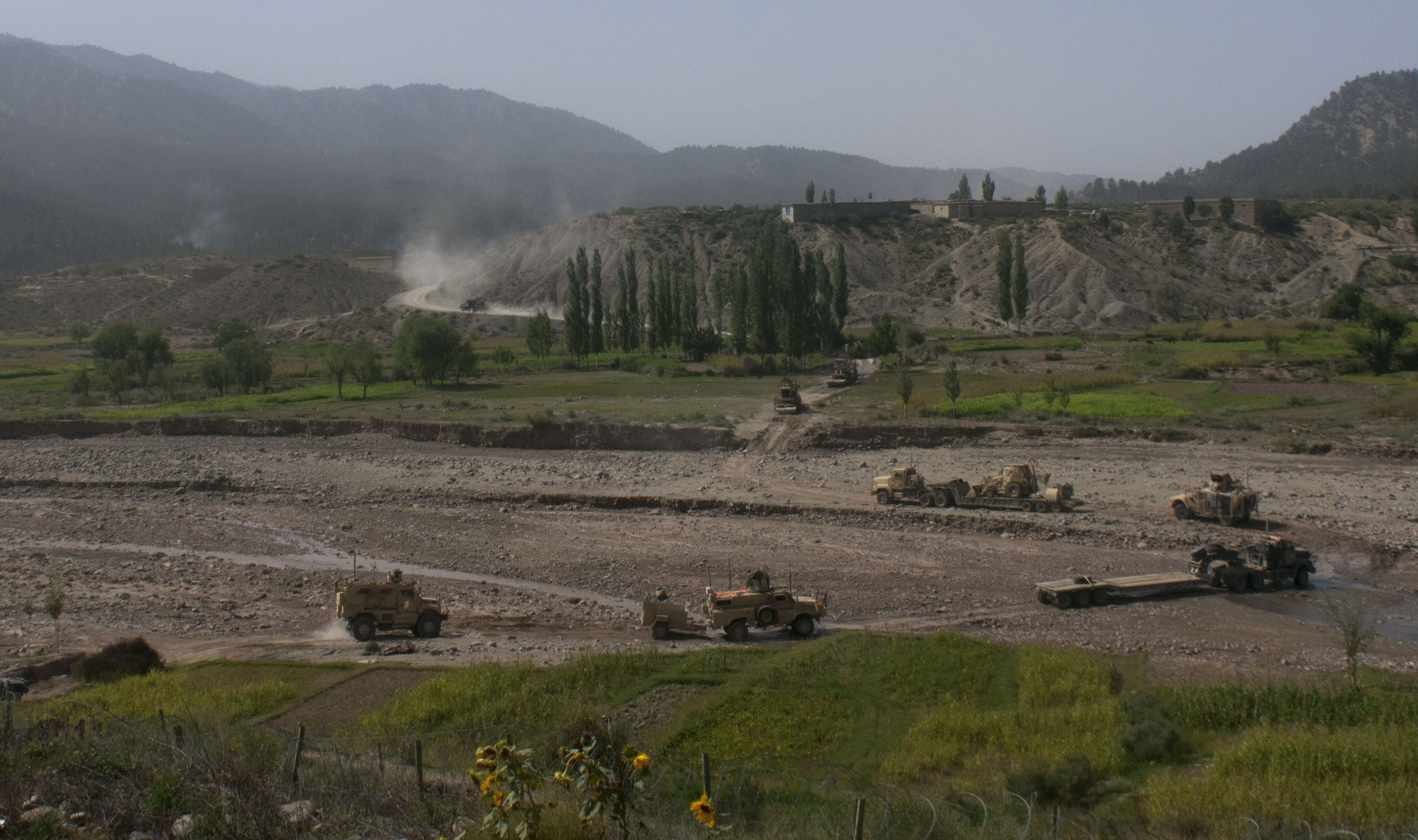
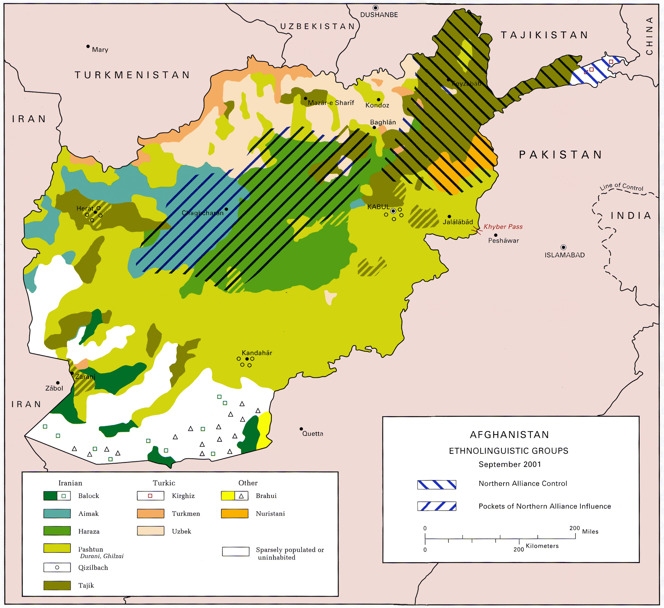
Paktika (Pashto: ) is one of the 34 provinces of Afghanistan, located in the eastern part of the country. Forming part of the larger Loya Paktia region, Paktika has a population of about 789,000 residents, who are mostly ethnic Pashtuns but smaller communities of Tajiks and others may also be found in the province. The town of Sharana serves as the provincial capital, while the most populous city is Urgun. In 2021, the Taliban gained control of the province during the 2021 Taliban offensive. Geography Paktika sits adjacent to the Durand Line border between Pakistan and Afghanistan. It is bordered by the Khost and Paktia provinces to the north. The western border is shared with the provinces of Ghazni and Zabul. The South Waziristan and North Waziristan agencies are to the east of Paktika, while Zhob District of the Balochistan province of Pakistan borders it the southeast. The Shinkay Hills run through the center of Paktika; Toba Kakar Range runs along the border with Pa ... [...More Info...] [...Related Items...] OR: [Wikipedia] [Google] [Baidu] |
Provinces Of Afghanistan
The provinces of Afghanistan ( ''Wilayah, wilāyat'') are the primary administrative divisions. Afghanistan is divided into 34 provinces. Each province encompasses a number of Districts of Afghanistan, districts or usually over 1,000 villages. Provincial governors played a critical role in the reconstruction of the Afghan state following the creation of the new government under Hamid Karzai. According to international security scholar Dipali Mukhopadhyay, many of the provincial governors of the western-backed government were former warlords who were incorporated into the political system. Provinces of Afghanistan Administrative The following table lists the province, capital, number of districts, UN region, region, ISO 3166-2:AF code and license plate code. Demographic The following table lists the province, population in 2024, area in square kilometers and population density. Regions of Afghanistan The following tables summarize data from the demographic ... [...More Info...] [...Related Items...] OR: [Wikipedia] [Google] [Baidu] |
Durand Line
The Durand Line (; ; ), also known as the Afghanistan–Pakistan border, is a international border between Afghanistan and Pakistan in South Asia. The western end runs to the border with Iran and the eastern end to the border with China. The Durand Line was established in 1893 as the international border between the Emirate of Afghanistan and the British Indian Empire by Mortimer Durand, a British diplomat of the Indian Civil Service, and Abdur Rahman Khan, the List of monarchs of Afghanistan, Emir of Afghanistan, to fix the limit of their respective Sphere of influence, spheres of influence and improve diplomatic relations and trade. Britain considered Afghanistan to be an independent state at the time, although they controlled its Ministry of Foreign Affairs (Afghanistan), foreign affairs and Foreign relations of Afghanistan, diplomatic relations. The single-page Agreement, dated 12 November 1893, contains seven short articles, including a commitment not to exercise Intervent ... [...More Info...] [...Related Items...] OR: [Wikipedia] [Google] [Baidu] |
Gomal River
The Gomal (, ) is a river in Afghanistan and Pakistan. It rises in northern Afghanistan's Paktika Province and joins the Indus River 20 miles south of Dera Ismail Khan, in Pakistan's Khyber Pakhtunkhwa province. Gomal University in Dera Ismail Khan and Gomal District in Afghanistan's Paktika province are named after the river. Etymology The name ''Gomal'' is thought to have derived from the river ''Gomati'', which is mentioned in the ''Rigveda''. Course Gomal River's headwaters are located in the northern part of Paktika Province, southeast of the city of Ghazni. The springs which form the headwaters of the Gomal's main branch emerge above the fort at Babakarkol in Katawaz, a district in Paktika inhabited by Ghilji Pashtuns from the Kharoti and Sulaimankhel clans. The Gomal's other branch, the "Second Gomal", joins the main channel about 14 miles below its source. The Gomal flows southeast through the eastern Ghilji country before entering Khyber Pakhtunkhwa, Pakistan.MacGr ... [...More Info...] [...Related Items...] OR: [Wikipedia] [Google] [Baidu] |
Dila District, Afghanistan
Dila District () is a district of Paktika Province, Afghanistan. The district is within the heartland of the Sulaimankhel tribe of Ghilji Pashtuns. Its population in 2019 was estimated to be 47,023. The area is approximately 600 km2. The seat of the district capital is Dila village, with a couple of hundred families. There are a number of other small villages in the area, with occupancies ranging from 3-50 families. Kuchi nomads migrate through the area with their families and herds of goats, sheep, and camels. The dominant tribes include the Suleiman Khel, Sultan Khel, and Jalalzai, and a considerable number of sub-tribes. The sub-governor/district leader is Habibullah, and the police chief is named Eid Gul, though Eid Gul was subsequently sighted in Doa China district. The local shura can attract over 100 elders if the event is big enough. Otherwise, the shura normally attracts about 30 elders. The area has several routes through it from Wazakhwa and Nawa to HWY 1 an ... [...More Info...] [...Related Items...] OR: [Wikipedia] [Google] [Baidu] |
Janikhel District (Paktika)
Janikhel (, ) is a district in Paktika Province, in eastern Afghanistan. It was created in 2004 out of a part of Khairkot District. Like in the rest of Afghanistan, no exact population numbers are available. The Afghan Ministry of Rural Rehabilitation & Development (MRRD) along with UNHCR and Central Statistics Office (CSO) of Afghanistan estimated the population of the district to be around 36,237 (CSO 2019). According to the same sources, Pashtuns Pashtuns (, , ; ;), also known as Pakhtuns, or Pathans, are an Iranian peoples, Iranic ethnic group primarily residing in southern and eastern Afghanistan and northwestern Pakistan. They were historically also referred to as Afghan (ethnon ... make up 100% of the total population. References Districts of Paktika Province {{Paktika-geo-stub ... [...More Info...] [...Related Items...] OR: [Wikipedia] [Google] [Baidu] |
Khairkot District
Khairkot District (), also known as Katawaz () or Zarghun Shar District (, ), is a district of Paktika Province, Afghanistan. The district is within the heartland of the Sulaimankhel tribe of Ghilji Pashtuns. The district capital is Khairkot town. In 1998, the district had an estimated population of over 75,000. However, by June 2004 the post-Taliban government separated off three new districts from the large Khairkot District. The new districts were Janikhel District, Yahyakhel District and Yusufkhel District."Paktika provincial profile" 2004, profile compiled by the National Area-Based Development Programme (NABDP) of the Ministry of Rural Rehabilitation and Development (MRRD) The district population in 2004 of the re ... [...More Info...] [...Related Items...] OR: [Wikipedia] [Google] [Baidu] |
Omna District
Omna District (, ) is a district of Paktika Province, Afghanistan. The district is within the heartland of the Sulaimankhel tribe of Ghilji Pashtuns Pashtuns (, , ; ;), also known as Pakhtuns, or Pathans, are an Iranian peoples, Iranic ethnic group primarily residing in southern and eastern Afghanistan and northwestern Pakistan. They were historically also referred to as Afghan (ethnon .... The estimated population in 2019 was 23,400. References Districts of Paktika Province {{Paktika-geo-stub ... [...More Info...] [...Related Items...] OR: [Wikipedia] [Google] [Baidu] |
Balochistan, Pakistan
Balochistan (; ; , ) is a province of Pakistan. Located in the southwestern region of the country, Balochistan is the largest province of Pakistan by land area but is the least populated one. It is bordered by the Pakistani provinces of Khyber Pakhtunkhwa to the north-east, Punjab to the east and Sindh to the south-east; shares international borders with Iran to the west and Afghanistan to the north; and is bound by the Arabian Sea to the south. Balochistan is an extensive plateau of rough terrain divided into basins by ranges of sufficient heights and ruggedness. It has a large deep sea port, the Port of Gwadar lying in the Arabian Sea. Although it makes up about 44% of the land area of Pakistan, only 5% of it is arable and it is noted for an extremely dry desert climate. Despite this, agriculture and livestock make up about 47% of Balochistan's economy. The name " Balochistan" means "the land of the Baloch people". Largely underdeveloped, its economy is also dominated by n ... [...More Info...] [...Related Items...] OR: [Wikipedia] [Google] [Baidu] |
Zhob District
Zhob District (, ) is a district in the northwestern part of Balochistan province of Pakistan. The population of Zhob District was estimated at 355,692 in 2023. Water from Zhob River is used for irrigation in the district. Administration The 1998 census report lists two sub-divisions: Lower Zhob (comprising Zhob tehsil and Sambaza sub-tehsil) and Kakar Khurasan (encompassing the tehsil of Qamar Din Karez and the subtehsil of Ashewat). A government webpage lists these as Ashwat, Qamar Din Karez, Sambaza and Zhob, without indicating if any of them are sub-tehsils. Demographics As of the[...More Info...] [...Related Items...] OR: [Wikipedia] [Google] [Baidu] |
North Waziristan
North Waziristan District (, ) is a Districts of Pakistan, district of Khyber Pakhtunkhwa province in Pakistan. It is the northern part of Waziristan, a mountainous region of northwest Pakistan, bordering Afghanistan and covering . The capital city of North Waziristan is Miranshah. Overview and history North Waziristan comprises the area west and south-west of Khyber Pakhtunkhwa between the Kurram River (Tochi) to the north and the Gomal River to the south. Miranshah is district headquarter of North Waziristan. The city of Bannu lies immediately to the east, while the largest town on the Afghan side of the border is Khost. North Waziristan is divided into the three subdivisions of Mirali, Miran Shah Subdivision, Miran Shah, and Razmak. The three subdivisions are further divided into nine tehsils: Datta Khel Tehsil, Dossali Tehsil, Gharyum Tehsil, Ghulam Khan Tehsil, Mir Ali Tehsil, Miran Shah Tehsil, Razmak Tehsil, Shewa Tehsil, Spinwam Tehsil. British (1894–1947) The B ... [...More Info...] [...Related Items...] OR: [Wikipedia] [Google] [Baidu] |
South Waziristan
South Mahsud Waziristan District () was a Districts of Pakistan, district in the Dera Ismail Khan Division of the Khyber Pakhtunkhwa province of Pakistan, before splitting into the Lower South Waziristan District and the Upper South Waziristan District on 13 April 2022. It covers around 11,585 km2 (4,473 mi2). Waziristan is located in the southwest of Khyber Pakhtunkhwa. It is situated between two rivers, the Tochi River to the north and the Gomal River to the south. The region was an independent tribal territory from 1893, separated from both Afghanistan and the United Kingdom, British-ruled empire in the subcontinent. Raiding the tribal areas was a constant problem for the British, requiring frequent punitive expeditions between 1860 and 1945. Troops of the British Raj coined a name for this region "Hell's Door Knocker" in recognition of the fearsome reputation of the local fighters and inhospitable terrain. The district headquarter of the South Waziristan district is ... [...More Info...] [...Related Items...] OR: [Wikipedia] [Google] [Baidu] |
Zabul Province
Zabul (Pashto/Dari: ) is one of the 34 provinces of Afghanistan, located in the south of the country. It has a population of 249,000. Zabul became an independent province from neighbouring Kandahar in 1963. Historically, it was part of the Zabulistan region. Qalat serves as the capital of the province. The major ethnic group are Pashtuns. Primary occupations within Zabul are agriculture and animal husbandry. Geography Zabul borders Uruzgan in the north, Kandahar in the west and in the south, Ghazni and Paktika in the east. It borders Pakistan in the east. The province covers an area of 17293 km2. Two-fifths of the province is mountainous or semi mountainous terrain (41%) while more than one quarter of the area is made up of flat land (28%). The primary ecoregion of the province is the central Afghan mountains xeric woodlands. Common vegetation is listed as dry shrub-land and pistachio. The high mountains of the northern portion of the province are in the Ghor-Hazarajat a ... [...More Info...] [...Related Items...] OR: [Wikipedia] [Google] [Baidu] |


