|
Zuwayla
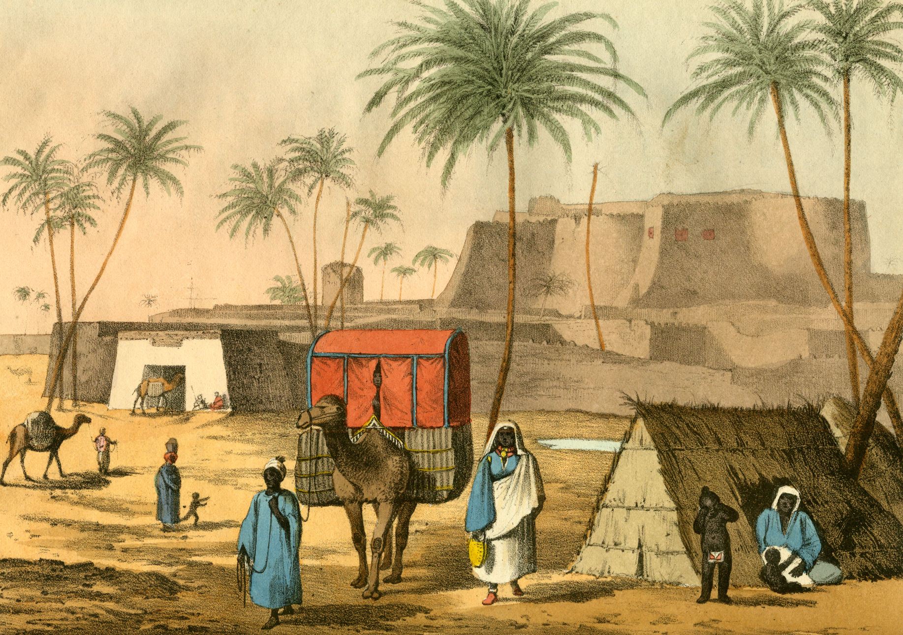
Zawila (also spelled Zuila, Zweila, Zwila, Zawilah, Zuwayla or Zuweila) is a village in southwestern Libya. During the Middle Ages, it was the capital of the Fezzan region. When Uqba ibn Nafi passed through the area in 46 A.H. (666/67 CE), there was no city there. Zawila was settled probably in the early 8th century. It very quickly became the chief town of the region. During its early history, it was dominated by the Hawwara Berbers, who mostly followed Ibadism. The Abbasids under Muhammad ibn al-Ash'ath al-Khuza'i captured the town in 762/63, and killed its Ibadi ruler, Abd Allah ibn Hayyan, but Ibadism persisted in Zuwila and the Fezzan in general. The town then became part of the Rustamid domains, albeit lying on the extreme eastern periphery of their realm. After the demise of the Rustamid dynasty at the hands of the Fatimids, in 918/19 Zawila became the capital of another independent Ibadi state, under the Berber Banu Khattab dynasty, which lasted until 1176/77. The Kanem ... [...More Info...] [...Related Items...] OR: [Wikipedia] [Google] [Baidu] |
Bab Zuwayla
Bab Zuwayla or Bab Zuweila () is one of three remaining gates in the city walls of historic Cairo in Egypt. It was also known as Bawabat al-Mitwali or Bab al-Mitwali. The gate was built in 1092 by the Fatimid vizier Badr al-Jamali. The two minaret towers on top of it were added between 1415 and 1422 as part of the construction of the adjacent Mosque of Sultan al-Muayyad. Today it remains one of the major landmarks of Cairo. Name Its name comes from ''Bab'', meaning "gate", and ''Zuwayla'', a Berber tribe originally from the town of Zawila in the Fezzan. This name was given because Fatimid soldiers from this tribe were lodged in this area when the gate was first created during the Fatimid founding of Cairo in 969. In Coptic tradition, the name was associated with Biblical Zebulun (). The gate later acquired the popular name Bab al-Mitwalior Bawabbat al-Mitwali. According to art historian Caroline Williams, this name dates from the Ottoman period. According to historian Nairy Ha ... [...More Info...] [...Related Items...] OR: [Wikipedia] [Google] [Baidu] |
Cairo
Cairo ( ; , ) is the Capital city, capital and largest city of Egypt and the Cairo Governorate, being home to more than 10 million people. It is also part of the List of urban agglomerations in Africa, largest urban agglomeration in Africa, List of largest cities in the Arab world, the Arab world, and List of largest metropolitan areas of the Middle East, the Middle East. The Greater Cairo metropolitan area is List of largest cities, one of the largest in the world by population with over 22.1 million people. The area that would become Cairo was part of ancient Egypt, as the Giza pyramid complex and the ancient cities of Memphis, Egypt, Memphis and Heliopolis (ancient Egypt), Heliopolis are near-by. Located near the Nile Delta, the predecessor settlement was Fustat following the Muslim conquest of Egypt in 641 next to an existing ancient Roman empire, Roman fortress, Babylon Fortress, Babylon. Subsequently, Cairo was founded by the Fatimid Caliphate, Fatimid dynasty in 969. It ... [...More Info...] [...Related Items...] OR: [Wikipedia] [Google] [Baidu] |
Fatimids
The Fatimid Caliphate (; ), also known as the Fatimid Empire, was a caliphate extant from the tenth to the twelfth centuries CE under the rule of the Fatimid dynasty, Fatimids, an Isma'ili Shi'a dynasty. Spanning a large area of North Africa and West Asia, it ranged from the western Mediterranean Sea, Mediterranean in the west to the Red Sea in the east. The Fatimids traced their ancestry to the Islamic prophet Muhammad's daughter Fatima and her husband Ali, the first Shia, Shi'a imam. The Fatimids were acknowledged as the rightful imams by different Isma'ili communities as well as by denominations in many other Muslim lands and adjacent regions. Originating during the Abbasid Caliphate, the Fatimids initially conquered Ifriqiya (roughly present-day Tunisia and north-eastern Algeria). They extended their rule across the Mediterranean coast and ultimately made Egypt the center of the caliphate. At its height, the caliphate included—in addition to Egypt—varying areas of the M ... [...More Info...] [...Related Items...] OR: [Wikipedia] [Google] [Baidu] |
List Of Sovereign States
The following is a list providing an overview of sovereign states around the world with information on their status and recognition of their sovereignty. The 205 listed states can be divided into three categories based on membership within the United Nations System: 193 member states of the United Nations, UN member states, two United Nations General Assembly observers#Current non-member observers, UN General Assembly non-member observer states, and ten other states. The ''sovereignty dispute'' column indicates states having undisputed sovereignty (188 states, of which there are 187 UN member states and one UN General Assembly non-member observer state), states having disputed sovereignty (15 states, of which there are six UN member states, one UN General Assembly non-member observer state, and eight de facto states), and states having a political status of the Cook Islands and Niue, special political status (two states, both in associated state, free association with New ... [...More Info...] [...Related Items...] OR: [Wikipedia] [Google] [Baidu] |
Mamluk
Mamluk or Mamaluk (; (singular), , ''mamālīk'' (plural); translated as "one who is owned", meaning "slave") were non-Arab, ethnically diverse (mostly Turkic, Caucasian, Eastern and Southeastern European) enslaved mercenaries, slave-soldiers, and freed slaves who were assigned high-ranking military and administrative duties, serving the ruling Arab and Ottoman dynasties in the Muslim world. The most enduring Mamluk realm was the knightly military class in medieval Egypt, which developed from the ranks of slave-soldiers. Originally the Mamluks were slaves of Turkic origins from the Eurasian Steppe, but the institution of military slavery spread to include Circassians, Abkhazians, Georgians, Armenians, Russians, and Hungarians, as well as peoples from the Balkans such as Albanians, Greeks, and South Slavs (''see'' Saqaliba). They also recruited from the Egyptians. The "Mamluk/Ghulam Phenomenon", as David Ayalon dubbed the creation of the specific warrior class, was ... [...More Info...] [...Related Items...] OR: [Wikipedia] [Google] [Baidu] |
Oases Of Libya
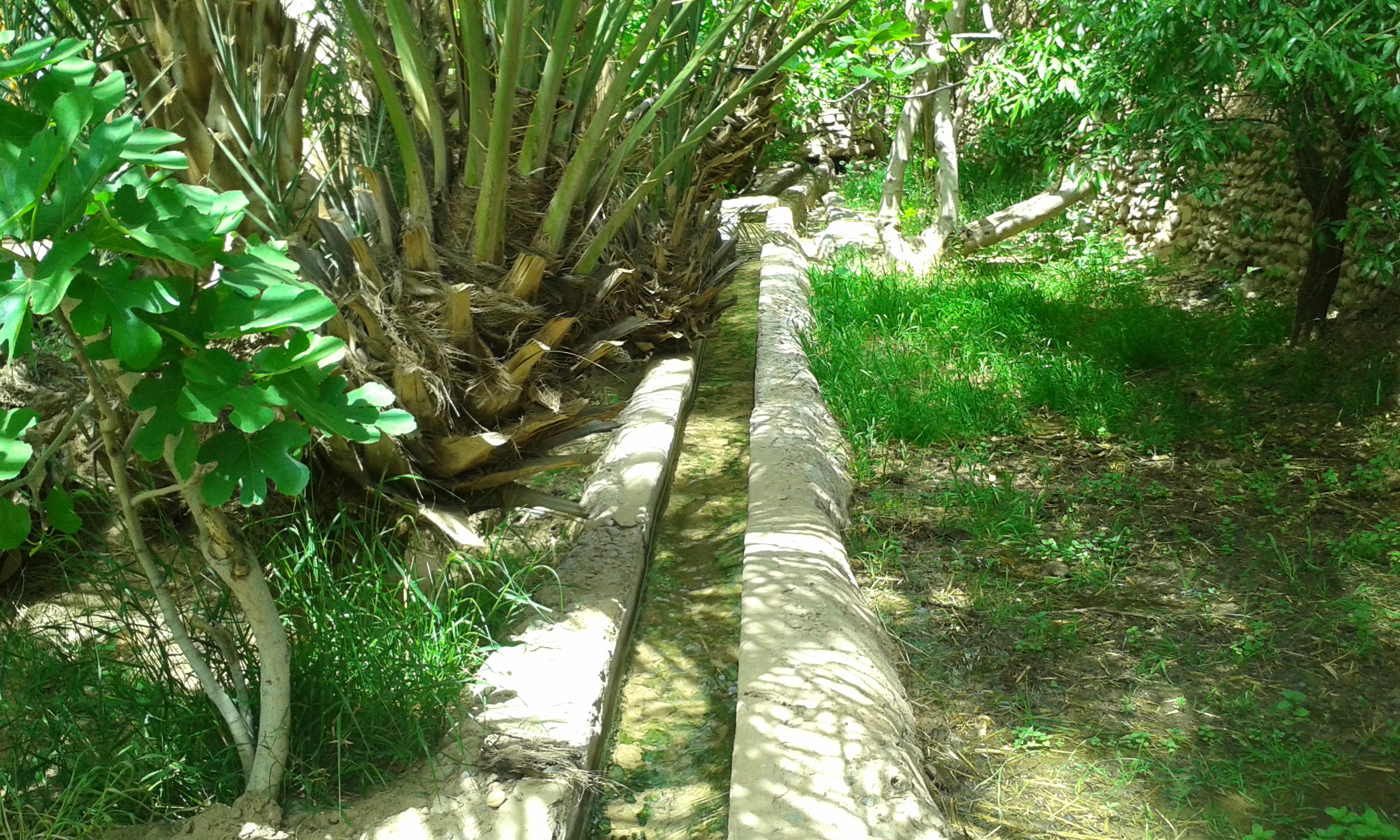
In ecology, an oasis (; : oases ) is a fertile area of a desert or semi-desert environmentBattesti, Vincent (2005) Jardins au désert: Évolution des pratiques et savoirs oasiens: Jérid tunisien. Paris: IRD éditions. . that sustains plant life and provides habitat for animals. Surface water may be present, or water may only be accessible from wells or underground channels created by humans. In geography, an oasis may be a current or past rest stop on a transportation route, or less-than-verdant location that nonetheless provides access to underground water through deep wells created and maintained by humans. Although they depend on a natural condition, such as the presence of water that may be stored in reservoirs and us ... [...More Info...] [...Related Items...] OR: [Wikipedia] [Google] [Baidu] |
Populated Places In Murzuq District
Population is a set of humans or other organisms in a given region or area. Governments conduct a census to quantify the resident population size within a given jurisdiction. The term is also applied to non-human animals, microorganisms, and plants, and has specific uses within such fields as ecology and genetics. Etymology The word ''population'' is derived from the Late Latin ''populatio'' (a people, a multitude), which itself is derived from the Latin word ''populus'' (a people). Use of the term Social sciences In sociology and population geography, population refers to a group of human beings with some predefined feature in common, such as location, race, ethnicity, nationality, or religion. Ecology In ecology, a population is a group of organisms of the same species which inhabit the same geographical area and are capable of interbreeding. The area of a sexual population is the area where interbreeding is possible between any opposite-sex pair within the area ... [...More Info...] [...Related Items...] OR: [Wikipedia] [Google] [Baidu] |
Murzuk
Murzuk, Murzuq, Murzug or Merzug () is an oasis town and the capital of the Murzuq District in the Fezzan region of southwest Libya.Robinson, Harry (1960) "Murzuq" ''The Mediterranean Lands'' University Tutorial Press, London, p. 414 It lies on the northern edge of the Murzuq Desert, an extremely arid region of ergs or great sand dunes which is part of the greater Sahara Desert. History Murzuk developed around an oasis which served as a stop on the north-south trade route across the Sahara Desert. From the 5th century BC to the 5th century AD, Marzuk was home to the Garamantian Empire, a city state which operated the Trans-Saharan trade routes between the Carthaginians—and later the Roman Empire—and the Sahelian states of West and Central Africa. By 1300, the area was ruled by the Arab Banu Sulaym tribe. According to Helmuth Kanter, a Moroccan tribe overran the area in 1310 and established Murzuk as the capital of their sultanate. The fortress, now in ruins, was built aroun ... [...More Info...] [...Related Items...] OR: [Wikipedia] [Google] [Baidu] |
Awlad Muhammad
Awlad Muhammad (or Ouled Muhammed) was a tribe that ruled over the Fezzan region from 1550 to 1812. At their height, their domain extended from Sokna, Libya, Sokna in the north to Murzuk, Murzuq in the south. Starting in 1577, the sultanate had to fend off against various attacks by the Ottoman Empire, Ottoman and the Karamanli dynasty which often resulted in the looting, capture or vassilization of Fezzan. Some of these campaigns were conducted in 1679-1682, 1690, 1716, 1718 and 1811/1812. See also *Banu Khattab *Kanem–Bornu Empire *Ottoman Tripolitania References {{more cats, date=January 2022 Tribes of Africa ... [...More Info...] [...Related Items...] OR: [Wikipedia] [Google] [Baidu] |
Kanuri People
The Kanuri people (Kanouri, Kanowri, also Yerwa, Barebari and several subgroup names) are an African ethnic group living largely in the lands of the former Kanem and Bornu Empires in Niger, Nigeria, Chad, and Cameroon, as well as a diaspora community residing in Sudan. Those generally termed Kanuri include several subgroups and dialect groups, some of whom identify as distinct from the Kanuri. Most trace their origins to ruling lineages of the medieval Kanem–Bornu Empire, and its client states or provinces. In contrast to the neighboring Toubou or Zaghawa pastoralists, Kanuri groups have traditionally been sedentary, engaging in farming, fishing the Chad Basin, trade, and salt processing. Background Kanuri peoples include several subgroups, and identify by different names in some regions. The Kanuri language was the major language of the Bornu Empire and remains a major language in southeastern Niger, northeastern Nigeria and northern Cameroon, but in Chad it is limited t ... [...More Info...] [...Related Items...] OR: [Wikipedia] [Google] [Baidu] |
Toubou People
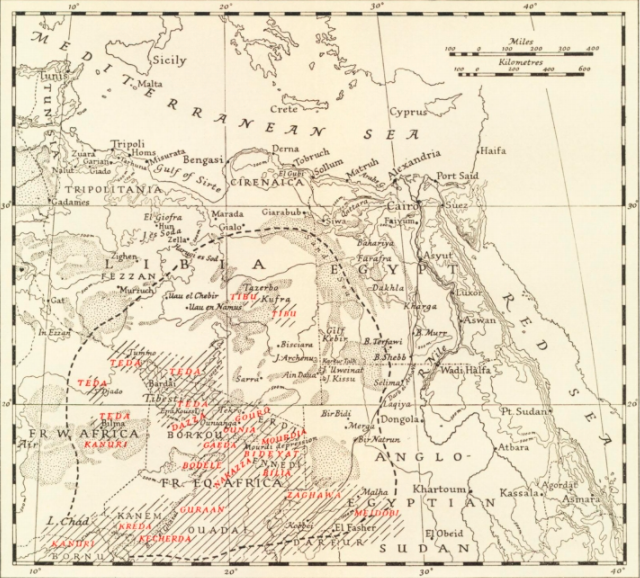
The Toubou or Tubu (from Old Tebu, meaning "rock people") are an ethnic group native to the Tibesti Mountains that inhabit the central Sahara in northern Chad, southern Libya, northeastern Niger, and northwestern Sudan. They live either as herders and nomads or as farmers near oases. Their society is clan-based, with each clan having certain oases, pastures and wells. The Toubou are generally divided into two closely related groups: the Teda (or Tuda, Téda, Toda, Tira) and the Daza (or Dazzaga, Dazagara, Dazagada). They are believed to share a common origin and speak the Tebu languages, which are from the Saharan branch of the Nilo-Saharan language family. Tebu is divided further into two closely related languages, called '' Tedaga'' (Téda Toubou) and '' Dazaga'' (Daza Toubou). Of the two groups, the Daza, found to the south of the Teda, are more numerous. The Toubou people are also referred to as the Tabu, Tebu, Tebou, Tibu, 'Tibbu, Toda, Todga, Todaga, Tubu, Tuda, Tudag ... [...More Info...] [...Related Items...] OR: [Wikipedia] [Google] [Baidu] |
Lake Chad Basin
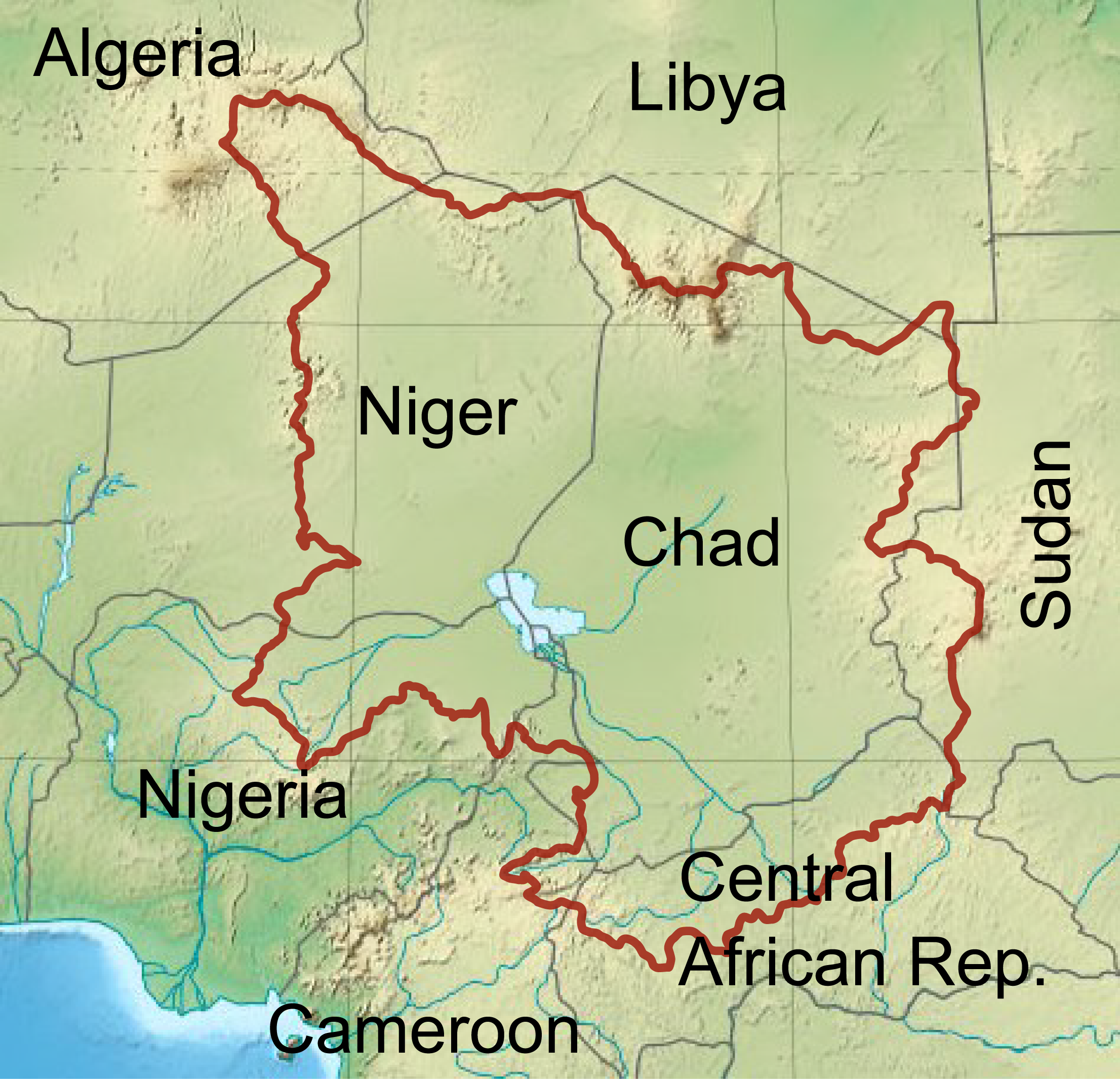
The Chad Basin is the largest endorheic basin in Africa, centered approximately on Lake Chad. It has no outlet to the sea and contains large areas of semi-arid desert and savanna. The drainage basin is approximately coterminous with the sedimentary basin of the same name, but extends further to the northeast and east. The basin spans four modern nations, including most of Chad and a large part of Niger, Nigeria and Cameroon. A combination of dams, increased irrigation, climate change, and reduced rainfall are causing water shortages. Lake Chad continues to shrink. Geology The geological basin, which is smaller than the drainage basin, is a Phanerozoic sedimentary basin formed during the plate divergence that opened the South Atlantic Ocean. The basin lies between the West African Craton and Congo Craton, and formed about the same time as the Benue Trough. It covers an area of about . It merges into the Iullemmeden Basin to the west at the Damergou gap between the Aïr and Zin ... [...More Info...] [...Related Items...] OR: [Wikipedia] [Google] [Baidu] |


