|
Ziezi
According to an anonymous Roman Chronographer of 354 CE, Ziezi was a son of Shem and a grandson of Noah. His name is mentioned in the excerpt ''Ziezi ex quo vulgares'' meaning "Ziezi, of whom the Bulgars" but being regarded as the first reference to the Bulgars as a people. Honour Ziezi Peak on Greenwich Island in the South Shetland Islands, Antarctica is named after Ziezi. SCAR Composite Gazetteer of Antarctica
The Composite Gazetteer of Antarctica (CGA) of the Scientific Committee on Antarctic Research (SCAR) is the authoritative international gazetteer containing all Antarctic toponyms published in national gazetteers, plus basic inf ...
[...More Info...] [...Related Items...] OR: [Wikipedia] [Google] [Baidu] |
Ziezi Peak
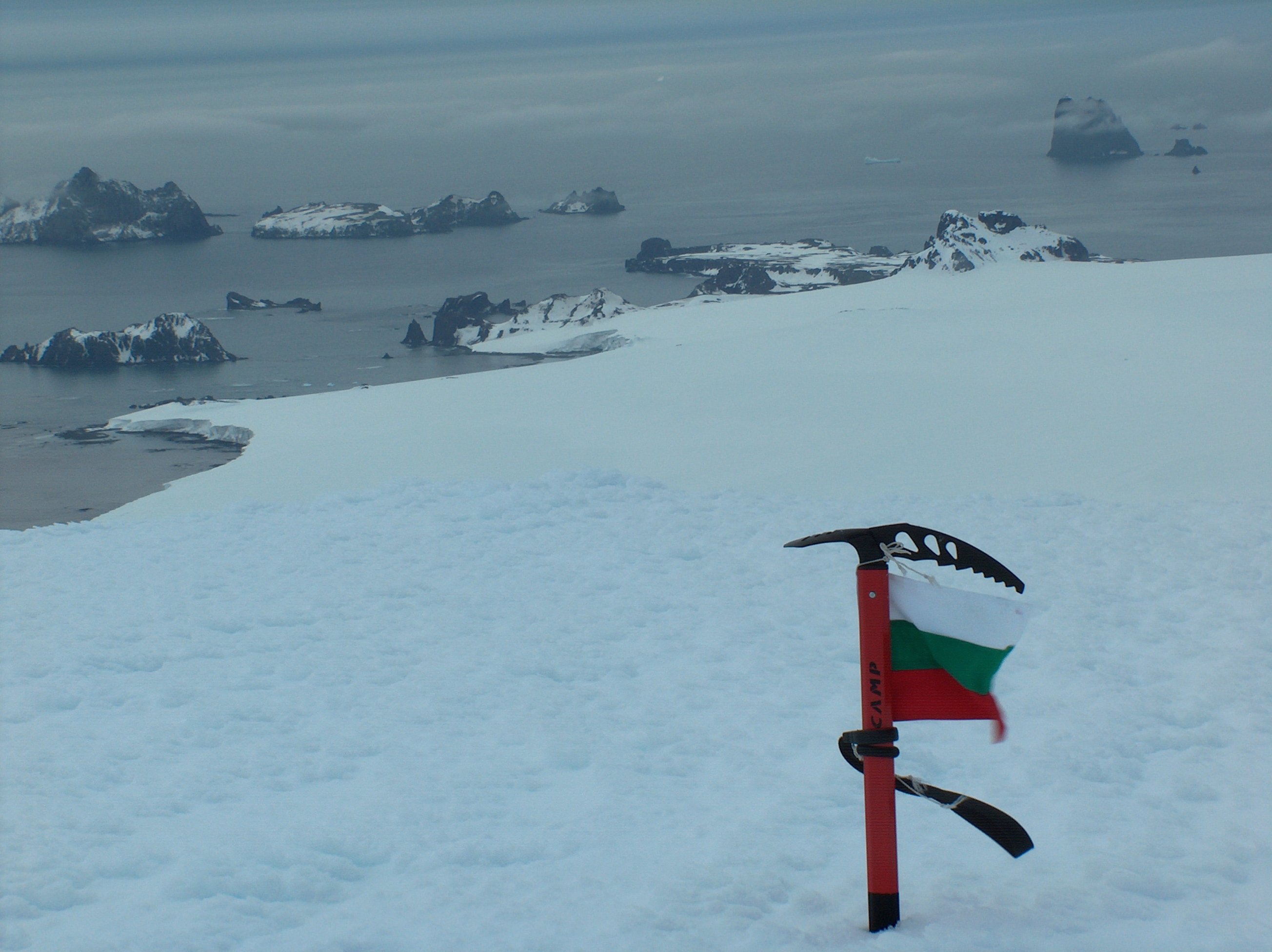
Ziezi Peak (, ) ia s rocky peak rising to 320 m in the southeast extremity of Breznik Heights on Greenwich Island in the South Shetland Islands, Antarctica overlooking Targovishte Glacier to the west. The feature is named after Ziezi, the mythical grandson of Noah, from whom the Bulgars descended, according to the 354 AD Roman Chronograph of Ravenna. Location The peak is located at which is 1.35 km east of Viskyar Ridge, 500 m south of Drangov Peak and 430 m west of Kormesiy Peak. Bulgarian topographic survey Tangra 2004/05 and mapping in 2009. Maps * L.L. Ivanov et al. Antarctica: Livingston Island and Greenwich Island, South Shetland Islands. Scale 1:100000 topographic map. Sofia: Antarctic Place-names Commission of Bulgaria, 2005. * L.L. IvanovAntarctica: Livingston Island and Greenwich, Robert, Snow and Smith Islands.Scale 1:120000 topographic map. Troyan: Manfred Wörner Foundation, 2009. References Ziezi Peak.SCAR Composite Gazetteer of Antarctica Bulgaria ... [...More Info...] [...Related Items...] OR: [Wikipedia] [Google] [Baidu] |
Bulgars
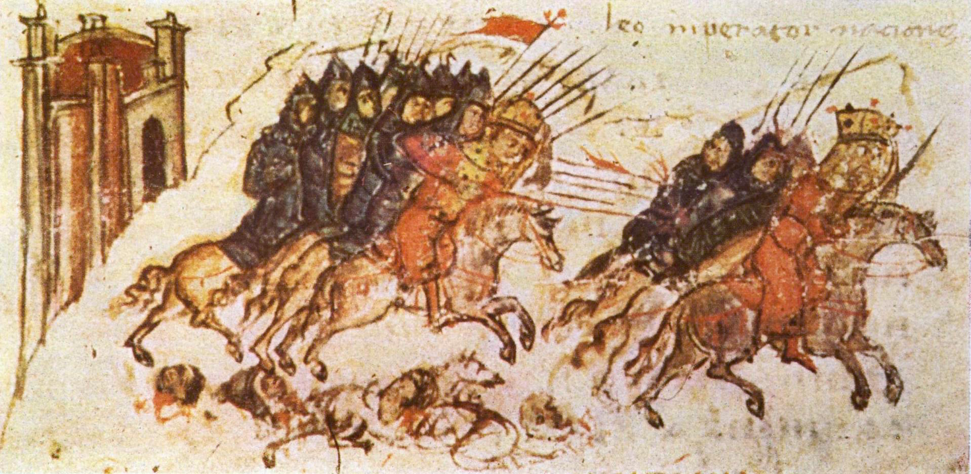
The Bulgars (also Bulghars, Bulgari, Bolgars, Bolghars, Bolgari, Proto-Bulgarians) were Turkic peoples, Turkic Nomad, semi-nomadic warrior tribes that flourished in the Pontic–Caspian steppe and the Volga region between the 5th and 7th centuries. They became known as Eurasian nomads, nomadic equestrians in the Volga-Ural region, but some researchers trace Bulgar ethnic roots to Central Asia. During their westward migration across the Eurasian Steppe, the Bulgar tribes absorbed other tribal groups and cultural influences in a process of ethnogenesis, including Iranian peoples, Iranic, Finno-Ugric peoples, Finno-Ugric, and Huns, Hunnic tribes. The Bulgars spoke a Turkic languages, Turkic language, the Bulgar language of the Oghur languages, Oghuric branch. They preserved the military titles, organization, and customs of Eurasian steppes as well as pagan shamanism and belief in the sky deity Tengri, Tangra. The Bulgars became semi-sedentary during the 7th century in the Pontic- ... [...More Info...] [...Related Items...] OR: [Wikipedia] [Google] [Baidu] |
Ancient Rome
In modern historiography, ancient Rome is the Roman people, Roman civilisation from the founding of Rome, founding of the Italian city of Rome in the 8th century BC to the Fall of the Western Roman Empire, collapse of the Western Roman Empire in the 5th century AD. It encompasses the Roman Kingdom (753–509 BC), the Roman Republic (50927 BC), and the Roman Empire (27 BC476 AD) until the fall of the western empire. Ancient Rome began as an Italic peoples, Italic settlement, traditionally dated to 753 BC, beside the River Tiber in the Italian peninsula. The settlement grew into the city and polity of Rome, and came to control its neighbours through a combination of treaties and military strength. It eventually controlled the Italian Peninsula, assimilating the Greece, Greek culture of southern Italy (Magna Graecia) and the Etruscans, Etruscan culture, and then became the dominant power in the Mediterranean region and parts of Europe. At its hei ... [...More Info...] [...Related Items...] OR: [Wikipedia] [Google] [Baidu] |
Chronograph Of 354
The Chronograph of 354 is a compilation of chronological and calendrical texts produced in 354 AD for a wealthy Roman Christian named Valentinus by the calligrapher and manuscript illuminator, illustrator Furius Dionysius Filocalus. The original illuminated manuscript, illustrated manuscript is lost, but several copies have survived. It is the earliest known codex to have had full page illustrations. The work is also called the Chronography or Calendar of 354, and the name Calendar of Filocalus or Filocalian Calendar is sometimes used to describe the whole collection, and sometimes just the sixth part, which is the Calendar itself. Other versions of the names ("Philocalus", "Philocalian", "Codex-Calendar of 354", etc.) are occasionally used. The text and illustrations are available online. It has had a variety of other names over the years; the historian Theodor Mommsen titled it "Chronica urbis Romae". Amongst other historically significant information, the work contains the e ... [...More Info...] [...Related Items...] OR: [Wikipedia] [Google] [Baidu] |
Shem
Shem (; ''Šēm''; ) is one of the sons of Noah in the Bible ( Genesis 5–11 and 1 Chronicles 1:4). The children of Shem are Elam, Ashur, Arphaxad, Lud and Aram, in addition to unnamed daughters. Abraham, the patriarch of Jews, Christians, and Muslims, is one of the descendants of Arphaxad. In medieval and early modern European tradition he was considered to be the ancestor of the peoples of Asia, Javakhishvili, Ivane (1950), ''Historical-Ethnological problems of Georgia, the Caucasus and the Near East''. Tbilisi, pp. 130–135 (in Georgian). and he gives his name to the title " Semites" formerly given to West Asian peoples. Islamic literature describes Shem as one of the believing sons of Noah. Some sources even identify Shem as a prophet in his own right and that he was the next prophet after his father. In the Bible Genesis 10 Genesis 10:21 refers to relative ages of Shem and his brother Japheth, but with sufficient ambiguity to have yielded different Engli ... [...More Info...] [...Related Items...] OR: [Wikipedia] [Google] [Baidu] |
Noah
Noah (; , also Noach) appears as the last of the Antediluvian Patriarchs (Bible), patriarchs in the traditions of Abrahamic religions. His story appears in the Hebrew Bible (Book of Genesis, chapters 5–9), the Quran and Baháʼí literature, Baha'i writings, and extra-canonical, extracanonically. The Genesis flood narrative is among the best-known stories of the Bible. In this account, God "regrets" making mankind because they filled the world with evil. Noah then labors faithfully to build the Noah's Ark, Ark at God's command, ultimately saving not only his own family, but mankind itself and all land animals, from extinction during the Great Flood, Flood. Afterwards, God makes a Covenant (biblical), covenant with Noah and promises never again to destroy the earth with a flood. Noah is also portrayed as a "tiller of the soil" who is the first to cultivate the vine. After the flood, God commands Noah and his sons to "be fruitful, and multiply, and replenish the earth." The sto ... [...More Info...] [...Related Items...] OR: [Wikipedia] [Google] [Baidu] |
Greenwich Island
Greenwich Island (variant historical names ''Sartorius Island'', ''Berezina Island'') is an island long and from (average ) wide, lying between Robert Island and Livingston Island in the South Shetland Islands, Antarctica. The island's surface area is . The name Greenwich Island dates back to at least 1821 and is now established in international usage. The Chilean base Arturo Prat and the Ecuadorian base Pedro Vicente Maldonado are situated on the northeast and north coast of the island, respectively. Chilean scientists have claimed that Amerinds visited the area, due to stone artifacts recovered from bottom-sampling operations off the island; however, the artefacts — two arrowheads — were later found to have been planted. See also * Breznik Heights * Composite Antarctic Gazetteer * Dryanovo Heights * List of Antarctic islands south of 60° S * SCAR * Tangra 2004/05 Expedition * Territorial claims in Antarctica Maps Chart of South Shetland including Coronation ... [...More Info...] [...Related Items...] OR: [Wikipedia] [Google] [Baidu] |
South Shetland Islands
The South Shetland Islands are a group of List of Antarctic and subantarctic islands, Antarctic islands located in the Drake Passage with a total area of . They lie about north of the Antarctic Peninsula, and between southwest of the nearest point of the South Orkney Islands. By the Antarctic Treaty System, Antarctic Treaty of 1959, the islands' sovereignty is neither recognized nor disputed by the signatories. According to British government language on the topic, "the whole of Antarctica is protected in the interests of peace and science." The islands have been claimed by three countries, beginning with the United Kingdom since 1908 (since 1962 as part of the equally unrecognized British Antarctic Territory). The islands are also claimed by the governments of Chile (since 1940, as part of the Antártica Chilena province), and by Argentina (since 1943, as part of Argentine Antarctica, Tierra del Fuego Province, Argentina, Tierra del Fuego Province). Several countries ... [...More Info...] [...Related Items...] OR: [Wikipedia] [Google] [Baidu] |
Antarctica
Antarctica () is Earth's southernmost and least-populated continent. Situated almost entirely south of the Antarctic Circle and surrounded by the Southern Ocean (also known as the Antarctic Ocean), it contains the geographic South Pole. Antarctica is the fifth-largest continent, being about 40% larger than Europe, and has an area of . Most of Antarctica is covered by the Antarctic ice sheet, with an average thickness of . Antarctica is, on average, the coldest, driest, and windiest of the continents, and it has the highest average elevation. It is mainly a polar desert, with annual Climate of Antarctica#Precipitation, precipitation of over along the coast and far less inland. About 70% of the world's freshwater reserves are frozen in Antarctica, which, if melted, would raise global sea levels by almost . Antarctica holds the record for the Lowest temperature recorded on Earth, lowest measured temperature on Earth, . The coastal regions can reach temperatures over in the ... [...More Info...] [...Related Items...] OR: [Wikipedia] [Google] [Baidu] |
Composite Gazetteer Of Antarctica
The Composite Gazetteer of Antarctica (CGA) of the Scientific Committee on Antarctic Research (SCAR) is the authoritative international gazetteer containing all Antarctic toponyms published in national gazetteers, plus basic information about those names and the relevant geographical features. The Gazetteer includes also parts of the International Hydrographic Organization (IHO) General Bathymetric Chart of the Oceans (GEBCO) gazetteer for under-sea features situated south of 60° south latitude. , the overall content of the CGA amounts to 37,893 geographic names for 19,803 features including some 500 features with two or more entirely different names, contributed by the following sources: {, class="wikitable sortable" ! Country ! Names , - , United States , 13,192 , - , United Kingdom , 5,040 , - , Russia , 4,808 , - , New Zealand , 2,597 , - , Australia , 2,551 , - , Argentina , 2,545 , - , Chile , 1,866 , - , Norway , 1,706 , - , Bulgaria , 1,450 , - , G ... [...More Info...] [...Related Items...] OR: [Wikipedia] [Google] [Baidu] |


