|
Nyingchi Prefecture
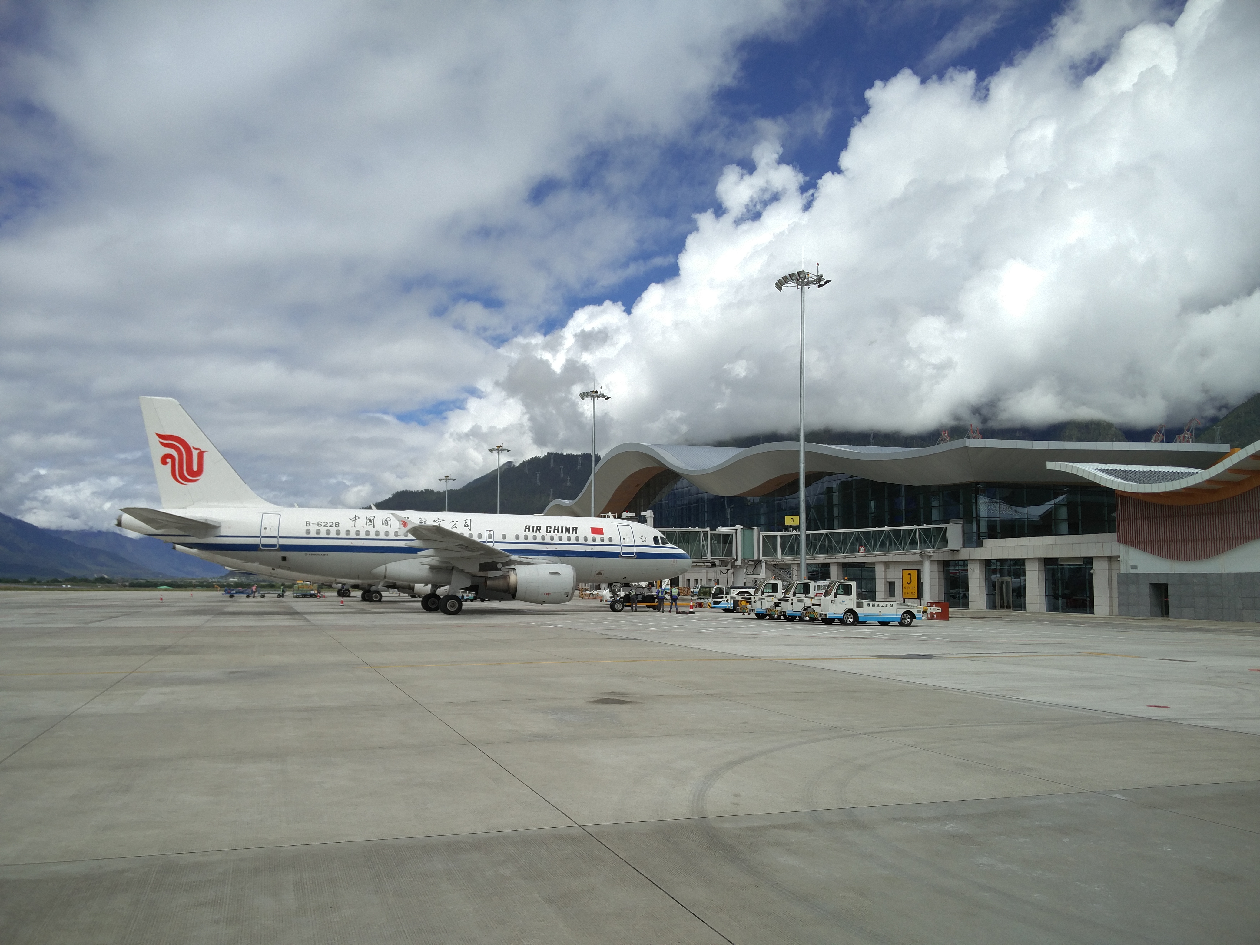
Nyingchi (), also known as Linzhi ( zh, s=林芝, p=Linzhi) or Nyingtri, is a prefecture-level city in the southeast of the Tibet Autonomous Region in China. The administrative seat of Nyingchi is Bayi District. Nyingchi is the location of Buchu Monastery. History The origins of Nyingchi date back to Tibet's prehistoric era. Researchers discovered several human bones and burial groups from the Neolithic Age near the Niyang River in the 1970s, suggesting that humans in Nyingchi were engaged in slash-and-burn agriculture and led a relatively sedentary lifestyle as early as 4,000-5,000 years ago. Unearthed artifacts, including net pendants and arrowheads, indicate that the inhabitants of this region, along the ancient Niyang River, Yarlung Zangbo River, and ancient lakes, were involved in both cultivation and fishing activities along the riverbanks. Initially, Linzhi was under the dominion of the King of Kongpo. In the Sakya and Patrul epochs (13th-16th centuries), Nyingc ... [...More Info...] [...Related Items...] OR: [Wikipedia] [Google] [Baidu] |
Zayul River
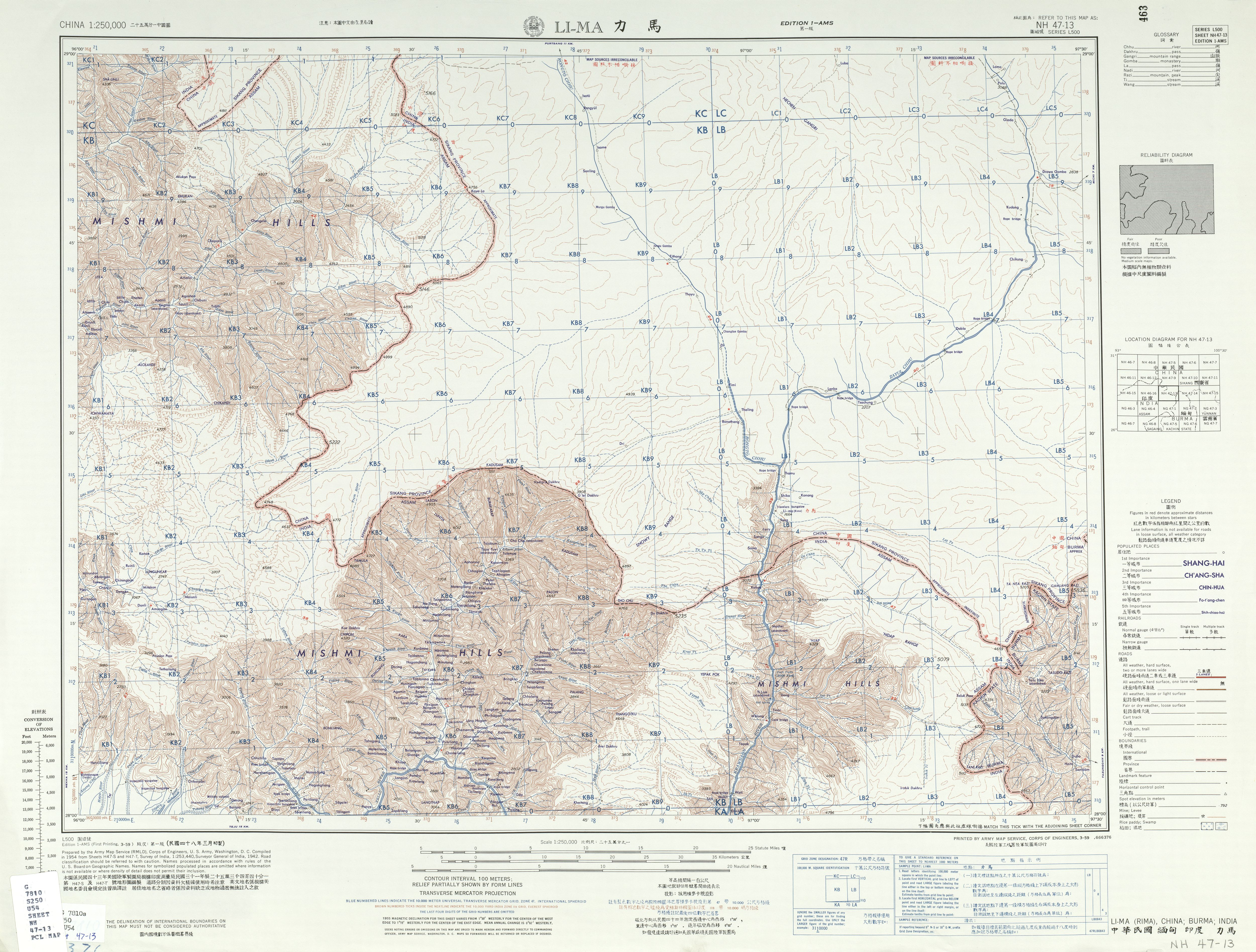
The Lohit River, whose name came from the Assamese word ''Lohit'' meaning 'blood', also known as the Zayul Chu by the Tibetans, Tilao by the Ahoms and Tellu by the Mishmis, is a river in China and India, which joins the Brahmaputra River in the state of Assam. It is formed in the Zayul County of the Tibet Autonomous Region, through a merger of two rivers: the Kangri Karpo Chu (also called Rongto Chu and Zayul Ngu Chu), which originates in the Kangri Karpo range, and Zayul Chu (), which originates to its northeast. The two rivers merge below the town of Rima. The combined river descends through this mountainous region and surges through Arunachal Pradesh in India for before entering the plains of Assam where it is known as the Lohit River. Tempestuous and turbulent, and known as the river of blood partly attributable to the lateritic soil, it flows through the Mishmi Hills, to meet the Siang (Brahmaputra) at the head of the Brahmaputra valley. Course Thickly f ... [...More Info...] [...Related Items...] OR: [Wikipedia] [Google] [Baidu] |
Rima, Tibet
__NOTOC__ Rima (; ) is the former capital of the Zayul in the southeastern Tibet Autonomous Region of China. It is on the border with India's Arunachal Pradesh Arunachal Pradesh (; ) is a States and union territories of India, state in northeast India. It was formed from the North-East Frontier Agency (NEFA) region, and India declared it as a state on 20 February 1987. Itanagar is its capital and la ... at the confluence of the ''Rongto Chu'' and ''Zayul Chu'' rivers, which join to form the Zayul River (or Lohit River) before it flows into Arunachal Pradesh. Rima was a notable border trading town, which the British contemplated as a location for a trade mart in the Lhasa Convention. References Bibliography * * * Populated places in Nyingchi {{Tibet-geo-stub ... [...More Info...] [...Related Items...] OR: [Wikipedia] [Google] [Baidu] |
County (People's Republic Of China)
Counties ( zh, s=县, labels=no) are found in the County-level divisions of China, third level of the administrative hierarchy in Provinces of China, provinces and Autonomous regions of China, autonomous regions and the second level in Direct-controlled municipality#People's Republic of China, municipalities and Hainan, a level that is known as "county level" and also contains autonomous county, autonomous counties, county-level city, county-level cities, Banners of Inner Mongolia, banners, Banners of Inner Mongolia#Autonomous banners, autonomous banners and District (China)#Ethnic districts, city districts. There are 1,355 counties in mainland China out of a total of 2,851 county-level divisions. The term ''xian'' is sometimes translated as "district" or "prefecture" when put in the context of History of China, Chinese history. History ''Xian'' have existed since the Warring States period and were set up nationwide by the Qin dynasty. The number of counties in China proper ... [...More Info...] [...Related Items...] OR: [Wikipedia] [Google] [Baidu] |
Chamdo
Chamdo, officially Qamdo () and also known in Chinese as Changdu (), is a prefecture-level city in the eastern part of the Tibet Autonomous Region, China. Its seat is the town of Chengguan in Karuo District. Chamdo is Tibet's third largest city after Lhasa and Shigatse.Buckley and Straus 1986, p. 215. Chamdo is divided into 11 county-level divisions: one district and ten counties. The main district is Karuo District. Other counties include Jonda County, Gonjo County, Riwoche County, Dengqen County, Zhag'yab County, Baxoi County, Zognang County, Maarkam County, Lhorong County, and Banbar County. History On 11 July 2014 Chamdo Prefecture was upgraded into a prefecture-level city. Languages Languages spoken in Chamdo include Khams Tibetan and the Chamdo languages of Lamo, Larong, and Drag-yab. Transportation Air Changdu Bangda Airport, opened in 1994, is located from Chengguan Town in Karub District. The long commute (2.5 hours by mountain road) is the result of ... [...More Info...] [...Related Items...] OR: [Wikipedia] [Google] [Baidu] |
Tibetan Empire
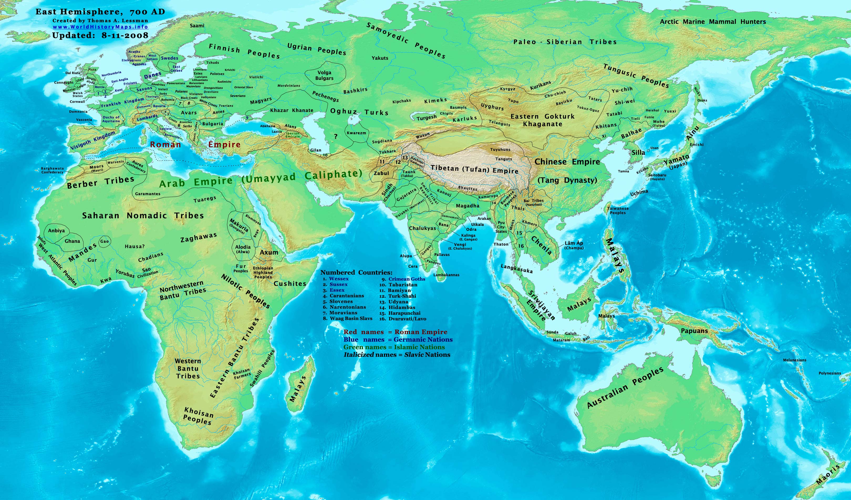
The Tibetan Empire (,) was an empire centered on the Tibetan Plateau, formed as a result of expansion under the Yarlung dynasty heralded by its 33rd king, Songtsen Gampo, in the 7th century. It expanded further under the 38th king, Trisong Detsen, and reached its greatest extent under the 40th king, Ralpacan, Ralpachen, stretching east to Chang'an, west beyond modern Afghanistan, south into modern India and the Bay of Bengal. The Yarlung dynasty was founded in 127 BC in the Yarlung Valley along the Yarlung River, south of Lhasa. The Yarlung capital was moved in the 7th century from the palace Yumbulingka to Lhasa by the 33rd king Songtsen Gampo, and into the Red Fort during the imperial period which continued to the 9th century. The beginning of the imperial period is marked in the reign of the 33rd king of the Yarlung dynasty, Songtsen Gampo. The power of Tibet's military empire gradually increased over a diverse terrain. During the reign of Trisong Detsen, the empire became ... [...More Info...] [...Related Items...] OR: [Wikipedia] [Google] [Baidu] |
Phagmodrupa Dynasty
The Phagmodrupa dynasty or Pagmodru (, ; ) was a dynastic regime that held sway over Tibet or parts thereof from 1354 to the early 17th century. It was established by Tai Situ Changchub Gyaltsen of the Lang () family at the end of the Yuan dynasty. The dynasty had a lasting importance on the history of Tibet; it created an autonomous kingdom after Yuan rule, revitalized the national culture, and brought about a new legislation that survived until the 1950s. Nevertheless, the Phagmodrupa had a turbulent history due to internal family feuding and the strong localism among noble lineages and fiefs. Its power receded after 1435 and was reduced to Ü (East Central Tibet) in the 16th century due to the rise of the ministerial family of the Rinpungpa. It was defeated by the rival Tsangpa dynasty in 1613 and 1620, and was formally superseded by the Ganden Phodrang regime founded by the 5th Dalai Lama in 1642. In that year, Güshi Khan of the Khoshut formally transferred the old posse ... [...More Info...] [...Related Items...] OR: [Wikipedia] [Google] [Baidu] |
Tibet (1912–1951)
Tibet () was a Limited recognition, ''de facto'' independent state in East Asia that lasted from the collapse of the Qing dynasty in 1912 until its Annexation of Tibet by the People's Republic of China, annexation by the People's Republic of China in 1951.; The Tibetan Ganden Phodrang regime was a Tibet under Qing rule, protectorate under Qing rule until 1910 when the Qing dynasty decided to assert greater control over the region. In 1912 the Provisional Government of the Republic of China (1912), provisional government of the Republic of China (ROC) succeeded the Qing and received an Imperial Edict of the Abdication of the Qing Emperor, imperial edict inheriting the claims over all of its territories. However, the newly formed ROC was unable to assert any real authority in Tibet. The 13th Dalai Lama declared that Tibet's relationship with China ended with the fall of the Qing dynasty and proclaimed independence, although this was not formally recognized by other countries. Tibe ... [...More Info...] [...Related Items...] OR: [Wikipedia] [Google] [Baidu] |
Pome County
In botany, a pome is a type of fruit produced by flowering plants in the subtribe Malinae of the family Rosaceae. Pome fruits consist of a central "core" containing multiple small seeds, which is enveloped by a tough membrane and surrounded by an edible layer of flesh. Pome fruit trees are deciduous, and undergo a dormant winter period that requires cold temperatures to break dormancy in spring. Well-known pomes include the apple, pear, and quince. Etymology The word ''pome'' entered English in the late 14th century, and referred to an apple or an apple-shaped object. It derived from the Old French word for "apple": (12th century; modern French is ), which in turn derived from the Late Latin or Vulgar Latin word "apple", originally the plural of Latin "fruit", later "apple". Morphology A pome is an accessory fruit composed of one or more Gynoecium, carpels surrounded by accessory tissue. The accessory tissue is interpreted by some specialists as an extension of the recept ... [...More Info...] [...Related Items...] OR: [Wikipedia] [Google] [Baidu] |
Prefecture-level Divisions Of China
zh, p=Dì Jí Xíngzhèngqū, labels=no , alt_name = , map = , category = Second level administrative division of a unitary state , territory = China , start_date = , current_number = 339 prefecture-level divisions including 6 in Taiwan Province , number_date = , population_range = 444 ( Sansha) – 14,047,625 (Chengdu) , area_range = ( Sansha) – ( Bayingolin) , government = Various, provincial government, central government , subdivision = Counties China is officially divided into 339 prefecture-level divisions, which rank below provinces and above counties as the second-level administrative division in the country. Of these, 333 are located in territory controlled by the People's Republic of China, while 6 are located in land controlled by Taiwan. There are four types of prefecture-level divisions: *299 Prefecture-level cities (293 in mainland China and 6 in the clai ... [...More Info...] [...Related Items...] OR: [Wikipedia] [Google] [Baidu] |


