|
Zatolmin
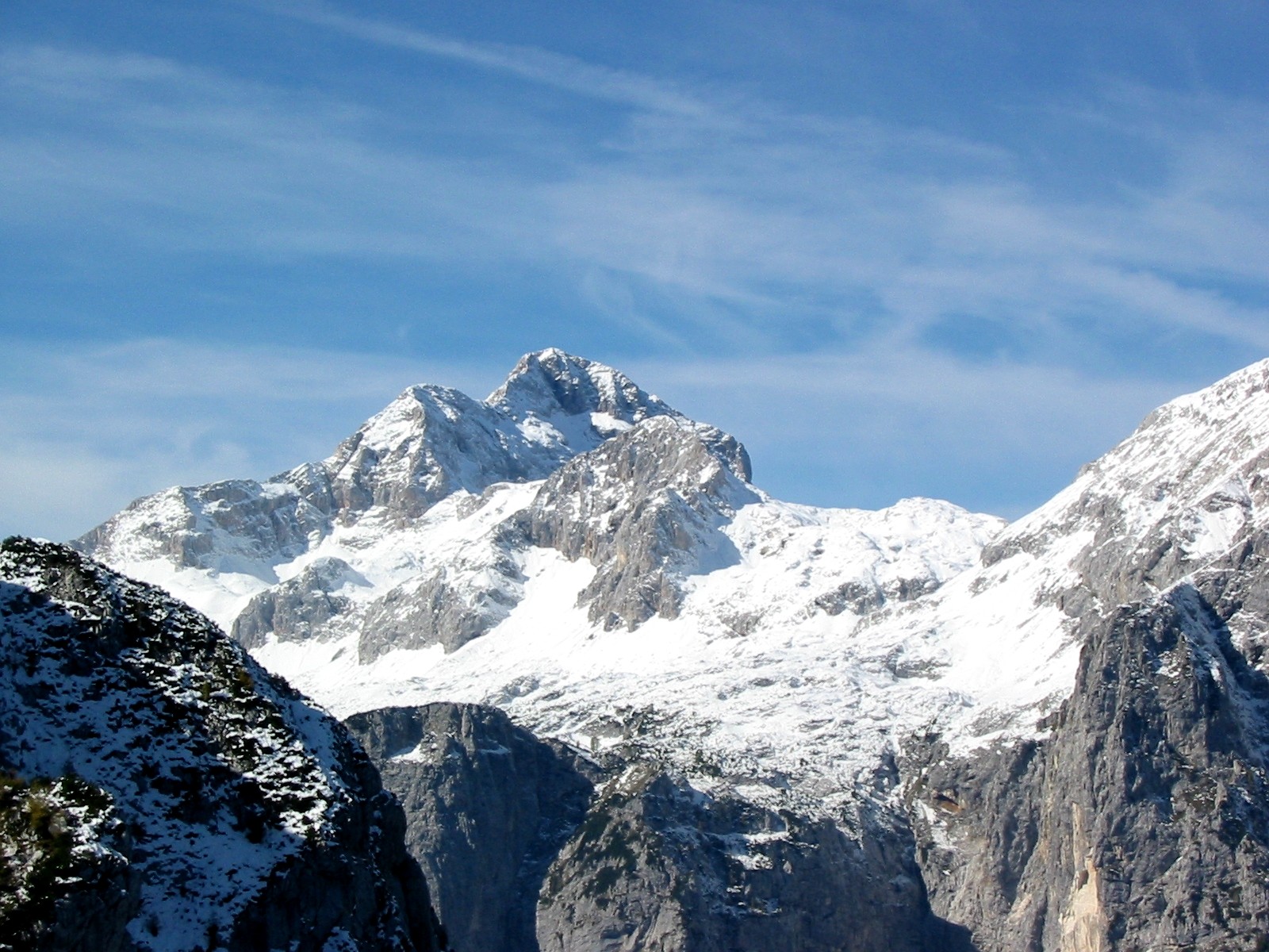
Zatolmin () is a settlement north of Tolmin in the Slovenian Littoral, Littoral region of Slovenia. Geography The territory of the settlement extends north from the village into the Julian Alps, with the highest elevation at Leskovca Peak ( sl, Leskovški vrh), also known as Mount Maselnik (). Podlog Cave ( sl, Podloška jama) lies below Mount Osojnica to the northeast; the cave is long and deep. Churches The local church is dedicated to Saint Peter and belongs to the Parish of Tolmin. A Church of the Holy Spirit, Javorca, second church of the Holy Spirit, built in the hills high above the settlement in the area known as Javorca, is a memorial church from the First World War and is dedicated to the Holy Spirit. The church was built by Austrian soldiers in 1916 based on plans by the Austrian architect Remigius Geyling (1878–1974). Its exterior portrays the stylized crests of the kingdoms and provinces of Austria-Hungary. The brightly colored interior of the church is decorated i ... [...More Info...] [...Related Items...] OR: [Wikipedia] [Google] [Baidu] |
Church Of The Holy Spirit, Javorca
Holy Spirit Church, Javorca is a memorial church near Zatolmin in Slovenia. It is located on Javorca Hill (elevation: ) above the Polog Plateau, and is about from the village. It was built as a memorial church for fallen soldiers on the Battles of the Isonzo. Near the church is located Blek's farmhouse, which was renovated in the year 1998, after the earthquake in Posočje, but doesn't have any residents. Access to the church is on the road from Zatolmin, which goes steep above the Tolminka River and crosses several smaller streams and smaller waterfalls. Not far from Javorca is a permanent settlement Zastenar farmhouse. Holy Spirit Church on Javorca was built between 1 March 1916 and 1 November 1916 in the times of Battles of the Isonzo. It was designed by Vienna's architect and lieutenant Remigius Geyling an Austrian painter, who was friend of Gustav Klimt in Vienna. Construction leader was a Hungarian Geza Jablonsky. The church was built in solidarity within the 3rd mountain br ... [...More Info...] [...Related Items...] OR: [Wikipedia] [Google] [Baidu] |
Municipality Of Tolmin
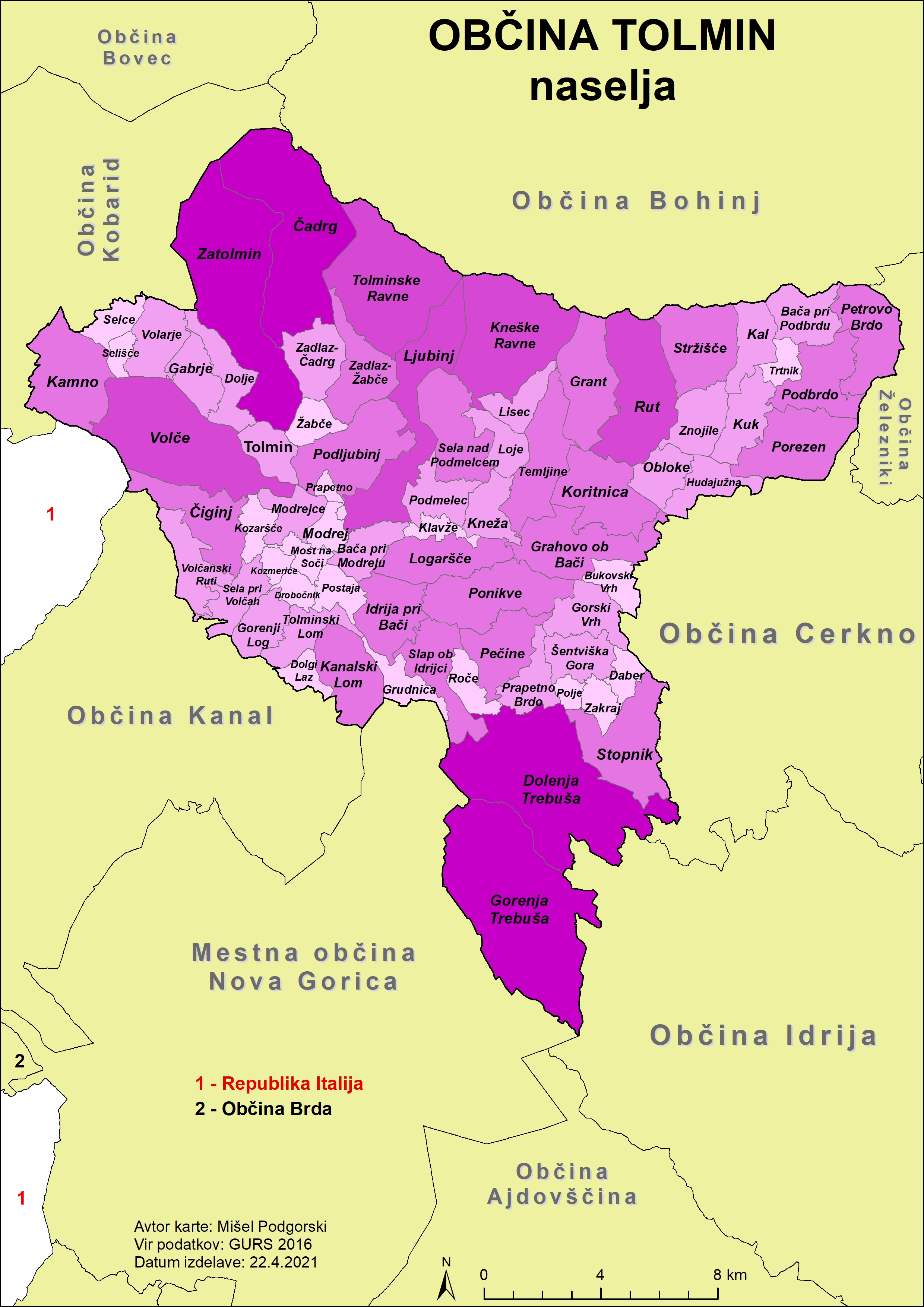
The Municipality of Tolmin (; sl, Občina Tolmin) is a municipality in northwestern Slovenia. Its seat and largest settlement is Tolmin. History In ancient times the area was inhabited by the Illyrians and then by the Romans. In the 6th century the Slavs, ancestors of present-day Slovenes, settled the area. Until 1420 it belonged to the Patriarchate of Aquileia, when it was acquired by the Republic of Venice. In 1514 it became a possession of the Habsburgs, who gave it as fief to the Coronini-Cronberg family. Medieval documents testify to a long series of uprisings, culminating in the Tolmin peasant revolt of 1713. That particular insurgence spread from Tolmin County to the Vipava Valley, Karst, and Brda, and further on to northern Istria. The uprising was mercilessly crushed by the imperial army and its eleven leaders were beheaded. In the 16th century, the area became part of the County of Gorizia and Gradisca. During the World War I, Tolmin served as a base for the victo ... [...More Info...] [...Related Items...] OR: [Wikipedia] [Google] [Baidu] |
Flag Of Slovenia
The national flag of Slovenia ( sl, zastava Slovenije) features three equal horizontal bands of white (top), blue, and red, with the Coat of arms of Slovenia located in the upper hoist side of the flag centered in the white and blue bands. The coat of arms is a shield with the image of Mount Triglav, Slovenia's highest peak, in white against a blue background at the center; beneath it are two wavy blue lines representing the Adriatic Sea and local rivers, and above it are three six-pointed golden stars arranged in an inverted triangle which are taken from the coat of arms of the Counts of Celje, the great Slovene dynastic house of the late 14th and early 15th centuries. The flag's colors are considered to be Pan-Slavism, Pan-Slavic, but they actually come from the Middle Ages, medieval coat of arms of the Duchy of Carniola, consisting of 3 stars, a mountain, and three colors (red, blue, yellow). crescent. The existing Slovene tricolor was raised for the first time in history duri ... [...More Info...] [...Related Items...] OR: [Wikipedia] [Google] [Baidu] |
Slovenia
Slovenia ( ; sl, Slovenija ), officially the Republic of Slovenia (Slovene: , abbr.: ''RS''), is a country in Central Europe. It is bordered by Italy to the west, Austria to the north, Hungary to the northeast, Croatia to the southeast, and the Adriatic Sea to the southwest. Slovenia is mostly mountainous and forested, covers , and has a population of 2.1 million (2,108,708 people). Slovenes constitute over 80% of the country's population. Slovene, a South Slavic language, is the official language. Slovenia has a predominantly temperate continental climate, with the exception of the Slovene Littoral and the Julian Alps. A sub-mediterranean climate reaches to the northern extensions of the Dinaric Alps that traverse the country in a northwest–southeast direction. The Julian Alps in the northwest have an alpine climate. Toward the northeastern Pannonian Basin, a continental climate is more pronounced. Ljubljana, the capital and largest city of Slovenia, is geogra ... [...More Info...] [...Related Items...] OR: [Wikipedia] [Google] [Baidu] |
Slovenian Littoral
The Slovene Littoral ( sl, Primorska, ; it, Litorale; german: Küstenland) is one of the five traditional regions of Slovenia. Its name recalls the former Austrian Littoral (''Avstrijsko Primorje''), the Habsburg possessions on the upper Adriatic coast, of which the Slovene Littoral was part. Geography The region forms the westernmost part of Slovenia, bordering the intermunicipal union of Giuliana in the region of Friuli Venezia Giulia of Italy. It stretches from the Adriatic Sea in the south up to the Julian Alps in the north. The Slovene Littoral comprises two traditional provinces: Goriška and Slovene Istria. The Goriška region takes its name from the town of Gorizia () now in Italy; the neighbouring conurbation of Nova Gorica and Šempeter-Vrtojba today is the urban centre of the Slovene Littoral. Slovene Istria comprises the northern part of the Istria peninsula and provides, on the Slovene Riviera coastline with the ports of Koper, Izola, and Piran, the coun ... [...More Info...] [...Related Items...] OR: [Wikipedia] [Google] [Baidu] |
Statistical Regions Of Slovenia
The statistical regions of Slovenia are 12 administrative entities created in 2000 for legal and statistical purposes. Division By a decree in 2000, Slovenia has been divided into 12 statistical regions (NUTS-3 level), which are grouped in two cohesion regions (NUTS-2 level). which replace the historical regions of the country. The statistical regions have been grouped into two cohesion regions are: * Eastern Slovenia (''Vzhodna Slovenija'' – SI01), which groups the Mura, Drava, Carinthia, Savinja, Central Sava, Lower Sava, Southeast Slovenia, and Littoral–Inner Carniola regions. *Western Slovenia Western Slovenia (''Zahodna Slovenija'') is one of the two NUTS-2 Regions of Slovenia. The region forms the western part of the country and includes the cities of Ljubljana, Koper, Kranj and Nova Gorica. It is the wealthier of the two regions o ... (''Zahodna Slovenija'' – SI02), which groups the Central Slovenia, Upper Carniola, Gorizia, and Coastal–Karst regions. Sou ... [...More Info...] [...Related Items...] OR: [Wikipedia] [Google] [Baidu] |
Gorizia Statistical Region
The Gorizia Statistical Region ( sl, Goriška statistična regija) is a statistical region in western Slovenia, along the border with Italy. It is named after the Italian town of Gorizia (the feminine adjective ''goriška'' comes from the Slovenian name for Gorizia: ''Gorica''). The Julian Alps, the Soča River, and the Vipava Valley are the most prominent natural features of this region. It contributed just over 5% to total national GDP in 2012, but in terms of GDP per capita it ranked fourth in the country. In the same year, disposable income per capita in the region the highest, in second place behind the Central Slovenia Statistical Region. Housing stock estimates indicate that at the end of 2013 the region had the highest share of dwellings with three or more rooms (around 70%). The share of single-room dwellings was less than 10%. Dwellings here are larger than the Slovenian average, with 37 m² of usable floor space per person on average. The number of cars per 1,000 pop ... [...More Info...] [...Related Items...] OR: [Wikipedia] [Google] [Baidu] |
Municipalities Of Slovenia
Slovenia is divided into 212 municipalities ( Slovene: ''občine'', singular'' občina''), of which 12 have urban (metropolitan) status. Municipalities are further divided into local communities and districts. Slovene is an official language of all the municipalities. Hungarian is a second official language of three municipalities in Prekmurje: Dobrovnik/Dobronak, Hodoš/Hodos, and Lendava/Lendva. Italian is a second official language of four municipalities (of which one has urban status) in the Slovene Littoral: Ankaran/Ancarano, Izola/Isola, Koper/Capodistria, and Piran/Pirano. In the EU statistics, the municipalities of Slovenia are classified as "local administrative unit 2" (LAU 2), below 58 administrative units ('), which are LAU 1. Names The Slovene names of the municipalities have the word ''Občina'' 'municipality' followed by a nominative In grammar, the nominative case (abbreviated ), subjective case, straight case or upright case is one of the grammatical cas ... [...More Info...] [...Related Items...] OR: [Wikipedia] [Google] [Baidu] |
Tolmin
Tolmin (; it, Tolmino,trilingual name ''Tolmein, Tolmino, Tolmin'' inGemeindelexikon, der im Reichsrate Vertretenen Königreiche und Länder. Bearbeit auf Grund der Ergebnisse der Volkszählung vom 31. Dezember 1900. Herausgegeben von der K.K. Statistischen Zentralkommission. VII. Österreichisch-Illyrisches Küstenland (Triest, Görz und Gradiska, Istrien). Wien 1906/ref> German ''Tolmein'') is a small town in northwestern Slovenia. It is the administrative centre of the Municipality of Tolmin. Geography Tolmin stands on the southern rim of the Julian Alps and is the largest settlement in the Upper Soča Valley ( sl, Zgornje Posočje), close to the border with Italy. It is located on a terrace above the confluence of the Soča and Tolminka rivers, positioned beneath steep mountainous valleys. The old town gave its name to the entire Tolmin area ( sl, Tolminsko) as its economic, cultural and administrative centre. The area is located in the historic Goriška region, itself pa ... [...More Info...] [...Related Items...] OR: [Wikipedia] [Google] [Baidu] |
Julian Alps
The Julian Alps ( sl, Julijske Alpe, it, Alpi Giulie, , ) are a mountain range of the Southern Limestone Alps that stretch from northeastern Italy to Slovenia, where they rise to 2,864 m at Mount Triglav, the highest peak in Slovenia. A large part of the Julian Alps is included in Triglav National Park. The second highest peak of the range, the 2,755 m high Jôf di Montasio, lies in Italy. The Julian Alps cover an estimated 4,400 km2 (of which 1,542 km2 lies in Italy). They are located between the Sava Valley and Canale Valley. They are divided into the Eastern and Western Julian Alps. Name The Julian Alps were known in antiquity as ''Alpe Iulia'', and also attested as ''Alpes Juliana'' AD 670, ''Alpis Julia'' 734, and ''Alpes Iulias'' in 1090. Like the municipium of ''Forum Julii'' (now Cividale del Friuli) at the foot of the mountains, the range was named after Julius Caesar of the Julian clan, perhaps due to a road built by Julius Caesar and completed ... [...More Info...] [...Related Items...] OR: [Wikipedia] [Google] [Baidu] |
Saint Peter
) (Simeon, Simon) , birth_date = , birth_place = Bethsaida, Gaulanitis, Syria, Roman Empire , death_date = Between AD 64–68 , death_place = probably Vatican Hill, Rome, Italia, Roman Empire , parents = John (or Jonah; Jona) , occupation = Fisherman, clergyman , feast_day = , venerated = All Christian denominations that venerate saints and in Islam , canonized_date = Pre- Congregation , attributes = Keys of Heaven, Red Martyr, pallium, papal vestments, rooster, man crucified upside down, vested as an Apostle, holding a book or scroll, Cross of Saint Peter , patronage = Patronage list , shrine = St. Peter's Basilica Saint Peter; he, שמעון בר יונה, Šimʿōn bar Yōnāh; ar, سِمعَان بُطرُس, translit=Simʿa̅n Buṭrus; grc-gre, Πέτρος, Petros; cop, Ⲡⲉⲧⲣⲟⲥ, Petros; lat, Petrus; ar, شمعون الصفـا, Sham'un al-Safa, Simon the Pure.; tr, Aziz Petrus (died between AD 64 and 68), also known as Peter ... [...More Info...] [...Related Items...] OR: [Wikipedia] [Google] [Baidu] |
Parish
A parish is a territorial entity in many Christian denominations, constituting a division within a diocese. A parish is under the pastoral care and clerical jurisdiction of a priest, often termed a parish priest, who might be assisted by one or more curates, and who operates from a parish church. Historically, a parish often covered the same geographical area as a manor. Its association with the parish church remains paramount. By extension the term ''parish'' refers not only to the territorial entity but to the people of its community or congregation as well as to church property within it. In England this church property was technically in ownership of the parish priest '' ex-officio'', vested in him on his institution to that parish. Etymology and use First attested in English in the late, 13th century, the word ''parish'' comes from the Old French ''paroisse'', in turn from la, paroecia, the latinisation of the grc, παροικία, paroikia, "sojourning in a fore ... [...More Info...] [...Related Items...] OR: [Wikipedia] [Google] [Baidu] |


