|
Zaporizhzhia
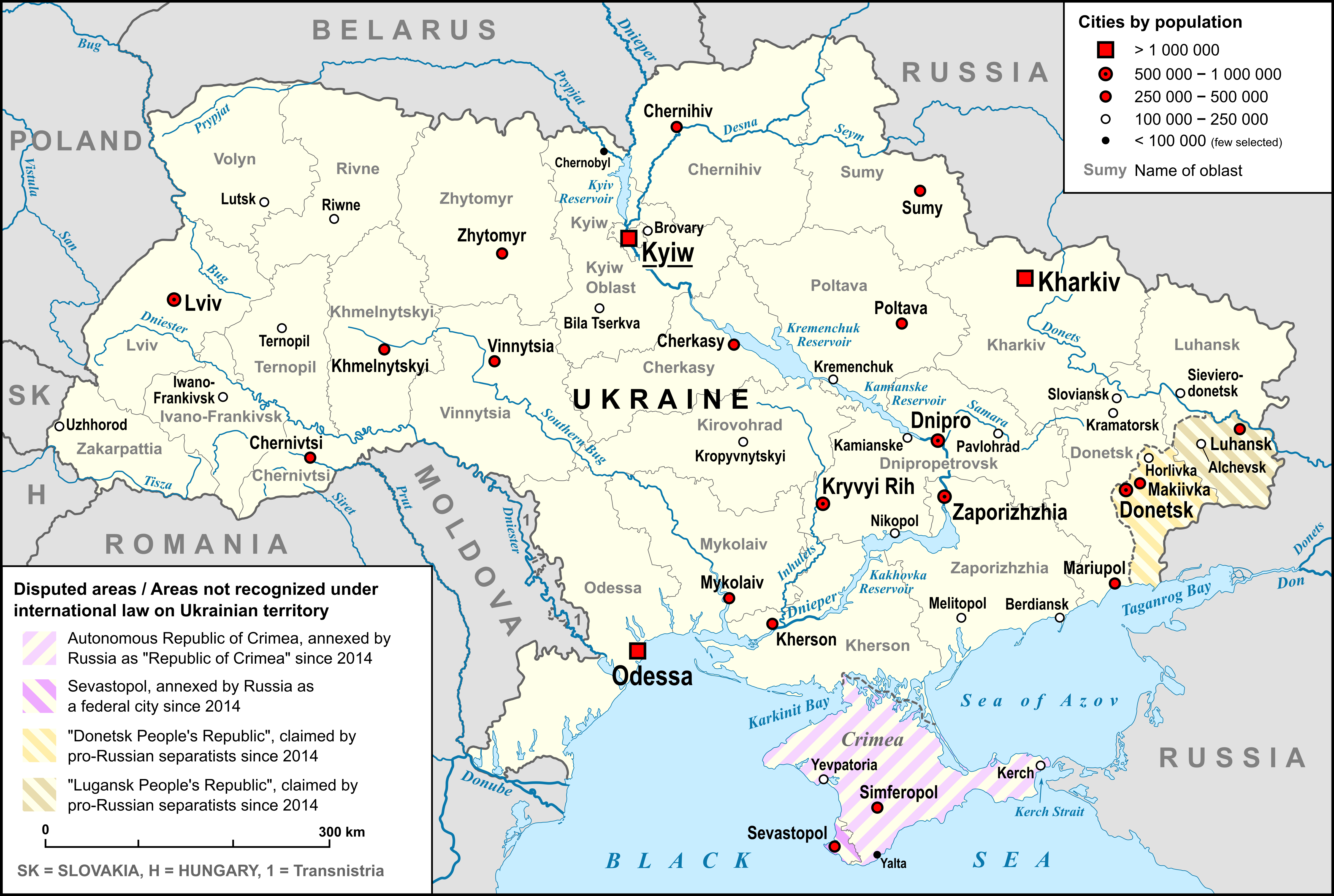
Zaporizhzhia, formerly known as Aleksandrovsk or Oleksandrivsk until 1921, is a city in southeast Ukraine, situated on the banks of the Dnieper, Dnieper River. It is the Capital city, administrative centre of Zaporizhzhia Oblast. Zaporizhzhia has a population of Zaporizhzhia is known for the historic island of Khortytsia, multiple power stations and for being an important industrial centre. Steel, aluminium, aircraft engines, automobiles, transformers for substations, and other heavy industrial goods are produced in the region. Names and etymology The name ''Zaporizhzhia'' refers to the position of the city: "beyond the rapids"—downstream or south of the Dnieper Rapids. These were previously an impediment to navigation and the site of important portages. In 1932, the rapids were flooded to become part of the reservoir of the Dnieper Hydroelectric Station.Pospelov, pp. 25–26 Before 1921, the city was called Aleksandrovsk (or Oleksandrivsk), named after the original fort ... [...More Info...] [...Related Items...] OR: [Wikipedia] [Google] [Baidu] |
Zaporizhzhia Oblast
Zaporizhzhia Oblast (), commonly referred to as Zaporizhzhia (), is an oblast (region) in south-east Ukraine. Its administrative centre is the city of Zaporizhzhia. The oblast covers an area of , and has a population of The oblast is an important part of Ukraine's industry and agriculture. Most of the oblast's area, including all of the coast, has been under Russian military occupation since the 2022 Russian invasion of Ukraine, although the capital and the majority of the population have remained under Ukrainian administration. In September 2022, Russia declared it had annexed the Zaporizhzhia oblast based on the results of a disputed referendum. The referendum and subsequent annexation are not internationally recognized. To the south, Zaporizhzhia Oblast covers roughly of coastline of the Sea of Azov, as part of a coastal region known as Pryazovia. Geography The area of the oblast is 27,183 km2; its population (estimated as of 1 January 2013) was 1,785,243. Zapor ... [...More Info...] [...Related Items...] OR: [Wikipedia] [Google] [Baidu] |
Zaporizhzhia Raion
Zaporizhzhia Raion () is one of the five raions (districts) of Zaporizhzhia Oblast in southeast Ukraine. Its administrative center is Zaporizhzhia. Population: On 18 July 2020, as part of the administrative reform of Ukraine, the number of raions of Zaporizhzhia Oblast was reduced to five, and the area of Zaporizhzhia Raion was significantly expanded. According to the 2001 census, its population was 54,804. The January 2020 estimate of the raion population was Geography Zaporizhzhia Raion is located in the northeast portion of Zaporizhzhia Oblast, surrounding the oblast's administrative center Zaporizhzhia. Its total area constitutes . The Dnieper and Konka rivers flow through the raion. History The territory which is now the Zaporizhzhia Raion was first established as the Voznesenskyi Raion () on 7 March 1923 as part of a full-scale administrative reorganization of the Ukrainian Soviet Socialist Republic. In 1926, it was renamed to the Khortytsia Raion (). From 1929 to 1 ... [...More Info...] [...Related Items...] OR: [Wikipedia] [Google] [Baidu] |
Voznesenivskyi District
Voznesenivskyi District () is an administrative-territorial unit within the city of Zaporizhzhia, Ukraine named after the historical village of Voznesenky. The economic and symbolic center of the city and the Zaporizhzhia metropolitan area, it is Zaporizhzhia's oldest district and home to many of region's cultural, financial, educational and historical landmarks including Zaporizhzhia Regional Administration, Krytyy Market and Festival Square. The district was formed on January 21, 1939, as Ordzhonikidzevskyi District in honor of Sergo Ordzhonikidze. It received its current name on February 19, 2016, by decree of the Ukrainian Government. History In ancient times, the Mariupol Road connected Kichkas and the village of Voznesenskaya. A settlement was established at this location by retired soldiers and their families who had served in the Alexander Fortress and did not want to settle in a suburb near the fortress. The name of the settlement was given by leaders of the Church of th ... [...More Info...] [...Related Items...] OR: [Wikipedia] [Google] [Baidu] |
Zaporizhzhia International Airport
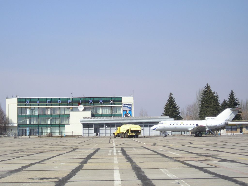
Zaporizhzhia International Airport () is the international airport that serves Zaporizhzhia, Ukraine, one of three airfields around the city. The aircraft engine factory Motor Sich has its base here. In May 2020, the airport was extended with a new terminal with a capacity of 400 passengers. The airport is also home to the Zaporizhzhia State Aircraft Repair Plant (ZDARZ). History The airport was established 15 October 1943. Immediately after the release of Zaporizhzhia from the Nazi troops, an order No. 1 was issued for the enterprise according to which the first head of the Zaporizhzhia airport was appointed. At that time, the airport infrastructure was located on the eastern outskirts of the city. After the end of the war in 1945, the airport began to operate flights between Zaporizhzhia-Moscow-Zaporizhzhia, and then Zaporizhzhia-Kyiv-Zaporizhzhia. In 1964, an artificial runway was put into operation at the current location of the airport. In 1965, the construction of th ... [...More Info...] [...Related Items...] OR: [Wikipedia] [Google] [Baidu] |
List Of Cities In Ukraine
There are 463 populated places in Ukraine, populated places in Ukraine that have been officially granted city status () by the Verkhovna Rada, the country's parliament, as of 23 April 2025. Settlements with more than 10,000 people are eligible for city status although the status is typically also granted to settlements of historical or regional importance. Smaller settlements are Populated places in Ukraine#Rural settlements, rural settlements () and villages (). Historically, there were systems of city rights, granted by the territorial lords, which defined the status of a place as a ''misto'' or ''selo''. In the past, cities were self-governing and had several privileges. The list of cities is roughly ordered by population and the 2022 estimates are compared to the 2001 Ukrainian census, except for Chernobyl for which the population is an unofficial estimate. The City with special status, cities with special status are shown in ''italic''. The average population size is 62,000. ... [...More Info...] [...Related Items...] OR: [Wikipedia] [Google] [Baidu] |
Governor Of Zaporizhzhia Oblast
The governor of Zaporizhzhia Oblast is the head of state administration for the Zaporizhzhia Oblast. The office of governor is an appointed position, with officeholders being appointed by the president of Ukraine, on recommendation from the prime minister of Ukraine, to serve a four-year term. Due to the current Russo-Ukrainian war, since 24 February 2022, the governor of Zaporizhzhia Oblast is officially called ''Head of the Zaporizhzhia Regional Military Civil Administration''. The official residence for the governor is located in Zaporizhzhia. Governors Chairman of Executive Committee of Zaporizhzhia Oblast * Danylo Lezhenko (1939) * Zakhar Dorofeyev (1940–1941) * ''Nazi German occupation (1941–1943)'' * Zakhar Dorofeyev (1943–1944) * Vasyl Ponomarenko (1944–1950) * Mykola Titov (1950–1951) * Vasyl Ponomarenko (1951–1952) * Volodymyr Skryabin (1952–1957) * Fedir Mokrous (1957–1963) * Oleksandr Guyva (1963–1964) * Pavlo Sklyarov (1963–1964) * Fed ... [...More Info...] [...Related Items...] OR: [Wikipedia] [Google] [Baidu] |
Slavutych-Arena
Slavutych Arena () is a football-only stadium in Zaporizhzhia, Ukraine. It is used for football (soccer), football matches and is the home of FC Metalurh Zaporizhzhia, Metalurh Zaporizhzhia. The stadium's official maximum capacity is 12,000. The stadium is located in a city neighborhood known as Sotsmisto, Zaporizhzhia, Sotsmisto, Dniprovskyi District, Zaporizhzhia, Dniprovskyi District. Sotsmisto or Sotsgorodok was the name of special experimental urban projects during the early periods of the Soviet Union. Central Stadium Metalurh The stadium was built in 2006 in place of another stadium that was called Central Stadium Metalurh (or Metalurh Stadium) and which existed since 2 May 1938. The new stadium was built after complete demolishing of the previous stadium. In 2001, the Football Federation of Ukraine suspended the Metalurh Stadium and Metalurh played most of its home games at the AvtoZAZ Stadium which was a home ground of FC Torpedo Zaporizhzhia. Slavutych Arena After the ... [...More Info...] [...Related Items...] OR: [Wikipedia] [Google] [Baidu] |
Komunarskyi District
The Komunarskyi District () is one of seven administrative urban districts (raions) of the city of Zaporizhzhia, located in southern Ukraine. Its population was 139,222 in the 2001 Ukrainian Census, and 134,465 . The raion contains the informal Pivdennyi (Southern) and Kosmichnyi (Cosmic) residential neighborhoods within its boundaries. Geography The Komunarskyi District is named after the former Komunar factory (currently, the Zaporizhzhia Automobile Building Plant) which is located within the district's boundaries. The district is located in the southeastern portion of the city, on the left-bank of the Dnipro River, just north of the urban-type settlement of Balabyne, Zaporizhzhia Oblast. Its total area is . History On 6 April 1977, the Komunarskyi District was established out of a portion of the present-day Oleksandrivskyi District by a decree of the Presidium of the Verkhovna Rada of the Ukrainian Soviet Socialist Republic The Ukrainian Soviet Socialist Repub ... [...More Info...] [...Related Items...] OR: [Wikipedia] [Google] [Baidu] |
Zaporizhzhia-1 Railway Station
Zaporizhzhia-1 railway station (Ukrainian language, Ukrainian: Запоріжжя I) is the main train station in Zaporizhzhia, Ukraine. The station is located on an electrified Synelnykove — Zaporizhzhia — Fedorivka line and is one of the four railway stations in the city. The station opened during the construction of Lozova-Pasazhyrskyi railway station, Lozova — Sevastopol railway station, Sevastopol railway on 5 November 1873. The new building was constructed in 1954, after the original was destroyed in World War II. The building of the station is a monument of architecture of regional significance. In 2018, the Zaporizhzhia-1 railway station was included in the top-10 busiest railway stations in Ukraine, serving 2.1 million long-distance passengers. History The station and a one-story, wooden station building were opened in 1873 during the construction of the first section of the private Lozovo-Sevastopol railway in 1870-1873. Since 1874, regular train traffic bega ... [...More Info...] [...Related Items...] OR: [Wikipedia] [Google] [Baidu] |
Khortytskyi District
The Khortytskyi District (, ) is one of seven administrative urban districts (raions) of the city of Zaporizhzhia, located in southern Ukraine. Its population was 122,575 in the 2001 Ukrainian Census, and 117,871 . Geography It is named after the nearby Khortytsia island, a national cultural reserve. The raion is located in the southern portion of the city, on the right-bank of the Dnipro River, neighboring the villages of Baburka and Novoslobidka in Zaporizhzhia Oblast. Its total area is . History The territory of the Khortytskyi District was first inhabited by German-speaking Mennonites settling the Chortitza Colony in the late 18th century. By the 1960s, the first residential neighborhoods were being constructed in the vicinity, which at the time administratively belonged to the city's Leninskyi District. On 19 January 1995, the Khortytskyi District was established out of a portion of the Leninskyi District by a decree of the Verkhovna Rada The Verkhovna Rada ( ... [...More Info...] [...Related Items...] OR: [Wikipedia] [Google] [Baidu] |
Shevchenkivskyi District, Zaporizhzhia
The Shevchenkivskyi District (, ) is one of seven administrative urban districts (raions) of the city of Zaporizhzhia, located in southern Ukraine. Its population was 157,000 in the 2001 Ukrainian Census. Geography The largest of Zaporizhzhia's seven urban districts, the district has an area of , making up approximately 29.3% of the total administrative area of Zaporizhzhia. The district is located fully on the left (east) side of the Dnieper river The Dnieper or Dnepr ( ), also called Dnipro ( ), is one of the major transboundary rivers of Europe, rising in the Valdai Hills near Smolensk, Russia, before flowing through Belarus and Ukraine to the Black Sea. Approximately long, with .... History The district was founded in 1962 by separating it from Zhovtnevyi District (since 2016 Oleksandrivskyi District). Following the passage of decommunization laws, in 2016, numerous streets within the district were renamed to replace their Soviet-era names. Some of the new st ... [...More Info...] [...Related Items...] OR: [Wikipedia] [Google] [Baidu] |


