|
Yokkaichi-juku
was the forty-third of the fifty-three stations (''shukuba'') of the Tōkaidō, which connected Edo with Kyoto in the Edo period of Japan. It was located in the former Ise Province in what is now part of the city of Yokkaichi, Mie Prefecture, Japan. History Yokkaichi-juku was a post town located at the intersection of the Tōkaidō and the Ise Sangū Kaidō, one of the main highways for pilgrims to the Ise Grand Shrines, and it developed as a market town from the Muromachi period, noted for holding a market on days ending in "four" of each month. The earliest recorded market dates back to 1470. Under the Tokugawa shogunate, Yokkaichi was ''tenryō'' territory under direct control of the Shōgun, and was administered by a ''daikan'' based in the town. It was also possible for travelers to take a ferry from here to Miya-juku, thus bypassing Kuwana-juku. Per the 1843 guidebook issued by the , the town had a population of 7114 in 1811 houses, including two ''honjin'', one ''waki ... [...More Info...] [...Related Items...] OR: [Wikipedia] [Google] [Baidu] |
Ishiyakushi-juku
was the forty-fourth of the fifty-three stations (''shukuba'') of the Tōkaidō connecting Edo with Kyoto in Edo period Japan. It was located in former Ise Province in what is now part of the city of Suzuka, Mie Prefecture, Japan. History Ishiyakushi-juku was established in 1616, as part of the Edo period's Tōkaidō. Originally, there had been no post stations between Yokkaichi-juku and Kameyama-juku, so Ishiyakushi-juku was formed with about 180 buildings at its inception.Nippon-Kichi Nippon-Kichi. Accessed October 27, 2007. The Ozawa family managed the '''' in the town and kept many records, which are still available today in a local archives museum. The post station received its name from ... [...More Info...] [...Related Items...] OR: [Wikipedia] [Google] [Baidu] |
Yokkaichi, Mie
is a city located in Mie Prefecture, Japan. , the city had an estimated population of 310,259 in 142162 households and a population density of 1500 persons per km2. The total area of the city is . Geography Yokkaichi is located in the north-central of Mie Prefecture, part of the northeastern Kii Peninsula. It stretches the width of Mie Prefecture, and is bordered by Ise Bay on the Pacific Ocean to the east, and Shiga Prefecture to the northwest. Neighboring municipalities Mie Prefecture * Asahi * Inabe * Kawagoe * Komono * Kuwana * Suzuka * Tōin Shiga Prefecture * Kōka Climate Yokkaichi has a Humid subtropical climate (Köppen ''Cfa'') characterized by warm summers and cool winters with light to no snowfall. The average annual temperature in Yokkaichi is . The average annual rainfall is with September as the wettest month. The temperatures are highest on average in August, at around , and lowest in January, at around . Demographics Per Japanese census data, the popul ... [...More Info...] [...Related Items...] OR: [Wikipedia] [Google] [Baidu] |
53 Stations Of The Tōkaidō
The are the rest areas along the Tōkaidō (road), Tōkaidō, which was a coastal route that ran from Nihonbashi in Edo (modern-day Tokyo) to Sanjō Ōhashi in Kyoto.. There were originally 53 government shukuba, post stations along the Tōkaidō, where travelers had to present traveling permits at each station if wanting to cross. In 1619, the Ōsaka Kaidō (大阪街道) was developed to extend the Tōkaidō so that it would reach Kōraibashi in modern-day Osaka. Instead of going to Sanjō Ōhashi, travelers would leave from Ōtsu-juku and travel towards Fushimi-juku (Tōkaidō), Fushimi-juku. Because of the addition of these four post towns, the Tōkaidō is occasionally referred to as having 57 stations. Another name for this extension was Kyōkaidō (京街道). The inland Nakasendō also started at Nihonbashi, and converged with the Tōkaidō at Kusatsu-juku. Shio no Michi intersected with the Tōkaidō at Okazaki-shuku. Stations of the Tōkaidō File:NihombashiDat ... [...More Info...] [...Related Items...] OR: [Wikipedia] [Google] [Baidu] |
Kuwana-juku
file:佐屋路と周辺の主要街道.png, 280px, Map showing the routes between Kuwana-juku and Miya-juku file:Kuwana shichiri-no-watashi 2012-03.JPG, 280px, Shichiri no watashi torii was the forty-second of the 53 Stations of the Tōkaidō, fifty-three stations (''shukuba'') of the Tōkaidō (road), Tōkaidō connecting Edo with Kyoto in Edo period Japan. It was located in former Ise Province in what is now part of the city of Kuwana, Mie, Kuwana, Mie Prefecture, Japan. History Kuwana-juku was located in the jōkamachi, castle town of Kuwana Domain, which was a major security barrier on the Tōkaidō for the Tokugawa shogunate. The post station was located on the western shores of the Ibi River. Between Kuwana and the next station to the west, Miya-juku, were the Kiso Three Rivers, which included the Nagara River and the Kiso River in addition to the Ibi River. As all three rivers were near their outlets to Ise Bay, their channels were wide, and the shogunate forbid the constr ... [...More Info...] [...Related Items...] OR: [Wikipedia] [Google] [Baidu] |
Shukuba
were Stage station, staging post stations during the Edo period in Japan, generally located on one of the Edo Five Routes or one of its sub-routes. They were also called ''shuku-eki'' (宿駅). These stage stations, or "" developed around them, were places where travelers could rest on their journey around the nation. They were created based on policies for the transportation of goods by horseback that were developed during the Nara period, Nara and Heian period, Heian periods. History These stations were first established by Tokugawa Ieyasu shortly after the end of the Battle of Sekigahara. The first stations were developed along the Tōkaidō (road), Tōkaidō (followed by stations on the Nakasendō and other routes). In 1601, the first of the Tōkaidō's 53 Stations of the Tōkaidō, fifty-three stations were developed, stretching from Shinagawa-juku in Edo to Ōtsu-juku in Ōmi Province. Not all the post stations were built at the same time, however, as the last one was bui ... [...More Info...] [...Related Items...] OR: [Wikipedia] [Google] [Baidu] |
Tenryō
The Tokugawa shogunate, also known as the was the military government of Japan during the Edo period from 1603 to 1868. The Tokugawa shogunate was established by Tokugawa Ieyasu after victory at the Battle of Sekigahara, ending the civil wars of the Sengoku period following the collapse of the Ashikaga shogunate. Ieyasu became the ''shōgun,'' and the Tokugawa clan governed Japan from Edo Castle in the eastern city of Edo (Tokyo) along with the ''daimyō'' lords of the ''samurai'' class. The Tokugawa shogunate organized Japanese society under the strict Tokugawa class system and banned most foreigners under the isolationist policies of '' Sakoku'' to promote political stability. The Tokugawa shoguns governed Japan in a feudal system, with each ''daimyō'' administering a '' han'' (feudal domain), although the country was still nominally organized as imperial provinces. Under the Tokugawa shogunate, Japan experienced rapid economic growth and urbanization, which led to ... [...More Info...] [...Related Items...] OR: [Wikipedia] [Google] [Baidu] |
Stations Of The Tōkaidō
Station may refer to: Agriculture * Station (Australian agriculture), a large Australian landholding used for livestock production * Station (New Zealand agriculture), a large New Zealand farm used for grazing by sheep and cattle ** Cattle station, a cattle-rearing station in Australia or New Zealand **Sheep station, a sheep-rearing station in Australia or New Zealand Communications * Radio communication station, a radio frequency communication station of any kind, including audio, TV, and non-broadcast uses ** Radio broadcasting station, an audio station intended for reception by the general public ** Amateur radio station, a station operating on frequencies allocated for ham or other non-commercial use ** Broadcast relay station ** Ground station (or Earth station), a terrestrial radio station for extraplanetary telecommunication with satellites or spacecraft ** Television station * Courier station, a relay station in a courier system ** Station of the ''cursus publicus'', ... [...More Info...] [...Related Items...] OR: [Wikipedia] [Google] [Baidu] |
Ukiyo-e
is a genre of Japanese art that flourished from the 17th through 19th centuries. Its artists produced woodblock printing, woodblock prints and Nikuhitsu-ga, paintings of such subjects as female beauties; kabuki actors and sumo wrestlers; scenes from history and folk tales; travel scenes and landscapes; Flora of Japan, flora and Wildlife of Japan#Fauna, fauna; and Shunga, erotica. In 1603, the city of Edo (Tokyo), Edo (Tokyo) became the seat of the ruling Tokugawa shogunate. The class (merchants, craftsmen and workers), positioned at the bottom of Four occupations, the social order, benefited the most from the city's rapid economic growth. They began to indulge in and patronize the entertainment of kabuki theatre, geisha, and oiran, courtesans of the Yūkaku, pleasure districts. The term ('floating world') came to describe this hedonistic lifestyle. Printed or painted ukiyo-e works were popular with the class, who had become wealthy enough to afford to decorate their homes wit ... [...More Info...] [...Related Items...] OR: [Wikipedia] [Google] [Baidu] |
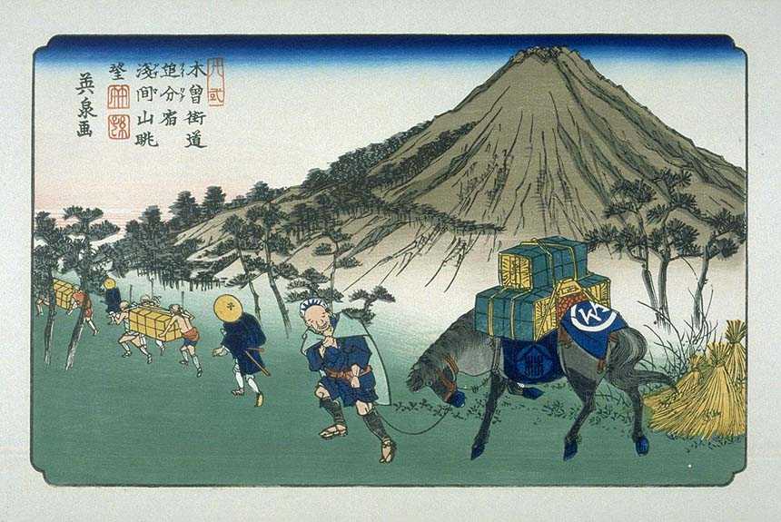
Utagawa Hiroshige
or , born Andō Tokutarō (; 1797 – 12 October 1858), was a Japanese ''ukiyo-e'' artist, considered the last great master of that tradition. Hiroshige is best known for his horizontal-format landscape series '' The Fifty-three Stations of the Tōkaidō'' and for his vertical-format landscape series '' One Hundred Famous Views of Edo''. The subjects of his work were atypical of the ''ukiyo-e'' genre, whose typical focus was on beautiful women, popular actors, and other scenes of the urban pleasure districts of Japan's Edo period (1603–1868). The popular series '' Thirty-six Views of Mount Fuji'' by Hokusai was a strong influence on Hiroshige's choice of subject, though Hiroshige's approach was more poetic and ambient than Hokusai's bolder, more formal prints. Subtle use of color was essential in Hiroshige's prints, often printed with multiple impressions in the same area and with extensive use of '' bokashi'' (color gradation), both of which were rather labor-intensive ... [...More Info...] [...Related Items...] OR: [Wikipedia] [Google] [Baidu] |
Kōsatsu
A kōsatsu (, literally "High plaque"), also called Seisatsu (, literally "Controlling plaque"), was a public notice of the han-lord's or shogun's proclamations earlier in Japanese history. They were local or nationwide laws written on a wooden plate, placed in the ''kōsatsu-ba'' of the ''shukuba'' or '' sekisho'' ( 関所), the border between han, where there was frequent traffic. The kōsatsu was used from the late Nara Period until the early Meiji period. One of the kosatsu in the Edo Period was on prohibiting Christianity. As the people's literacy rate improved and the modern nation emerged, the kōsatsu was abolished in 1873 and eventually replaced by the Kanpō (Japanese government gazette) and other means of public notice. See also *Public notice *Kanpō *Bulletin board *Wall newspaper A wall newspaper or placard newspaper is a hand-lettered or printed newspaper designed to be displayed and read in public places both indoors and outdoors, utilizing vertical surfaces ... [...More Info...] [...Related Items...] OR: [Wikipedia] [Google] [Baidu] |
Hatago
were Edo period lodgings for travelers at ''shukuba'' (post stations) along the national highways, including the Edo Five Routes and the subroutes. In addition to a place to rest, ''hatago'' also offered meals and other foods to the travelers. They were also called . Name origin ''Hatago'' means "traveling basket." The word itself originally derived from baskets that contained food for horses and were carried by travelers. From there, it became a tool with which travelers were carry their own food and goods. Shops that began preparing and selling food for travelers gained the suffix , meaning "shop," but this was eventually shortened to just ''hatago''. Preserved ''hatago'' Because many post stations along the Tōkaidō, Nakasendō The , also called the ,Richard Lane, ''Images from the Floating World'' (1978) Chartwell, Secaucus ; pg. 285 was one of the centrally administered Edo Five Routes, five routes of the Edo period, and one of the two that connected the ''de facto'' ... [...More Info...] [...Related Items...] OR: [Wikipedia] [Google] [Baidu] |
Honjin
image:Ohara-juku01s3200.jpg, The ''honjin'' at Inaba Kaidō's Ōhara-shuku. is the Japanese word for an inn for government officials, generally located in post stations (''shukuba'') during the later part of the Edo period. Evolution of ''Honjin'' Originally, ''honjin'' were places from which generals directed battles and, therefore, were fleeting in nature. However, as commanders began to transform the ''honjin'' into temporary lodgings during battle and travel, ''honjin'' came to be places where ''daimyō'' and other representatives of the shogunate, including ''hatamoto'', ''monzeki'', etc., were allowed to stay during their travels. Many of the ''honjin'' were actually personal residences of village and town leaders. As such, they received official designations from the government and expanded their residences to include walls, gates and other features. Because of their cooperation, the owners of the ''honjin'' also gained various special rights. General travelers, regardless ... [...More Info...] [...Related Items...] OR: [Wikipedia] [Google] [Baidu] |


