|
Yaumatei
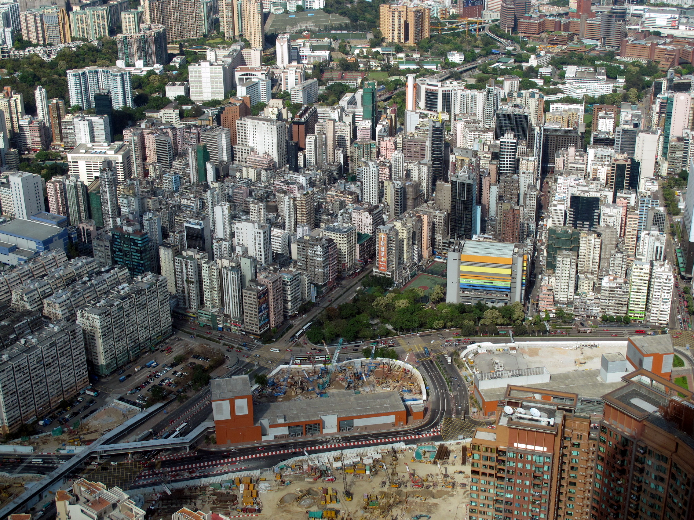
Yau Ma Tei is an area in the Yau Tsim Mong District in the south of the Kowloon Peninsula in Hong Kong. Name ''Yau Ma Tei'' is a phonetic transliteration of the name (originally written as ) in Cantonese. It can also be spelt as Yaumatei, Yau Ma Ti, Yaumati or Yau-ma-Tee. ''Yau'' ( 油) literally means "oil", ''Ma'' ( 麻 or 蔴) can either refer to "sesame" or "jute", and ''Tei'' (地) means "field" or "open ground". Hence, ''Yau Ma Tei'' can be interpreted to mean either "oil-sesame field" or "oil and jute ground". This dual-interpretation is perhaps the reason for there being two explanations for the origin of the place name.Architectural Conservation Office, HKSAR Government ... [...More Info...] [...Related Items...] OR: [Wikipedia] [Google] [Baidu] |
Fruit Market
The Yau Ma Tei Fruit Market, officially Yau Ma Tei Wholesale Fruit Market, also simply known as the Fruit Market, is a wholesale fruit market in Yau Ma Tei, Kowloon, Hong Kong. Etymology It is known as ''gwo laan'' () in Cantonese. ''gwo'' () means fruit while ''laan'' () means wholesale market, derived from railing and enclosed area. History The market was founded in 1913 between Ferry Street, Waterloo Road and Reclamation Street with Shek Lung Street passing through it. The name of the market was originally Government Vegetables Market () which sold fruit and vegetables. Fish traders joined in the 1930s. With the opening of Cheung Sha Wan Vegetables Wholesaling Market () and Cheung Sha Wan Fishery Wholesaling Market () in Cheung Sha Wan in 1965, the vegetables and fish stalls moved out. From then on the market has operated as a specialist fruit wholesaling market. The market was then officially known as Kowloon Wholesale Fruit Market until the name was transferred to Cheun ... [...More Info...] [...Related Items...] OR: [Wikipedia] [Google] [Baidu] |
Yau Ma Tei Typhoon Shelter
Yau Ma Tei Typhoon Shelter () is a typhoon shelter located near Yau Ma Tei, Kowloon, Hong Kong. History The Government of Hong Kong planned for the construction of a second typhoon shelter after (the old) Causeway Bay Typhoon Shelter in late 1906. In 1908 the Public Works Department decided to construct the typhoon shelter at Yau Ma Tei. Works on the typhoon shelter lasted from 1910 to 1915. The cost was HK$2.21 million. The typhoon shelter was officially opened by Sir Francis Henry May, then Governor of Hong Kong, on 16 December 1915. The Yau Ma Tei Boat People settled in the shelter from around 1916 to 1990. The West Kowloon Reclamation Project began in 1990 as part of the Airport Core Programme, which required a replacement for the original typhoon shelter. The new typhoon shelter was built to the west of the original one, and was completed in 1992. Housing estates built on the reclaimed land of the initial typhoon shelter include: Park Avenue Park Avenue is a bou ... [...More Info...] [...Related Items...] OR: [Wikipedia] [Google] [Baidu] |
Lin Zexu
Lin Zexu (30 August 1785 – 22 November 1850), courtesy name Yuanfu, was a Chinese political philosopher and politician. He was a head of state (Viceroy), Governor General, scholar-official, and under the Daoguang Emperor of the Qing dynasty best known for his role in the First Opium War of 1839–42. He was from Fuzhou, Fujian Province. Lin's forceful opposition to the opium trade was a primary catalyst for the First Opium War. He is praised for his constant position on the "moral high ground" in his fight, but he is also blamed for a rigid approach which failed to account for the domestic and international complexities of the problem. The Emperor endorsed the hardline policies and anti-drugs movement advocated by Lin, but placed all responsibility for the resulting disastrous Opium War onto Lin. However, Lin's efforts against the opium trade was appreciated by drug prohibition activists and revered as a culture hero in Chinese culture, symbolizes drug abuse resistance in ... [...More Info...] [...Related Items...] OR: [Wikipedia] [Google] [Baidu] |
Waterloo Road, Hong Kong
Waterloo Road (Chinese: 窩打老道) is one of the principal north-south thoroughfares of Kowloon, Hong Kong. It stretches from Yau Ma Tei to Kowloon Tong. Location The road starts in the west at the intersection with Lai Cheung Road and Ferry Street, Hong Kong, Ferry Street, and runs east past Nathan Road. It then runs on a northeast-southwest alignment through the Yau Ma Tei and Ho Man Tin until the intersection with Princess Margaret Road and Argyle Street. The road then takes another turn and runs north through Kowloon Tong, leading towards the Lion Rock Tunnel. History Waterloo Road was named to commemorate the Battle of Waterloo. It was laid out in the early 20th century. The stretch of the road through Kowloon Tong was built in 1922 as part of the plans to develop the area. This portion of the road was designated as part of Hong Kong's Route 1 (Hong Kong), Route 1 in 1974, and is the only part of Route 1 which features several intersections without grade separation. ... [...More Info...] [...Related Items...] OR: [Wikipedia] [Google] [Baidu] |
Nathan Road
Nathan Road () is the main thoroughfare in Kowloon, Hong Kong, aligned south–north from Tsim Sha Tsui to Sham Shui Po. It is lined with shops and restaurants and throngs with visitors, and was known in the post–World War II years as the Golden Mile, a name that is now rarely used. It starts on the southern part of Kowloon at its junction with Salisbury Road, Hong Kong, Salisbury Road, a few metres north of Victoria Harbour, and ends at its intersection with Boundary Street in the north. Portions of the Kwun Tong line, Kwun Tong and Tsuen Wan line, Tsuen Wan lines (Prince Edward station, Prince Edward, Mong Kok station, Mong Kok, Yau Ma Tei station, Yau Ma Tei, Jordan station, Jordan and Tsim Sha Tsui station, Tsim Sha Tsui) run underneath Nathan Road. The total length of Nathan Road is about . History The first section of the road was completed in 1861. It was the first road built in Kowloon, after Convention of Peking, the land was ceded by the Qing dynasty government to ... [...More Info...] [...Related Items...] OR: [Wikipedia] [Google] [Baidu] |
Shanghai Street
Shanghai Street (Traditional Chinese characters, Chinese: 上海街) is a 2.3 km long List of streets and roads in Hong Kong, street in the Jordan, Hong Kong, Jordan, Yau Ma Tei and Mong Kok areas of Kowloon, Hong Kong. Completed in 1887 under the name of Station Street (), it was once the most prosperous street in Kowloon. It originates from the south at Austin Road, and terminates in the north at Lai Chi Kok Road. Parallel to Shanghai Street are Nathan Road, Temple Street, Hong Kong, Temple Street, Portland Street, Reclamation Street and Canton Road. Though parallel, Shanghai Street was marked by 2- to 3-floor Chinese-style buildings while Nathan Road was marked by Western-style buildings. History Prior to 1874 the land that Shanghai Street stands on was sea, making Shanghai Street an early example of Land reclamation in Hong Kong, reclaimed land in Hong Kong. The street is not so named because of a Shanghainese people, Shanghainese population. Prior to being renamed ... [...More Info...] [...Related Items...] OR: [Wikipedia] [Google] [Baidu] |
Hongkong And Yaumati Ferry
The Hongkong and Yaumati Ferry Company Limited (HYF), is a ferry company founded in 1897 in Hong Kong. It is commonly known as Yaumati Ferry. After restructuring the company in 1989, it became a subsidiary of Hong Kong Ferry (Holdings) Company Limited (). Its head office is in the northern Tsing Yi. History The original company was founded by a Chinese business man named Lau Tak Po in 1897 during the colonial Hong Kong era. At the time he purchased 5 wooden boats and provided services exclusively to Kowloon under the company name "Yaumati Ferry". Yaumati is the alternative transliteration of Yau Ma Tei. Until the Ferries Ordinance of 1917, there was no regulation set by the government as to who can run a ferry service. After the Ordinance was enacted, no one can operate a ferry service without securing a licence from the government through public tender.Except for Star Ferry, which obtained a different licence under a ordinance passed in 1902. The first companies who obtaine ... [...More Info...] [...Related Items...] OR: [Wikipedia] [Google] [Baidu] |
Hong Kong Island
Hong Kong Island () is an island in the southern part of Hong Kong. The island, known originally and on road signs simply as "Hong Kong", had a population of 1,289,500 and a population density of , . It is the second largest island in Hong Kong, with the largest being Lantau Island. Hong Kong Island forms one of the three areas of Hong Kong, with the other two being Kowloon and the New Territories. In 1842, following the Qing dynasty's defeat at the First Opium War (1839–1842), Hong Kong Island was formally ceded in perpetuity to the United Kingdom of Great Britain and Ireland, United Kingdom under the Treaty of Nanking. The Victoria, Hong Kong, City of Victoria was then established on the island by British forces in honour of Queen Victoria. At that time, the island had a population of about 3,000 inhabitants scattered in a dozen fishing villages. The northern-east part of the island, being known as the Central, Hong Kong, Central area is the historical, political, and econ ... [...More Info...] [...Related Items...] OR: [Wikipedia] [Google] [Baidu] |
Ferry Point, Hong Kong
Ferry Point (), also known as Austin and West Kowloon, is an area located on the west of Jordan/ Kwun Chung in Kowloon of Hong Kong. The place names are in dynamic contest to each other over the reclamation of 1990s, with Ferry Point, from 1960s, centred in Man Wah Sun Chuen, West Kowloon, from 1990s, in Kowloon Station and Austin, from 2000s, in Austin Station. But West Kowloon is a vague place name which could extend northwest to Lai Chi Kok and even Stonecutters Island where the West Kowloon reclamation ends. Ferry Point is often considered as the area at the west of Jordan and Kwun Chung, the south of Tai Kok Tsui and the east of Elements, a mall above Kowloon station of the MTR Airport Express and Tung Chung line in 1998. Ferry Point was at the seafront and adjacent to former Jordan Road Ferry Pier, first vehicle ferry pier in Kowloon commencing in 1933, together with passenger service, connecting to Central on Island side. Bus terminus was built for commuters f ... [...More Info...] [...Related Items...] OR: [Wikipedia] [Google] [Baidu] |
Typhoon Shelter
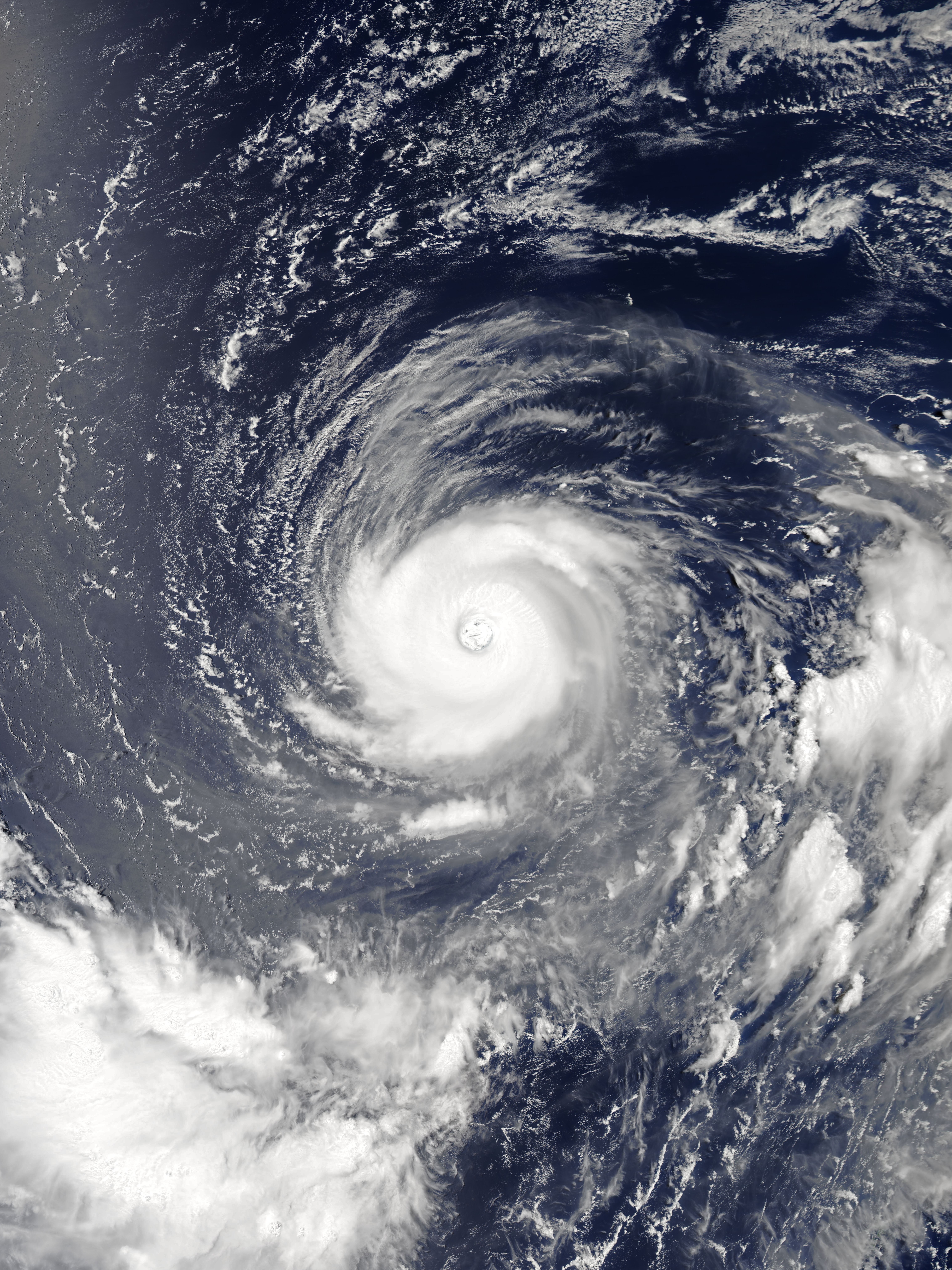
A typhoon is a tropical cyclone that develops between 180° and 100°E in the Northern Hemisphere and which produces sustained hurricane-force winds of at least . This region is referred to as the Northwestern Pacific Basin, accounting for almost one third of the world's tropical cyclones. For organizational purposes, the northern Pacific Ocean is divided into three regions: the eastern (North America to 140°W), central (140°W to 180°), and western (180° to 100°E). The Regional Specialized Meteorological Center (RSMC) for tropical cyclone forecasts is in Japan, with other tropical cyclone warning centres for the northwest Pacific in Hawaii (the Joint Typhoon Warning Center), the Philippines, and Hong Kong. Although the RSMC names each system, the main name list itself is coordinated among 18 countries that have territories threatened by typhoons each year. Within most of the northwestern Pacific, there are no official typhoon seasons as tropical cyclones form throughout ... [...More Info...] [...Related Items...] OR: [Wikipedia] [Google] [Baidu] |
Government Of Hong Kong
The Government of the Hong Kong Special Administrative Region (commonly known as the Hong Kong Government or HKSAR Government) is the executive authorities of Hong Kong. It was established on 1 July 1997, following the handover of Hong Kong. The Chief Executive and the principal officials are appointed by the State Council of the People's Republic of China in accordance with the outcome of local processes. The Government Secretariat is headed by the Chief Secretary of Hong Kong, who is the most senior principal official of the Government. The Chief Secretary and the other secretaries jointly oversee the administration of Hong Kong, give advice to the Chief Executive as members of the Executive Council, and are accountable for their actions and policies to the Chief Executive and the Legislative Council. Under the " one country, two systems" constitutional principle, the Government is, in law, exclusively in charge of Hong Kong's internal affairs and specified external ... [...More Info...] [...Related Items...] OR: [Wikipedia] [Google] [Baidu] |
Tanka (ethnic Group)
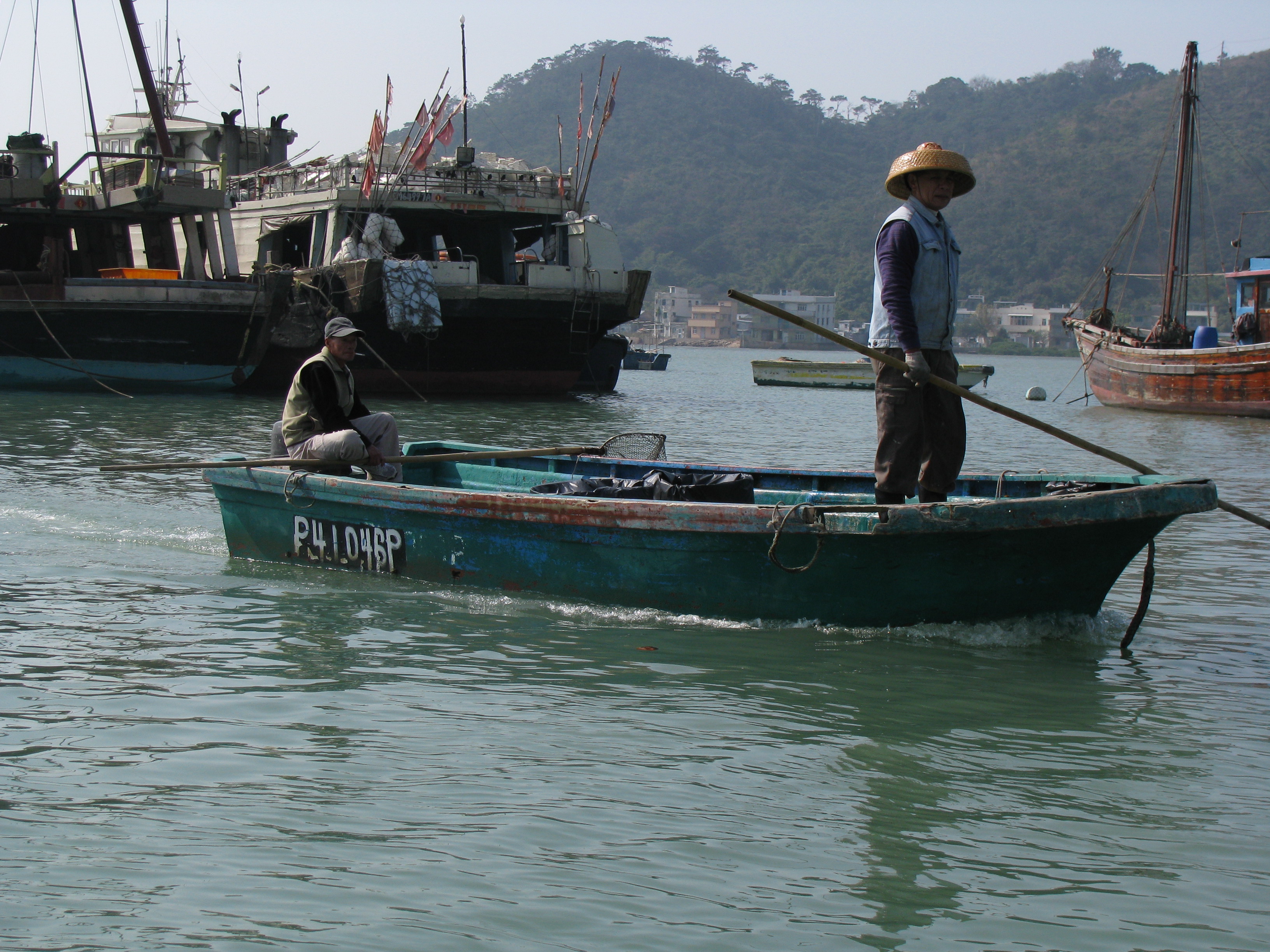
The Boat Dwellers, also known as Shuishangren (; "people living on the water") or Boat People, or the derogatory Tankas, are a sinicised ethnic group in Southern China who traditionally lived on junks in coastal parts of Guangdong, Guangxi, Fujian, Hainan, Shanghai, Zhejiang and along the Yangtze river, as well as Hong Kong, and Macau. The Boat Dwellers are referred to with other names outside of Guangdong. Though many now live onshore, some from the older generations still live on their boats and pursue their traditional livelihood of fishing. The origins of the Boat Dwellers can be traced back to the native ethnic minorities of southern China known historically as the Baiyue, who may have taken refuge on the sea and gradually assimilated into Han Chinese culture. However, they have preserved many of their native traditions not found in Han culture. A small number of Boat Dwellers also live in parts of Vietnam. There they are called Dan () and are classified as a subgrou ... [...More Info...] [...Related Items...] OR: [Wikipedia] [Google] [Baidu] |


