|
Yalgoo (biogeographic Region)
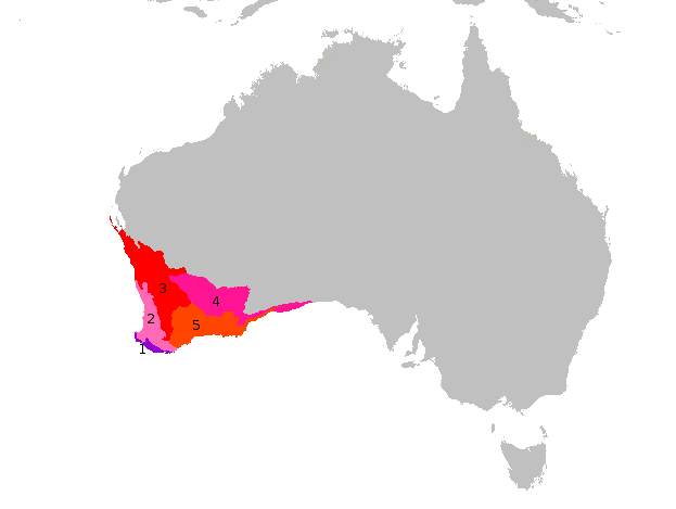
Yalgoo is an interim Australian bioregion located in Western Australia. It has an area of . The bioregion, together with the Avon Wheatbelt and Geraldton Sandplains bioregions, is part of the larger Southwest Australia savanna ecoregion as classified by the World Wildlife Fund. Geography The Yalgoo bioregion extends southeastwards from the southern end of Shark Bay on Australia's west coast nearly to Lake Barlee in the interior of Western Australia. The western portion, known as the Edel subregion, includes the Edel Land peninsula and Dirk Hartog, Bernier, and Dorre islands, which enclose Shark Bay on the west. It also includes the coastal plain south of Shark Bay nearly to Kalbarri, where it transitions to the Geraldton Sandplains bioregion. The Edel subregion rests on the Carnarvon and Perth sedimentary basins. The Zuytdorp Cliffs line the coast from the northern end of Edel Land to the mouth of the Murchison River. Soils are generally white sands along the coast, an ... [...More Info...] [...Related Items...] OR: [Wikipedia] [Google] [Baidu] |
Zuytdorp Cliffs
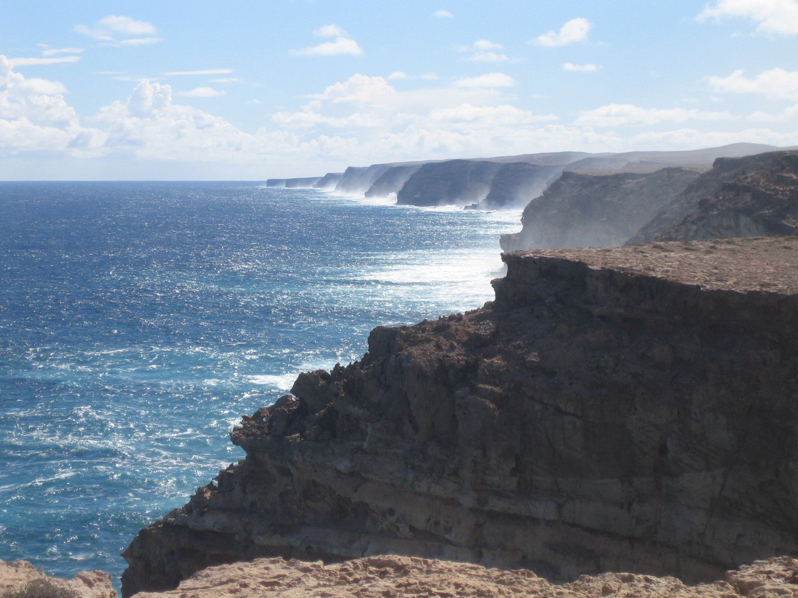
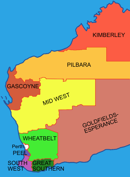
The Zuytdorp Cliffs extend for about along a rugged, spectacular and little visited segment of the Western Australian Indian Ocean coast. The cliffs extend from just south of the mouth of the Murchison River at Kalbarri, to Pepper Point south of Steep Point. The cliffs are situated in both the Gascoyne and Mid West regions of the state. At the highest point, near Womerangee Hill, the top of the cliffs are above the sea. They are named after , a trading ship of the Dutch East India Company that was wrecked against the cliffs in 1712. Geology The Zuytdorp Cliffs are composed of Pleistocene aged limestone, a formation called the Tamala Limestone. This limestone formed by the cementation of ancient calcareous sand dunes that accumulated near the coast during episodes of the last ice age. It has been inferred that the relatively straight edge of the cliffs is due to a major fault line just off shore.Hearty, Paul J & O'Leary, Michael J (1 February 2008). Carbonate eolianites, ... [...More Info...] [...Related Items...] OR: [Wikipedia] [Google] [Baidu] |
Dirk Hartog Island
Dirk Hartog Island is an island off the Gascoyne (Western Australia), Gascoyne coast of Western Australia, within the Shark Bay, Western Australia, Shark Bay World Heritage Area. It is about long and between wide and is Western Australia's largest and westernmost island. It covers an area of and is approximately north of Perth. Known as by the First Nations Australian traditional custodianship, traditional custodians of the island, the Malgana people, the island is named after Dirk Hartog, a Dutch sea captain, whose ship first encountered the Western Australian coastline in 1616, close to the 26th parallel south latitude, which runs through the island. After leaving the island, Hartog continued his voyage north-east along the coast, giving the Australian mainland one of its earliest known names, Eendrachtsland, which he named after his ship ''Eendracht (1615 ship), Eendracht'', meaning "concord". The island is now the site of a major environmental reconstruction project ... [...More Info...] [...Related Items...] OR: [Wikipedia] [Google] [Baidu] |
Southwest Australia
Southwest Australia is a biogeographic region in Western Australia. It includes the Mediterranean-climate area of southwestern Australia, which is home to a diverse and distinctive flora and fauna. The region is also known as the Southwest Australia Global Diversity Hotspot. Geography The region includes the Mediterranean forests, woodlands, and scrub ecoregions of Western Australia. The region covers 356,717 km2, consisting of a broad coastal plain 20–120 kilometres wide, transitioning to gently undulating uplands made up of weathered granite, gneiss and laterite. Bluff Knoll in the Stirling Range is the highest peak in the region, at 1,099 metres (3,606 ft) elevation. Desert and xeric shrublands lie to the north and east across the centre of Australia, separating Southwest Australia from the other Mediterranean and humid-climate regions of the continent. Climate The region has a wet-winter, dry-summer Mediterranean climate, one of five such regions in the worl ... [...More Info...] [...Related Items...] OR: [Wikipedia] [Google] [Baidu] |
Mediterranean Climate
A Mediterranean climate ( ), also called a dry summer climate, described by Köppen and Trewartha as ''Cs'', is a temperate climate type that occurs in the lower mid-latitudes (normally 30 to 44 north and south latitude). Such climates typically have dry summers and wet winters, with summer conditions being hot and winter conditions typically being mild. These weather conditions are typically experienced in the majority of Mediterranean-climate regions and countries, but remain highly dependent on proximity to the ocean, altitude and geographical location. The dry summer climate is found throughout the warmer middle latitudes, affecting almost exclusively the western portions of continents in relative proximity to the coast. The climate type's name is in reference to the coastal regions of the Mediterranean Sea, which mostly share this type of climate, but it can also be found in the Atlantic portions of Iberia and Northwest Africa, the Pacific portions of the United States ... [...More Info...] [...Related Items...] OR: [Wikipedia] [Google] [Baidu] |
Edel (biogeographic Subregion)
Edel is both a surname and a given name. Notable people with the name include: Surname * Abraham Edel (1908–2007), North American philosopher and ethicist * Alfred William Edel (c. 1930–2005), American television news presenter * Apoula Edel (born 1986), Cameroonian-Armenian footballer * Leon Edel (1907–1997), North American literary critic and biographer * Uli Edel (born 1947), German film director Given name ;Male: * Edel (footballer), Ildefonso Soares de Oliveira (born 1958), Brazilian footballer * Edel Oliva (born 1965), Cuban race walker * Edel Rodriguez (born 1971), Cuban-American artist and illustrator ;Female, Irish: Pronounced * Edel Quinn (1907–1944), Irish lay missionary * Edel Bhreathnach, Irish historian and academic * Edel McMahon (born 1994), Irish rugby player ;Female, Scandinavian: * Edel Eckblad (1914–1994), Norwegian actress * Edel Hætta Eriksen (1921–2023), Norwegian schoolteacher and politician * Edele Jernskjæg (died 1512), Danish noble, lady ... [...More Info...] [...Related Items...] OR: [Wikipedia] [Google] [Baidu] |
IBRA 6
The Interim Biogeographic Regionalisation for Australia (IBRA) is a biogeography, biogeographic regionalisation of Australia developed by the Australian government's Department of Sustainability, Environment, Water, Population and Communities (Australia), Department of Sustainability, Environment, Water, Population, and Communities. It was developed for use as a planning tool, for example for the establishment of a national Reserve System, national reserve system. The first version of IBRA was developed in 1993–94 and published in 1995. Within the broadest scale, Australia is a major part of the Australasia Australasian realm, biogeographic realm, as developed by the World Wide Fund for Nature. Based on this system, the world is also split into Biome#Olson & Dinerstein (1998) biomes for WWF / Global 200, 14 terrestrial habitats, also called biomes, of which eight are shared by Australia. The Australian land mass is divided into 89 bioregions and 419 Terrestrial ecoregion, subr ... [...More Info...] [...Related Items...] OR: [Wikipedia] [Google] [Baidu] |
States And Territories Of Australia
The states and territories are the national subdivisions and second level of government of Australia. The states are partially sovereignty, sovereign, administrative divisions that are autonomous administrative division, self-governing polity, polities, having ceded some sovereign rights to the Australian Government, federal government. They have their own state constitutions in Australia, constitutions, Parliaments of the Australian states and territories, legislatures, Premiers and chief ministers of the Australian states and territories, executive governments, Judiciary of Australia#State and territory courts and tribunals, judiciaries and state police#Australia, law enforcement agencies that administer and deliver public policy, public policies and programs. Territories can be autonomous administrative division, autonomous and administer local policies and programs much like the states in practice, but are still legally subordinate to the federal government. Australia has si ... [...More Info...] [...Related Items...] OR: [Wikipedia] [Google] [Baidu] |
Murchison River (Western Australia)
The Murchison River is the second longest river in Western Australia. It flows for about from the southern edge of the Robinson Ranges to the Indian Ocean at Kalbarri. The Murchison-Yalgar-Hope river system is the longest river system in Western Australia. It has a mean annual flow of 208 gigalitres, although in 2006, the peak year on record since 1967, flow was 1,806gigalitres. Basin The Murchison River basin covers an area of about in the Mid West region of Western Australia. It extends about inland from the Indian Ocean, onto the Yilgarn craton east of Meekatharra and north of Sandstone. Rain generally falls in the upper basin during summer cyclones, so for much of the year the Murchison River does not flow, leaving a dry sandy river bed and intermittent permanent pools. The eastern reaches of the basin contain large chains of salt lakes, which flow only following rainfall. The drainage lines from these lakes merge to form the Murchison River about north-north ... [...More Info...] [...Related Items...] OR: [Wikipedia] [Google] [Baidu] |
Perth Basin
The Perth Basin is a thick, elongated sedimentary basin in Western Australia. It lies beneath the Swan Coastal Plain west of the Darling Scarp, representing the western limit of the much older Yilgarn craton, and extends further west offshore. Cities and towns including Perth, Busselton, Bunbury, Mandurah and Geraldton are built over the Perth Basin. Geological setting and evolution The Perth Basin began forming in the Late Permian during the breakup of Gondwana, as the Australian continental plate began rifting away from the African and Indian continental plates. During the Permian, what is now the Perth Basin was the eastern half of a rift valley that formed as the continental plates were pulled apart. This pulling apart, which continued until the Jurassic, led to the central zone subsiding as a graben allowing the sea to enter with the subsequent deposition of transgressive marine sediments. The Perth Basin architecture is dominated by listric, extensional faulting that ... [...More Info...] [...Related Items...] OR: [Wikipedia] [Google] [Baidu] |
Carnarvon Basin
The Carnarvon Basin is a geological basin located in the north west of Western Australia which extends from the Dampier Archipelago to the Murchison bioregion, and is the main geological feature that makes up the North West Shelf. The onshore part of the Carnarvon Basin covers about 115,000 km2 and the offshore part covers approximately 535,000 km2 with water depths up to 3,500 metres. It is separated into two major areas - the Northern Carnarvon Basin, and the Southern Carnarvon Basin. Northern Carnarvon Basin The Northern Carnarvon Basin includes the Exmouth Plateau, Wombat Plateau (on the northern part of the Exmouth Plateau), Investigator Sub-basin, Rankin Platform, Exmouth Sub-basin, Barrow Sub-basin, Dampier Sub-basin, Beagle Sub-basin, Enderby Terrace, Peedamullah Shelf and the Lambert Shelf. [...More Info...] [...Related Items...] OR: [Wikipedia] [Google] [Baidu] |


