|
Xicotepec
Xicotepec (in Nahuatl: xico; tepetl, ' jicote or bumblebee; hill' 'Hill of jicotes'') is one of the 217 municipalities that make up the Mexican state of Puebla in central-eastern Mexico. It is located within the Sierra Norte de Puebla and belongs to the first region of the state. Its head is the city of Xicotepec de Juárez, which has been recognized by the Mexico's Secretary of Tourism as one of the 121 pueblos mágicos (magical towns) in the country since 2012. History It is said that the first expeditionaries of this place were the Olmecs, who found on these lands a depression that seemed adequate to raise their ceremonial center; torrential rains, its special topography, the confluence of two rivers and dense vegetation made it the ideal place to live. A Huastec warrior named Cuextécatl fought and expelled the Olmecs, withdrawing them to the coast, thus the Huastecs took possession of the place. This place gained importance and was categorized as ceremonial center, whi ... [...More Info...] [...Related Items...] OR: [Wikipedia] [Google] [Baidu] |
Puebla
Puebla ( en, colony, settlement), officially Free and Sovereign State of Puebla ( es, Estado Libre y Soberano de Puebla), is one of the 32 states which comprise the Federal Entities of Mexico. It is divided into 217 municipalities and its capital is the city of Puebla. It is located in East-Central Mexico. It is bordered by the states of Veracruz to the north and east, Hidalgo, México, Tlaxcala and Morelos to the west, and Guerrero and Oaxaca to the south. The origins of the state lie in the city of Puebla, which was founded by the Spanish in this valley in 1531 to secure the trade route between Mexico City and the port of Veracruz. By the end of the 18th century, the area had become a colonial province with its own governor, which would become the State of Puebla, after the Mexican War of Independence in the early 19th century. Since that time the area, especially around the capital city, has continued to grow economically, mostly through industry, despite being the scen ... [...More Info...] [...Related Items...] OR: [Wikipedia] [Google] [Baidu] |
Sierra Norte De Puebla
The Sierra Norte de Puebla is a rugged mountainous region accounting for the northern third of the state of Puebla, Mexico. It is at the intersection of the Trans-Mexican Volcanic Belt and the Sierra Madre Oriental, between the Mexican Plateau and the Gulf of Mexico coast. From the Mesoamerican period to the 19th century, this area was part of a larger region called Totonacapan, and area dominated by the Totonac people, extending further east to the Gulf of Mexico. Political maneuvers to weaken the Totonacs led to the region being divided between the modern states of Puebla and Veracruz with the Puebla section given its current name. Until the 19th century, the area was almost exclusively indigenous, with the four main groups still found here today, Totonacs, Nahuas, Otomis and Tepehuas, but coffee cultivation brought in mestizos (mixed indigenous/European people) and some European immigrants who took over political and economic power. While highly marginalized socioecon ... [...More Info...] [...Related Items...] OR: [Wikipedia] [Google] [Baidu] |
Municipalities Of Puebla
Puebla is a state in central Mexico that is divided into 217 municipalities. According to the 2020 Mexican Census, it is the fifth most populated state with inhabitants and the 21st largest by land area spanning . Municipalities in Puebla are administratively autonomous of the state according to the 115th article of the 1917 Constitution of Mexico. Every three years, citizens elect a municipal president (Spanish: ''presidente municipal'') by a plurality voting system who heads a concurrently elected municipal council (''ayuntamiento'') responsible for providing all the public services for their constituents. The municipal council consists of a variable number of trustees and councillors (''regidores y síndicos''). Municipalities are responsible for public services (such as water and sewerage), street lighting, public safety, traffic, and the maintenance of public parks, gardens and cemeteries. They may also assist the state and federal governments in education, emergency fire ... [...More Info...] [...Related Items...] OR: [Wikipedia] [Google] [Baidu] |
Pueblos Mágicos
The Programa Pueblos Mágicos (; "Magical Towns Programme") is an initiative led by Mexico's Secretariat of Tourism, with support from other federal agencies, to promote a series of towns around the country that offer visitors special experiences because of their natural beauty, cultural richness, traditions, folklore, historical relevance, cuisine, art crafts, and great hospitality. It is intended to increase tourism to more localities, especially smaller towns in rural areas. The program promotes visiting small, rural towns, where visitors may see indigenous crafts, spectacular landscapes and other attractions. The Government created the 'Pueblos Mágicos' program to recognize places across the country that have certain characteristics and traditions that make them unique, and historically significant, offering magical experiences to visitors. A "Magical Village" is a place with symbolism, legends, history, important events, festivals, traditions, great food, and enjoyable s ... [...More Info...] [...Related Items...] OR: [Wikipedia] [Google] [Baidu] |
Totonac
The Totonac are an indigenous people of Mexico who reside in the states of Veracruz, Puebla, and Hidalgo. They are one of the possible builders of the pre-Columbian city of El Tajín, and further maintained quarters in Teotihuacán (a city which they claim to have built). Until the mid-19th century they were the world's main producers of vanilla. Etymology The term "totonac" refers to the people living in Totonacapan. There is no agreement as to the origin of the term. Some authors have translated the term "totonac" as a Nahuatl word meaning "People of Hot Land". The translation for this word in the Totonac Language, according to sources, is "toto-nacu" meaning "three hearts" signifying their three cities or cultural centers: Cempoala, Tajin and Teayo. Evidence, however, is inconclusive. Geography and traditional lifestyle In the 15th century, the Aztecs labeled the region of the Totonac " Totonacapan"; which then extended roughly from Papantla in the north to Cem ... [...More Info...] [...Related Items...] OR: [Wikipedia] [Google] [Baidu] |
Nezahualcoyotl (tlatoani)
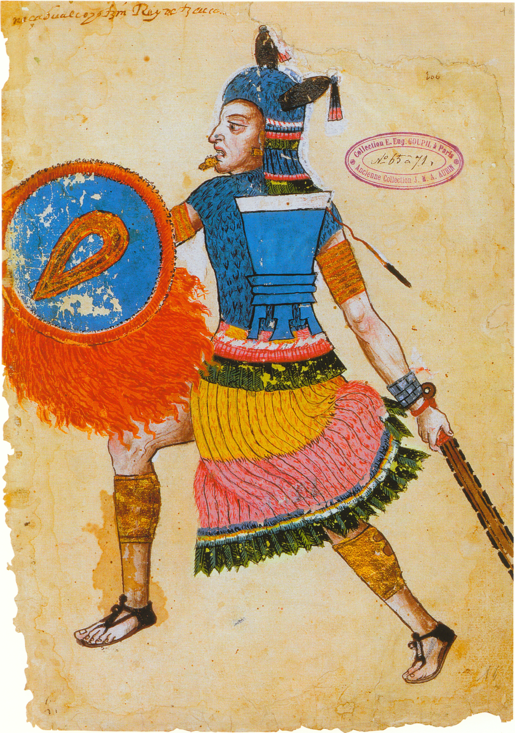
Nezahualcoyotl ( nci, Nezahualcoyōtl , ) (April 28, 1402 – June 4, 1472) was a scholar, philosopher (tlamatini), warrior, architect, poet and ruler (''tlatoani'') of the city-state of Texcoco (altepetl), Texcoco in pre-Columbian era Mexico. Unlike other high-profile Mexican figures from the century preceding Spanish conquest of the Aztec Empire, Nezahualcoyotl was not fully Mexica; his father's people were the Acolhua, another Nahuan people settled in the eastern part of the Valley of Mexico, on the coast of Lake Texcoco. His mother, however, was the sister of Chimalpopoca, the Mexica king of Tenochtitlan. He is best remembered for his poetry, but according to accounts by his descendants and biographers, Fernando de Alva Cortés Ixtlilxóchitl and Juan Bautista Pomar, he had an experience of an "Unknown, Unknowable Lord of Everywhere" to whom he built an entirely empty temple in which no blood sacrifices of any kind were allowed — not even those of animals. However, he allowed ... [...More Info...] [...Related Items...] OR: [Wikipedia] [Google] [Baidu] |
Otomi
The Otomi (; es, Otomí ) are an indigenous people of Mexico inhabiting the central Mexican Plateau (Altiplano) region. The Otomi are an indigenous people of Mexico who inhabit a discontinuous territory in central Mexico. They are linguistically related to the rest of the Otomanguean-speaking peoples, whose ancestors have occupied the Trans-Mexican Volcanic Belt since several millennia before the Christian era. Currently, the Otomi inhabit a fragmented territory ranging from northern Guanajuato, to eastern Michoacán and southeastern Tlaxcala. However, most of them are concentrated in the states of Hidalgo, Mexico and Querétaro. According to the National Institute of Indigenous Peoples of Mexico, the Otomi ethnic group totaled 667,038 people in the Mexican Republic in 2015, making them the fifth largest indigenous people in the country. Of these, only a little more than half spoke Otomi. In this regard, it should be said that the Otomi language presents a high degree of inter ... [...More Info...] [...Related Items...] OR: [Wikipedia] [Google] [Baidu] |
Texcoco (altepetl)
Tetzcoco ( Classical Nahuatl: ''Tetzco(h)co'' ) was a major Acolhua altepetl (city-state) in the central Mexican plateau region of Mesoamerica during the Late Postclassic period of pre-Columbian Mesoamerican chronology. It was situated on the eastern bank of Lake Texcoco in the Valley of Mexico, to the northeast of the Aztec capital, Tenochtitlan. The site of pre-Columbian Tetzcoco is now subsumed by the modern Mexico, Mexican ''municipio (Mexico), municipio'' of Texcoco, Mexico State, Texcoco and its major settlement, the city formally known as Texcoco de Mora. It also lies within the greater metropolitan area of Mexico City. Pre-Columbian Tetzcoco is most noted for its membership in the Aztec Triple Alliance. At the time of the Spanish conquest of the Aztec Empire, it was one of the largest and most prestigious cities in central Mexico, second only to the Aztec capital, Tenochtitlan. A survey of Mesoamerican cities estimated that pre-conquest Tetzcoco had a population of 2 ... [...More Info...] [...Related Items...] OR: [Wikipedia] [Google] [Baidu] |
Acolhua
The Acolhua are a Mesoamerican people who arrived in the Valley of Mexico in or around the year 1200 CE. The Acolhua were a sister culture of the Aztecs (or Mexica) as well as the Tepanec, Chalca, Xochimilca and others. The most important political entity in ancient Mesoamerica was the Triple Alliance (Nahuatl, ''excan tlatoloyan''), founded in 1428 when the rulers of Tenochtitlan, Tetzcoco, and Tlacopan formed an alliance that replaced the Tepanec Empire of Azcapotzalco and eventually integrated into a single polity the most developed regions of western Mesoamerica. Because of the predominance of Tenochtitlan, it has also been called the Mexica, Aztec, or Tenochca Empire. It came to an end with the Spanish conquest of 1521. Each of the three allied kings led a group of lesser kingdoms that coincided with the three major ethnic components and political powers of previous times: the Colhuas, the Acolhua-Chichimecs, and the Tepanecs. The domain of Tenochtitlan was the southern p ... [...More Info...] [...Related Items...] OR: [Wikipedia] [Google] [Baidu] |


