|
Wynd
In Scotland and Northern England, a wynd () is a narrow lane between houses. The word derives from Old Norse ''venda'' ("to turn"), implying a turning off a main street, without implying that it is curved. In fact, most wynds are straight. In many places wynds link streets at different heights and thus are mostly thought of as being ways up or down hills. Locations There are many wynds in North Yorkshire and County Durham, such as "Bull Wynd" in Darlington and Castle Wynd in Richmond, North Yorkshire. The Old Town of Edinburgh had many wynds, such as St. Mary's Wynd, Blackfriars Wynd and Niddry Wynd, until Victorian street improvements in the 19th century led them to be widened and thus, renamed "streets". Wynds feature prominently in the city centre of Aberdeen, a testament to the medieval street pattern in the city's past. Before the levelling of St. Catherine's Hill and the construction of Union Street, Back Wynd served as the main thoroughfare to and from The Green, the ... [...More Info...] [...Related Items...] OR: [Wikipedia] [Google] [Baidu] |
Northern England
Northern England, or the North of England, refers to the northern part of England and mainly corresponds to the Historic counties of England, historic counties of Cheshire, Cumberland, County Durham, Durham, Lancashire, Northumberland, Westmorland and Yorkshire. Officially, it is a grouping of three Regions of England, statistical regions: the North East England, North East, the North West England, North West, and Yorkshire and the Humber, which had a combined population of 15.5 million at the 2021 United Kingdom census, 2021 census, an area of and 17 City status in the United Kingdom, cities. Northern England is cultural area, culturally and Economic inequality, economically distinct from both the Midlands of England, Midlands and Southern England. The area's northern boundary is the Anglo-Scottish border, border with Scotland, its western the Irish Sea and a short England–Wales border, border with Wales, and its eastern the North Sea. Its southern border is often debated, ... [...More Info...] [...Related Items...] OR: [Wikipedia] [Google] [Baidu] |
Old Town, Edinburgh
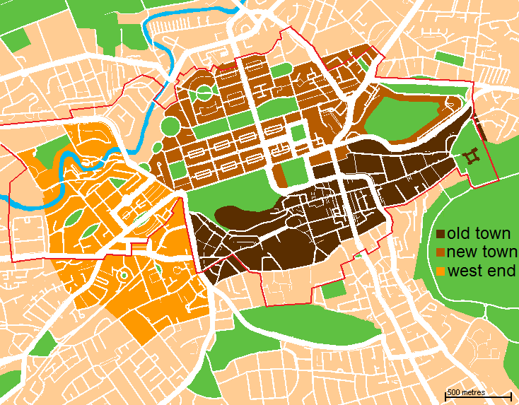
The Old Town () is the oldest part of Scotland's capital city of Edinburgh. The area has preserved much of its medieval street plan and many Scottish Reformation, Reformation-era buildings. Together with the 18th/19th-century New Town, Edinburgh, New Town, and West End, Edinburgh, West End, it forms part of a protected UNESCO World Heritage Site. Royal Mile The "Royal Mile" is a name coined in the early 20th century for the main street of the Old Town which runs on a downwards slope from Edinburgh Castle to Holyrood Palace and the ruined Holyrood Abbey. Narrow ''List of closes on the Royal Mile, closes'' (alleyways), often no more than a few feet wide, lead steeply downhill to both north and south of the main spine which runs west to east. Significant buildings in the Old Town include St. Giles' Cathedral, the General Assembly Hall of the Church of Scotland, the National Museum of Scotland, the Old College, University of Edinburgh, Old College of the University of Edinburgh, P ... [...More Info...] [...Related Items...] OR: [Wikipedia] [Google] [Baidu] |
Old Tolbooth Wynd, Canongate, Edinburgh
Old or OLD may refer to: Places *Old, Baranya, Hungary *Old, Northamptonshire, England *Old Street station, a railway and tube station in London (station code OLD) *OLD, IATA code for Old Town Municipal Airport and Seaplane Base, Old Town, Maine, United States People *Old (surname) Music *OLD (band), a grindcore/industrial metal group * ''Old'' (Danny Brown album), a 2013 album by Danny Brown * ''Old'' (Starflyer 59 album), a 2003 album by Starflyer 59 * "Old" (song), a 1995 song by Machine Head *"Old", a 1982 song by Dexys Midnight Runners from ''Too-Rye-Ay'' Other uses * ''Old'' (film), a 2021 American thriller film *''Oxford Latin Dictionary'' *Online dating *Over-Locknut Distance (or Dimension), a measurement of a bicycle wheel and frame See also *Old age *List of people known as the Old *''Old LP'', a 2019 album by That Dog * * *Olde, a list of people with the surname *Olds (other) Olds may refer to: People * The olds, a jocular and irreverent online nick ... [...More Info...] [...Related Items...] OR: [Wikipedia] [Google] [Baidu] |
East Neuk
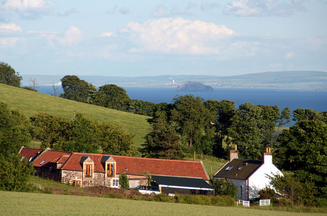
The East Neuk () or East Neuk of Fife is an area of the coast of Fife, Scotland. "Neuk" is the Scots language, Scots word for nook or corner, and the East Neuk is generally accepted to comprise the fishing villages of the most northerly part of the Firth of Forth and the land and villages slightly inland. It would include Elie and Earlsferry, Colinsburgh, St Monans, Pittenweem, Arncroach, Carnbee Parish, Scotland, Carnbee, Anstruther, Cellardyke, Kilrenny, Crail, and the immediate hinterland, as far as the upland area known as the Riggin o Fife. The area houses a Cold War era bunker near Crail. Built in the late 1950s to be a Regional Seat of Government, regional seat of government in the event of a Nuclear warfare, nuclear war, it is now a tourist attraction. See also *Fife Coastal Path References External links ''Collins Encyclopaedia of Scotland'' John Keay ''The East Neuk of Fife: Its History and Antiquities, Geology, Botany, and Natural History in General'' Rev. Walt ... [...More Info...] [...Related Items...] OR: [Wikipedia] [Google] [Baidu] |
Ginnel
A ginnel is a word in various Scottish and northern English dialects describing a fenced or walled alley between residential buildings that provides a pedestrian shortcut to nearby streets.Ginnel Yorkshire Historical Dictionary. Retrieved 16 November 2022. Ginnels are typically found in suburban areas, and do not contain any business premises, unlike some other types of alley. Other related terms include snicket, tenfoot and Snickelways of York, snickelway.This is why a ginnel is called a ginnel in Yorkshire - according to the experts By Danielle Hoe from Examiner Live. 29 March 2020. Retrieved 16 N ... [...More Info...] [...Related Items...] OR: [Wikipedia] [Google] [Baidu] |
Vennel
A vennel is a passageway between the gables of two buildings which can in effect be a minor street in Scotland and the north east of England, particularly in the old centre of Durham. Etymology In Scotland, the term originated in royal burghs created in the twelfth century, the word deriving from the Old French word ''venelle'' meaning "alley" or "lane". Unlike a tenement entry to private property, known as a "close", a vennel was a public way leading from a typical high street to the open ground beyond the Burgage">burgage plots. The Latin form is ''venella'', related to the English word "funnel". Names The Scottish burgh, Scottish burghs established by David I of Scotland, David I (see Burghs section of [ conomy of Scotland in the High Middle Ages) drew upon the burgh model of Newcastle upon Tyne and used a number of French or Germanic words for townscape features. Aberdeen City Council refers to vennels having been part of the old town and historical records suggest A ... [...More Info...] [...Related Items...] OR: [Wikipedia] [Google] [Baidu] |
Bald Head Island, North Carolina
Bald Head Island, historically Smith Island, is a village located on the east side of the Cape Fear River in Brunswick County, North Carolina, United States. Compared to the nearby city of Wilmington to the north, the village of Bald Head Island is small and somewhat remote. Despite its name, Bald Head Island is not an island. The historical Corncake Inlet that separated it from Kure Beach filled in after Hurricane Floyd in 1999 and has remained closed ever since. It is accessible by ferry from the nearby town of Southport and by four-wheel drive vehicle along the beach strand from Fort Fisher to the north. Only government officials are allowed to drive the beach strand route. There are few cars on the island; instead, residents drive modified electric golf carts. Bald Head Island is nationally recognized for its sea turtle nesting activity. The population of the village was 268 at the 2020 census. The village is part of the Wilmington metropolitan area. The village is revere ... [...More Info...] [...Related Items...] OR: [Wikipedia] [Google] [Baidu] |
Abernethy Round Tower
Abernethy Round Tower is a stone-built Irish-style round tower which stands in School Wynd in Abernethy, Perthshire. It is one of two round towers in Scotland, alongside the tower at Brechin Cathedral. The tower is located on the town's School Wynd within the village's cemetery alongside St Bride's parish church. Dating from the 11th century, the tower is protected as a scheduled monument. History The tower is associated with the historic abbey or monastery in the village - previously held by Culdees and later as an by Augustinians before its dissolution in the mid-16th century. Remains of the abbey were still visible in the late 18th century but are now lost. https://canmore.org.uk/site/27936/abernethy-culdees-monastery A plaque on the tower commemorates the site as the place where Malcolm III of Scotland paid homage to William the Conqueror in 1072, some six years after the Battle of Hastings, in the Treaty of Abernethy. Structure The sandstone tower is high and has a d ... [...More Info...] [...Related Items...] OR: [Wikipedia] [Google] [Baidu] |
Abernethy, Perth And Kinross
Abernethy is a village and former burgh in the Perth and Kinross council area and historic county of Perthshire, in the east central Lowlands of Scotland. The village is situated in rural Strathearn, south-east of the city of Perth, near the River Earn's confluence with the River Tay and on the northern edge of the Ochil Hills. Formerly the site of a number of Roman encampments, Abernethy became an important Pictish religious and political centre. The village was the setting for the Treaty of Abernethy, where Malcolm Canmore gave allegiance to William the Conqueror and its mediaeval round tower marks the site of a former abbey and, later, collegiate church. The civil parish of Abernethy also contains the nearby settlement of Aberargie and traditionally extends to Mugdrum Island in the Firth of Tay. It is part of the Almond and Earn ward for elections to Perth and Kinross Council History Etymology Abernethy, recorded in the 10th century as ''Aburnethige'', means 'mouth o ... [...More Info...] [...Related Items...] OR: [Wikipedia] [Google] [Baidu] |
School Wynd
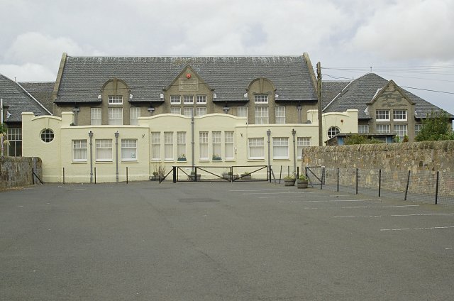
School Wynd is a street and open space in the centre of Abernethy, Perth and Kinross, Scotland. Running between Main Street in the south and Back Dykes in the north, it is the site of Abernethy Round Tower, a scheduled monument dating to the 18th century. The street is named for the school which formerly operated on it, a building now occupied by Abernethy Museum. The village's Category C listed parish church and mercat cross A mercat cross is the Scots language, Scots name for the market cross found frequently in Scotland, Scottish cities, towns and villages where historically the right to hold a regular market or fair was granted by the monarch, a bishop or ... also stand on School Wynd.{{Cite web , title=SCHOOL WYND, ABERNETHY PARISH CHURCH (LB20876) , url=https://portal.historicenvironment.scot/designation/LB20876 , access-date=2023-02-03 , website=portal.historicenvironment.scot See also * Wynd References Streets in Scotland ... [...More Info...] [...Related Items...] OR: [Wikipedia] [Google] [Baidu] |
Fife
Fife ( , ; ; ) is a council areas of Scotland, council area and lieutenancy areas of Scotland, lieutenancy area in Scotland. A peninsula, it is bordered by the Firth of Tay to the north, the North Sea to the east, the Firth of Forth to the south, Perth and Kinross to the west and Clackmannanshire to the south-west. The largest settlement is the city of Dunfermline, and the administrative centre is Glenrothes. The area has an area of and had a resident population of in , making it Scotland's largest local authority area by population. The population is concentrated in the south, which contains Dunfermline, Kirkcaldy and Glenrothes. The north is less densely populated, and the largest town is St Andrews on the north-east coast. The area is governed by the unitary Fife Council. It covers the same area as the Counties of Scotland, historic county of the same name. Fife was one of the major Picts, Pictish monarchy, kingdoms, known as ''Fib'', and is still commonly known as the ... [...More Info...] [...Related Items...] OR: [Wikipedia] [Google] [Baidu] |
Pittenweem
Pittenweem ( ) is a fishing village and civil parish in Fife, on the east coast of Scotland. At the 2001 census, it had a population of 1,747. Etymology The name derives from Pictish and Scottish Gaelic. "Pit-" represents Pictish ''pett'' 'place, portion of land', and "-enweem" is Gaelic ''na h-Uaimh'', 'of the Caves' in Gaelic, so "The Place of the Caves", named after St Fillan's cave. The name is rendered ''Baile na h-Uaimh'' in modern Gaelic, with ''baile'', 'town, settlement', substituted for the Pictish prefix. History The settlement has existed as a fishing village since early medieval times. The oldest structure, St. Fillan's Cave, dates from the 7th century. An Augustinian priory moved here from the Isle of May in the 13th century, but there was already a church at that time. Pittenweem Parish Church (which is attached to the local tolbooth) has a Norman doorway dating to before 1200. The gatehouse to the east is 15th century. The priory dormitory and refectory was ... [...More Info...] [...Related Items...] OR: [Wikipedia] [Google] [Baidu] |


