|
Wye Valley Walk
The Wye Valley Walk () is a long distance footpath in Wales and England following the course of the River Wye. History In 1975 the Wye Valley Walk opened with a stretch between St. Arvans and Monmouth. Further stretches were added, leading to it becoming a 34-mile (55 km) footpath by 1981. During the 1980s, gaps between Ross-on-Wye, Hay-on-Wye and Rhayader were integrated into the pathway, forming a walk reaching from near the river's mouth at Chepstow in Monmouthshire, to Rhayader in Mid Wales. In September 2002, the route was finally extended to start or finish in Coed Hafren, having passed within viewing distance of the source of the River Wye on Plynlimon near Aberystwyth, a total of . The route The Wye Valley Walk is marked out by circular yellow waymark arrows, finger posts, and signs showing the path's logo, a leaping salmon. Most of the route follows Public Rights of Way. Some parts are permissive paths where owners have agreed for them to be used. Par ... [...More Info...] [...Related Items...] OR: [Wikipedia] [Google] [Baidu] |
Lydbrook Junction Railway Station
Lydbrook Junction railway station is a disused railway station in England opened by the Ross and Monmouth Railway in 1873, it remained open for 91 years until 1964 when the line finally closed to freight, though passenger services ceased in 1959. The station was constructed in the hamlet of Stowfield approximately } from Lydbrook and its viaduct on the Severn and Wye Railway. It was located approximately along the railway from Ross-on-Wye station. In 1874 the Severn and Wye Railway opened a branch from Serridge Junction and Cinderford, passenger services commenced in 1875. All passenger trains along the S&W branch were withdrawn from 1929. History The station was built by the Ross and Monmouth Railway which ran between Monmouth and Ross-on-Wye heading along the route of the River Wye, the Severn and Wye Railway which went south east into the Forest of Dean met the railway soon after. It was situated on the south side of the River Wye and consisted of four platforms, (two ... [...More Info...] [...Related Items...] OR: [Wikipedia] [Google] [Baidu] |
Hafren Forest
Hafren Forest lies north-west of Llanidloes, an ancient market town in Mid Wales. Overview The forest covers around , and consists mainly of pine and spruce trees. It takes its name from the which rises in a deep peat bog approximately outside western boundary of the forest, high on the slopes of Pumlumon, the highest mountain in Mid Wales. History The forest, planted in 1937, is continually changing with felling and planting of trees. The forest is also home to Bronze Age copper and lead mines, most notably "Nant yr Eira" and possibly "Nant yr Rickett". The creation of the forest in 1937 involved the purchase of twelve upland sheep farms, including "Rhyd y Benwch" which is now the location of a car park and picnic area. Although the farms were not left derelict, they could not provide enough accommodation for forest workers in this sparsely populated area. At first, with the initial small size of the forest, enough workers could be found locally. Later, workers were transpo ... [...More Info...] [...Related Items...] OR: [Wikipedia] [Google] [Baidu] |
Tintern
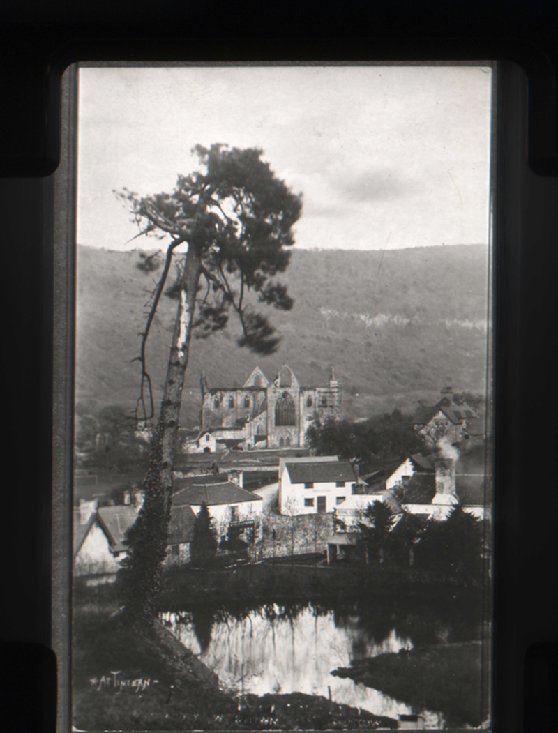
Tintern () is a village in the community (Wales), community of Wye Valley (community), Wye Valley, on the west bank of the River Wye in Monmouthshire, Wales, close to the border with England, about north of Chepstow. It is popular with tourists, in particular for the scenery and the ruined Tintern Abbey. Modern Tintern has been formed by the coalescence of two historic villages: Tintern Parva, forming the northern end of the village, and Chapel Hill, which forms the southern end. The village is designated as a Conservation Area (United Kingdom), Conservation Area. In 2022 the community was renamed from "Tintern" to "Wye Valley" and had boundary changes. History Early history The name Tintern may derive from the Welsh ''din'' + ''d/teyrn'', meaning "rocks of the king".E. T. Davies, ''A History of the Parish of Mathern'', 1990 A Ford (crossing), ford, known as Tintern Ford, stretched across the tidal River Wye and was in use in Roman times. After the Romans withdrew from Wales ... [...More Info...] [...Related Items...] OR: [Wikipedia] [Google] [Baidu] |
AONB
An Area of Outstanding Natural Beauty (AONB; , AHNE) is one of 46 areas of countryside in England, Wales, or Northern Ireland that has been designated for conservation due to its significant landscape value. Since 2023, the areas in England and Wales have also adopted the name National Landscape (). Areas are designated in recognition of their national importance by the relevant public body: Natural England, Natural Resources Wales, and the Northern Ireland Environment Agency respectively. On 22 November 2023, following a review, the AONBs in England and Wales adopted the National Landscapes name, and are in the process of rebranding. AONBs in Northern Ireland did not rename. The name "area of outstanding natural beauty" is still the designated legal term. In place of the term AONB, Scotland uses the similar national scenic area (NSA) designation. Areas of Outstanding Natural Beauty enjoy levels of protection from development similar to those of UK national parks, but unli ... [...More Info...] [...Related Items...] OR: [Wikipedia] [Google] [Baidu] |
Countryside And Rights Of Way Act 2000
The Countryside and Rights of Way Act 2000 (c. 37), also known as the CRoW Act and "Right to Roam" Act, is a United Kingdom Act of Parliament affecting England and Wales which came into force on 30 November 2000. Right to roam The Act implements the so-called "right to roam" (also known as ''jus spatiandi'') long sought by the Ramblers' Association and its predecessors, on certain upland and uncultivated areas of England and Wales. This element of the act was implemented in stages as conclusive maps of different regions were produced. The act refers to areas of 'mountain, moor, heath and down' in addition to registered common land; not all uncultivated land is covered. Rights of way A staged review of public rights of way, including limited rights to create new public footpaths where needed, is being conducted under the Act. Again, this is being conducted in a staged manner, which can produce anomalies – of the two administrative areas of the County of Gloucestershire, ... [...More Info...] [...Related Items...] OR: [Wikipedia] [Google] [Baidu] |
Right To Roam
The freedom to roam, or everyone's right, every person's right or everyman's right, is the general public's right to access certain public or privately owned land, lakes, and rivers for recreation and exercise. The right is sometimes called the right of public access to the wilderness or the right to roam. In Austria, Belarus, Estonia, Finland, Iceland, Latvia, Lithuania, Norway, Scotland, Sweden, Switzerland and the Czech Republic, the freedom to roam takes the form of general public rights which are sometimes codified in law. The access is ancient in parts of Northern Europe and has been regarded as sufficiently fundamental that it was not formalised in law until modern times. However, the right usually does not include any substantial economic exploitation, such as hunting or logging, or disruptive activities, such as making fires and driving offroad vehicles. In countries without such general rights, there may be a network of rights of way, or some nature reserves with footp ... [...More Info...] [...Related Items...] OR: [Wikipedia] [Google] [Baidu] |
Rights Of Way In England And Wales
In England and Wales, excluding the 12 Inner London London boroughs, boroughs and the City of London, the Right-of-way (property access), right of way is a legally protected right of the public to pass and re-pass on specific paths. Private rights of way or easements also exist. The law in England and Wales differs from Scots law in that rights of way exist only where they are so designated (or are able to be designated if not already), whereas in Scotland any route that meets certain conditions is rights of way in Scotland, defined as a right of way, and in addition, there is a general presumption of access to the countryside (the "right to roam"). Definitive maps Definitive maps of public rights of way have been compiled for all of England and Wales, as a result of the National Parks and Access to the Countryside Act 1949, except the 12 Inner London boroughs, which, along with the City of London, were not covered by the Act. Definitive maps exist for the Outer London borough ... [...More Info...] [...Related Items...] OR: [Wikipedia] [Google] [Baidu] |
Salmon
Salmon (; : salmon) are any of several list of commercially important fish species, commercially important species of euryhaline ray-finned fish from the genera ''Salmo'' and ''Oncorhynchus'' of the family (biology), family Salmonidae, native to tributary, tributaries of the North Atlantic (''Salmo'') and North Pacific (''Oncorhynchus'') basins. ''Salmon'' is a colloquial or common name used for fish in this group, but is not a scientific name. Other closely related fish in the same family include trout, Salvelinus, char, Thymallus, grayling, Freshwater whitefish, whitefish, lenok and Hucho, taimen, all coldwater fish of the subarctic and cooler temperate regions with some sporadic endorheic populations in Central Asia. Salmon are typically fish migration, anadromous: they hatch in the shallow gravel stream bed, beds of freshwater headstreams and spend their juvenile fish, juvenile years in rivers, lakes and freshwater wetlands, migrate to the ocean as adults and live like sea ... [...More Info...] [...Related Items...] OR: [Wikipedia] [Google] [Baidu] |
Logo
A logo (abbreviation of logotype; ) is a graphic mark, emblem, or symbol used to aid and promote public identification and recognition. It may be of an abstract or figurative design or include the text of the name that it represents, as in a wordmark. In the days of hot metal typesetting, a logotype was one word cast as a single piece of type (e.g. "The" in ATF Garamond), as opposed to a ligature, which is two or more letters joined, but not forming a word. By extension, the term was also used for a uniquely set and arranged typeface or colophon. At the level of mass communication and in common usage, a company's logo is today often synonymous with its trademark or brand.Wheeler, Alina. ''Designing Brand Identity'' © 2006 John Wiley & Sons, Inc. (page 4) Etymology Douglas Harper's ''Online Etymology Dictionary'' states that the first surviving written record of the term 'logo' dates back to 1937, and that the term was "probably a shortening of logogram". Histo ... [...More Info...] [...Related Items...] OR: [Wikipedia] [Google] [Baidu] |
Finger Post
A fingerpost (or guidepost) is a type of sign post consisting of a post with one or more arms, known as fingers, pointing in the direction of travel to places named on the fingers, often including distance information. United Kingdom Fingerposts are a traditional type of sign used in the United Kingdom. The posts have traditionally been made from cast iron or wood, with poles painted in black, white or grey and fingers with black letters on a white background, often including distance information in miles. In most cases, they are used to give guidance for road users, but examples also exist on the canal network, for instance. They are also used to mark the beginning of a footpath, bridleway, or similar public path. History Legislation was enacted in England in 1697 which enabled magistrates to place ''direction posts at cross-highways''. However, the oldest fingerpost still extant is thought to be that close to Chipping Campden in Gloucestershire, dated 1669 and pointing t ... [...More Info...] [...Related Items...] OR: [Wikipedia] [Google] [Baidu] |
Waymark
Trail blazing or way marking is the practice of marking paths in outdoor recreational areas with signs or markings that follow each other at certain, though not necessarily exactly defined, distances and mark the direction of the trail. A blaze in the beginning meant "a mark made on a tree by slashing the bark" (''The Canadian Oxford Dictionary''). Originally a waymark was "any conspicuous object which serves as a guide to travellers; a landmark" (''Oxford English Dictionary''). Today, paint (most prevalent), carvings, affixed markers, posts, flagging, cairns, and crosses, are commonly used. Blaze frequency and recognizability varies significantly. In some wilderness areas, such as those governed by the US Wilderness Act requiring that the land seem "untrammeled by man," blazes are kept to a minimum. Alternatively, highly utilized public areas, such as busy municipal, county, or state parks, will use frequent and highly visible blazes to maximize trail recognition. Types of s ... [...More Info...] [...Related Items...] OR: [Wikipedia] [Google] [Baidu] |
Northern End Of The Wye Valley Walk - Geograph
Northern may refer to the following: Geography * North, a point in direction * Northern Europe, the northern part or region of Europe * Northern Highland, a region of Wisconsin, United States * Northern Province, Sri Lanka * Northern Range, a range of hills in Trinidad * Northern State (Sudan), one of the 18 wilayat (states) of Sudan Schools * Northern Collegiate Institute and Vocational School (NCIVS), a school in Sarnia, Canada * Northern Secondary School, Toronto, Canada * Northern Secondary School (Sturgeon Falls), Ontario, Canada * Northern University (other), various institutions * Northern Guilford High School, a public high school in Greensboro, North Carolina Companies * Arriva Rail North, a former train operating company in northern England * Chemins de fer du Nord (Northern Railway Company), a former rail transport company in northern France * Nord-Aviation (Northern Aviation), a former state-owned French aircraft manufacturer. * Compañía de los Caminos de ... [...More Info...] [...Related Items...] OR: [Wikipedia] [Google] [Baidu] |


