|
Wurmlingen (Rottenburg)
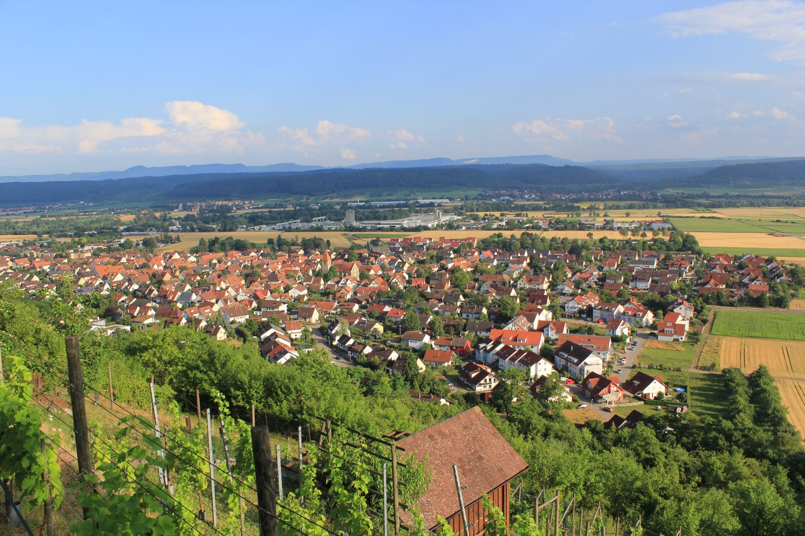
Wurmlingen () is a suburban district of Rottenburg am Neckar in the administrative district of Tübingen in Baden-Württemberg (Germany). It is famous for its chapel, located atop a hill, which is the subject of a famous poem by Ludwig Uhland. Geography Wurmlingen is located 4 km (2.5 mi) northeastern from Rottenburg and 8 km (5 mi) southwestern from Tübingen in valley of the Neckar. Extent The area of the district is 714 hectares. Thereof fall 68.6% upon agriculturally used area, 15.1% upon forest area, 15.1% upon settlement area and roads, 0.1% upon water expanse and 1.1% upon other. Neighbour localities The territories of the following localities adjoin to Wurmlingen, they are called clockwise beginning in the north: Unterjesingen, Hirschau, Rottenburg (Town), Wendelsheim. All bordering localities are in the administrative district of Tübingen. Unterjesingen and Hirschau are suburban districts of Tübingen Tübingen (, , Swabian: ''Dibenga'') is a ... [...More Info...] [...Related Items...] OR: [Wikipedia] [Google] [Baidu] |
Rottenburg Am Neckar
Rottenburg am Neckar (; until 10 July 1964 only ''Rottenburg''; Swabian: ''Raodaburg'') is a medium-sized town in the administrative district (''Landkreis'') of Tübingen in Baden-Württemberg, Germany. It lies about 50 kilometres (31 miles) southwest of the provincial capital Stuttgart and about 12 km (7 mi) southwest of the district town Tübingen. Rottenburg is the second-largest town of the district after Tübingen and makes up a secondary centre for the surrounding community. Since 1 May 1972, Rottenburg am Neckar has been a district town (''Große Kreisstadt''). Rottenburg agreed to an administrative collective with the municipalities of Hirrlingen, Neustetten and Starzach. Rottenburg is the seat of a Roman Catholic bishop, being the official centre of the diocese of Rottenburg-Stuttgart. Moreover, it has a college of church music and a university of applied sciences (German ''Fachhochschule''), specialising in forestry. Geography Rottenburg is divided i ... [...More Info...] [...Related Items...] OR: [Wikipedia] [Google] [Baidu] |
Tübingen (district)
Tübingen is a ''Landkreis'' (district) in the middle of Baden-Württemberg, Germany. Neighboring districts are (from north clockwise) Böblingen, Reutlingen, Zollernalbkreis and Freudenstadt. History The district dates back to the ''Oberamt Tübingen'' in the state of Württemberg. In 1811 the ''Oberamt Rottenburg'' was created, and both were converted into districts in 1934. In 1938 most of the district Rottenburg as well as a few municipalities from the district Herrenberg and Reutlingen were added to the district Tübingen. In 1974 it was enlarged again when some municipalities from the dissolved district Horb were added. Geography The main river in the district is the Neckar The Neckar () is a river in Germany, mainly flowing through the southwestern state of Baden-Württemberg, with a short section through Hesse. The Neckar is a major right tributary of the Rhine. Rising in the Schwarzwald-Baar-Kreis near Schwenn .... The landscapes covered by the district are c ... [...More Info...] [...Related Items...] OR: [Wikipedia] [Google] [Baidu] |
Baden-Württemberg
Baden-Württemberg (; ), commonly shortened to BW or BaWü, is a German state () in Southwest Germany, east of the Rhine, which forms the southern part of Germany's western border with France. With more than 11.07 million inhabitants across a total area of nearly , it is the third-largest German state by both area (behind Bavaria and Lower Saxony) and population (behind North Rhine-Westphalia and Bavaria). As a federated state, Baden-Württemberg is a partly-sovereign parliamentary republic. The largest city in Baden-Württemberg is the state capital of Stuttgart, followed by Mannheim and Karlsruhe. Other major cities are Freiburg im Breisgau, Heidelberg, Heilbronn, Pforzheim, Reutlingen, Tübingen, and Ulm. What is now Baden-Württemberg was formerly the historical territories of Baden, Prussian Hohenzollern, and Württemberg. Baden-Württemberg became a state of West Germany in April 1952 by the merger of Württemberg-Baden, South Baden, and Württemberg-Hohe ... [...More Info...] [...Related Items...] OR: [Wikipedia] [Google] [Baidu] |
Germany
Germany, officially the Federal Republic of Germany (FRG),, is a country in Central Europe. It is the most populous member state of the European Union. Germany lies between the Baltic and North Sea to the north and the Alps to the south. Its 16 constituent states have a total population of over 84 million in an area of . It borders Denmark to the north, Poland and Czechia to the east, Austria and Switzerland to the south, and France, Luxembourg, Belgium, and the Netherlands to the west. The nation's capital and most populous city is Berlin and its main financial centre is Frankfurt; the largest urban area is the Ruhr. Settlement in what is now Germany began in the Lower Paleolithic, with various tribes inhabiting it from the Neolithic onward, chiefly the Celts. Various Germanic tribes have inhabited the northern parts of modern Germany since classical antiquity. A region named Germania was documented before AD 100. In 962, the Kingdom of Germany formed the ... [...More Info...] [...Related Items...] OR: [Wikipedia] [Google] [Baidu] |
Mile
The mile, sometimes the international mile or statute mile to distinguish it from other miles, is a British imperial unit and United States customary unit of distance; both are based on the older English unit of length equal to 5,280 English feet, or 1,760 yards. The statute mile was standardised between the British Commonwealth and the United States by an international agreement in 1959, when it was formally redefined with respect to SI units as exactly . With qualifiers, ''mile'' is also used to describe or translate a wide range of units derived from or roughly equivalent to the Roman mile, such as the nautical mile (now exactly), the Italian mile (roughly ), and the Chinese mile (now exactly). The Romans divided their mile into 5,000 Roman feet but the greater importance of furlongs in Elizabethan-era England meant that the statute mile was made equivalent to or in 1593. This form of the mile then spread across the British Empire, some successor states of w ... [...More Info...] [...Related Items...] OR: [Wikipedia] [Google] [Baidu] |
Tübingen
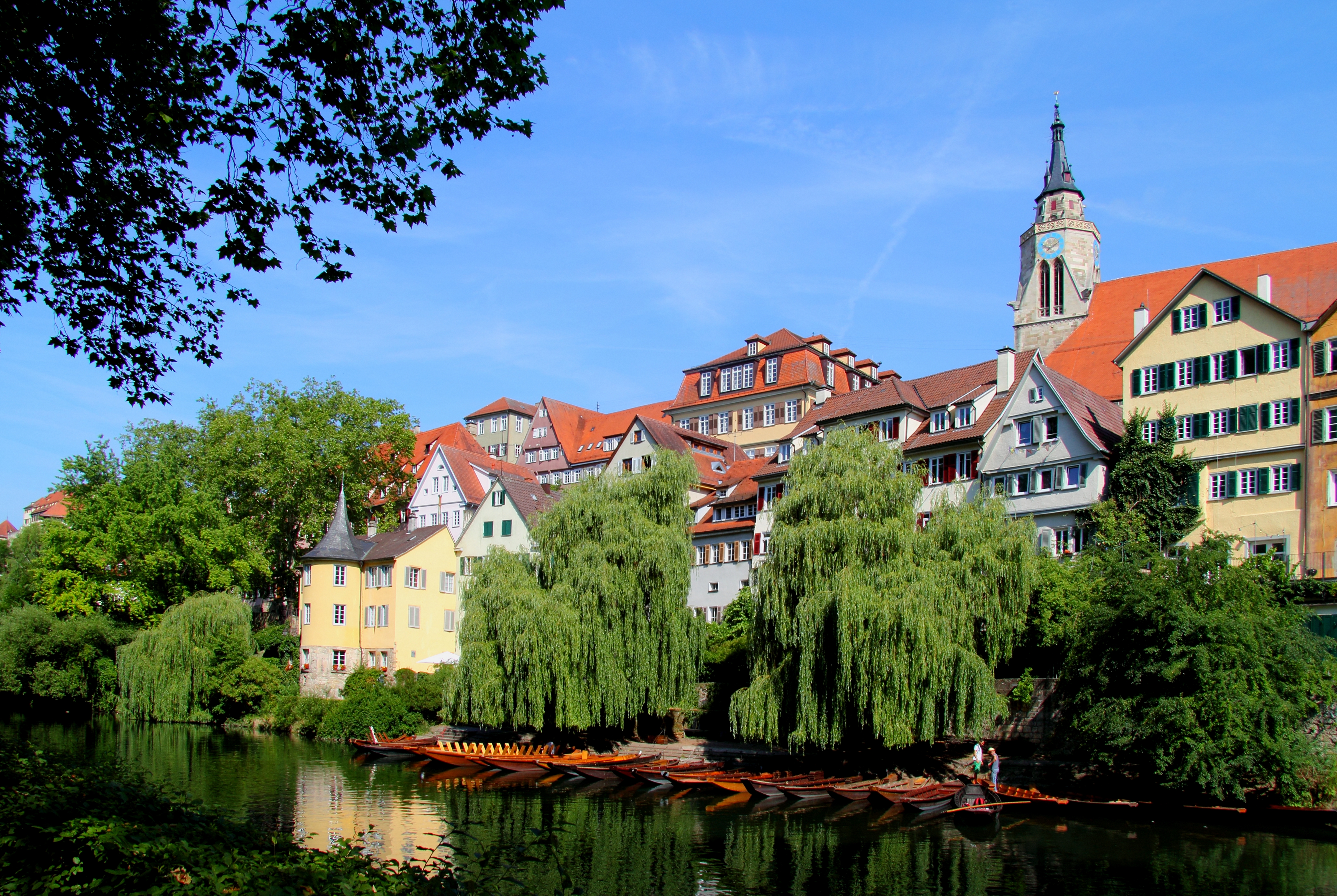
Tübingen (, , Swabian: ''Dibenga'') is a traditional university city in central Baden-Württemberg, Germany. It is situated south of the state capital, Stuttgart, and developed on both sides of the Neckar and Ammer rivers. about one in three of the 90,000 people living in Tübingen is a student. As of the 2018/2019 winter semester, 27,665 students attend the Eberhard Karls University of Tübingen. The city has the lowest median age in Germany, in part due to its status as a university city. As of December 31, 2015, the average age of a citizen of Tübingen is 39.1 years. The city is known for its veganism and environmentalism. Immediately north of the city lies the Schönbuch, a densely wooded nature park. The Swabian Alb mountains rise about (beeline Tübingen City to Roßberg - 869 m) to the southeast of Tübingen. The Ammer and Steinlach rivers are tributaries of the Neckar river, which flows in an easterly direction through the city, just south of the medieval old ... [...More Info...] [...Related Items...] OR: [Wikipedia] [Google] [Baidu] |
Neckar
The Neckar () is a river in Germany, mainly flowing through the southwestern state of Baden-Württemberg, with a short section through Hesse. The Neckar is a major right tributary of the Rhine. Rising in the Schwarzwald-Baar-Kreis near Schwenningen in the ''Schwenninger Moos'' conservation area at a height of above sea level, it passes through Rottweil, Rottenburg am Neckar, Kilchberg, Tübingen, Wernau, Nürtingen, Plochingen, Esslingen, Stuttgart, Ludwigsburg, Marbach, Heilbronn and Heidelberg, before discharging on average of water into the Rhine at Mannheim, at above sea level, making the Neckar its 4th largest tributary, and the 10th largest river in Germany. Since 1968, the Neckar has been navigable for cargo ships via 27 locks for about upstream from Mannheim to the river port of Plochingen, at the confluence with the Fils. From Plochingen to Stuttgart, the Neckar valley is densely populated and heavily industrialised, with several well-known com ... [...More Info...] [...Related Items...] OR: [Wikipedia] [Google] [Baidu] |
Hectare
The hectare (; SI symbol: ha) is a non-SI metric unit of area equal to a square with 100- metre sides (1 hm2), or 10,000 m2, and is primarily used in the measurement of land. There are 100 hectares in one square kilometre. An acre is about and one hectare contains about . In 1795, when the metric system was introduced, the ''are'' was defined as 100 square metres, or one square decametre, and the hectare (" hecto-" + "are") was thus 100 ''ares'' or km2 (10,000 square metres). When the metric system was further rationalised in 1960, resulting in the International System of Units (), the ''are'' was not included as a recognised unit. The hectare, however, remains as a non-SI unit accepted for use with the SI and whose use is "expected to continue indefinitely". Though the dekare/decare daa (1,000 m2) and are (100 m2) are not officially "accepted for use", they are still used in some contexts. Description The hectare (), although not a unit of SI, ... [...More Info...] [...Related Items...] OR: [Wikipedia] [Google] [Baidu] |
Unterjesingen
Unterjesingen is a village in the centre of Baden-Württemberg, Germany, in the Tübingen district. Since 1971, it is a part of the city of Tübingen. Unterjesingen lies in the valley of the small Ammer river, about 2 km to the east of Pfäffingen, which is part of Ammerbuch Ammerbuch is a municipality in the district of Tübingen, in Baden-Württemberg, Germany. It is situated 7 km northwest of Tübingen. Geographical location The municipality Ammerbuch is 345–551 meters above sea level in part on the edge of ..., and 6 km to the west of the town centre of Tübingen. WorldPlaces.net. Accessed May 24, 2012. References [...More Info...] [...Related Items...] OR: [Wikipedia] [Google] [Baidu] |
Hirschau (Tübingen)
Hirschau is a village in Tübingen district in Baden-Württemberg, Germany. Since 1971, it is an outer district of the city of Tübingen. Hirschau has a population of 3297 (2020) on an area of 6.17 km2. It is the westernmost district of Tübingen. Hirschau lies to the north of the Neckar river, about 3 km to the east of Wurmlingen, which is a part of Rottenburg am Neckar, and about 6 km to the east of the town centre of Rottenburg am Neckar as well as to the west of the city centre of Tübingen. The highest point is the Spitzberg at 475 m above mean sea level. Unlike most of Tübingen, Hirschau is, like neighbouring Rottenburg, mostly Roman Catholic Roman or Romans most often refers to: *Rome, the capital city of Italy *Ancient Rome, Roman civilization from 8th century BC to 5th century AD *Roman people, the people of ancient Rome *''Epistle to the Romans'', shortened to ''Romans'', a letter .... References {{DEFAULTSORT:Hirschau (Tubingen) Villages i ... [...More Info...] [...Related Items...] OR: [Wikipedia] [Google] [Baidu] |
Wendelsheim (Rottenburg)
Wendelsheim is a suburban district of Rottenburg am Neckar in the administrative district of Tübingen in Baden-Württemberg (Germany). Geography Wendelsheim is located 4 km (2.5 mi) northern from Rottenburg and 11 km (6.8 mi) southwestern from Tübingen. Extent The area of the district is 470 hectares. Thereof fall 71.0% upon agriculturally used area, 15.1% upon forest area, 13.6% upon settlement area and roads, 0.2% upon water expanse and 0.2% upon other. Neighbour localities The territories of the following localities adjoin to Wendelsheim, they are called clockwise beginning in the north: Oberndorf, Wurmlingen, Rottenburg (town), Seebronn. All bordering localities are in the administrative district of Tübingen, and all are part of the Town of Rottenburg. Population Wendelsheim has 1555 inhabitants (31/01/08). It is one of the largest suburbs of Rottenburg. At an area of 4.70 km² (1.8 sq mi) this corresponds to a population density of ... [...More Info...] [...Related Items...] OR: [Wikipedia] [Google] [Baidu] |


