|
Wright Upper Glacier
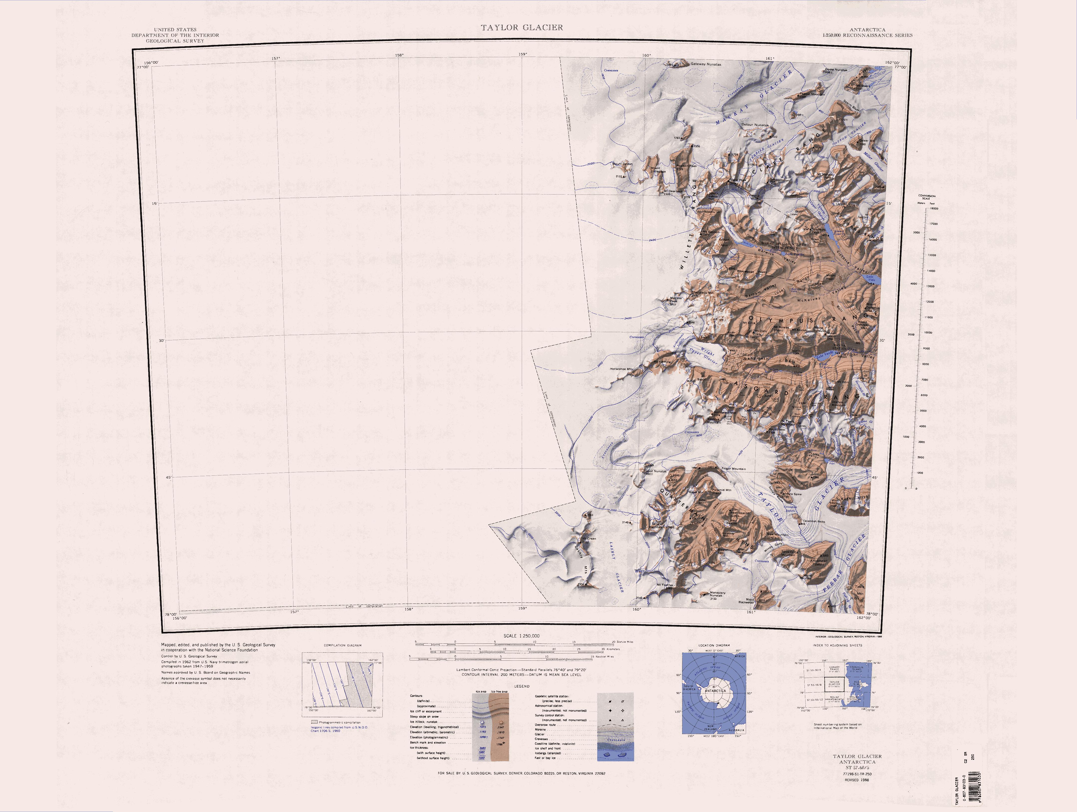
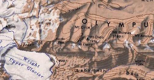
Wright Upper Glacier () is an ice apron at the upper west end of Wright Valley in the Asgard Range, Antarctica. It is formed by a glacier flowing east from the inland ice plateau. It was named by the Victoria University of Wellington Antarctic Expedition (VUWAE) (1958–59) for C. S. Wright, a member of the British Antarctic Expedition (1910–13), after whom the "Wright Glacier" (adjusted to Wright Lower Glacier by the VUWAE) was named. Location The head of the Wright Upper Glacier is to the east of the Antarctic Plateau, Horseshoe Mountain and Mount Fleming. To their north, the glacier is fed by the Airdevronsix Icefalls, and to their south the Warren Icefalls and Vortex Col descend into the glacier. Mount Baldr, at the eastern end of the Asgard Range, is south of the glacier, and the Labyrinth is to the east. Apollo Peak at the west end of the Olympus Range is to the northeast. Features Airdevronsix Icefalls . A line of icefalls at the head of Wright Upper Glacier, ... [...More Info...] [...Related Items...] OR: [Wikipedia] [Google] [Baidu] |
Labyrinth (Antarctica) lies to the east.
The The Labyrinth () is an extensive flat upland area which has been deeply eroded, at the west end of Wright Valley, in Victoria Land, Antarctica. It was so named by the Victoria University of Wellington Antarctic Expedition (VUWAE) (1958–59) because the eroded dolerite of which it is formed gives an appearance of a labyrinth. Location The Labyrinth lies in the western Wright Valley. The Asgard Range, Mount Thor and Linnaeus Terrace are to the south. The Olympus Range and Mount Dido are to the north. Minotaur Pass provides a route through the Olympus Range to McKelvey Valley. The Wright Upper Glacier fills the Wright Valley to the west, and the Dais A dais or daïs ( or , American English also but sometimes considered nonstandard)dais in the Random House Dictionary< ... [...More Info...] [...Related Items...] OR: [Wikipedia] [Google] [Baidu] |
Mount Baldr (Antarctica)
The Inland Forts () are a line of peaks extending between Northwest Mountain and Saint Pauls Mountain, in the Asgard Range of Victoria Land, Antarctica. The peaks were discovered by Ervon r. Koenig and named by the British National Antarctic Expedition, 1901–04. Location The Inland Forts are to the south of the western end of the Asgard Range. They face the head of the Taylor Glacier to the southwest. A number of valley run north from the Inland Forts down to the lowlands between the Wright Upper Glacier and the Wright Valley. Features Named features, from west to east, include Beehive Mountain, Northwest Mountain, Hess Mesa, Mudrey Cirque, West Grain, Sutherland Peak, Mary Cirque, East Groin, Wolak Peak, Round Mountain and Saint Pauls Mountain. Beehive Mountain . A mountain north of Finger Mountain, standing at the north margin and near the head of Taylor Glacier. Named by the British National Antarctic Expedition (BrNAE) (1901-04), possibly at the suggestion of Arm ... [...More Info...] [...Related Items...] OR: [Wikipedia] [Google] [Baidu] |
New Zealand Antarctic Place-Names Committee
New Zealand Antarctic Place-Names Committee (NZ-APC) is an adjudicating committee established to authorize the naming of features in the Ross Dependency on the Antarctic continent. It is composed of the members of the New Zealand Geographic Board plus selected specialists on Antarctica. This committee works in collaboration with similar place-naming authorities in Australia, Great Britain and the United States to reach concurrence on each decision. The NZ-APC committee was established in 1956. Names attributed by the committee * Alberich Glacier, named after Alberich, king of the elves and chief of the Nibelungen * Arena Saddle, named in conjunction with Arena Valley * Brawhm Pass, named after the six party members of the University of New South Wales expeditions of 1964–65 and 1966–67 * Caliper Cove, named for descriptive features * Canada Stream, named in conjunction with Canada Glacier * Cape Crossfire, named for descriptive features * Cuneiform Cliffs, named for de ... [...More Info...] [...Related Items...] OR: [Wikipedia] [Google] [Baidu] |
Commonwealth Trans-Antarctic Expedition
The Commonwealth Trans-Antarctic Expedition (CTAE) of 1955–1958 was a Commonwealth-sponsored expedition that successfully completed the first overland crossing of Antarctica, via the South Pole. It was the first expedition to reach the South Pole overland for 46 years, preceded only by Amundsen's expedition and Scott's expedition in 1911 and 1912. In keeping with the tradition of polar expeditions of the Heroic Age of Antarctic Exploration, the CTAE was a private venture, though it was supported by the governments of the United Kingdom, New Zealand, United States, Australia and South Africa, as well as many corporate and individual donations, under the patronage of Queen Elizabeth II. It was headed by British explorer Vivian Fuchs, with New Zealander Sir Edmund Hillary leading the New Zealand Ross Sea Support team. The New Zealand party included scientists participating in International Geophysical Year research while the British team were separately based at Halley ... [...More Info...] [...Related Items...] OR: [Wikipedia] [Google] [Baidu] |
British National Antarctic Expedition
The ''Discovery'' Expedition of 1901–1904, known officially as the British National Antarctic Expedition, was the first official British exploration of the Antarctic regions since the voyage of James Clark Ross sixty years earlier (1839–1843). Organized on a large scale under a joint committee of the Royal Society and the Royal Geographical Society (RGS), the new expedition carried out scientific research and geographical exploration in what was then largely an untouched continent. It launched the Antarctic careers of many who would become leading figures in the Heroic Age of Antarctic Exploration, including Robert Falcon Scott who led the expedition, Ernest Shackleton, Edward Wilson, Frank Wild, Tom Crean and William Lashly. Its scientific results covered extensive ground in biology, zoology, geology, meteorology and magnetism. The expedition discovered the existence of the only McMurdo Dry Valleys, snow-free Antarctic valleys, which contains the longest river of ... [...More Info...] [...Related Items...] OR: [Wikipedia] [Google] [Baidu] |
Taylor Glacier
The Taylor Glacier () is a glacier in Antarctica about long, flowing from the plateau of Victoria Land into the western end of Taylor Valley, north of the Kukri Hills. It flows to the south of the Asgard Range. The middle part of the glacier is bounded on the north by the Inland Forts and on the south by Beacon Valley. History The Taylor Glacier was discovered by the British National Antarctic Expedition (BrNAE, 1901–1904) and at that time thought to be a part of Ferrar Glacier. The Western Journey Party of the Terra Nova Expedition, British Antarctic Expedition of 1910 determined that the upper and lower portions of what was then known as Ferrar Glacier are apposed, i.e., joined in Siamese-twin fashion north of Knobhead. With this discovery Robert F. Scott, Robert Falcon Scott named the upper portion for Thomas Griffith Taylor, geologist and leader of the Western Journey Party. Glaciology Research The Taylor Glacier has been the focus of a measurement and modeling effor ... [...More Info...] [...Related Items...] OR: [Wikipedia] [Google] [Baidu] |
Operation Deep Freeze
Operation Deep Freeze is the code name for a series of United States missions to Antarctica, beginning with "Operation Deep Freeze I" in 1955–56, followed by "Operation Deep Freeze II", "Operation Deep Freeze III", and so on. (There was an initial operation before Richard E. Byrd, Admiral Richard Byrd proposed 'Deep Freeze'). Given the continuing and constant US presence in Antarctica since that date, "Operation Deep Freeze" has come to be used as a general term for US operations in that continent, and in particular for the regular missions to resupply US Antarctic bases, coordinated by the Military of the United States, United States military. Task Force 199 was involved. For a few decades the missions were led by the United States Navy, though the Air National Guard and National Science Foundation are also important parts of the missions. In Antarctica, when the polar dawn starts late in the year things begin warming up and the mission usually runs from late in the year to ear ... [...More Info...] [...Related Items...] OR: [Wikipedia] [Google] [Baidu] |
Olympus Range
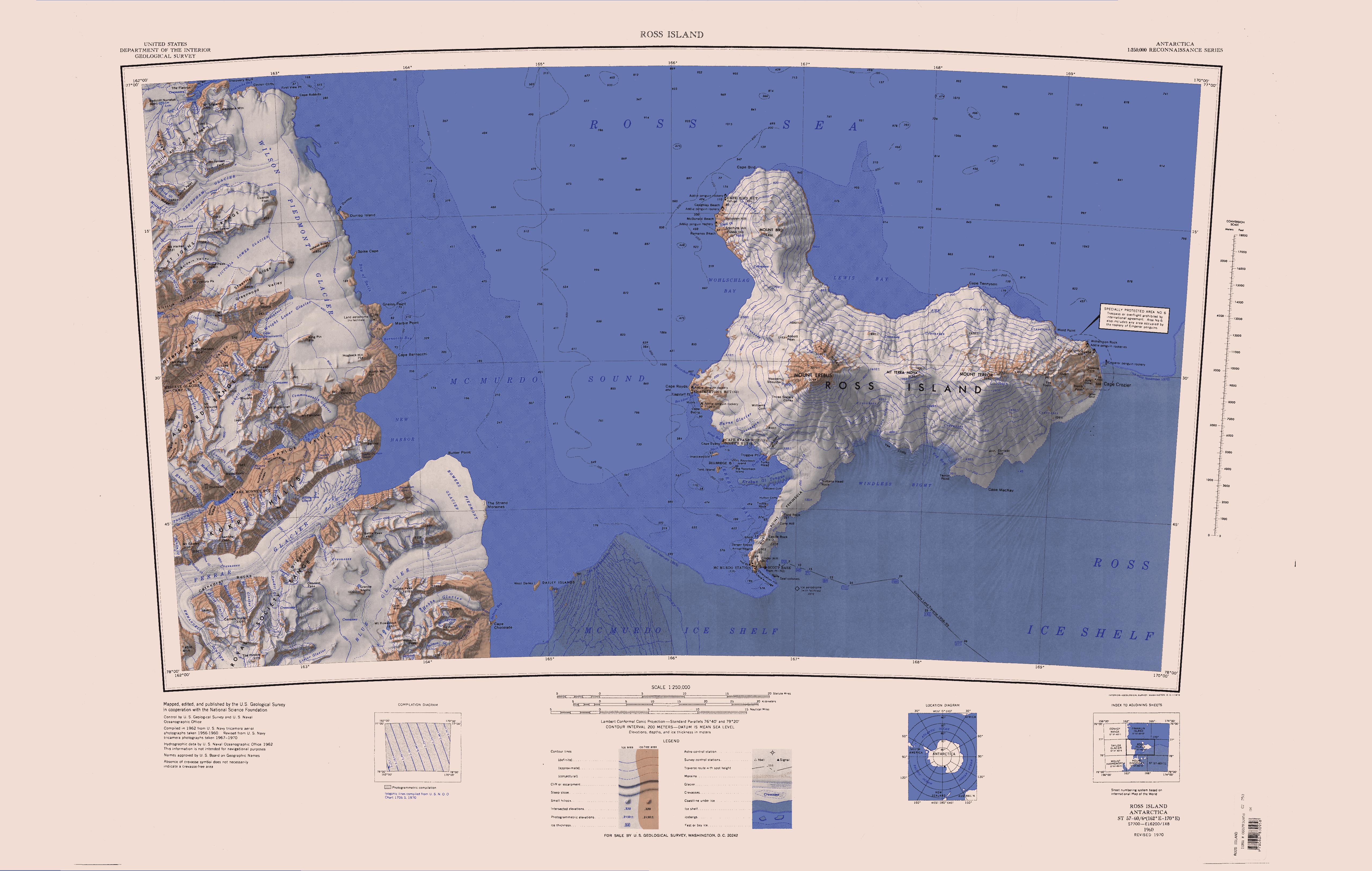
The Olympus Range () is a primarily ice-free mountain range of Victoria Land, Antarctica, with peaks over high, between Victoria Valley and McKelvey Valley on the north and Wright Valley on the south. It is south of the Clare Range and north of the Asgard Range. Exploration and naming The Olympus Range was mapped by the Victoria University of Wellington Antarctic Expedition, 1958–59, and named for the Mount Olympus, mythological home of the Greek gods. Peaks in the range are named for figures in Greek mythology. Location The Olympus Range extends from the Antarctic Plateau to the Wilson Piedmont Glacier on the west coast of the Ross Sea. The range is bounded by the Balham Valley, McKelvey Valley and Victoria Valley to the north, and the Wright Valley to the south. Glaciers Glaciers and snowfields include, from west to east, Nakai Snowfield, Orestes Glacier, Cerberus Glacier, Sandy Glacier, Enyo Glacier, Clio Glacier, Eos Glacier, Chinn Glacier and Clark Glacier ... [...More Info...] [...Related Items...] OR: [Wikipedia] [Google] [Baidu] |
Apollo Peak
The Olympus Range () is a primarily ice-free mountain range of Victoria Land, Antarctica, with peaks over high, between Victoria Valley and McKelvey Valley on the north and Wright Valley on the south. It is south of the Clare Range and north of the Asgard Range. Exploration and naming The Olympus Range was mapped by the Victoria University of Wellington Antarctic Expedition, 1958–59, and named for the Mount Olympus, mythological home of the Greek gods. Peaks in the range are named for figures in Greek mythology. Location The Olympus Range extends from the Antarctic Plateau to the Wilson Piedmont Glacier on the west coast of the Ross Sea. The range is bounded by the Balham Valley, McKelvey Valley and Victoria Valley to the north, and the Wright Valley to the south. Glaciers Glaciers and snowfields include, from west to east, Nakai Snowfield, Orestes Glacier, Cerberus Glacier, Sandy Glacier, Enyo Glacier, Clio Glacier, Eos Glacier, Chinn Glacier and Clark Glacier (Antarctic ... [...More Info...] [...Related Items...] OR: [Wikipedia] [Google] [Baidu] |
Antarctic Plateau
The Antarctic Plateau, Polar Plateau or King Haakon VII Plateau is a large area of East Antarctica that extends over a diameter of about , and includes the region of the geographic South Pole and the Amundsen–Scott South Pole Station. This huge continental plateau is at an average elevation of about . Exploration This plateau was first sighted in 1903 during the '' Discovery'' Expedition to the Antarctic, which was led by Robert Falcon Scott. Ernest Shackleton became the first to cross parts of this plateau in 1909 during his '' Nimrod'' Expedition, which turned back in bad weather when it had reached a point from the South Pole. Shackleton named this plateau the King Edward VII Plateau in honour of the king of the United Kingdom. In December 1911, while returning from the first journey to the South Pole, the Norwegian explorer Roald Amundsen decided to name this plateau the King Haakon VII Plateau in honour of the newly elected king of Norway. The Antarctic Plate ... [...More Info...] [...Related Items...] OR: [Wikipedia] [Google] [Baidu] |
Ross Dependency
The Ross Dependency is a region of Antarctica defined by a circular sector, sector originating at the South Pole, passing along longitudes 160th meridian east, 160° east to 150th meridian west, 150° west, and terminating at latitude 60th parallel south, 60° south. It is claimed by New Zealand, a claim mutually accepted only by Australia, the United Kingdom, UK, France and Norway, which are countries that also have territorial claims in Antarctica. Under the 1961 Antarctic Treaty System, Antarctic Treaty, of which all territorial claimants are signatories, including New Zealand, all claims are held in abeyance. Article IV states: "No acts or activities taking place while the present Treaty is in force shall constitute a basis for asserting, supporting or denying a claim to territorial sovereignty in Antarctica or create any rights of sovereignty in Antarctica". The Dependency takes its name from James Clark Ross, Sir James Clark Ross, who discovered the Ross Sea and includes ... [...More Info...] [...Related Items...] OR: [Wikipedia] [Google] [Baidu] |


