|
Woolwich Common
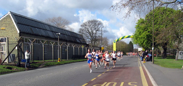
Woolwich Common is a common in Woolwich in southeast London, England. It is partly used as military land (less than 40%) and partly as an urban park. Woolwich Common is a conservation area. It is part of the South East London Green Chain. It is also the name of a street on the east side of the common, as well as an electoral ward of the Royal Borough of Greenwich. The population of the ward at the 2011 Census was 17,499. Location Woolwich Common lies on the northern slope of Shooter's Hill, a 132 metres high hill in the Royal Borough of Greenwich, only a few hundred metres southwest of Woolwich town centre. It is bounded to the south side by the A207 Shooters Hill Road, although the open space continues south of this road in Oxleas Wood and Eltham Common. Academy Road (part of the A205 South Circular road) and the former Royal Military Academy form the eastern borders of the common. Repository Road and the Queen Elizabeth Hospital make up the western border. On the north side ... [...More Info...] [...Related Items...] OR: [Wikipedia] [Google] [Baidu] [Amazon] |
Royal Military Academy, Woolwich
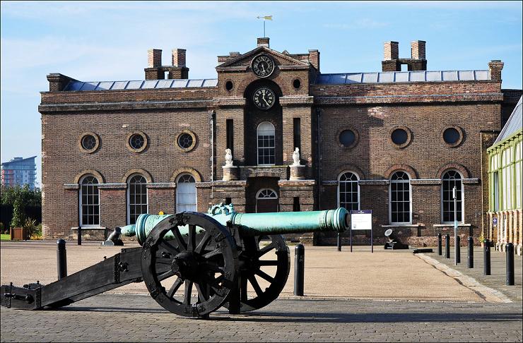
The Royal Military Academy (RMA) at Woolwich, in south-east London, was a British Army military academy for the training of Officer (armed forces), commissioned officers of the Royal Artillery and Royal Engineers. It later also trained officers of the Royal Corps of Signals and other technical corps. RMA Woolwich was commonly known as "The Shop" because its first building was a converted workshop of the Royal Arsenal, Woolwich Arsenal. History Origins in the Royal Arsenal An attempt had been made by the Board of Ordnance in 1720 to set up an academy within its Arsenal (then known as the Warren) to provide training and education for prospective officers of its new Royal Regiment of Artillery, Regiment of Artillery and Corps of Royal Engineers, Corps of Engineers (both of which had been established there in 1716). A new building was being constructed in readiness for the Academy and funds had been secured, seemingly, through investment in the South Sea Company; but the latter's col ... [...More Info...] [...Related Items...] OR: [Wikipedia] [Google] [Baidu] [Amazon] |
Shooter's Hill
Shooter's Hill is a district of South East London, England, straddling the Royal Borough of Greenwich and the London Borough of Bexley. It lies north of Eltham and south of Woolwich. With a height of , it is the highest point in the Borough of Greenwich and one of the List of highest points in London, highest points in London. Shooter's Hill also gives its name to the road which passes through east to west, part of the A207 road, the A2 road (Great Britain), A2 road and Watling Street. Geography The name Shooters Hill is thought to takes its name from the practice of archery there during the Middle Ages. The area had a reputation as a haunt for highwayman, highwaymen and was infamous as a site of Gibbeting, gibbets of executed criminals. On 1 May 1515, Henry VIII and Catherine of Aragon rode from Greenwich Palace to have breakfast in an arbour constructed in a wood at Shooter's Hill. Catherine and her ladies were dressed in Spanish-style riding gear, Henry was dressed in gree ... [...More Info...] [...Related Items...] OR: [Wikipedia] [Google] [Baidu] [Amazon] |
Map Of Woolwich, 1746
A map is a symbolic depiction of interrelationships, commonly spatial, between things within a space. A map may be annotated with text and graphics. Like any graphic, a map may be fixed to paper or other durable media, or may be displayed on a transitory medium such as a computer screen. Some maps change interactively. Although maps are commonly used to depict geographic elements, they may represent any space, real or fictional. The subject being mapped may be two-dimensional such as Earth's surface, three-dimensional such as Earth's interior, or from an abstract space of any dimension. Maps of geographic territory have a very long tradition and have existed from ancient times. The word "map" comes from the , wherein ''mappa'' meant 'napkin' or 'cloth' and ''mundi'' 'of the world'. Thus, "map" became a shortened term referring to a flat representation of Earth's surface. History Maps have been one of the most important human inventions for millennia, allowing humans t ... [...More Info...] [...Related Items...] OR: [Wikipedia] [Google] [Baidu] [Amazon] |
Woolwich Vestry
Woolwich, also known as Woolwich St Mary, was an ancient parish containing the town of Woolwich on the south bank of the Thames and North Woolwich on the north bank. The parish was governed by its vestry from the 16th century to 1852, based in the Church of St Mary until 1842, after which in the purpose-built Woolwich Town Hall. The parish adopted the Public Health Act 1848 ( 11 & 12 Vict. c. 63) and was governed by the Woolwich Local Board of Health from 1852. When the parish became part of the district of the Metropolitan Board of Works in 1855 the local board was treated as if it were an incorporated vestry. It was in the county of Kent until it was transferred to London in 1889. In 1900 it was amalgamated with other parishes to form the Metropolitan Borough of Woolwich and had only nominal existence until it was abolished as a civil parish in 1930. Since 1965 it has been split between the Royal Borough of Greenwich and the London Borough of Newham. Geography The main part o ... [...More Info...] [...Related Items...] OR: [Wikipedia] [Google] [Baidu] [Amazon] |
Royal Arsenal
The Royal Arsenal, Woolwich is an establishment on the south bank of the River Thames in Woolwich in south-east London, England, that was used for the manufacture of armaments and ammunition, proof test, proofing, and explosives research for the British armed forces. It was originally known as the Woolwich Warren, having begun on land previously used as a Warren (domestic), domestic warren in the grounds of a mid-16th century Tudor house, Tower Place. Much of the initial history of the site is linked with that of the Office of Ordnance, which purchased the Warren in the late 17th century in order to expand an earlier base at Gun Wharf in Woolwich Dockyard. Over the next two centuries, as operations grew and innovations were pursued, the site expanded massively. At the time of the World War I, First World War the Arsenal covered and employed close to 80,000 people. Thereafter its operations were scaled down. It finally closed as a factory in 1967 and the Ministry of Defence m ... [...More Info...] [...Related Items...] OR: [Wikipedia] [Google] [Baidu] [Amazon] |
Woolwich Dockyard
Woolwich Dockyard (formally H.M. Dockyard, Woolwich, also known as The King's Yard, Woolwich) was an English Royal Navy Dockyard, naval dockyard along the river Thames at Woolwich - originally in north-west Kent, now in southeast London - where many ships were built from the early 16th century until the late 19th century. William Camden called it 'the Mother Dock of all England'. By virtue of the size and quantity of vessels built there, Woolwich Dockyard is described as having been 'among the most important shipyards of seventeenth-century Europe'. During the Age of Sail, the yard continued to be used for shipbuilding and repair work more or less consistently; in the 1830s a specialist factory within the dockyard oversaw the introduction of Steamship, steam power for ships of the Royal Navy. At its largest extent it filled a 56-acre site north of Woolwich Church Street, between Warspite Road and New Ferry Approach; 19th-century naval vessels were fast outgrowing the yard, howe ... [...More Info...] [...Related Items...] OR: [Wikipedia] [Google] [Baidu] [Amazon] |
South West Gatehouse, Woolwich
South is one of the cardinal directions or compass points. The direction is the opposite of north and is perpendicular to both west and east. Etymology The word ''south'' comes from Old English ''sūþ'', from earlier Proto-Germanic ''*sunþaz'' ("south"), possibly related to the same Proto-Indo-European root that the word ''sun'' derived from. Some languages describe south in the same way, from the fact that it is the direction of the sun at noon (in the Northern Hemisphere), like Latin meridies 'noon, south' (from medius 'middle' + dies 'day', ), while others describe south as the right-hand side of the rising sun, like Biblical Hebrew תֵּימָן teiman 'south' from יָמִין yamin 'right', Aramaic תַּימנַא taymna from יָמִין yamin 'right' and Syriac ܬܰܝܡܢܳܐ taymna from ܝܰܡܝܺܢܳܐ yamina (hence the name of Yemen, the land to the south/right of the Levant). South is sometimes abbreviated as S. Navigation By convention, the ''bottom or down-f ... [...More Info...] [...Related Items...] OR: [Wikipedia] [Google] [Baidu] [Amazon] |
Sir John Shaw, 1st Baronet
Sir John Shaw, 1st Baronet ( – 1680) of Eltham Lodge, Kent was an English merchant and politician who sat in the House of Commons from 1661 to 1679. Shaw was the second son of London vintner Robert Shaw (d. 1678) and his wife Elizabeth Domilowe, daughter of John Domilowe of London. He made a considerable fortune in business and provided Charles II during exile with considerable sums of money. After the Restoration, he was made one of the Farmers of the Customs of London. He was knighted on 28 July 1660. In 1661, he was elected Member of Parliament for Lyme Regis in the Cavalier Parliament. From 1663 he leased, from the Crown, the Manor of Eltham which included the then derelict "Kings House" or Eltham Palace and built a new manor house, Eltham Lodge, on the estate. He was created baronet of Eltham on 15 April 1665. In 1667, he rebuilt the north aisle of Eltham Church. He was appointed a Gentleman of the privy chamber from June 1660 until his death. He was a commissi ... [...More Info...] [...Related Items...] OR: [Wikipedia] [Google] [Baidu] [Amazon] |
Eltham Palace
Eltham Palace is a large house at Eltham ( ) in southeast London, England, within the Royal Borough of Greenwich. The house consists of the medieval great hall of a former royal residence, to which an Art Deco extension was added in the 1930s. The hammerbeam roof of the great hall is the third-largest of its type in England, and the Art Deco interior of the house has been described as a "masterpiece of modern design". The house is owned by the Crown Estate and managed by English Heritage, which took over responsibility for the great hall in 1984 and the rest of the site in 1995. History 1300–1930 The original palace was given to Edward II in 1305 by the Bishop of Durham, Anthony Bek, and used as a royal residence from the 14th to the 16th century. According to one account, the incident which inspired Edward III's foundation of the Order of the Garter took place here. As the favourite palace of Henry IV, it played host to Manuel II Palaiologos, the only Byzantin ... [...More Info...] [...Related Items...] OR: [Wikipedia] [Google] [Baidu] [Amazon] |
Eltham
Eltham ( ) is a district of South London, southeast London, England, within the Royal Borough of Greenwich. It is east-southeast of Charing Cross, and is identified in the London Plan as one of 35 major centres in Greater London. The three wards of Eltham North, South and West have a total population of 35,459. 88,000 people live in Eltham. History Origins Eltham developed along part of the road from London to Maidstone, and lies almost due south of Woolwich. Mottingham, to the south, became part of the parish on the abolition of all extra-parochial areas, which were rare anomalies in the parish system. Eltham College and other parts of Mottingham were therefore not considered within Eltham's boundaries even before the 1860s. From the sixth century Eltham was in the ancient Lathe of Sutton at Hone. In the Domesday Book of 1086 its hundred was named ''Gren[u/v]iz'' (Greenwich), which by 1166 was renamed ''Blachehedfeld'' Blackheath, Kent (hundred), (Blackheath) because it ... [...More Info...] [...Related Items...] OR: [Wikipedia] [Google] [Baidu] [Amazon] |
The Crown
The Crown is a political concept used in Commonwealth realms. Depending on the context used, it generally refers to the entirety of the State (polity), state (or in federal realms, the relevant level of government in that state), the executive government specifically or only to the monarch and their Viceroy, direct representatives. The term can be used to refer to the rule of law; or to the functions of executive (government), executive (the Crown-King-in-Council, in-council), legislative (the Crown-in-parliament), and judicial (the Crown on the bench) governance and the civil service. The concept of the Crown as a corporation sole developed first in the Kingdom of England as a separation of the physical crown and property of the kingdom from the person and personal property of the monarch. It spread through English and later British colonisation and developed into an imperial crown, which rooted it in the legal lexicon of all 15 Commonwealth realms, their various dependencies, ... [...More Info...] [...Related Items...] OR: [Wikipedia] [Google] [Baidu] [Amazon] |
Ulex Europaeus
''Ulex europaeus'', commonly known as gorse, common gorse, furze or whin, is a species of flowering plant native to Western Europe. Description Growing to tall, it is an evergreen shrub. The young stems are green, with the shoots and leaves modified into green spines, long. Young seedlings produce normal leaves for the first few months; these are trifoliate, resembling a small clover leaf. The solitary flowers are yellow, long, with the pea-flower structure typical of the Fabaceae; they are produced throughout the year, but mainly over a long period in spring. They are coconut-scented. The fruit is a legume (pod) long, dark purplish-brown, partly enclosed by the pale brown remnants of the flower; the pod contains 2–3 small blackish, shiny, hard seeds, which are ejected when the pod splits open in hot weather. Seeds remain viable for 30 years. Like many species of gorse, it is often a fire-climax plant, which readily catches fire but re-grows from the roots after the f ... [...More Info...] [...Related Items...] OR: [Wikipedia] [Google] [Baidu] [Amazon] |


