|
Wislicenus Crater
Wislicenus is an impact crater on Mars, located in the Sinus Sabaeus quadrangle at 18.4° south latitude and 348.6° west longitude. It measures approximately in diameter and was named after German astronomer Walter Wislicenus (1859–1905). The name was adopted by the IAU in 1973. Layers Wislicenus crater contains layers, also called strata. Many places on Mars show rocks arranged in layers. Sometimes the layers are of different colors. Light-toned rocks on Mars have been associated with hydrated minerals like sulfates. The Mars rover ''Opportunity'' examined such layers close-up with several instruments. Some layers are probably made up of fine particles because they seem to break up into find dust. Other layers break up into large boulders so they are probably much harder. Basalt, a volcanic rock, is thought to in the layers that form boulders. Basalt has been identified on Mars in many places. Instruments on orbiting spacecraft have detected clay (also called phyllosilica ... [...More Info...] [...Related Items...] OR: [Wikipedia] [Google] [Baidu] |
Viking Program
The ''Viking'' program consisted of a pair of identical American space probes, '' Viking 1'' and '' Viking 2'', which landed on Mars in 1976. Each spacecraft was composed of two main parts: an orbiter designed to photograph the surface of Mars from orbit, and a lander designed to study the planet from the surface. The orbiters also served as communication relays for the landers once they touched down. The Viking program grew from NASA's earlier, even more ambitious, Voyager Mars program, which was not related to the successful Voyager deep space probes of the late 1970s. ''Viking 1'' was launched on August 20, 1975, and the second craft, ''Viking 2'', was launched on September 9, 1975, both riding atop Titan IIIE rockets with Centaur upper stages. ''Viking 1'' entered Mars orbit on June 19, 1976, with ''Viking 2'' following on August 7. After orbiting Mars for more than a month and returning images used for landing site selection, the orbiters and landers detached; the lande ... [...More Info...] [...Related Items...] OR: [Wikipedia] [Google] [Baidu] |
Planetary Nomenclature
Planetary nomenclature, like terrestrial nomenclature, is a system of uniquely identifying features on the surface of a planet or natural satellite so that the features can be easily located, described, and discussed. Since the invention of the telescope, astronomers have given names to the surface features they have discerned, especially on the Moon and Mars. To found an authority on planetary nomenclature, the International Astronomical Union (IAU) was organized in 1919 to designate and standardize names for features on Solar System bodies. How names are approved by the IAU When images are first obtained of the surface of a planet or satellite, a theme for naming features is chosen and a few important features are named, usually by members of the appropriate IAU task group (a commonly accepted planet-naming group). Later, as higher resolution images and maps become available, additional features are named at the request of investigators mapping or describing specific surfaces ... [...More Info...] [...Related Items...] OR: [Wikipedia] [Google] [Baidu] |
Ore Resources On Mars
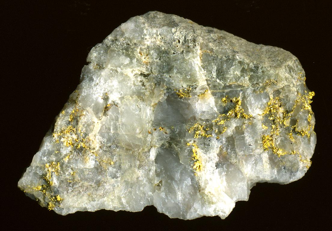
Mars may contain ores that would be very useful to potential colonists. The abundance of volcanic features together with widespread cratering are strong evidence for a variety of ores. While nothing may be found on Mars that would justify the high cost of transport to Earth, the more ores that future colonists can obtain from Mars, the easier it would be to build colonies there. How deposits are made Ore deposits are produced with the help of large amounts of heat. On Mars, heat can come from molten rock moving under the ground and from crater impacts. Liquid rock under the ground is called magma. When magma sits in underground chambers, slowly cooling over thousands of years, heavier elements sink. These elements, including copper, chromium, iron, and nickel become concentrated at the bottom. When magma is hot, many elements are free to move. As cooling proceeds, the elements bind with each other to form chemical compounds or minerals. Because some elements do not bond easily ... [...More Info...] [...Related Items...] OR: [Wikipedia] [Google] [Baidu] |
Ore Genesis
Various theories of ore genesis explain how the various types of mineral deposits form within Earth's crust. Ore-genesis theories vary depending on the mineral or commodity examined. Ore-genesis theories generally involve three components: source, transport or conduit, and trap. (This also applies to the petroleum industry: petroleum geologists originated this analysis.) *''Source'' is required because metal must come from somewhere, and be liberated by some process. *''Transport'' is required first to move the metal-bearing fluids or solid minerals into their current position, and refers to the act of physically moving the metal, as well as to chemical or physical phenomena which encourage movement. *''Trapping'' is required to concentrate the metal via some physical, chemical, or geological mechanism into a concentration which forms mineable ore. The biggest deposits form when the source is large, the transport mechanism is efficient, and the trap is active and ready at the ... [...More Info...] [...Related Items...] OR: [Wikipedia] [Google] [Baidu] |
List Of Craters On Mars
__NOTOC__ This is a list of craters on Mars. Impact craters on Mars larger than exist by the hundreds of thousands, but only about one thousand of them have names. Names are assigned by the International Astronomical Union after petitioning by relevant scientists, and in general, only craters that have a significant research interest are given names. Martian craters are named after famous scientists and science fiction authors, or if less than in diameter, after towns on Earth. Craters cannot be named for living people, and names for small craters are rarely intended to commemorate a specific town. Latitude and longitude are given as planetographic coordinates with west longitude. Catalog of named craters The catalog is divided into three partial lists: * List of craters on Mars: A–G * List of craters on Mars: H–N * List of craters on Mars: O–Z Names are grouped into tables for each letter of the alphabet, containing the crater's name (linked if article exists), co ... [...More Info...] [...Related Items...] OR: [Wikipedia] [Google] [Baidu] |
Lakes On Mars
In summer 1965, the first close-up images from Mars showed a cratered desert with no signs of water. However, over the decades, as more parts of the planet were imaged with better cameras on more sophisticated satellites, Mars showed evidence of past river valleys, lakes and present ice in glaciers and in the ground. It was discovered that the climate of Mars displays huge changes over geologic time because its axis is not stabilized by a large moon, as Earth's is. Also, some researchers maintain that surface liquid water could have existed for periods of time due to geothermal effects, chemical composition or asteroid impacts. This article describes some of the places that could have held large lakes. Overview Besides seeing features that were signs of past surface water, researchers found other types of evidence for past water. Minerals detected in many locations needed water to form. An instrument in ''2001 Mars Odyssey'' orbiter mapped the distribution of water in the sha ... [...More Info...] [...Related Items...] OR: [Wikipedia] [Google] [Baidu] |
Impact Event
An impact event is a collision between astronomical objects causing measurable effects. Impact events have physical consequences and have been found to regularly occur in planetary systems, though the most frequent involve asteroids, comets or meteoroids and have minimal effect. When large objects impact terrestrial planets such as the Earth, there can be significant physical and biospheric consequences, though atmospheres mitigate many surface impacts through atmospheric entry. Impact craters and structures are dominant landforms on many of the Solar System's solid objects and present the strongest empirical evidence for their frequency and scale. Impact events appear to have played a significant role in the evolution of the Solar System since its formation. Major impact events have significantly shaped Earth's history, and have been implicated in the formation of the Earth–Moon system. Impact events also appear to have played a significant role in the evolutionary h ... [...More Info...] [...Related Items...] OR: [Wikipedia] [Google] [Baidu] |
Hydrothermal Circulation
Hydrothermal circulation in its most general sense is the circulation of hot water (Ancient Greek ὕδωρ, ''water'',Liddell, H.G. & Scott, R. (1940). ''A Greek-English Lexicon. revised and augmented throughout by Sir Henry Stuart Jones. with the assistance of. Roderick McKenzie.'' Oxford: Clarendon Press. and θέρμη, ''heat'' ). Hydrothermal circulation occurs most often in the vicinity of sources of heat within the Earth's crust. In general, this occurs near volcanic activity, but can occur in the shallow to mid crust along deeply penetrating fault irregularities or in the deep crust related to the intrusion of granite, or as the result of orogeny or metamorphism. Seafloor hydrothermal circulation Hydrothermal circulation in the oceans is the passage of the water through mid-oceanic ridge systems. The term includes both the circulation of the well-known, high-temperature vent waters near the ridge crests, and the much-lower-temperature, diffuse flow of water through sedim ... [...More Info...] [...Related Items...] OR: [Wikipedia] [Google] [Baidu] |
HiRISE
High Resolution Imaging Science Experiment is a camera on board the ''Mars Reconnaissance Orbiter'' which has been orbiting and studying Mars since 2006. The 65 kg (143 lb), US$40 million instrument was built under the direction of the University of Arizona's Lunar and Planetary Laboratory by Ball Aerospace & Technologies Corp. It consists of a 0.5m (19.7 in) aperture reflecting telescope, the largest so far of any deep space mission, which allows it to take pictures of Mars with resolutions of 0.3m/pixel (1ft/pixel), resolving objects below a meter across. HiRISE has imaged Mars exploration rovers on the surface, including the ''Opportunity'' rover and the ongoing ''Curiosity'' mission. History In the late 1980s, of Ball Aerospace & Technologies began planning the kind of high-resolution imaging needed to support sample return and surface exploration of Mars. In early 2001 he teamed up with Alfred McEwen of the University of Arizona to propose such ... [...More Info...] [...Related Items...] OR: [Wikipedia] [Google] [Baidu] |
Climate Of Mars
The climate of Mars has been a topic of scientific curiosity for centuries, in part because it is the only terrestrial planet whose surface can be directly observed in detail from the Earth with help from a telescope. Although Mars is smaller than the Earth, 11% of Earth's mass, and 50% farther from the Sun than the Earth, its climate has important similarities, such as the presence of polar ice caps, seasonal changes and observable weather patterns. It has attracted sustained study from planetologists and climatologists. While Mars' climate has similarities to Earth's, including periodic ice ages, there are also important differences, such as much lower thermal inertia. Mars' atmosphere has a scale height of approximately , 60% greater than that on Earth. The climate is of considerable relevance to the question of whether life is or ever has been present on the planet. The climate briefly received more interest in the news due to NASA measurements indicating increased sublim ... [...More Info...] [...Related Items...] OR: [Wikipedia] [Google] [Baidu] |
Sulfates
The sulfate or sulphate ion is a polyatomic anion with the empirical formula . Salts, acid derivatives, and peroxides of sulfate are widely used in industry. Sulfates occur widely in everyday life. Sulfates are salts of sulfuric acid and many are prepared from that acid. Spelling "Sulfate" is the spelling recommended by IUPAC, but "sulphate" was traditionally used in British English. Structure The sulfate anion consists of a central sulfur atom surrounded by four equivalent oxygen atoms in a tetrahedral arrangement. The symmetry is the same as that of methane. The sulfur atom is in the +6 oxidation state while the four oxygen atoms are each in the −2 state. The sulfate ion carries an overall charge of −2 and it is the conjugate base of the bisulfate (or hydrogensulfate) ion, , which is in turn the conjugate base of , sulfuric acid. Organic sulfate esters, such as dimethyl sulfate, are covalent compounds and esters of sulfuric acid. The tetrahedral molecular geometry of the ... [...More Info...] [...Related Items...] OR: [Wikipedia] [Google] [Baidu] |


.jpg)

