|
Wisbech Rural District
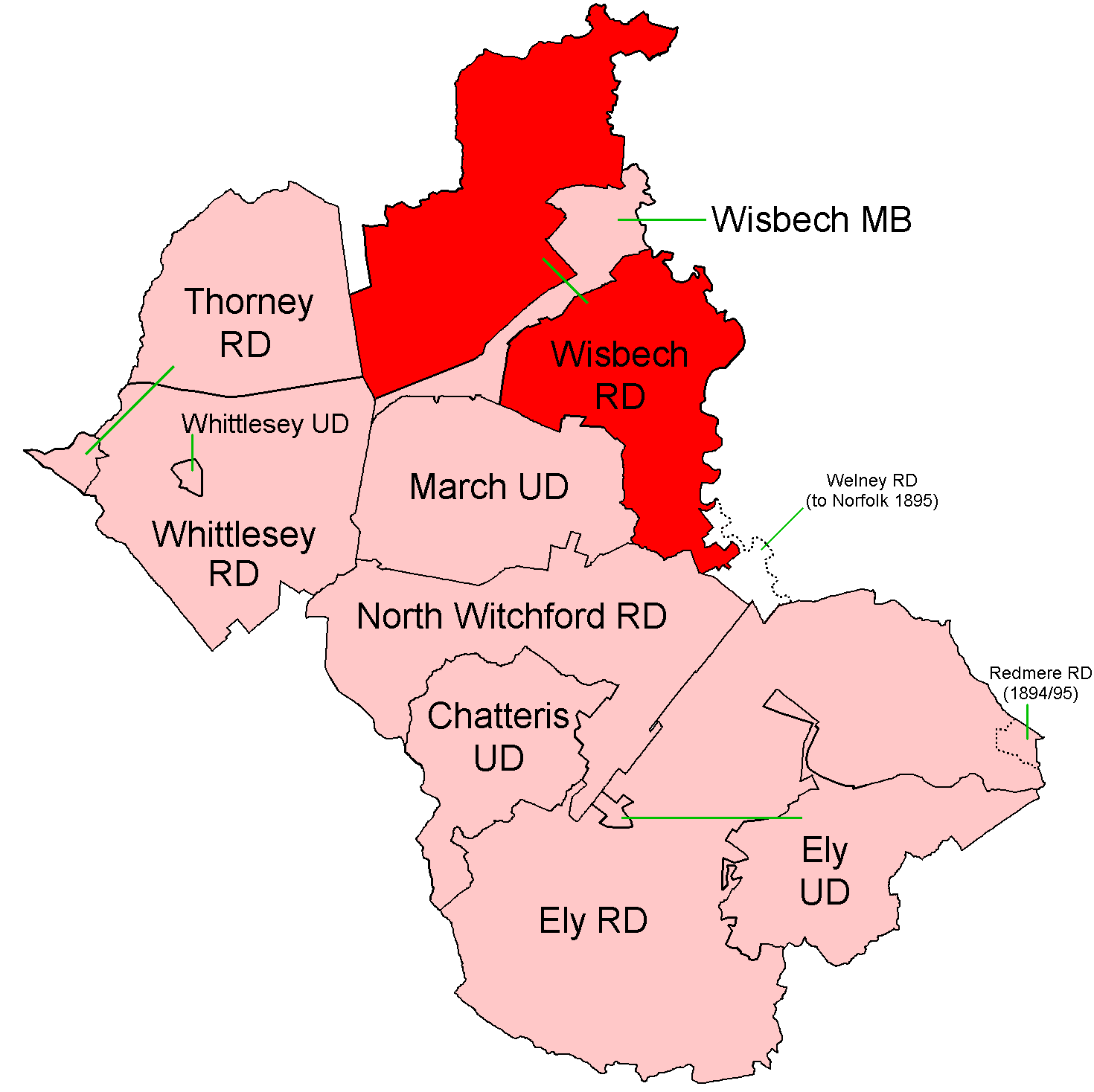
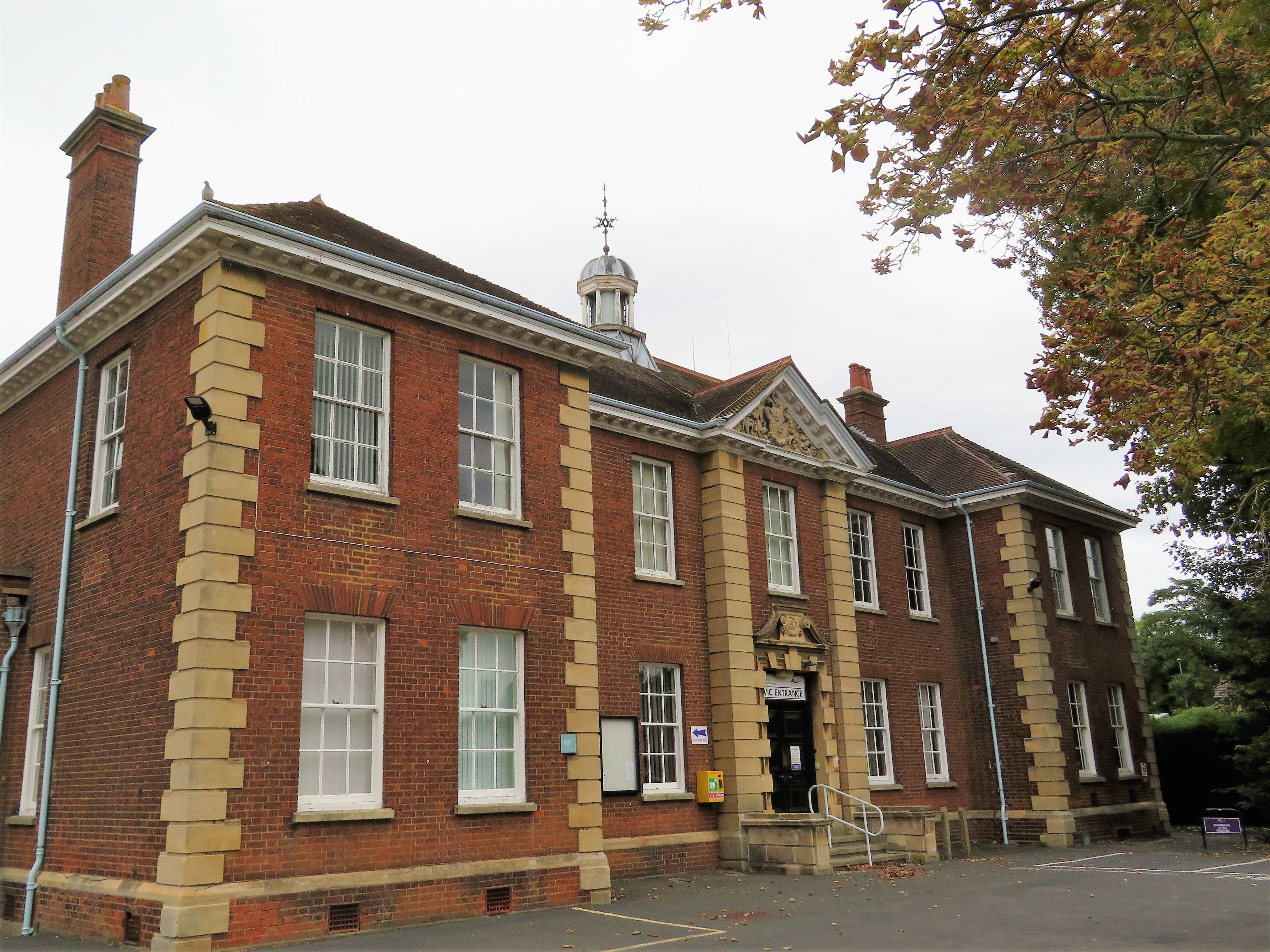
Wisbech was a rural district in Cambridgeshire in England from 1894 to 1974. It was formed from that part of the Wisbech rural sanitary district which was in Isle of Ely, Cambridgeshire, by the Local Government Act 1894. It covered the parishes of Elm, Leverington, Outwell, Parson Drove, Tydd St Giles, Upwell and Wisbech St Mary. The offices were in Alexandra Road, Wisbech. When first created, the district consisted of two detached parts separated by the long, narrow tail of Wisbech Municipal Borough. In 1933 the south-western part of Wisbech MB was transferred to the parish of Elm, leaving Wisbech RD surrounding the town on three sides. It formed part of the administrative county of Isle of Ely from its creation until 1965, when this merged to form part of Cambridgeshire and Isle of Ely. In 1974 the district was abolished under the Local Government Act 1972 The Local Government Act 1972 (c. 70) is an Act of the Parliament of the United Kingdom that reformed loca ... [...More Info...] [...Related Items...] OR: [Wikipedia] [Google] [Baidu] |
Wisbech RD 1894
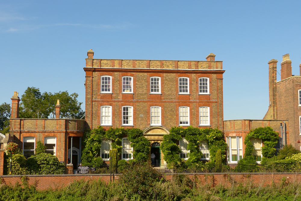
Wisbech ( ) is a market town, inland port and civil parish in the Fenland district in Cambridgeshire, England. In 2011 it had a population of 31,573. The town lies in the far north-east of Cambridgeshire, bordering Norfolk and only 5 miles (8 km) south of Lincolnshire. The tidal River Nene running through the town is spanned by two road bridges. Wisbech is in the Isle of Ely (a former administrative county) and has been described as 'the Capital of The Fens". Wisbech is noteworthy for its fine examples of Georgian architecture, particularly the parade of houses along the North Brink, which includes the National Trust property of Peckover House and the circus surrounding Wisbech Castle. History Etymology The place name 'Wisbech' is first attested in the ''Anglo-Saxon Chronicle'' for the year 656, where it appears as ''Wisbeach''. It is recorded in the 1086 Domesday Book as ''Wisbeach''. The name Wisbech is popularly believed to mean "on the back of the (River) Ouse", ... [...More Info...] [...Related Items...] OR: [Wikipedia] [Google] [Baidu] |
Tydd St Giles
Tydd St Giles is a village in Fenland, Cambridgeshire, England. It is the northernmost village in the Isle of Ely, Cambridgeshire (bordering Lincolnshire), on the same latitude as Midlands towns such as Loughborough, Leicestershire and Shrewsbury, Shropshire. The village is in the distribution area of one local free newspaper, ''The Fenland Citizen''. Origin The derivation of the name 'Tydd' is said to come from the Saxon 'Tid' or 'Tide', as the village was home to an important sluice used for draining the Fens. Although many Fenland names derive from Anglo-Saxon words, a few scattered around Wisbech include Anglo-Saxon words referencing the native British population. Although the village is old enough, it does not appear in the ''Domesday Book'', because the village was in the liberty of the Bishop of Ely.A History of the County of Cambridge and the Isle of Ely: Volume 4: City of Ely: Ely N. and S. Witchford and the Wisbech Hundreds, Authors: R B Pugh (Editor), T D Atkinson, E ... [...More Info...] [...Related Items...] OR: [Wikipedia] [Google] [Baidu] |
Districts Of England Abolished By The Local Government Act 1972
A district is a type of administrative division that, in some countries, is managed by the local government. Across the world, areas known as "districts" vary greatly in size, spanning regions or county, counties, several municipality, municipalities, subdivisions of municipalities, school district, or political district. By country/region Afghanistan In Afghanistan, a district (Persian language, Persian ps, ولسوالۍ ) is a subdivision of a province. There are almost 400 districts in the country. Australia Electoral districts are used in state elections. Districts were also used in several states as cadastral units for land titles. Some were used as squatting districts. Cadastral divisions of New South Wales, New South Wales had several different types of districts used in the 21st century. Austria In Austria, the word is used with different meanings in three different contexts: * Some of the tasks of the administrative branch of the national and regional governme ... [...More Info...] [...Related Items...] OR: [Wikipedia] [Google] [Baidu] |
History Of Cambridgeshire
:''This article concerns the History of Cambridgeshire. For other information on the region, see Cambridgeshire''. The English county of Cambridgeshire has a long history. Anglo-Saxon times The area that is now Cambridgeshire was settled at about the 6th century by groups of Angles, who pushed their way up the Ouse and the Cam, and established themselves in the fen-district, where they became known as the Gyrwas, the districts corresponding to the modern counties of Huntingdonshire and Cambridgeshire being distinguished as the lands of the North Gyrwas and the South Gyrwas respectively. At this period the fen-district stretched southward as far as Cambridge, and the essential unity which it preserved is illustrated later by its inclusion under one sheriff, chosen in successive years from Cambridgeshire proper and the Liberty of the Isle of Ely. In 656 numerous lands in the neighbourhood of Wisbech were included in the endowment of the abbey of Peterborough, and in the same ce ... [...More Info...] [...Related Items...] OR: [Wikipedia] [Google] [Baidu] |
Fenland District
Fenland is a local government district in Cambridgeshire, England. It was historically part of the Isle of Ely and borders the city of Peterborough to the northwest, Huntingdonshire to the west, and East Cambridgeshire to the southeast. It also borders the Lincolnshire district of South Holland to the north and the Norfolk district of King's Lynn and West Norfolk to the northeast. The administrative centre is in March. The district covers around of mostly agricultural land in the extremely flat Fens. The population of the district was 98,262 at the 2011 Census. It was formed on 1 April 1974, with the merger of the Borough of Wisbech, Chatteris Urban District, March Urban District, Whittlesey Urban District, North Witchford Rural District and Wisbech Rural District. In 2022 the council was reported to be the second most complained about in the county. Settlements in Fenland District Its council covers the market towns of Chatteris, March, Whittlesey and Wisbech (which is ... [...More Info...] [...Related Items...] OR: [Wikipedia] [Google] [Baidu] |
Local Government Act 1972
The Local Government Act 1972 (c. 70) is an Act of the Parliament of the United Kingdom that reformed local government in England and Wales on 1 April 1974. It was one of the most significant Acts of Parliament to be passed by the Heath Government of 1970–74. Its pattern of two-tier metropolitan and non-metropolitan county and district councils remains in use today in large parts of England, although the metropolitan county councils were abolished in 1986, and both county and district councils have been replaced with unitary authorities in many areas since the 1990s. In Wales, too, the Act established a similar pattern of counties and districts, but these have since been entirely replaced with a system of unitary authorities. Elections were held to the new authorities in 1973, and they acted as "shadow authorities" until the handover date. Elections to county councils were held on 12 April, for metropolitan and Welsh districts on 10 May, and for non-metropolitan distr ... [...More Info...] [...Related Items...] OR: [Wikipedia] [Google] [Baidu] |
Cambridgeshire And Isle Of Ely
Cambridgeshire and Isle of Ely was, from 1965 to 1974, an administrative and geographical county in East Anglia in the United Kingdom. In 1974 it became part of an enlarged Cambridgeshire. Formation The Local Government Act 1888 created four small neighbouring administrative counties in the east of England: Cambridgeshire, Isle of Ely, Huntingdonshire and the Soke of Peterborough. Following the Second World War, a Local Government Boundary Commission was formed to review county-level administration in England and Wales. The commission was of the opinion that counties needed to have a population of between 200,000 and 1 million to provide effective services. Accordingly, they recommended the amalgamation of all four counties into a single entity. The commission's recommendations were not carried out, however. The reform of local government was returned to in 1958, with the appointment of a Local Government Commission for England. The four counties were included in the East Mi ... [...More Info...] [...Related Items...] OR: [Wikipedia] [Google] [Baidu] |
Wisbech Municipal Borough
Wisbech was a municipal borough in the Isle of Ely, Cambridgeshire in England from 1835 until 1974. History The corporation met at the Wisbech Town Hall, North Brink. It operated the Port of Wisbech, Wisbech Market, the borough police and the weights and measures department. A painting of Henry Leach (1798-1873) artist unknown, was presented to the Wisbech Corporation by his family. He was the last bailiff, and first Mayor of Wisbech following the Municipal Corporations Act 1835. He was also mayor in 1839 and 1847. The Leach printing company printed many significant publications through the years, and were last based on Nene Quay. The picture is on display in the council chamber. Local shipping owner Richard Young was mayor five times. The last mayor was June Bond in 1973-4. At the 1871 census Wisbech (Municipal Borough Limits) consisted of 6,432acres, 2,162 houses, and 9,362 persons. A long, narrow tail of land was detached and given to Wisbech Rural District. In 1933 the ... [...More Info...] [...Related Items...] OR: [Wikipedia] [Google] [Baidu] |
Wisbech St Mary
Wisbech St Mary is a village in the Fenland District of Cambridgeshire, England. It is west of the town of Wisbech. It lies between two roads, the B1169 and the A47. The population of the civil parish (including Guyhirn and Thorney Toll) at the 2011 Census was 3,556. History In the later Middle Ages various subordinate manors were located in the parish including Hiptofts, Jacketts, Tuddenham Hall and Bevis Hall. About 1400 Edward and John Hiptoft had a licence for an oratory in their house on or near the site of Hiptoft Farm, about a mile east of Murrow and a mile west of St Mary's village. In 1476 Isabel, wife of Sir William Norreys and widow of John Nevile, Marquess of Montagu, held 100 shillings rents of assize in Wisbech, known as 'Hiptofts rent'. The manor of Hiptofts was settled in 1525–6 by Christopher Coote and Elizabeth his wife on John Huddleston and others, together with the fishery and 40 shillings rent in Wisbech and Leverington. By 1620 it was held by Humphrey ... [...More Info...] [...Related Items...] OR: [Wikipedia] [Google] [Baidu] |
Upwell
__NOTOC__ Upwell is a village and civil parish in the English county of Norfolk. Upwell village is on the A1101 road, as is Outwell, its conjoined village at the north. The nearest towns are Wisbech to the north-west and Downham Market to the east. The parish covers an area of and had a population of 2,456 in 1,033 households at the 2001 census, increasing to 2,750 at the 2011 Census. History The villages name means 'higher well (= spring/stream)'. Originally, part of a single place called Well; 'upp' was appended to distinguish from Outwell. Upwell in 1202 had a market-place and a weekly market. Marmont Priory was endowed by Richard I with 300 acres in Upwell and Outwell. The priory of Gilbertines was founded in the reign of King John. Cultivation of flax and hemp is referred to in an order of Sessions of Sewers in 1340. Upwell was connected with Wisbech by a steam tramway in 1884 William Wolsey a constable of Upwell, Outwell & Welney (and Robert Piggot of Wisbech ... [...More Info...] [...Related Items...] OR: [Wikipedia] [Google] [Baidu] |
Parson Drove
Parson Drove is a fen village in the Isle of Ely, Cambridgeshire, England. A linear settlement, it is west of Wisbech, the nearest town. The village is named after the central thoroughfare along which the village developed, a green drove, much wider than the current metalled road (B1166). The population at the 2001 Census was 1,030. The population is included in the civil parish of Wisbech St Mary. The city of Peterborough, is to the west, and the town of King's Lynn, to the east. History The area was farmed by the Romans, who left evidence of their presence in several places throughout Parson Drove and the surrounding parish. Samuel Pepys wrote about Parson Drove in his diary for 17 September 1663, describing it as a "heathen place" where he found his uncle and aunt in a "sad poor thatched cottage", after which he took them to a "miserable inn" (the Swan Inn), where he was staying, and where his uncle's horse was subsequently stolen. A lawyer's clerk from London was, by hi ... [...More Info...] [...Related Items...] OR: [Wikipedia] [Google] [Baidu] |


