|
Windischeschenbach
Windischeschenbach is a town in the district of Neustadt an der Waldnaab, in Bavaria, Germany. It is situated north of Weiden in der Oberpfalz Weiden in der Oberpfalz (, ; official abbreviation: Weiden i.d.OPf.; Northern Bavarian: ''Weidn in da Owapfalz'') is a district-free city in Bavaria, Germany. It is located east of Nuremberg and west of the Czech border. Weiden is the second b .... The German Continental Deep Drilling Programme, which reached a super-deep maximum depth of , is located near Windischeschenbach. Windischeschenbach is generally considered the centre of Zoigl beer. References Neustadt an der Waldnaab (district) {{NeustadtWaldnaabdistrict-geo-stub ... [...More Info...] [...Related Items...] OR: [Wikipedia] [Google] [Baidu] |
Zoigl
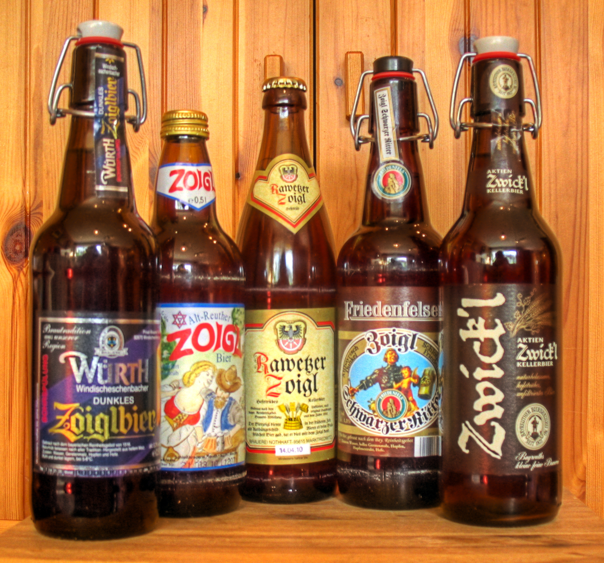
Zoigl is a type of German beer brewed in the Oberpfalz, eastern Bavaria, between Franconia and the Czech Republic. The name is believed to be derived from a Windischeschenbacher dialect pronunciation of the German word ''zeigen'' or ''Zeichen'' meaning "sign", the symbol used to advertise that the beer is available at an establishment. Its logo is composed of two component triangles represent the joining of six beer ingredients: the first triangle denoting water, fire and air; the second and inverted triangle denoting malted barley, hops, water. History The first documented example of the word "zeigl" occurs in a 1508 document at Neustadt an der Waldnaab, having derived from the German "Zeichen" meaning sign, or "zeigen" meaning show. It was pronounced "zeigel" in the Oberpfalz region. Today the word "Zoigl" is still in use and has given its name to this style of beer production. Zoigl has been brewed for centuries in communal breweries, owned either by the town or by an as ... [...More Info...] [...Related Items...] OR: [Wikipedia] [Google] [Baidu] |
German Continental Deep Drilling Programme
The German Continental Deep Drilling Programme (), abbreviated as the KTB borehole, was a scientific drilling project carried out from 1987 to 1995 near Windischeschenbach, Bavaria. The main super-deep borehole reached a depth of in the Earth's continental crust. The Federal Ministry of Research funded the project with 528 million DM (270 million euros). The (Lower Saxony) LBEG mining office (State Office for Mining, Energy and Geology) took the project lead. After the drilling project ended, the German Research Centre for Geosciences used the borehole to install a seismic deep observatory () which was active from 1996 to 2001. The derrick used at the site, one of the largest in the world, remains in place and has become a tourist attraction. The two boreholes were kept open for further scientific research and for in-situ testing of equipment and devices. History In October 1986 the German Minister for Research and Technology (Bundesminister für Forschung und Technologie ... [...More Info...] [...Related Items...] OR: [Wikipedia] [Google] [Baidu] |
Neustadt An Der Waldnaab (district)
Neustadt an der Waldnaab is a ''Landkreis'' (district) in Bavaria, Germany. It is bounded by (from the south and clockwise) the districts of Schwandorf, Amberg-Sulzbach, Bayreuth and Tirschenreuth, and by the Czech Republic The Czech Republic, also known as Czechia, and historically known as Bohemia, is a landlocked country in Central Europe. The country is bordered by Austria to the south, Germany to the west, Poland to the northeast, and Slovakia to the south ... ( Plzeň Region). The city of Weiden in der Oberpfalz is enclosed by, but does not belong to the district. History The district was established in 1972 by merging the former districts of Neustadt an der Waldnaab, Eschenbach and Vohenstrauß. Geography The district is located in the mountains of the Upper Palatine Forest (''Oberpfälzer Wald''). The two headstreams of the River Naab, the Waldnaab and Haidenaab, both run through the district to merge in the south of the area. Coat of arms The coat ... [...More Info...] [...Related Items...] OR: [Wikipedia] [Google] [Baidu] |
Ortsteil
A village is a human settlement or Residential community, community, larger than a hamlet (place), hamlet but smaller than a town with a population typically ranging from a few hundred to a few thousand. Although villages are often located in rural areas, the term urban village is also applied to certain urban neighborhoods. Villages are normally permanent, with fixed dwellings; however, transient villages can occur. Further, the dwellings of a village are fairly close to one another, not scattered broadly over the landscape, as a dispersed settlement. In the past, villages were a usual form of community for societies that practice subsistence agriculture and also for some non-agricultural societies. In Great Britain, a hamlet earned the right to be called a village when it built a Church (building), church. [...More Info...] [...Related Items...] OR: [Wikipedia] [Google] [Baidu] |
Bayerisches Landesamt Für Statistik
The statistical offices of the German states (German language, German: ) carry out the task of collecting official statistics in Germany together and in cooperation with the Federal Statistical Office of Germany, Federal Statistical Office. The implementation of statistics according to Article 83 of the Basic Law for the Federal Republic of Germany, constitution is executed at state level. The Bundestag, federal government has, under Article 73 (1) 11. of the constitution, the exclusive legislation for the "statistics for federal purposes." There are 14 statistical offices for the States of Germany, 16 states: See also * Federal Statistical Office of Germany References {{Reflist National statistical services, Germany Lists of organisations based in Germany, Statistical offices Official statistics, Germany ... [...More Info...] [...Related Items...] OR: [Wikipedia] [Google] [Baidu] |
Bavaria
Bavaria, officially the Free State of Bavaria, is a States of Germany, state in the southeast of Germany. With an area of , it is the list of German states by area, largest German state by land area, comprising approximately 1/5 of the total land area of Germany, and with over 13.08 million inhabitants, it is the list of German states by population, second most populous German state, behind only North Rhine-Westphalia; however, due to its large land area, its population density is list of German states by population density, below the German average. Major cities include Munich (its capital and List of cities in Bavaria by population, largest city, which is also the list of cities in Germany by population, third largest city in Germany), Nuremberg, and Augsburg. The history of Bavaria includes its earliest settlement by Iron Age Celts, Celtic tribes, followed by the conquests of the Roman Empire in the 1st century BC, when the territory was incorporated into the provinces of Ra ... [...More Info...] [...Related Items...] OR: [Wikipedia] [Google] [Baidu] |
Germany
Germany, officially the Federal Republic of Germany, is a country in Central Europe. It lies between the Baltic Sea and the North Sea to the north and the Alps to the south. Its sixteen States of Germany, constituent states have a total population of over 84 million in an area of , making it the most populous member state of the European Union. It borders Denmark to the north, Poland and the Czech Republic to the east, Austria and Switzerland to the south, and France, Luxembourg, Belgium, and the Netherlands to the west. The Capital of Germany, nation's capital and List of cities in Germany by population, most populous city is Berlin and its main financial centre is Frankfurt; the largest urban area is the Ruhr. Settlement in the territory of modern Germany began in the Lower Paleolithic, with various tribes inhabiting it from the Neolithic onward, chiefly the Celts. Various Germanic peoples, Germanic tribes have inhabited the northern parts of modern Germany since classical ... [...More Info...] [...Related Items...] OR: [Wikipedia] [Google] [Baidu] |
Weiden In Der Oberpfalz
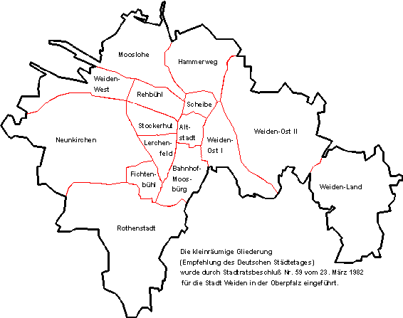
Weiden in der Oberpfalz (, ; official abbreviation: Weiden i.d.OPf.; Northern Bavarian: ''Weidn in da Owapfalz'') is a district-free city in Bavaria, Germany. It is located east of Nuremberg and west of the Czech border. Weiden is the second biggest city in the governmental district Oberpfalz, next to Regensburg. A branch of the German Army is located here. History Weiden in der Oberpfalz was first mentioned in a document in 1241 as Weiden. It is assumed that the first settlements in Weiden are dated the year 1000. Located at the intersection of two major trading routes (Goldene Strasse and Magdeburger Strasse), Weiden soon became an important trading center with a population of 2,200 in 1531. Two city fires, the Thirty Years' War and the Plague gave the city setbacks, which it didn't recover from until the end of the 18th Century. Between 1634 and 1635, as well as between 1648 and 1650; Weiden was occupied by Swedish troops. Since 1714 the city fully belonged to the Duchy of ... [...More Info...] [...Related Items...] OR: [Wikipedia] [Google] [Baidu] |


