|
Winchell's Kingfisher
The rufous-lored kingfisher (''Todiramphus winchelli)'', also known as Winchell's kingfisher, is a species of bird in the kingfisher family Alcedinidae. It is endemic to the Philippines, its natural habitat consists of tropical moist lowland forests. It is threatened by deforestation, and the International Union for Conservation of Nature (IUCN) has assessed it as a vulnerable species. Description The rufous-lored kingfisher is about long. The crown is blackish-blue, with cobalt-blue edges, and the lores and neck-collar are rufous. The upperparts are mostly blackish and dark blue, with a bright azure-blue rump. The underparts are white in the male, and buff in the female. The eyes are dark brown, the beak is black, and the legs are greyish. The juvenile bird is similar to the female, but with duller plumage. The subspecies are coloured different shades of blue. A black patch on the sides of the male's breast is conspicuous in subspecies ''nigrorum'' and concealed in others, a ... [...More Info...] [...Related Items...] OR: [Wikipedia] [Google] [Baidu] |
Richard Bowdler Sharpe
Richard Bowdler Sharpe (22 November 1847 – 25 December 1909) was an English people, English zoologist and ornithology, ornithologist who worked as curator of the bird collection at the British Museum of natural history. In the course of his career he published several monographs on bird groups and produced a multi-volume catalogue of the specimens in the collection of the museum. He described many new species of bird and also has had species named in his honour by other ornithologists including Sharpe's longclaw (''Macronyx sharpei'') and Sharpe's starling (''Pholia sharpii''). Biography Richard was born in London, the first son of Thomas Bowdler Sharpe. His grandfather, Reverend Lancelot Sharpe was Rector of All Hallows Staining. His father was a publisher on Skinner Street and was best known for being the publisher of ''Sharpe's London Magazine'', an illustrated periodical (weekly but monthly from 1847). His care from the age of six was under an aunt, Magdalen Wallace, widow ... [...More Info...] [...Related Items...] OR: [Wikipedia] [Google] [Baidu] |
Romblon
Romblon (, , ), officially the Province of Romblon, is an archipelagic province of the Philippines located in the Mimaropa region. Its main components include Romblon, an archipelagic municipality of the same name that also serves as the provincial capital; Tablas, the largest island, covering nine municipalities (including Odiongan, the largest municipality in the province); Sibuyan with its three towns; as well as the smaller island municipalities of Corcuera, Banton, Concepcion, and San Jose. The province lies south of Marinduque and Quezon, east of Oriental Mindoro, north of Aklan and Capiz, and west of Masbate. According to the 2020 census, it has a total population of 308,985. Romblon was inhabited by aboriginal Filipinos prior to the arrival of the Spanish in 1569. Archaeological artifacts recovered by the National Museum in 1936 indicate that the aborigines of Romblon have a rich and advanced culture. During the Spanish colonial rule, Romblon was initially adm ... [...More Info...] [...Related Items...] OR: [Wikipedia] [Google] [Baidu] |
Sulu Archipelago
The Sulu Archipelago ( Tausug: Kapū'-pūan sin Sūg Sulat Sūg: , ) is a chain of islands in the Pacific Ocean, in the southwestern Philippines. The archipelago forms the northern limit of the Celebes Sea and southern limit of the Sulu Sea. The Sulu Archipelago islands are within the Mindanao island group, consisting of the Philippines provinces of Basilan, Sulu, and Tawi-Tawi; hence the archipelago is sometimes referred to as Basulta, derived from the first syllables of the three provinces. The archipelago is not, as is often supposed, the remains of a land bridge between Borneo and the Philippines. Rather, it is the exposed edge of small submarine ridges produced by tectonic tilting of the sea bottom. Basilan, Jolo, Tawi-Tawi and other islands in the group are extinct volcanic cones rising from the southernmost ridge. Tawi-Tawi, the southernmost island of the group, has a serpentine basement-complex core with a limestone covering. This island chain is an important ... [...More Info...] [...Related Items...] OR: [Wikipedia] [Google] [Baidu] |
Camiguin
Camiguin, officially the Province of Camiguin (; ; Kamigin: ''Probinsya ta Kamigin''), is an island province in the Philippines located in the Bohol Sea, about off the northern coast of mainland Mindanao. It is geographically part of Region X, the Northern Mindanao Region of the country and formerly a part of Misamis Oriental province. Camiguin is the second-smallest province in the country in both population and land area after Batanes. The provincial capital is Mambajao, which is also the province's largest municipality in both area and population. The province is famous for its sweet lanzones, to which its annual Lanzones Festival is dedicated and celebrated every third weekend of October. It is home to lush interior forest reserves, collectively known as the Mount Hibok-Hibok Protected Landscape, which has been declared by all Southeast Asian nations as an ASEAN Heritage Park. The province also boasts three National Cultural Treasures, namely, the Old Bonbon Church ru ... [...More Info...] [...Related Items...] OR: [Wikipedia] [Google] [Baidu] |
Mindanao
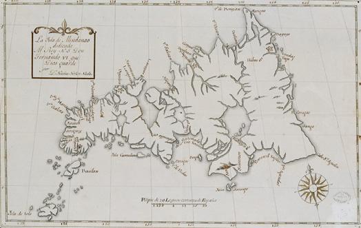
Mindanao ( ) is the List of islands of the Philippines, second-largest island in the Philippines, after Luzon, and List of islands by population, seventh-most populous island in the world. Located in the southern region of the archipelago, the island is part of an island group of the same name that also includes its adjacent islands, notably the Sulu Archipelago. According to the 2020 census, Mindanao had a population of 26,252,442, while the entire island group had an estimated population of 27,021,036. Mindanao is divided into six administrative regions: the Zamboanga Peninsula, Northern Mindanao, the Caraga region, the Davao Region, Davao region, Soccsksargen, and the autonomous region of Bangsamoro. According to the 2020 census, Davao City is the most populous city on the island, with 1,776,949 people, followed by Zamboanga City (pop. 977,234), Cagayan de Oro (pop. 728,402), General Santos (pop. 697,315), Butuan (pop. 372,910), Iligan (pop. 363,115) and Cotabato City (pop. ... [...More Info...] [...Related Items...] OR: [Wikipedia] [Google] [Baidu] |
Bohol
Bohol (), officially the Province of Bohol (; ), is an island province of the Philippines located in the Central Visayas Regions of the Philippines, region, consisting of the island itself and 75 minor surrounding islands. It is home to Boholano people. Its capital is Tagbilaran, the largest city of the province. With a land area of and a coastline long, Bohol is the List of islands of the Philippines#List of islands by size, tenth largest island of the Philippines.The Island-Province of Bohol Retrieved November 15, 2006. The province of Bohol is a first-class province divided into 3 Legislative districts of Bohol, congressional districts, comprising 1 Cities of the Philippines, component city and 47 Philippine municipality, municipalities. It has 1,109 barangay, barangays. [...More Info...] [...Related Items...] OR: [Wikipedia] [Google] [Baidu] |
Siquijor
Siquijor ( , ), officially the Province of Siquijor (; ), is a Philippines, Philippine Provinces of the Philippines, island province (List of islands of the Philippines, the third smallest in the country, in terms of population and land area) located within the Negros Island Region. Its largest town and capital is the Municipalities of the Philippines, municipality of Siquijor, Siquijor, Siquijor. The province lies south of Cebu, southeast of Negros Oriental, southwest of Bohol, and north of Mindanao. During the History of the Philippines (1565-1898), Spanish colonial period of the Philippines, the Spaniards called Siquijor the (Island of Fire), due to the glow of fireflies that swarmed the molave trees. Etymology One popular legend says the name "Siquijor" comes from the famed pre-Spanish ruler of the island, King Datu Kihod. Upon the Spaniards' arrival, Kihod introduced himself by saying "si kihod", or "I am Kihod", something which, presumably, the Spanish believed to be ... [...More Info...] [...Related Items...] OR: [Wikipedia] [Google] [Baidu] |
Cebu
Cebu ( ; ), officially the Province of Cebu (; ), is a province of the Philippines located in the Central Visayas region, and consists of a main island and 167 surrounding islands and islets. The coastal zone of Cebu is identified as a site of highest marine biodiversity importance in the Coral Triangle. Its capital and largest city is Cebu City, nicknamed "the Queen (Catholic) City of the South" having the Second Cardinal, the oldest city and first capital of the Philippines, which is politically independent from the provincial government along with Mandaue and Lapu-Lapu City. The Cebu Metropolitan Area or Metro Cebu is the third largest metropolitan area in the Philippines (after Metro Manila and Metro Davao) with Cebu City as the main center of commerce, trade, education and industry in the Visayas as well as the regional center of Central Visayas. Being one of the most developed provinces in the Philippines, in a decade it has transformed into a global hub for b ... [...More Info...] [...Related Items...] OR: [Wikipedia] [Google] [Baidu] |
Negros
Negros (, , ) is the fourth largest and third most populous island in the Philippines, with a total land area of . The coastal zone of the southern part of Negros is identified as a site of highest marine biodiversity importance in the Coral Triangle. Negros is one of the many islands of the Visayas, in the central part of the country. The predominant inhabitants of the island region are mainly called Negrenses (locally ''Negrosanons''). As of 2020 census, the total population of Negros is 4,656,893 people. From 2015 to 2017, the whole island was governed as an Regions of the Philippines, administrative region officially named the Negros Island Region, which comprised the Cities of the Philippines#City classification, highly urbanized city of Bacolod and the Philippine provinces, provinces of Negros Occidental and Negros Oriental, along with its corresponding outlying islands and islets within a total regional area of . It was created on May 29, 2015, by virtue of Executive Ord ... [...More Info...] [...Related Items...] OR: [Wikipedia] [Google] [Baidu] |
Leyte
Leyte ( ) is an island in the Visayas group of islands in the Philippines. It is eighth-largest and sixth-most populous island in the Philippines, with a total population of 2,626,970 as of 2020 census. Since the accessibility of land has been depleted, Leyte has provided countless number of migrants to Mindanao. Most inhabitants are farmers. Fishing is a supplementary activity. Rice and corn (maize) are the main food crops; cash crops include coconuts, abaca, tobacco, bananas, and sugarcane. There are some manganese deposits, and sandstone and limestone are quarried in the northwest. Politically, the island is divided into two provinces: (Northern) Leyte and Southern Leyte. Territorially, Southern Leyte includes the island of Panaon to its south. To the north of Leyte is the island province of Biliran, a former sub-province of Leyte. The major cities of Leyte are Tacloban, on the eastern shore at the northwest corner of Leyte Gulf, and Ormoc, on the west coast. Leyte tod ... [...More Info...] [...Related Items...] OR: [Wikipedia] [Google] [Baidu] |
Biliran
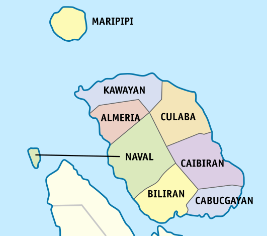
Biliran, officially the Province of Biliran (Waray language, Waray-Waray: ''Probinsya han Biliran''; ; ), is an island province in the Philippines located in the Eastern Visayas Regions of the Philippines, region (Region VIII). Biliran is one of the country's smallest and newest Provinces of the Philippines, provinces. Formerly a sub-province of Leyte (province), Leyte, it became an independent province in 1992. Biliran lies less than a kilometer north of the island of Leyte. A bridge-causeway fixed link over Poro Island in the gateway town of Biliran, Biliran, Biliran connects the province to Leyte. Its capital is the municipality of Naval, Biliran, Naval on the western coast of the island which is the most populous in the province. Biliran is sometimes called "The Singapore of Eastern Visayas" by locals, due to it having a causeway that is similar to that of Singapore's, and also because of its small size and its strategic position in the Visayas Archipelago wherein it is a ... [...More Info...] [...Related Items...] OR: [Wikipedia] [Google] [Baidu] |


