|
Wild Fields
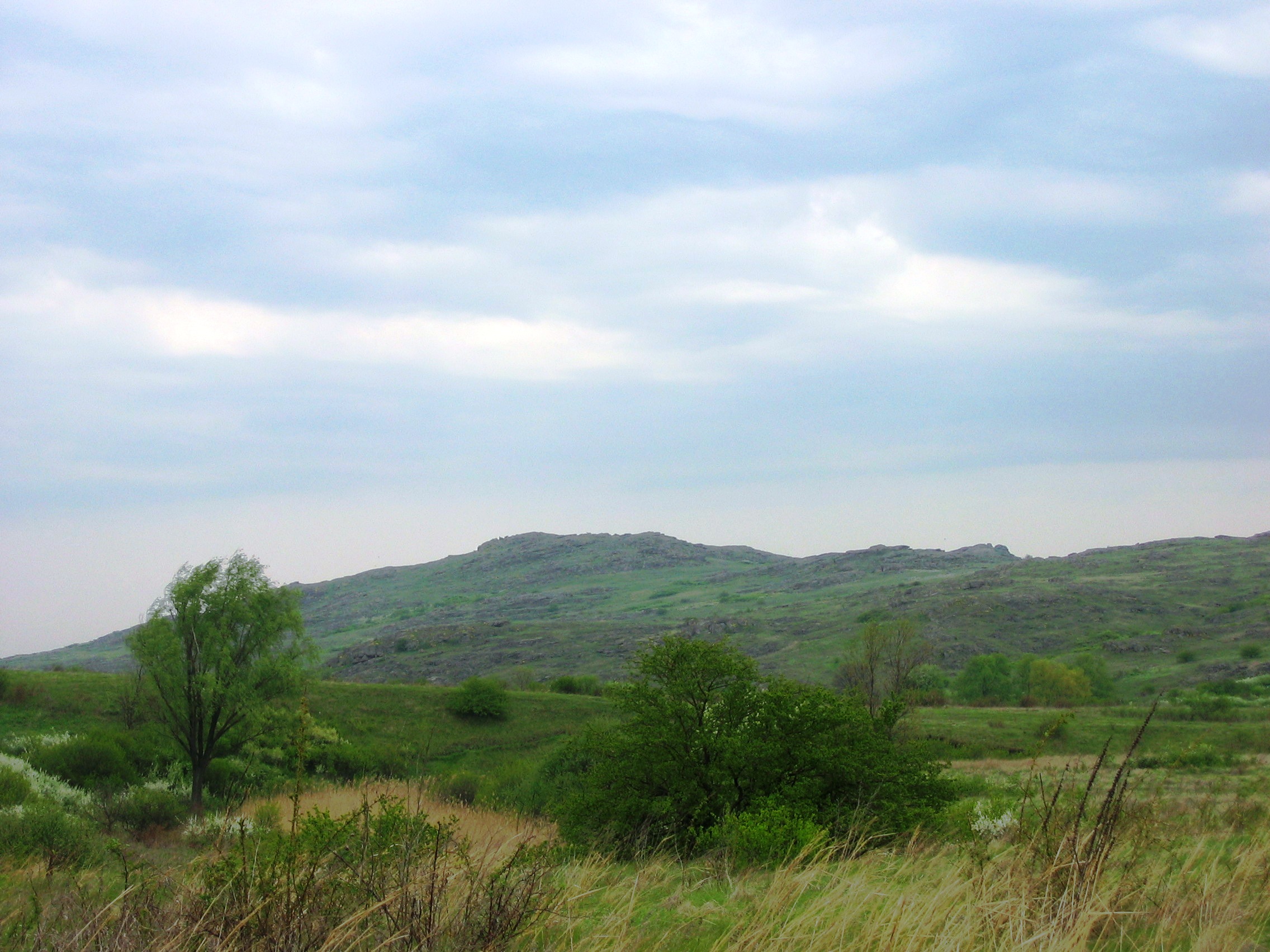
The Wild Fields is a historical term used in the Polish–Lithuanian documents of the 16th to 18th centuries to refer to the Pontic steppe in the territory of present-day Eastern and Southern Ukraine and Western Russia, north of the Black Sea and Azov Sea. It was the traditional name for the Black Sea steppes in the 16th and 17th centuries. In a narrow sense, it is the historical name for the demarcated and sparsely populated Black Sea steppes between the middle and lower reaches of the Dniester in the west, the lower reaches of the Don and the Siverskyi Donets in the east, from the left tributary of the Dnipro–Samara, and the upper reaches of the Southern Bug– Syniukha and Ingul in the north, to the Black and Azov Seas and Crimea in the south. In a broad sense, it is the name of the entire Great Eurasian Steppe, which was also called Great Scythia in ancient times or Great Tartary in the Middle Ages in European sources and Desht-i-Kipchak in Eastern (mainly Persian ... [...More Info...] [...Related Items...] OR: [Wikipedia] [Google] [Baidu] |
Kamyana Mohyla
Kamyana Mohyla (; ) is an archaeological site in the Molochna River () valley, about a mile from the village of Terpinnia, Zaporizhzhia Oblast, Ukraine. Petroglyphs of Kamyana Mohyla are dated from Upper Paleolithic (Kukrek culture) to Medieval, with Stone Age depictions subjected to most archaeological interest. The site is listed on the List of World Heritage Sites in Ukraine#Tentative list, Tentative List of World Heritage Sites in Ukraine. The site encompasses a group of isolated blocks of sandstone, up to twelve meters in height, scattered around an area of some 3,000 sq m. As Noghai legend has it, it resulted from a scuffle of two baghaturs who took turns throwing rocks at each other. In truth, the site had its origins in a sandbank of the Tethys Ocean. For a long time it was an island in the Molochna River, which has since been silted up and now flows a short distance to the west. It is thought to represent the only sandstone outcrop in the Azov-Kuban Depression. The sha ... [...More Info...] [...Related Items...] OR: [Wikipedia] [Google] [Baidu] |
Inhul
The Inhul () is a left tributary of the Southern Bug (Boh) and is the 14th longest river of Ukraine. It flows through the Kirovohrad and Mykolaiv regions. It starts near the village of Rodnykivka, Oleksandriia Raion in Kirovohrad Oblast (Central Ukraine), flowing south towards the Southern Bug at Mykolaiv, which is north (up river) from where the Southern Bug empties into the Black Sea. The Inhul River is long. The river valley is mostly trapezium-like with a width of up to 4 km and a depth of up to 60 meters. At the upper stream it has a narrow winding channel that cuts through the Dnieper Upland, and its rocky banks show granite and gneiss; at the middle and lower stream after entering the Black Sea Lowland, it widens up to 30 meters and over. The river freezes over in December and thaws sometime in March. Among major cities on the river are Kropyvnytskyi and Mykolaiv. See also * Inhul River Park References External links * Sukhenko, O., Domaranskyi, A. In ... [...More Info...] [...Related Items...] OR: [Wikipedia] [Google] [Baidu] |
Dnieper Basin
The Dnieper Basin is the drainage basin of the Dnieper River, covering an area of . Its water resources compose around 80% of the total for all Ukraine. Geography The Dnieper Basin lies within Ukraine, Belarus, and Russia. It borders on the Volga Basin in the northeast, on the Donets River Basin in the east, which belongs to the Don River Basin, and in the southeast on several small watersheds, the watercourses of which flow in flow into the Sea of Azov. The southern edge of the watershed borders on other small watersheds whose rivers flow into the Black Sea. In the south of the catchment area, the main river Dnieper runs into a peak west of the city of Kherson and runs across the Dnieper–Bug estuary, where the stream flows into the Black Sea. In the southwest, the catchment area of the Dnieper borders on the Southern Bug Basin, which attaches laterally to the catchment area of the Dnieper. To the west is a small border with the Dniester Basin, as well as the Vistula Basin. In ... [...More Info...] [...Related Items...] OR: [Wikipedia] [Google] [Baidu] |
Józef Wereszczyński
Józef Wereszczyński (born 1530 in Zbaraż, died 1598) was a Polish political writer, polemicist, moralist, preacher, and bishop of Kiev. He was probably born in Zbaraż, in 1530, as the son of Andrzej of Ruthenian origin, and Anna née Jaroski (Jaroski or Jarocki). He grew up and was educated in Krasnystaw. It is not known where he obtained his doctorate in theology. Before 1577 he became a canon of Chełmno. In 1581 he became an abbot of the Benedictine monastery in Sieciechów. In 1587 he supported the candidacy of Sigismund III Vasa. In 1592 he became the bishop of Kiev. References Roman Catholic bishops of Kyiv Benedictine abbots Polish nobility 17th-century Roman Catholic bishops in the Polish–Lithuanian Commonwealth Polish abbots 16th-century Polish monks 16th-century Christian abbots 1598 deaths 1530 births {{Poland-RC-bishop-stub ... [...More Info...] [...Related Items...] OR: [Wikipedia] [Google] [Baidu] |
Blaise De Vigenère
Blaise de Vigenère (5 April 1523 – 19 February 1596) () was a French diplomat, cryptographer, translator and alchemist. Biography Vigenère was born into a respectable family in the village of Saint-Pourçain in Bourbonnais. When he was 12, his father, Jehan (modern spelling Jean) de Vigenère, arranged for him to have a classical education in Paris. Registered at the university at 14, he quit after three years without a known degree.Sarazin 1997, p. 18. From 1539 to around 1545, he worked under Gilbert Bayard, a first secretary to King Francis I, who had fiefs in Bourbonnais. In 1545, he accompanied the French envoy Louis Adhémar de Monteil, Count of Grignan, to the Diet of Worms as a junior secretary. After the diet's rupture, he traveled in Europe.Moreri 1759 vol. 10, p. 606 ("Vigenere, Blaise de") In 1547, he quit the court and entered the service of the House of Nevers. He would remain associated with it until at least a year before his death in 1596. At first ... [...More Info...] [...Related Items...] OR: [Wikipedia] [Google] [Baidu] |
De Moribus Tartarorum, Lituanorum Et Moscorum
''De moribus tartarorum, lituanorum et moscorum'' ("On the Customs of Tatars, Lithuanians and Muscovites") is a 16th-century Latin treatise by Michalo Lituanus ("Michael the Lithuanian"). The work, which was originally dedicated to King of Poland and Grand Duke of Lithuania Sigismund II Augustus, survived only in ten fragments that were first published in 1615 by Johann Jacob Grasser in Basel, Switzerland. Content The treatise is thought to date from around 1550: the author's ideas and writing style show the clear influence of humanism. While the treatise contains some useful historical information, this should be treated with care. The work is neither a chronicle nor a travel book, but rather a political essay which is critical of the author's motherland (Grand Duchy of Lithuania) and overly praises Muscovy and the Crimean Khanate for their centralized governments and united subjects. [...More Info...] [...Related Items...] OR: [Wikipedia] [Google] [Baidu] |
Zaporozhian Cossacks
The Zaporozhian Cossacks (in Latin ''Cossacorum Zaporoviensis''), also known as the Zaporozhian Cossack Army or the Zaporozhian Host (), were Cossacks who lived beyond (that is, downstream from) the Dnieper Rapids. Along with Registered Cossacks and Sloboda Cossacks, Zaporozhian Cossacks played an important role in the history of Ukraine and the ethnogenesis of Ukrainians. The Zaporozhian Sich grew rapidly in the 15th century from serfs fleeing the more controlled parts of the Polish–Lithuanian Commonwealth. The least controlled region, that was located between the Dniester and mid-Volga was first known from the 15th century as the '' Wild Fields'', which was subject to colonization by the Zaporozhian Cossacks.Shcherbak, V.Wild Field (ДИКЕ ПОЛЕ). ''Encyclopedia of History of Ukraine''. 2004 Zaporozhian Host became established as a well-respected political entity with a parliamentary system of government. During the course of the 16th, 17th and well into the 18th c ... [...More Info...] [...Related Items...] OR: [Wikipedia] [Google] [Baidu] |
Volga
The Volga (, ) is the longest river in Europe and the longest endorheic basin river in the world. Situated in Russia, it flows through Central Russia to Southern Russia and into the Caspian Sea. The Volga has a length of , and a catchment area of .«Река Волга» , Russian State Water Registry It is also Europe's largest river in terms of average discharge at delta – between and – and of . It is widely regarded as the national river of |
Desht-i Kipchak
The name Cumania originated as the Latin exonym for the Cuman–Kipchak confederation, which was a tribal confederation in the western part of the Eurasian Steppe, between the 10th and 13th centuries. The confederation was dominated by two Turkic nomadic tribes: the Cumans (also known as the Polovtsians or ''Folban'') and the Kipchaks. Cumania was known in Islamic sources as ''Dasht-i Qipchaq'' (دشت قپچاق) which means "Steppe of the Kipchaks" or "Kipchak Plains" in Persian, and ''al-Qumāniyīn'' (القمانيين) which means "The Cumans" or "The Cuman people" in Arabic. Russian sources have referred to Cumania as the "Polovtsian Steppe" (''Polovetskaia Step''), or the "Polovtsian Plain" (''Pole Polovetskoe''). A different, more organized entity that was later known as the Golden Horde was also referred to as "Comania" by Armenian chronicler Hethum (Hayton) of Korykos. "Cumania" was also the source of names, or alternate names, for several smaller areas – some of ... [...More Info...] [...Related Items...] OR: [Wikipedia] [Google] [Baidu] |
Great Tartary
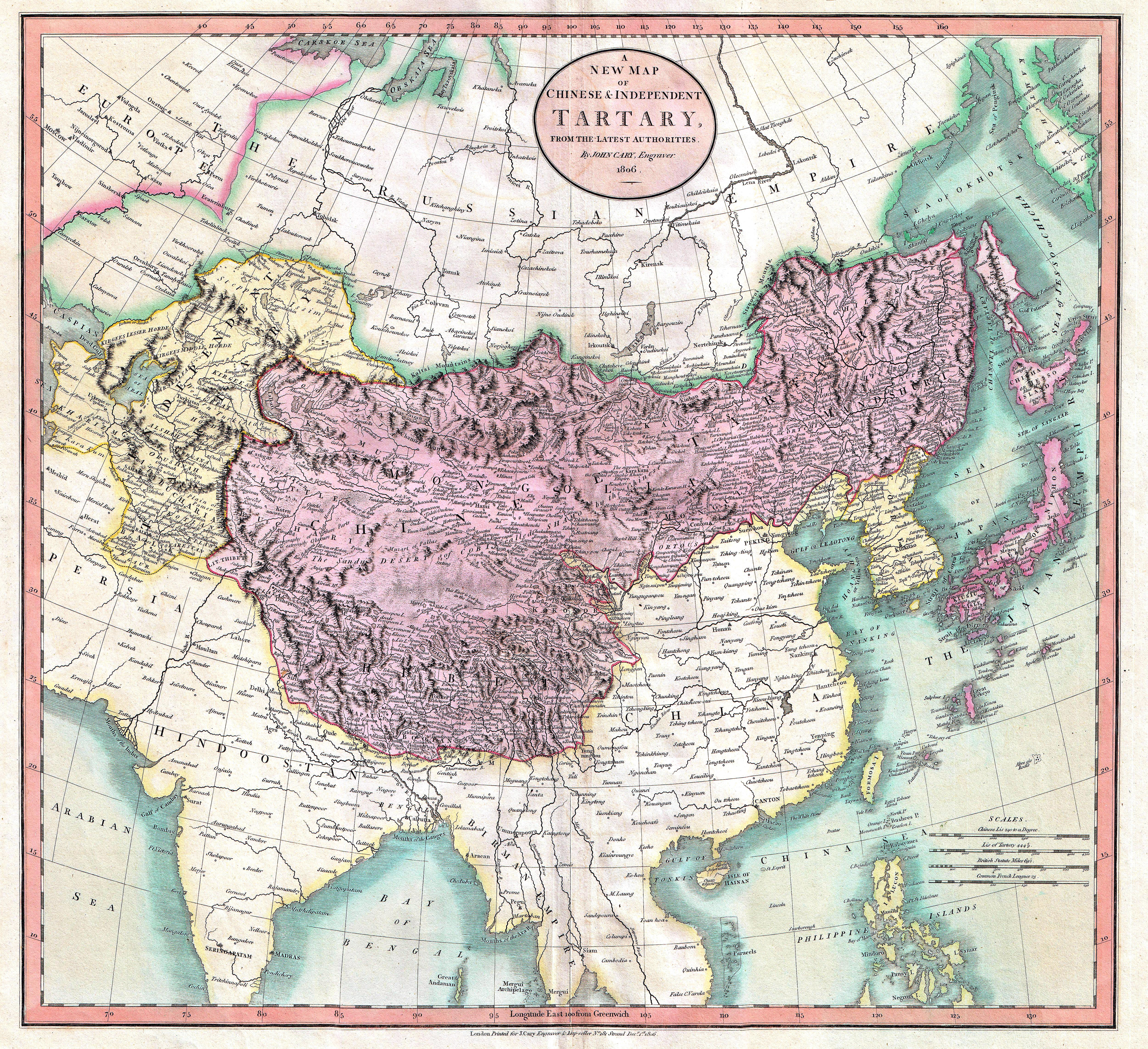
Tartary (Latin: ''Tartaria''; ; ; ) or Tatary () was a blanket term used in Western European literature and cartography for a vast part of Asia bounded by the Caspian Sea, the Ural Mountains, the Pacific Ocean, and the northern borders of China, India, and Persia, at a time when this region was largely unknown to European geographers. The active use of the toponym (place name) can be traced from the 13th to the 19th centuries. In European sources, Tartary became the most common name for Central Asia that had no connection with the real polities or ethnic groups of the region; until the 19th century, European knowledge of the area remained extremely scarce and fragmentary. In modern English-speaking tradition, the region formerly known as Tartary is usually called Inner Asia or Central Eurasia. Much of this area consists of arid plains, the main nomadic population of which in the past was engaged in animal husbandry. Ignorance surrounding Tartary's use as a place name has spawned ... [...More Info...] [...Related Items...] OR: [Wikipedia] [Google] [Baidu] |
Great Scythia
Scythia (, ) or Scythica (, ) was a geographic region defined in the ancient Graeco-Roman world that encompassed the Pontic steppe. It was inhabited by Scythians, an ancient Eastern Iranian equestrian nomadic people. Etymology The names and are themselves Latinisations of the Ancient Greek names () and (), which were themselves derived from the ancient Greek names for the Scythians, () and (), derived from the Scythian endonym . Geography Scythia proper The territory of the Scythian kingdom of the Pontic steppe extended from the Don river in the east to the Danube river in the west, and covered the territory of the treeless steppe immediately north of the Black Sea's coastline, which was inhabited by nomadic pastoralists, as well as the fertile black-earth forest-steppe area to the north of the treeless steppe, which was inhabited by an agricultural population. The northern border of this Scythian kingdom were the deciduous woodlands, while several rivers, including ... [...More Info...] [...Related Items...] OR: [Wikipedia] [Google] [Baidu] |


